100% I agree same deal with mid shift comms changes
Posted new IR maps on Twitter: https://twitter.com/wildland_zko/status/1418951063797862400?s=20
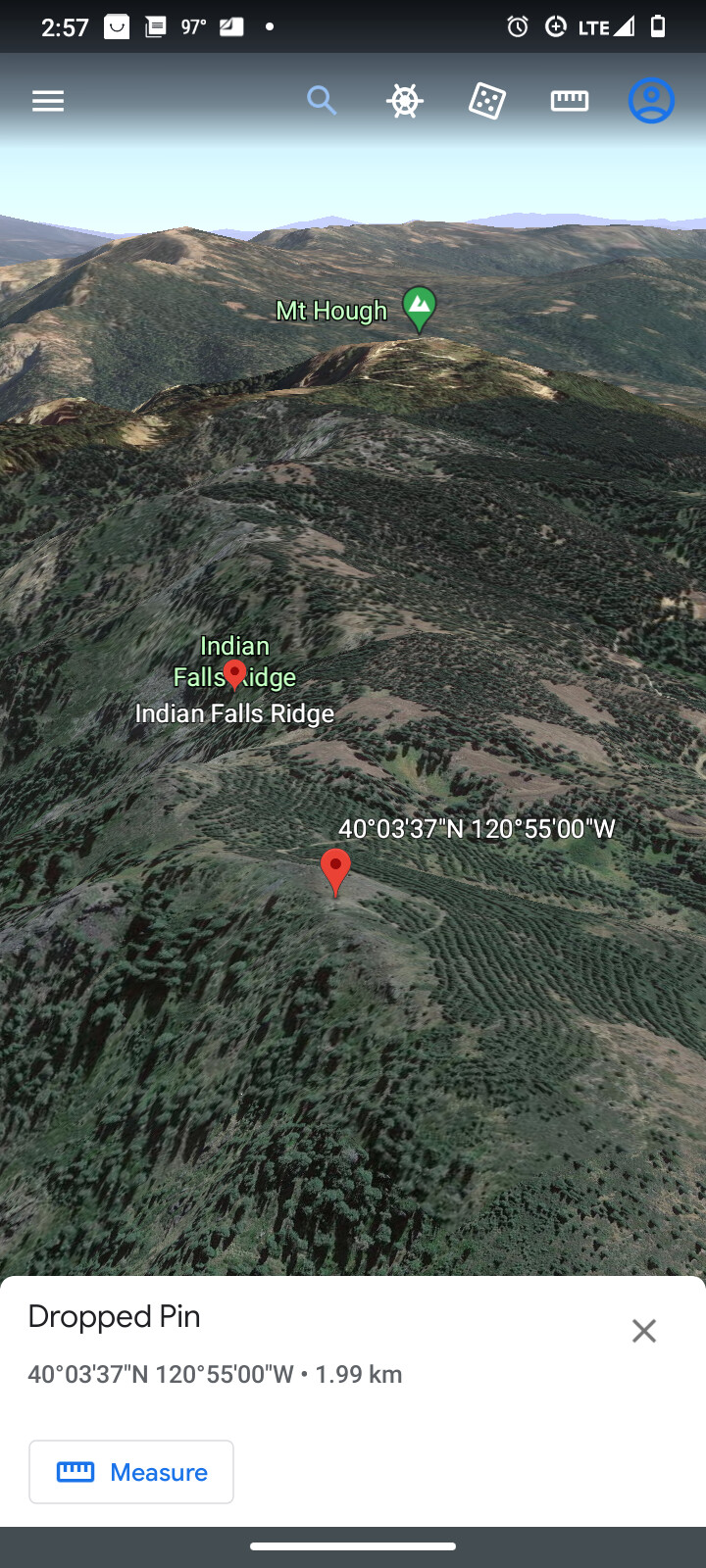
and some eyecandy satellite imagery, too. https://twitter.com/DeerCreekGIS/status/1418962252573540356?s=20
8 Likes
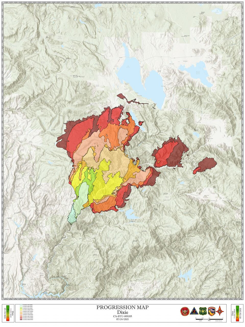
This morning the Dixie Fire is at 181,289 acres and 19 percent containment. The Fly Fire is 2,800 acres and 5 percent containment. Thus far 10 structures and 6 minor structures are confirmed destroyed, and an additional 10 are damaged. Another 7,010 structures are threatened.
As of now 4,266 personnel are assigned to the fire, with more expected.
The Dixie Fire remains in Unified Command, with two teams overseeing the fire: Cal Fire; Incident Management Team 1 on the West Zone and California Interagency Incident Command Team 2 on the East Zone.
In the West Zone hot and dry conditions will continue today, and minimum relative humidifies will drop into the upper single digits with little to no recovery. The fire continues to burn in a remote area with limited access, and extended travel times with steep terrain are hampering control efforts A second incident base, in Westwood, has been established to support logistical needs of the fire. The fire is expected to remain active at night along ridge tops and in canyon bottoms that align with the down canyon winds.
The fire line in the southern section of the Dixie Fire east zone has been successfully tied into the west end of Bucks Lake. Fire crews will now begin to build indirect line to the north to tie in the southeast portion of the fire.
The eastern portion of the fire grew significantly, primarily in the area north of Highway 70 near the community of Twain. Fire crews and equipment are positioned to protect properties in Twain as the fire grows to the northeast.
14 Likes
Wow, that’s a nice looking progression map!
2 Likes
Your Tax Dollars at work…lol 
7 Likes
Smoke here at lake Davis is starting to push back to the north about 2 miles visibility now. The tree branches are starting to move in the breeze which looks to be SW until tonight 20mph which is normal here same tomorrow. My heart out to those of you in fire path especially those NE.
7 Likes
North side of chandler rd mandatory evacuation. That’s from Oakland camp rd to hwy 70. I lived there many years ago used to cross country run there so sad to see so much beautiful country going under these high intensity fires.
2 Likes
This was not a mid operational period change, it was done for a new operational period. It isn’t optimal, but changing division identifiers during the next operational period is like requiring re-cloning and a new 205 for the next operational period, isn’t it? Other than having to on initial response operations during a rapidly expanding incident should you try to/want to/have to change Comms or division identifiers in the middle of an operational period - I think we can all agree to that. However, as an incidents grow, are split into an incident complex, or are organizationally retracted, there are bound to be changes. The unwritten rule is to never do it during an operational period, only at the beginning of the next operational period, so everyone can be briefed and made aware of the changes.
6 Likes
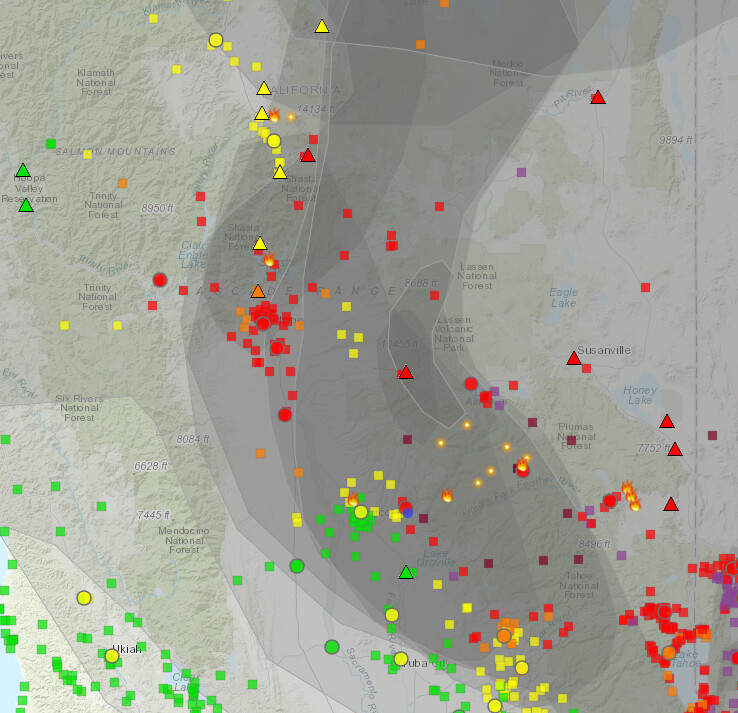
I was looking around the world wide whatever for a map that would show smoke cover and tripped on to this. Gives you an idea why nothing is in the air yet . It does not translate to this page real well so it may be worth checking out for a closer look
I ran into this as well. Sort of a interesting running loop of the smoke flow
6 Likes
As to why the air tankers aren’t flying, I felt that was quite obvious when I last checked the cameras. Visibility was 0. Heard a pilot say, “If they can’t see through it, they can’t fly through it.” I live in Santa Rosa and after last year, I think I would be fine if I never smell smoke again.
4 Likes
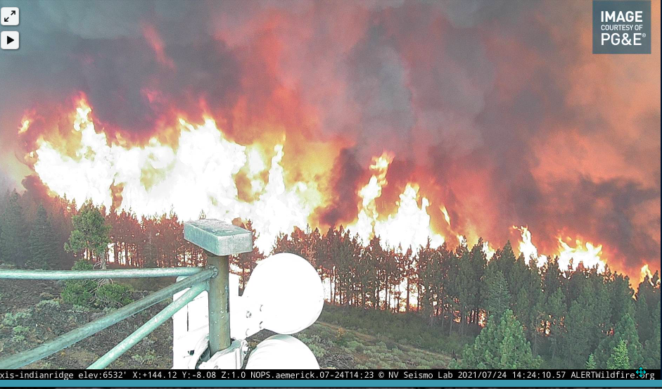
Looks like good clearance around the tower but it’s gonna get HOT!!
4 Likes
A few ago it switched views and showed the road leading up to it, it didn’t look that good at all on that side. I was going to get a shot and then the view disappeared. Look at the 15 minute loop and you’ll see they may not have all they need depending on the intensity of the front when/if it gets close on that side.
5 Likes
That crown run on Indian Ridge cam…… yikes.
4 Likes
Yea, from about 2:30 or so to probably 3:00 will be an epic video to keep for what fire looks like coming at you and doing a 360 on your position. Frankly I am a little surprised it survived the 2:40 to 2:48 onslaught.
8 Likes
That was a pretty good little run right at the tower. Looks like the camera has a chance. Took a pretty good advance and most of the front is past it. See if it can survive the duration now.
2 Likes
Completely agree. I would love to know the temperature as that run hit.
2 Likes
site is not showing any faults
1 Like