Surreal … this and Zeke’s mention on questions of whether it could make its way over Susanville direction … of it being in the realm of possibility
1 Like
Thanks very interesting images. I was up in hills above Milford a couple months ago. Really beautiful area. Mix of oak and pine which I don’t see much around here.
2 Likes
Interesting there is a shortage of jet fuel in the west coast due to deliver driver shortage and the increased use by firefighting aircraft. Well they definitely should have top priority.
At least my humidity is up today 15% vs 2 yesterday.
And west wind picking up. About 20 to 25 based on beaufort…being near ridge top exaggerates wind speed a bit here.
2 Likes
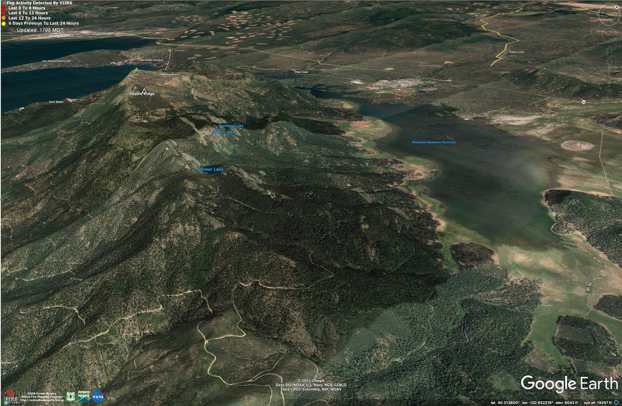
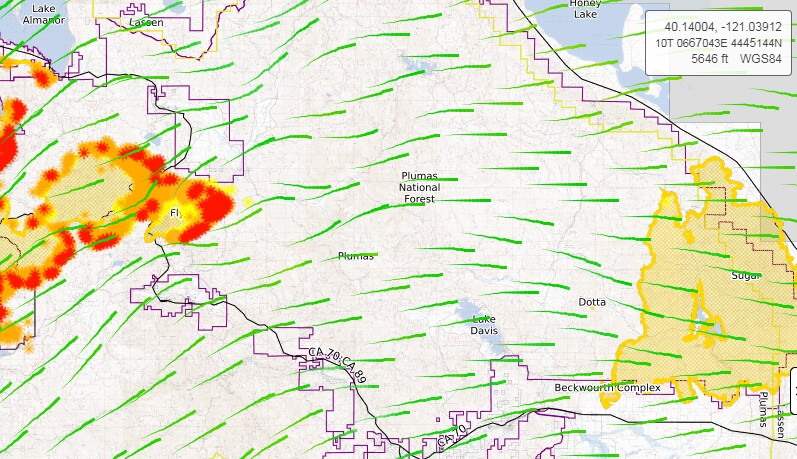
Just received an evacuation warning from Lassen county for the southside of mountain meadows res. Basicly Dyer mountain and north side of Keddie ridge.
3 Likes
Looking at goes west looks like a pretty big plume or maybe a pyro cumulus forming?
Just received an evacuation warning from Lassen county for the southside of mountain meadows res. Basicly Dyer mountain and north side of Keddie ridge.
Not many people live out there, that I know of. There is a cabin and the Stroing Ranch, that’s about it. If the fire down by Indian Falls/Round Valley makes a big run, we won’t hold it on Highway 89 or Old Haun Road. South Side of Mountain Meadows would be the place, but tying into anything on the east side is going to be tough - not many places to get up and over Keddie Ridge.
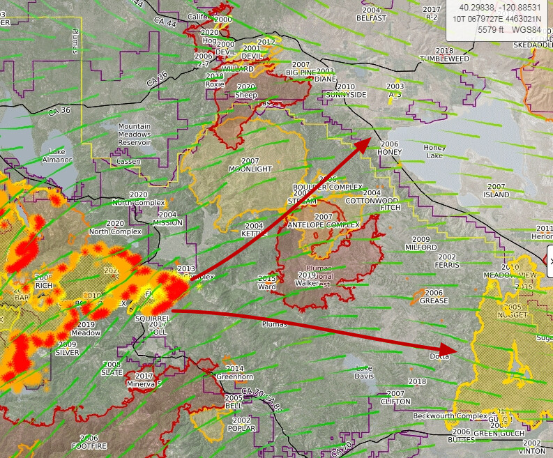
2007 Moonlight Fire in light blue.
4 Likes
Anyone have insight on it coming down into american valley?
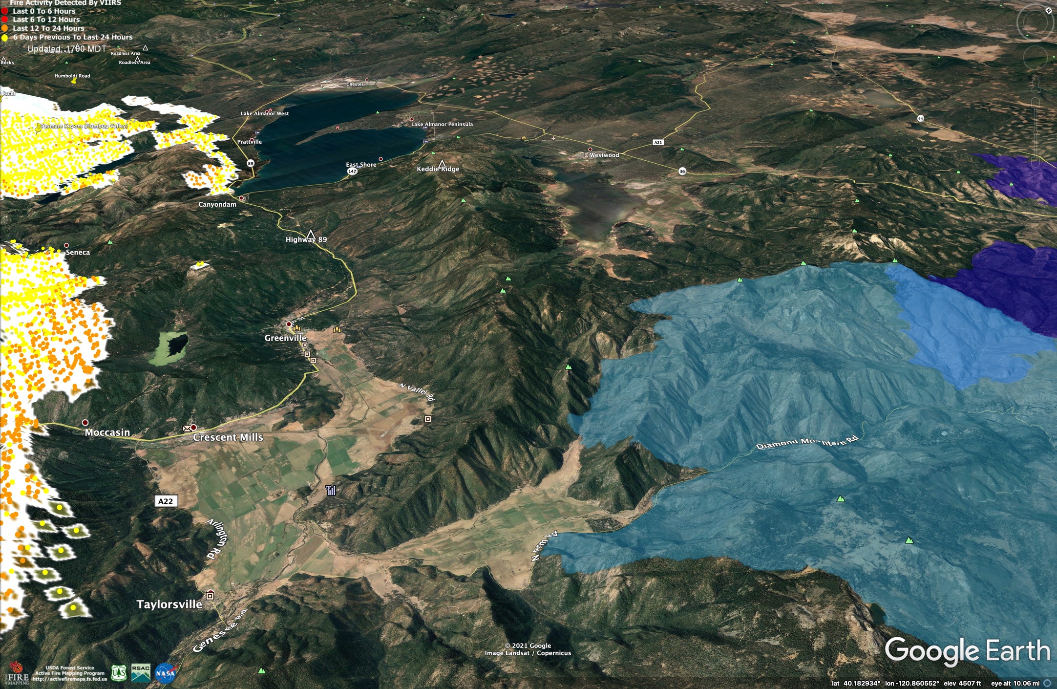
Gotten very dark here, at lake Davis, think that’s some clouds building up not just smoke. Still a west breeze now probably NW tonight. A fire could start a few hundred feet away I’d not even know it. And fire fighters go right into these areas always amazes me great people.
6 Likes
Where are you located?
1 Like
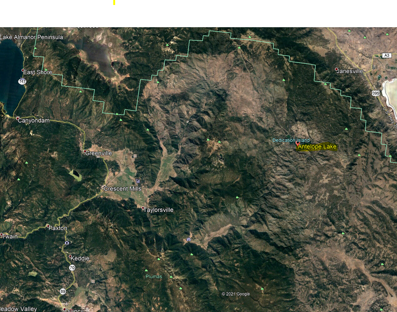
Antelope lake now advisory. I’m not sure where that is I know of antelope mtn way out by eagle lake but lake? Wow yep that’s the area.
I’m near lake davis SE side.
3 Likes
My mind must be going I’ve been there  , thanks for the brain refresh.
1 Like
Antelope is west of Janesville and Milford. Lots of burn scars around there.
I think the real question is will this fire that started on the west slope of the Sierras really burn all the way to the east slope???
6 Likes
I would not be surprised at anything anymore. I keep expecting to see four strange looking horsemen riding by  . I wouldn’t be surprised if this thing decided burn down to Beckwourth complex.
8 Likes
25 miles give or take as the crow flies from Taylorsville out to hwy 395… and a lot more in actual travel…
Longest distance I could map from the origin point to the fires edges runs from the mid 20’s up to 30 miles in a straight(ish) line… Just to give your comment some perspective… Just a awesomely horrible thought. but you would be a little more than halfway at this point I think
4 Likes
Pyrogeography thanks for the info and your input is appreciated and respected. My main concern at the time was let people know that lassen is in the mix now and also was curious as to why did they pull the plug on the warning at that time because I hadnt seen anything that stood out as far as spread in that direction . I know its going to big problem if it heads that way!!
2 Likes
Remember when they said at the 80-something thousand point that this would end up 150k? And here we are at/near/over 200k end of today. Then look at the wind map, or possible wind map, the other day this was way off from actual winds…
4 Likes
How are those roads looking? I just drove through there coming home from the beckwourth and the road construction will make evacuation a lot tougher for people trying to get to Susanville.
2 Likes