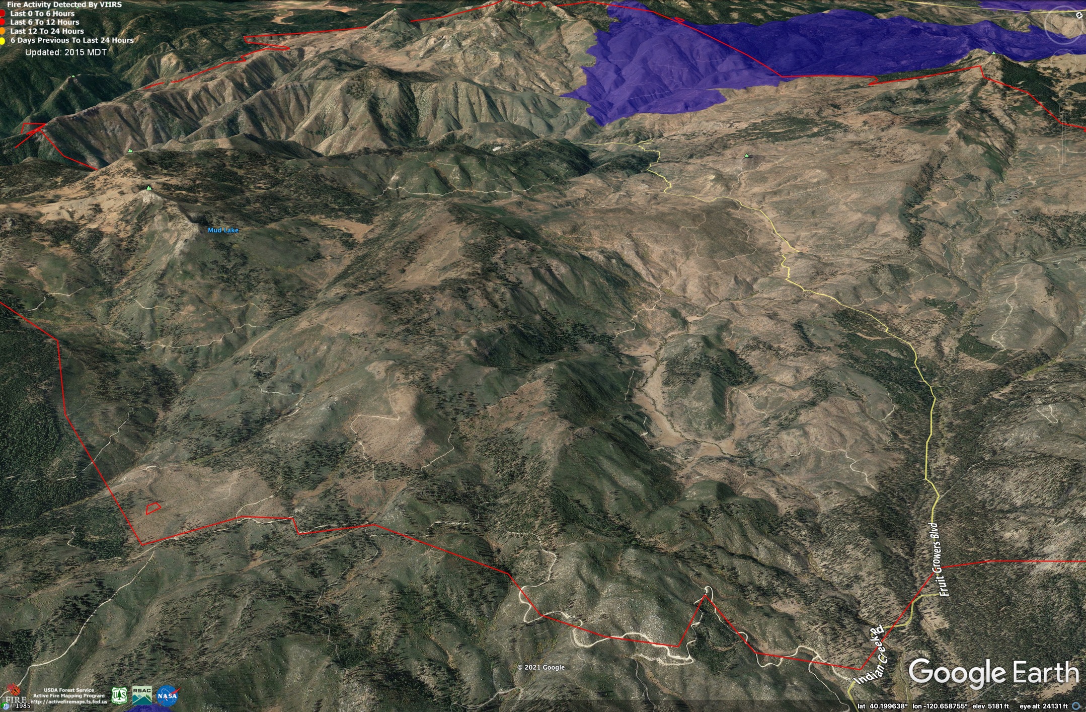
I think considering how much of this fire was 2012 reburn (and much of Bear was 2008 reburn), the Moonlight Fire may not be a substantial barrier, especially with wind or Haines 6 or whatever. There was a good amount of Moonlight reburn on the Sheep Fire after all.
Moonlight Fire (red) is 14 years old. Some portions were salvaged and sprayed for site prep and a lot more barren. Others are brush with 14 years of deadfall from un-salvaged high-severity burn. Overall, the burn buys firefighters some good advantage.
6 Likes
I was thinking the same thing. From what I remember from flying on the Moonlight fire, there were a lot of areas of low intensity underburn that left the timber. But even without that, there’s been plenty of time for brush to grow back and with ERCs we’ve been seeing this summer combined with the fact that it may be impossible to get retardant ahead of the fire given the visibility lately… Seems like we need a wind flow reversal and /or a good rain to slow this fire down (though I’m not seeing the fire first hand, so this is just armchair recon on my part).
5 Likes
I see they’ve added 30% chance of thunder storms and showers after 2pm tomorrow at least at lake Davis. And upped it to 40% Tuesday. We can hope for that rain.
3 Likes
You might be right. I was thinking the open canopy would help out a lot if we can get tankers, but it’s true we might not have the air to fly them in.
4 Likes
Yeah same, I’m going crazy trying to watch from afar
So Dixie slowed down today that’s good news for a change. Grew about 2000 acres.
2 Likes
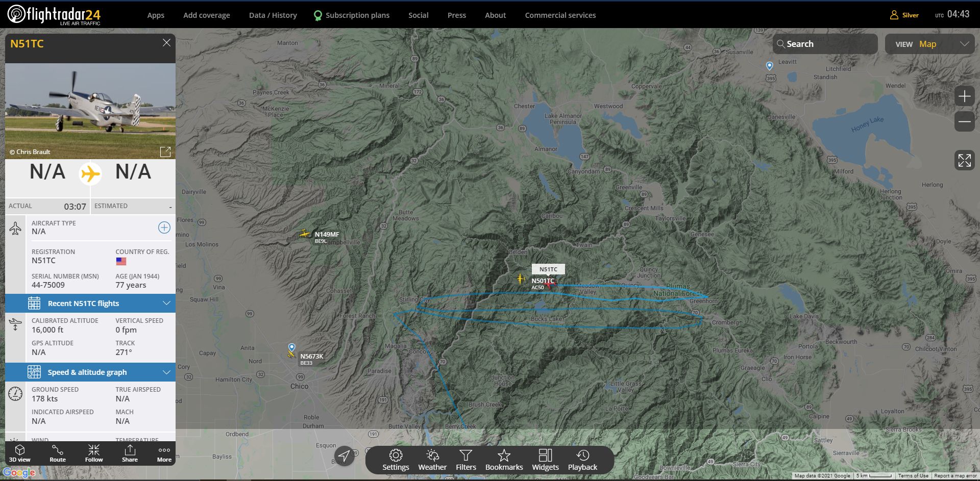
The CA Guard ships are now in FlightRadar24.
1 Like
The MAFFS were all along, but now a P-51 seems to have joined in.
Probably a database error, but a slight shred of amusement.
12 Likes
Maybe…. Lead51???
Sorry couldn’t help it!!
1 Like
More on topic… the one hour loop for the East Quincy cam… the wind looks opposite from before… does the Fly side of the incident have a chance to burn back towards Quincy, with that wind flow? Or is that flank up on the ridge have black back downslope? Just curious…
http://www.alertwildfire.org/shastamodoc/index.html?camera=Axis-EastQuincy&v=fd40730
In the briefing they said they are preparing to do some firing ops to protect Quincy from the Fly.
1 Like
Copy. Looks like really light air movement… but certainly would want that side buttoned up before a substantial wind got things going!
It’s a database error, it’s actually an aero commander 500 mapping the fire
3 Likes
Well I am sticking with my idea!! I might make it to MCC this week… going to have to scrounge up a Calfire/USFS/Aero Union/Coulson/Airstrike emblem of some sort and slap it on a plane. I thought there is a P-51 out there.
1 Like
Flighradar is a fun tool, but definitely imperfect. I live under the flight path from the Oroville helibase to the Philbrook area, and some copters were showing on FlightRadar today and some weren’t. A formation of 3 of what I think were camouflage or green Chinooks went over and didn’t show up at all, and a National Guard Blackhawk went up and did show on Flightradar but a smaller red and black copter that was right behind it did not. All of the other helicopters I saw did match up, but I’m pretty there are more aircraft working in at least the Philbrook/Butte Meadows area than Flightradar gives the impression of.
6 Likes
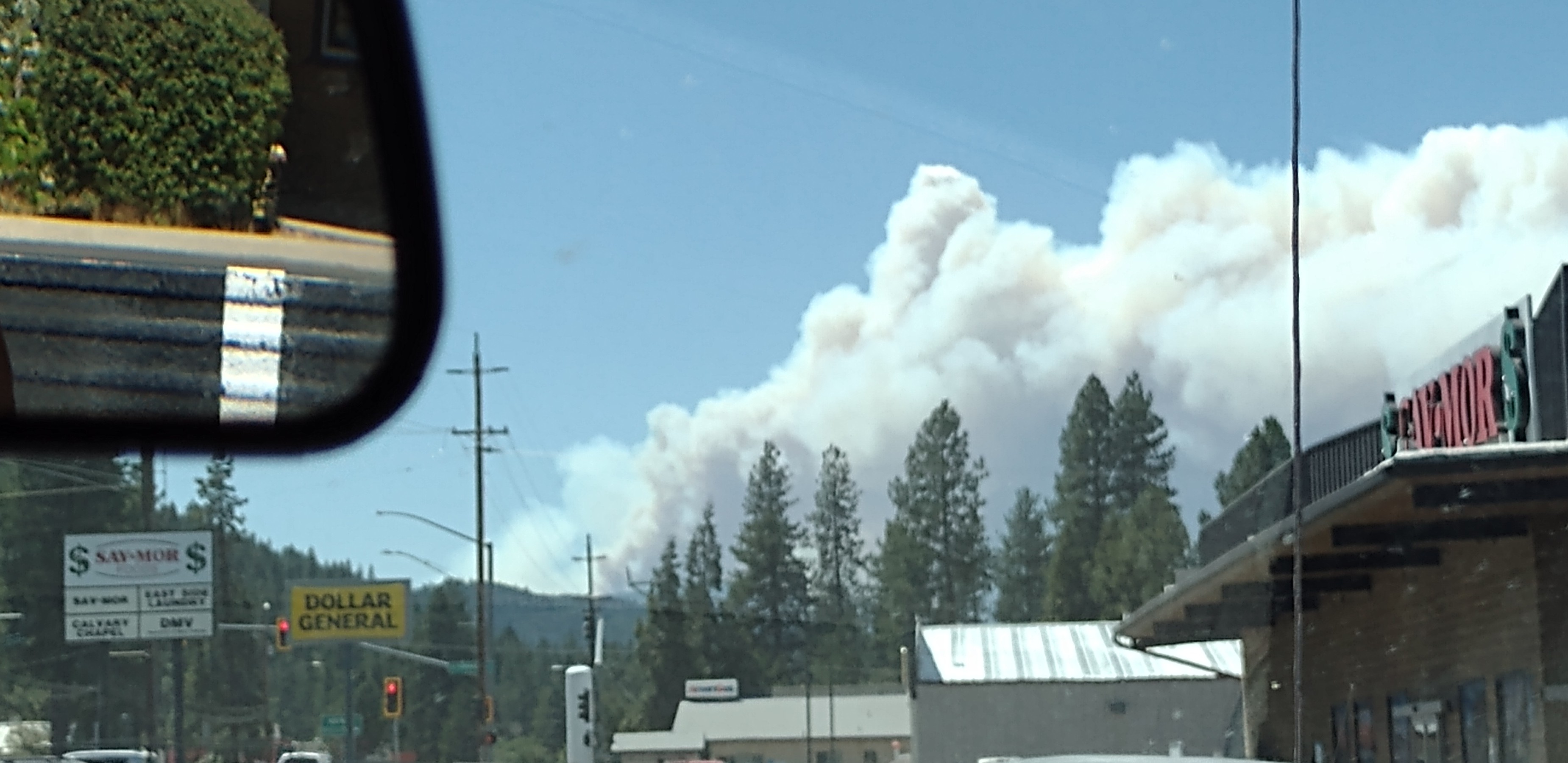
I didn’t realize it at the time so many smoke plumes around but this was a pic I took when I was in Quincy of the fly just as it was getting going.
1 Like
There is no conspiracy going on regarding the fire. My comment was geared toward previous comments about which aircraft are working when. Flightradar is not an official radar, it’s just a useful civilian ap but it doesn’t always pick up all aircraft for various reasons. The fire has slowed in growth, especially on the west side, but there is definitely a lot of work ahead and the potential for variable weather in the coming days. After over a week of public info meetings, a lot of the information is the same, there really aren’t new things to say. This fire is in a logistically huge area and planned control tactics cannot be completely quickly. If you live anywhere in the WUI I would do what you can to harden your property, be fire wise, alert to weather forecasts, and keep an eye out for and report any new starts.
10 Likes
There’s always a conspiracy with containment
2 Likes
The official mapping is what we use on the line. It is based upon IR data from both civilian and/or agency aircraft. There is no reason or justification to suggest that the current maps are either deliberately or inadvertently being misrepresented. There are many variables in IR mapping especially when there is a heavy inversion layer in place which will often distort the return. Many times the acreage figures are estimates due to an inability to get an accurate IR mapping run. By no means does this a misrepresentation of the acreage or progression.
I am going to leave your post in place for now, but please leave the conspiracy theories or notions out of these discussions. Let’s be factual about what is posted
17 Likes