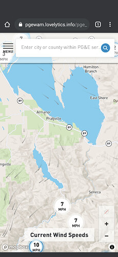
Radio-Hill2 at about 22:30 hours you can see a complete reversal of wind direction.
http://www.alertwildfire.org/shastamodoc/index.html?camera=Axis-RadioHill2&v=fd40730
Anybody know what the glow in the background of the sloat camera is? Looks about right for fire but maybe lights reflecting in smoke like Taylorsville?
Sloat
The glow is gone so was likely fire.
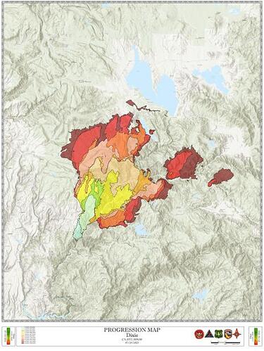
What are you talking about? The fire progression map shows the fire getting bigger every day. 9k-30k runs every day.
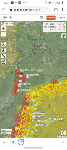
Fire edge mapping is also heavy influenced by the GPS/GIS track logs and marker points given the Situation Unit Leader by line supervisors going off duty as well as aerial mapping providing the same data. All IR data should be truth checked vs. ground GPS/GIS data.
Interesting it’s showing a down slope NNE flow over me at Lake Davis… and that’s exactly what’s happening.
Maps here:
Nice! Thank you!
Main thing I’m noticing today is humidity way up 41%. Those showers just might appear. Visibility is stuck at 400’ though straight up I can see a cloud or two.
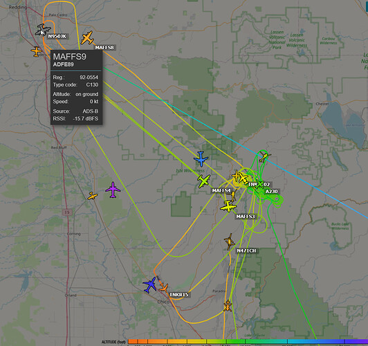
AA210 & 230 are over the west side of the fire with helicopters.
Launching 4 Type 1s and a Vlat
That Humboldt Road line is their last resort to keep it out of the virgin timber to the north around Butt Mountain, and then the Hwy36/32 corridor past that. It’ll put good black from Hwy 89 all the way over to Jonesville, and further west Butte Meadows, can hook it south towards Philbrook or further west along Skyway, Lots of iron work on that line with some rotor and LAT/VLAT support as well. Thankfully rate of spread slowed enough to catch up and hopefully get this in place.
Turn around from the firing op and the Deer Creek MRB up near Hwy32/36 intersection is about 6 miles for the rotor. Not much water up there otherwise.
I live between GVAAB and McClellan and very close to Beale AFB so I see lots of fun stuff in the air. I find ADSBexchange picks up a lot of stuff FR misses, especially the military/NG stuff. It takes some getting used to but it will ID aircraft FR completely misses. https://www.adsbexchange.com/
Visability at south end of lake Davis is slowly improving. About 2 miles now.
Kinda big air show eh? MAFFS 3, 4, 02, 9, and 8. TNKR 102, 15, and 911 per radar.
Looks like some pretty good rain Truckee to Donner Summit. With lightning strikes. A few strikes showing up south of Portola though I haven’t heard anything yet. Weak sun just came out. With a few clouds… horizontal visibility still pretty bad.
Flash flood warning just issued down on the Tamarack.
Those all seem to be CC luckily.


