Yeah strikes was the wrong word…as it probably implies CG.
I’m looking at various lightning sites and it seems ground based detectors don’t show anything north of Tahoe but sat does, and Timber says they seem to be CC… is that through visual or some sort of site/app that differentiates between ground strikes vs cloud to cloud?
When I chased storms in the midwest, the lightning sites I used picked up less than a quarter of the strikes we could see
As the lightning sites say “for entertainment purposes only”. You can build a lightning detector quite easily but as to accuracy… well the way I think of it is as an indicator of what’s happening. On the site I’m using CG gets a circle around it.
The detectors I know of use AM radio don’t remember how they deferentiate between CG CC.
CG emits more current and is easier to detect. I’m sure there’s some in-between stuff though 
As long as this post is off topic, sorry, I’ll add one more tidbit a private jet crashed at Truckee today started a brush fire that’s been put out. (Edit of edit) stories are getting conflated don’t know status of pilot or any passengers…that’s a tricky airport especially with density altitude this plane was on approach.
Does anyone know the status of the proposed line to be built on the 24n30 road (Old Silver Lake Road) in Meadow Valley?
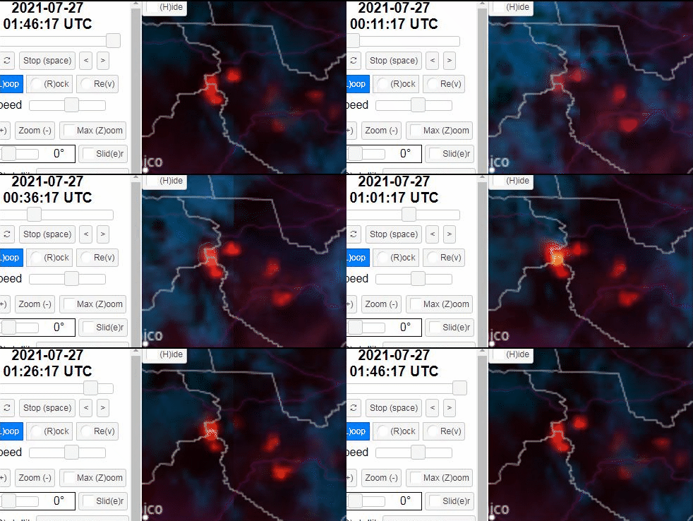
Time laps of 1 hour as fire burns over the Indian Ridge camera site:
Scroll down a few frames/posts (a bit). Pretty good that the site survived.
https://twitter.com/AlertWildfire
Getting a a few drops of rain. Or drizzle would be better description.
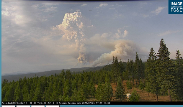
It’s gone nuclear.
http://www.alertwildfire.org/shastamodoc/index.html?camera=Axis-BaldMtnButte2&v=fd40730
Wind has picked up a lot variable direction. Can just barely make things out four miles away. Wish some real rain would come.
Wow now I can make things out about 20 miles to south and south west about 5 miles to W and NW
Backfire getting a little crazy? They turned the corner earlier up there…
TheBrushSlasher…
What is your definition of “GONE NUCLEAR”???
Thanks.
This on the northwest piece of the fire. Hope they can hold the line.

I am near the point on the Almanor Peninsula. Starting to get airy white ash here. Been calm today but breeze has started.
Was wondering if that was the firing op ?
Prolly Not

That’ll be the firing ops, with some significant upper level moisture passing overhead making things look dramatic, combined with some outflow and fresh clear skies. Firing is still going, with a drone (DJI M600) lighting fire in the Eagle Rocks area and bringing it down and slightly east to Humboldt Rd, and winds are relatively in their favor, coming out of the west. Right at the top there at Humboldt Summit is the switch where “down canyon” is either into the Sac Valley to the west, or down into Lake Almanor to the east. With the west winds, it’s definitely all going towards Almanor. Take it and run while you can!
The 1 hour time lapse for a number of the regional cams is a bit ominous with the rapid clearing. Nice to have the visibility for the air support, but probably challenging the containment lines. Could get interesting.
Radio Hill 2 in particular
Thanks for the update, good to hear about a cool little piece of technology being used.
Is something going on just west of Portola I’ve just seen something big flying in and out of smoke around there. My internet is too slow for the web cams right now.
I’ve spotted something that could be fresh smoke down there really too far to tell could just be wisps of smoke clearing out. Probably the later it’s not far from houses I believe… probably plane was checking.
