weathernode.net/flir sorry put a coma in not a dot on the other one.
Just checked twitch.tv/digitalpath … Almanor West really is going. That fire’s all the way up on the hill, all along Osprey Loop, as high as Goose Bay View and higher. It’s marching crossways right down through the entire development, parallel to the east-west roads like Maidu.
EDIT: OK, maybe. That might also be on the other side of the hill and silhouetted, it’s kind of hard to tell.
3 Likes
Removed my Deer Creek post, can’t confirm how far into Deer Creek the fire has gotten.
4 Likes
I’m seeing the shift on DIV J as predicted on the PGE Childs Meadows WX station. I’ve been watching that as an indicator of what DIV J is doing in relation to spread into Mill Creek and Deer Creek. It was pegged at SE for a while that helped cause some of the issues in upper 32 now. That and Colby Mtn RAWS to get some Deer Creek Canyon insight, although there is an elevation difference to account for there.
5 Likes
There is nothing on the Concow/Jarbo cameras. Are we sure it’s doubling back? Those DIVs have been cold a while
I believe the Concow/Bald Mtn was called out of an abundance of caution for the upcoming wind shifts and subsequent Jarbo Gap winds. Yeah the crews have been doing great there, but like they said at briefing this morning, every point of the fire today will become The Head of the fire at some point as this front boundary passes and winds go crazy. Add any potential outflow winds and all bets are off anywhere along this beast.
5 Likes
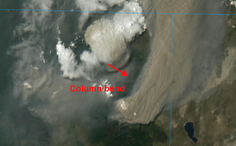
The front is moving in now as evident by the bend in the smoke dispersion and surface smoke from the fire also changing.
6 Likes
Looking at time lapse radar of the smoke plumes, there’s a sudden 15 degree shift in steering winds from SW winds to Westerly with the frontal passage.
2 Likes
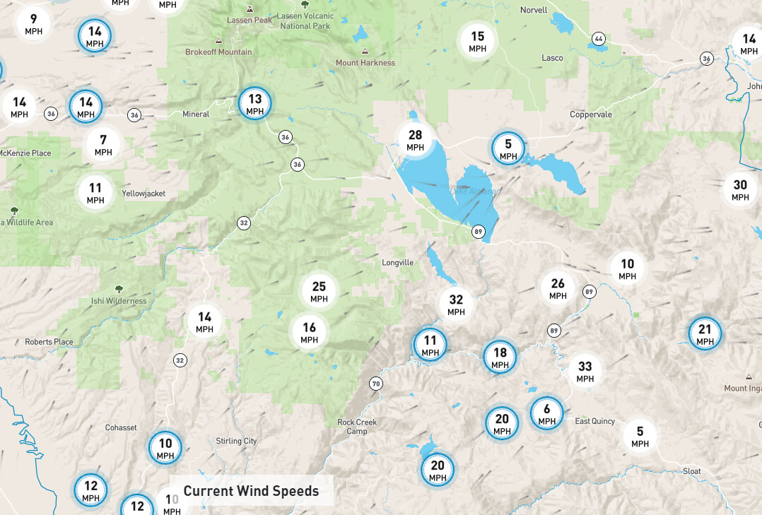
In the last 30 minutes or so the wind direction has changed some in Paradise. Seem more out of the west… you can see the afternoon winds are picking up
1 Like
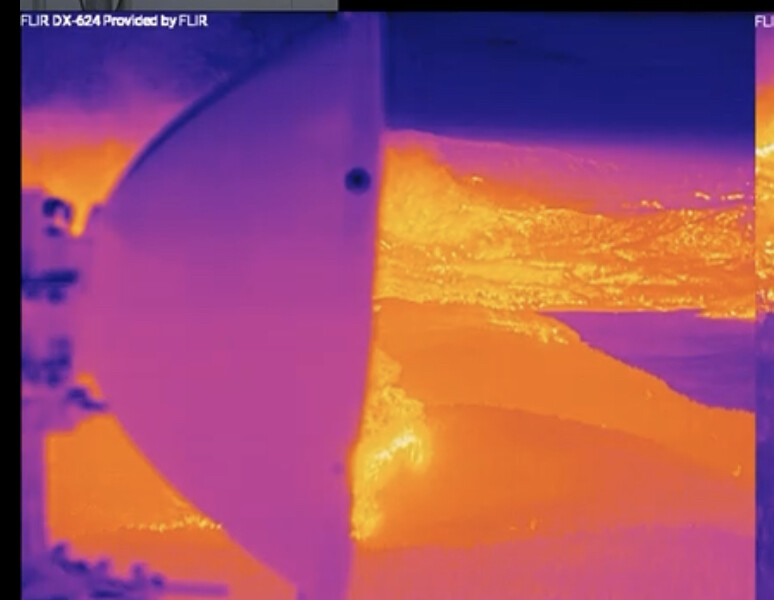
Watching the flir image pretty intently and noticed a wind shift now flowing the air toward the face of Amanor Dam down the shoreline from the north.
1 Like
Check out the 1 hour time lapse on the Butt Lake cam. Looks like it spotted across the lake as the camera swung that direction. Any thoughts??
1 Like
it just went dark as night over in susanville about 30 minutes ago now. still dark like night, even with the sky glowing red you can’t barely see your hands in front of you
4 Likes
I believe that is fire working NW from Wolf Creek area. IR shows fire at the base of Dyer. And shows the fire at Canyondam working up the eastern most shoreline.
Maybe it was a spot at the base of Dyer! 
Looking due south from Dyer.
Spot fire behind dish. Canyondam is the far point of the lake in the center.
Can someone please share what LAW represents- I’m not familiar with the area.
1 Like
Smoke on the foreground on the eastquincy cam looks to be building? Dixie in the background.
New IR maps and commentary posted:
https://the-lookout.org/2021/08/05/dixie-fire-8-5-2021-afternoon-update/
12 Likes
Don’t forget to check out the GOES west images the shift in direction and interaction of front with the Dixie smoke are pretty amazing from space. Radar returns are worth a look too.
1 Like
Lake Almanor West.
3 Likes
Thank you.
1 Like
Lake Almanor West, it is a housing area on the side of the lake that the fire came in from.
2 Likes