Where did you see the branch & division maps? For “west”
6 Likes
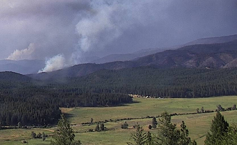
Smoke rising up near Oakland Camp (Per scanner), about 2 miles north of Quincy.
http://beta.alertwildfire.org/region/tahoe/?camera=Axis-RadioHill2
http://beta.alertwildfire.org/region/tahoe/?camera=Axis-EastQuincy
1 Like
New start or spot?
All I caught over the scanner was the location and they were aware of it.
2 Likes
1 Like
Started as a top smoke but has been steadily building.
1 Like
Its an interior island burning out … hopefully it stays interior.
9 Likes
And @Paulito I agree that’s a spot north of the tiny spots that the 1430 IR flight caught. It is in Sec12 here. @jhiggins was just checking it out too with the FLIR. What will win the fire’s influence, terrain or the winds? I think there was hope for CalFire to prep the Dyer Mtn site, but the buildings are unwrapped still I believe, and resources got diverted to life safety. Dyer is crucial for command radio traffic, PCSO, and obviously our intel here. We got a VTAC repeater on Mt. Hough after it burned over for law enforcement traffic if needed, if it’s not already being used for the LEMA resources.
1819: Ops and Dep Ops discussing this 150acre spot now seen on latest IR map. Trying to get ground truth on it. (It’s there ![]() )
)
3 Likes
Looking almost creek like. 400,000+ acres is a real possibility with this one. This is a f…ed up situation.
10 Likes
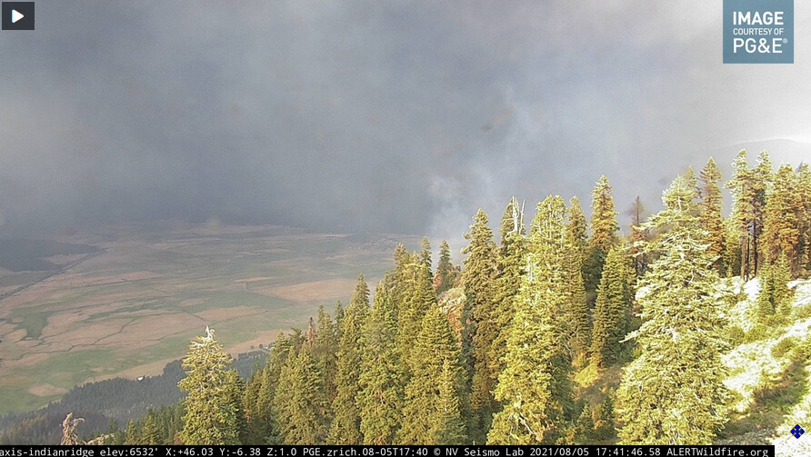
Looks like Indian Ridge might have a start.
http://beta.alertwildfire.org/region/tahoe/?camera=Axis-IndianRidge
2 Likes
I was guessing flare up.
I don’t think the column has leaned this far south yet?
1 Like
I thought it might be smoke blowing from the north at first, but the camera has focused in on it and I haven’t seen any of the smoke blow this direction from the north.
IR data from what appears to be a flight at 1515 hours is posted here.
2 Likes
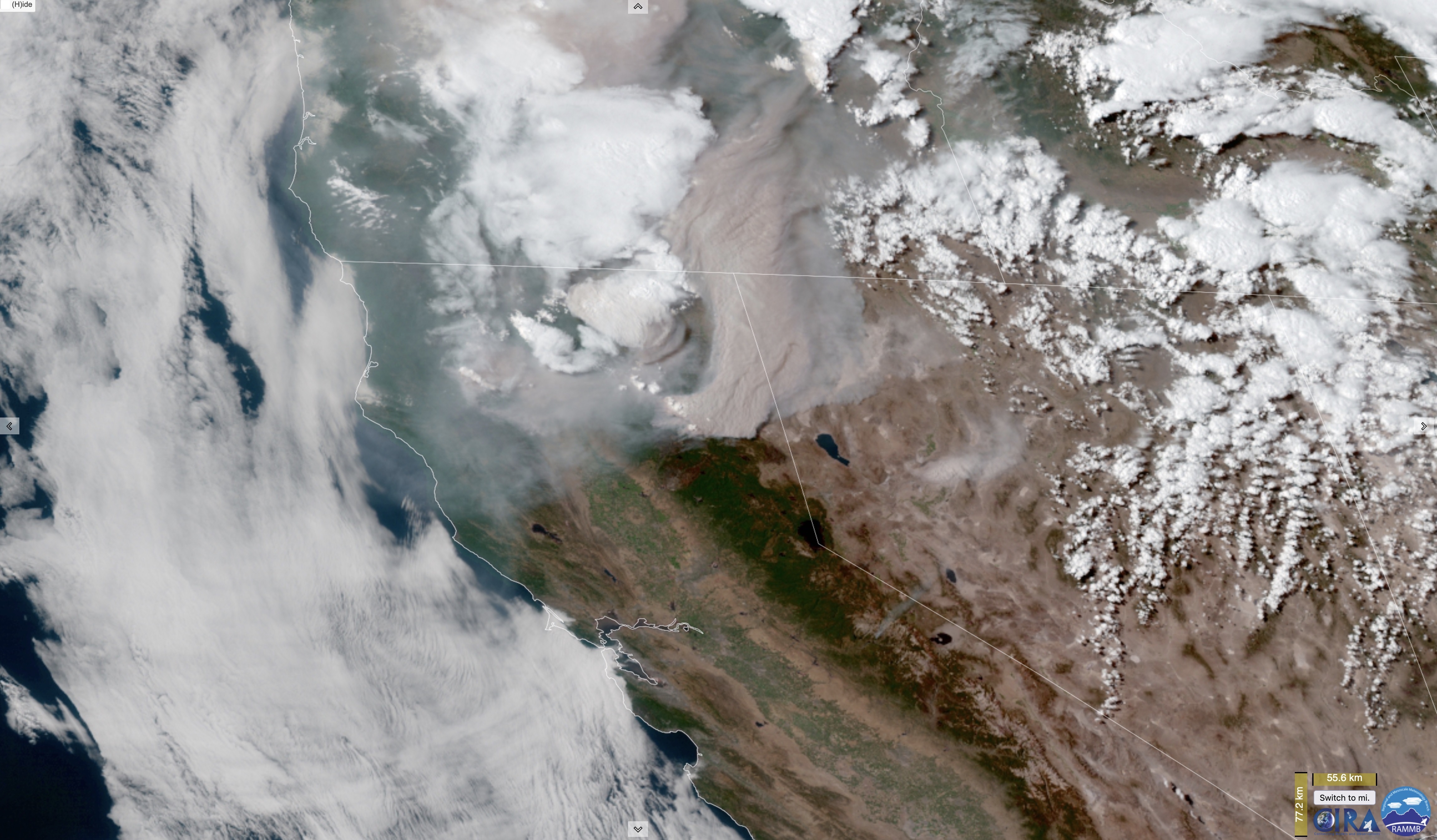
The weather satellites are freakin blowing my mind.
11 Likes
Locals are saying they meant bald rock at berry creek not bald mt. Not sure if that is true or not but would live to know
With this front passing through, what are the general thoughts for anticipated wind shifts in the Greenville area?
Could be the very definition of the Paradox the irresistible force vs immovable object . Hope it plays out better than we all seem to think .
In a matter of what seemed minutes our skies in Paradise went from Blue to black…
3 Likes
If you mean the evacuation warning for the Concow area, I believe Bald Mountain makes more sense from their directions and landmarks.
1 Like
The FS is on scene of a 1 acre fire near there. Near 32 road. 1 acre, SROS, not doing much. LMU is sending at ST and some single resources to assist. Calling it the Pine incident.