We all need to be saving this data and satellite animation for the next S190-S590 classes. Bookmark and save. Unfortunately dire frontal passage
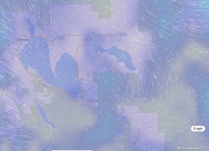
Looks like the wind flow changes somewhere between 9 and 10 pm to be more of a N by NW direction.
This is anticipated wind direction for the area about 10 pm . looks to hold that direction till mid morning tomorrow when it changes direction again. Wind speed at 10 M above ground has anticipated winds at calm to 5 mph with occasional gusts to 15- Mph.
Well that explains the sudden oblique Right turn The Dixie just took. Watch all those Right flanks!
Doesn’t look good for the Penninsula.
Finally just turned Indian Ridge camera toward Crescent Mills.
Doesn’t look good for north town around Pioneer rd.
Fire above town to the west as well.
http://www.alertwildfire.org/shastamodoc/index.html?camera=Axis-IndianRidge&v=fd40731
It doesn’t look all that good for anything up there… Gonna be another tough night . This is like some bad movie that keeps going
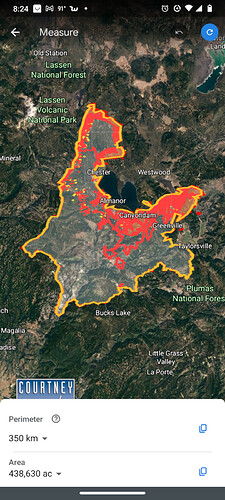
New IR data as of 1925 hours:
Looks like Courtney Aviation has been mapping this every couple of hours… someone who knows what they’re doing could make a really disturbing fire progression animation from that data.
none of the links uploads. must not work w/o some program to make it so
open the kmz file in google earth
Hearing CF IMT 3 will be taking the North Zone of the fire.
you need to download google earth
Also will overlay in Avenza if you’ve downloaded the appropriate incident map into Avenza
Where might one find said incident map?
The FTP site has all the maps and such
Just curious, any idea why is the Indian Ridge camera showing the fire as purple?
INFRARED IMAGES…
Most likely there is just enough light energy on the fire to turn the camera into day mode. Violet being the longest light wave, which is just enough to trigger the camera into day mode.
Thanks for answering that. I appreciate it!
Hopefully, that is mostly correct. Physics was many years and beers ago.


