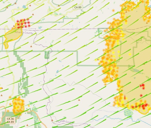
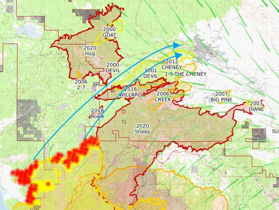
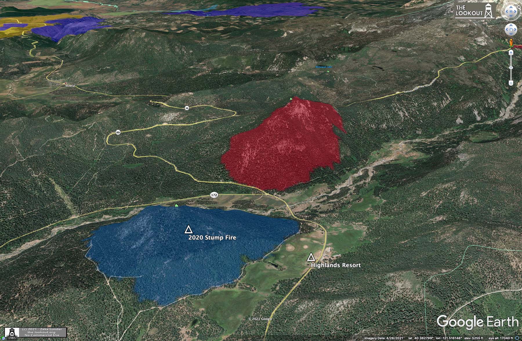
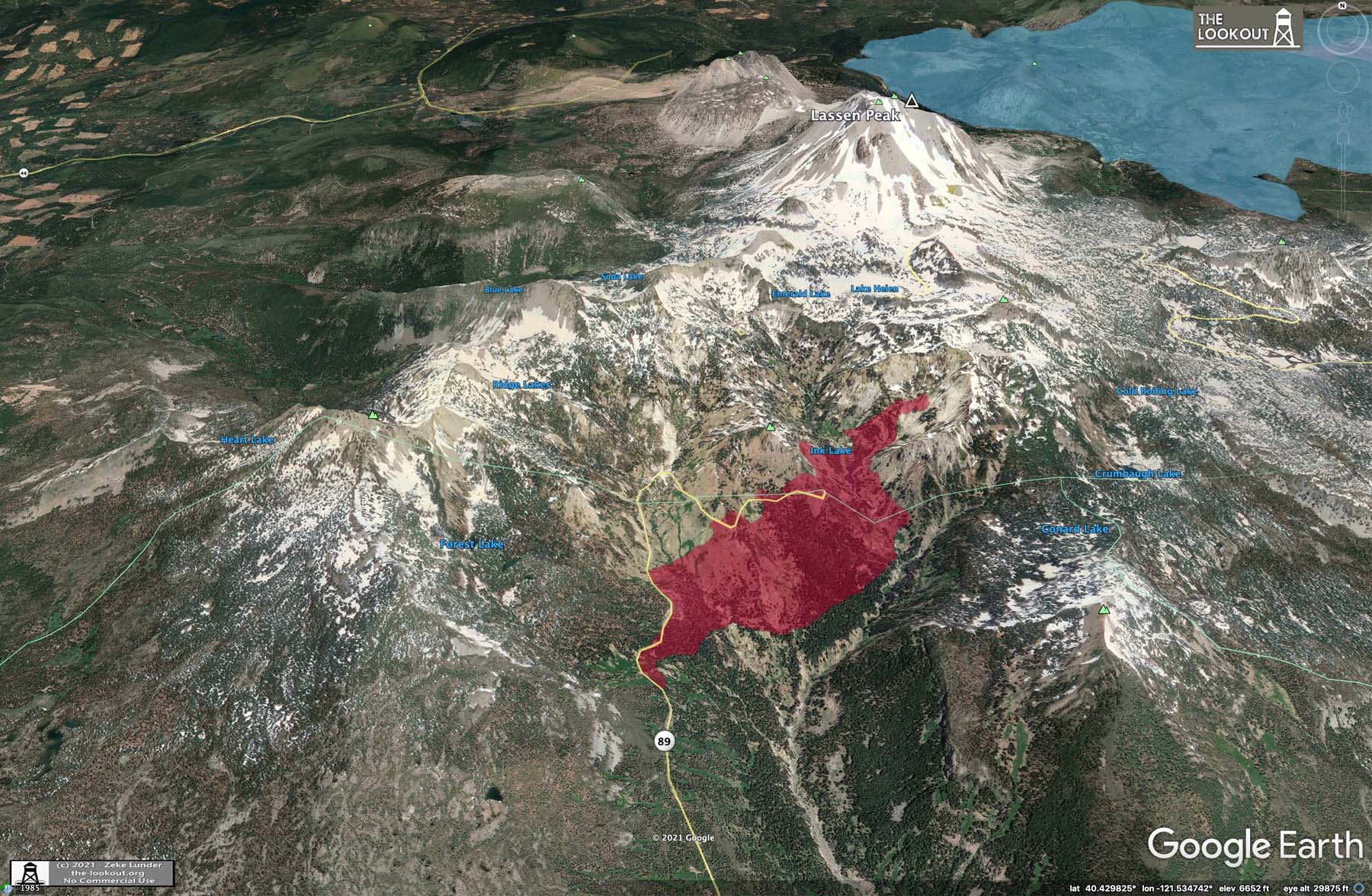
It’s a bad setup for a run to Susanville. The little finger ridges that run N-S on south side of Susan River make a perfect springboard for the fire to hopscotch one to the next with long-range spotting. Check out the maps on today’s update on the-lookout.org
5 Likes
4 Likes
I was saying it about Chester as recently as the Humboldt Line was going to stop the spread. I was figuring on a Chips Fire repeat. Now it’s seriously threatening where a lot of people from Chester evacuated to.
4 Likes
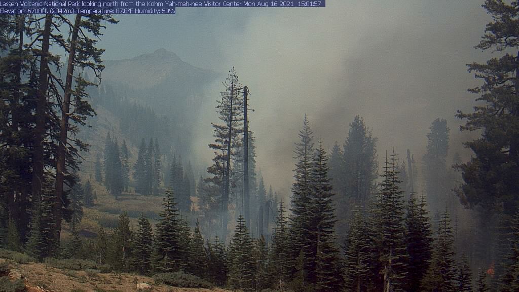
Good eye on the column from Cromerg. Too smokey in Quincy to see it…
1 Like
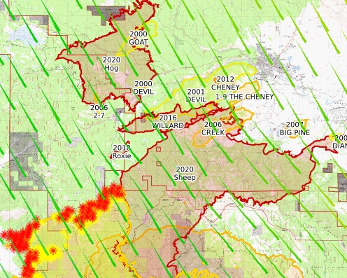
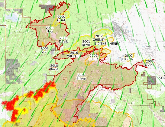
Susanville forecast 30 mph gusts today and tomorrow. I don’t see this being off the table for a possibility. I’m not up there, don’t know how much growth the Willard scar has had, but through it, spot over it (2/3 to 1 mile width), or around it aren’t odds I’d bet against at this point. The Sheep scar seems to be working well to their advantage, so if they can hit the north side hard would be good. 30 and 36 hour wind forecast could be in their favor.
30 hour wind forecast:
36 hour wind forecast:
6 Likes
But the shift doesn’t bode well for Genesee…
5 Likes
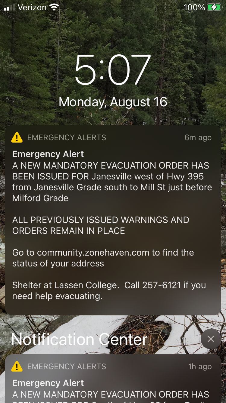
sounds like it crossed fruit growers according to the scanner, anyone else catch that? i believe that was the trigger for janesville
4 Likes
yes. you heard correct.
1 Like
They’re also asking for AA at DP-263 due to fire jumping the line.
2 Likes
Does anyone have the most recent division map?
this is generally updated multiple times a day. everything here
Bookmark this as a tab for easy access.
3 Likes
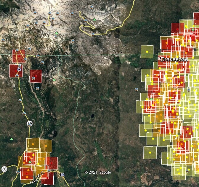
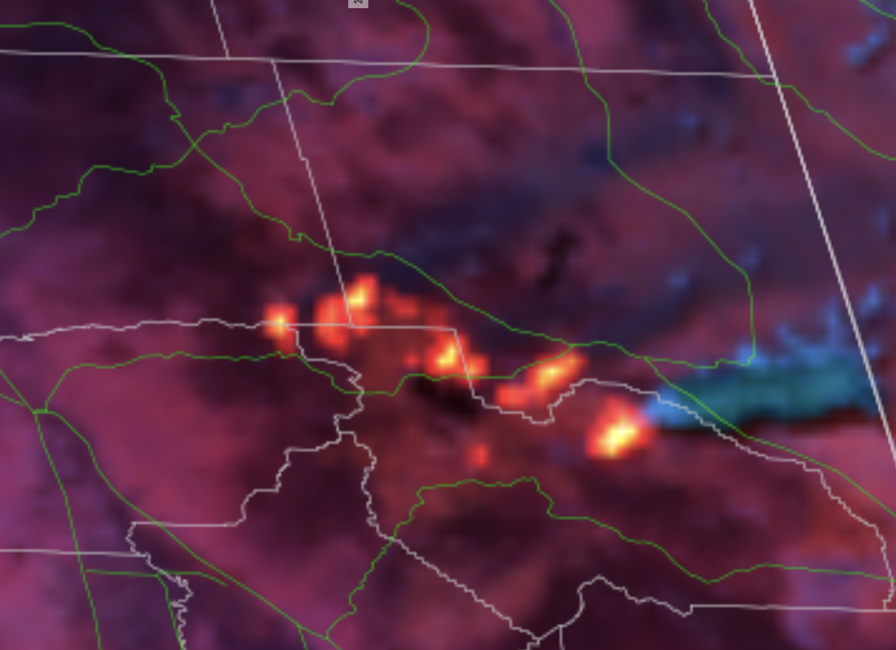
A lot of heat everywhere that has been active on Dixie at 14:20.
Left to right heat dots:
Morgan Summit
West of Willow Lake
Warner Valley/Mt. Harkness (Junction of Lassen, Plumas, Shasta Co lines)
East of Chester and firing at Hwy 36/147
Hamilton Mtn/Coyote Peak
Antelope Lake.
The heat near 36/44 junction is worrisome for Susanville.
2 Likes
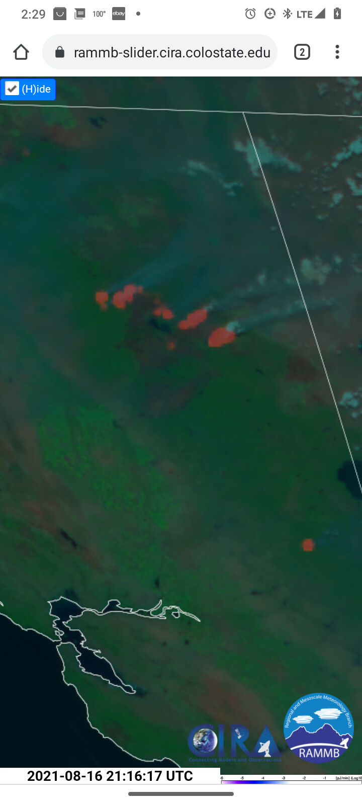
According to RAMMB/CIRA, the smoke from the southern most of those is vering more easterly now, as of 16:31
2 Likes
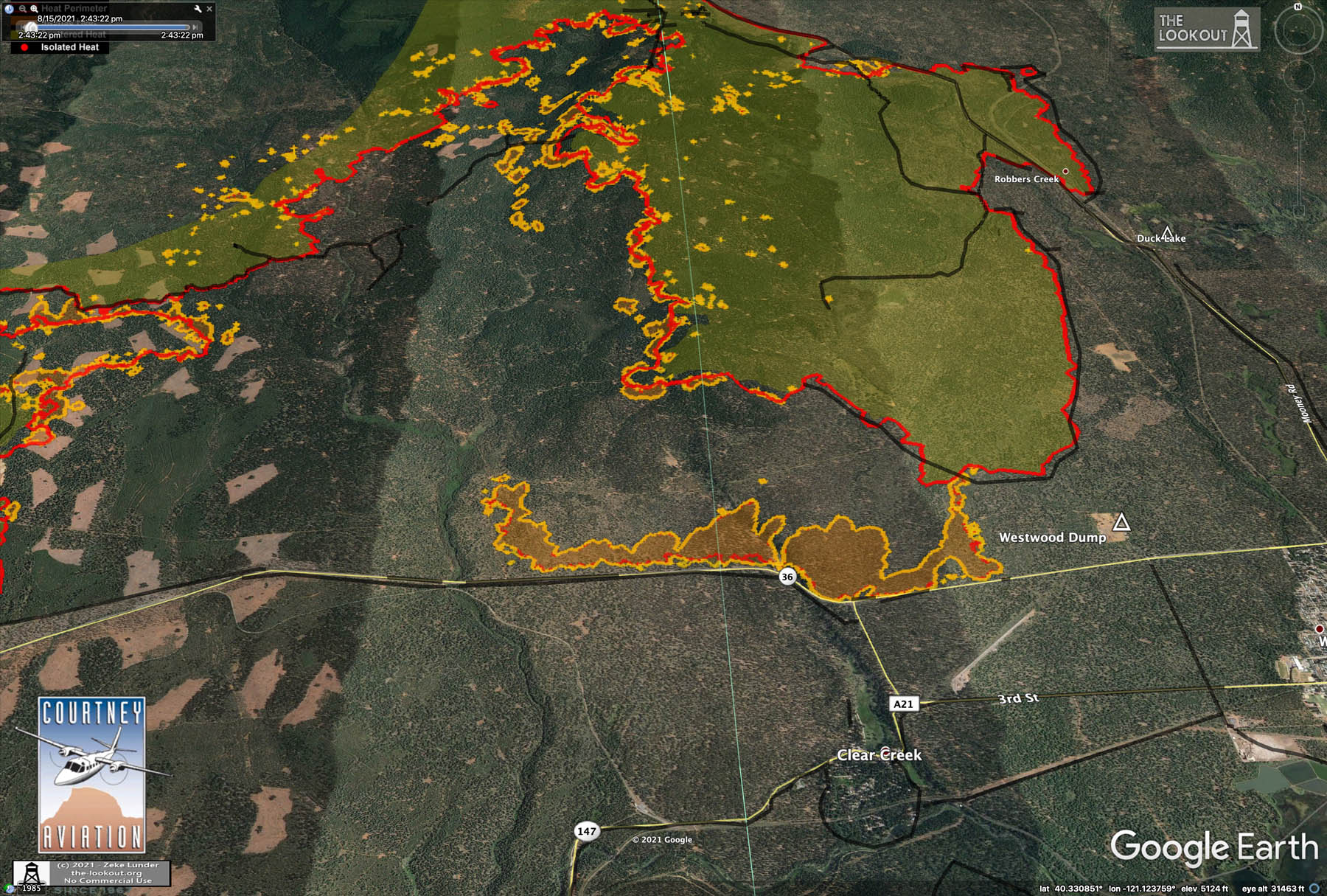
Hope they can hang on to A21 down to highway 36, it’s running hard toward the main fire west of A21.
5 Likes
Part of the fire that’s visible on the FLIR running toward A-21 is inside of the unburned crescent, going to hit black from where it burned past couple days. Fire is making some good runs to the NE, filling in that big crescent, in general.
Main part to worry about is east flank of where they just fired, that is south of previous black.
4 Likes
The US Army taught those if us who went to BLC and PLC when when things get tence it’s time for all those on the front lines or in this case, fire, to remember:
“OODA Loop”. (Observe, Orient, Decide, Act)
.
Focus on filtering available information, putting it in context and quickly making the most appropriate decision while also understanding that changes can be made as more data becomes available. The strategy is applicable at an individual level as well as an organizational level. It is particularly useful in scenarios where competition for resources are involved and where the ability to react to changing circumstances faster than an opponent leads to an advantage.
.
12 Likes