Yes firing ops
6 Likes
Is the Mandatory Evac for the Jordan Flats Area a potential re-ignition of the Beckworth Complex?
1 Like
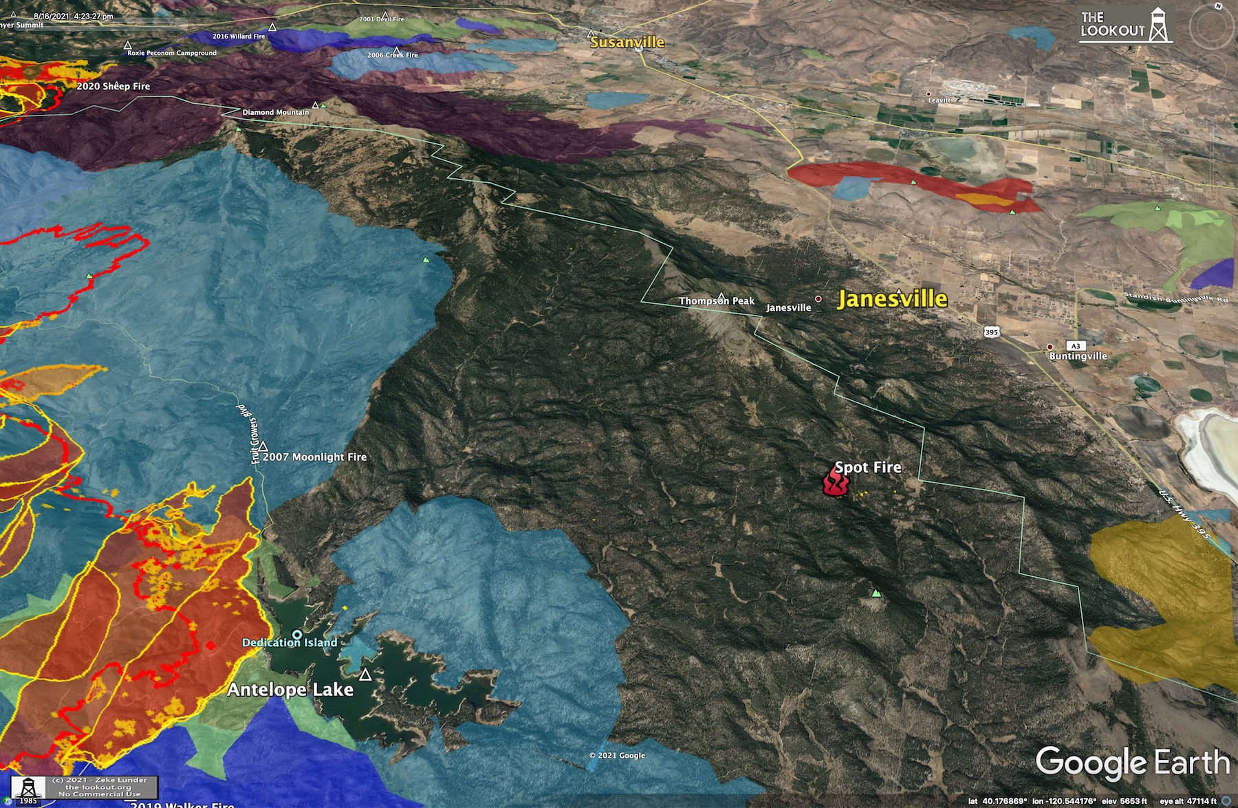
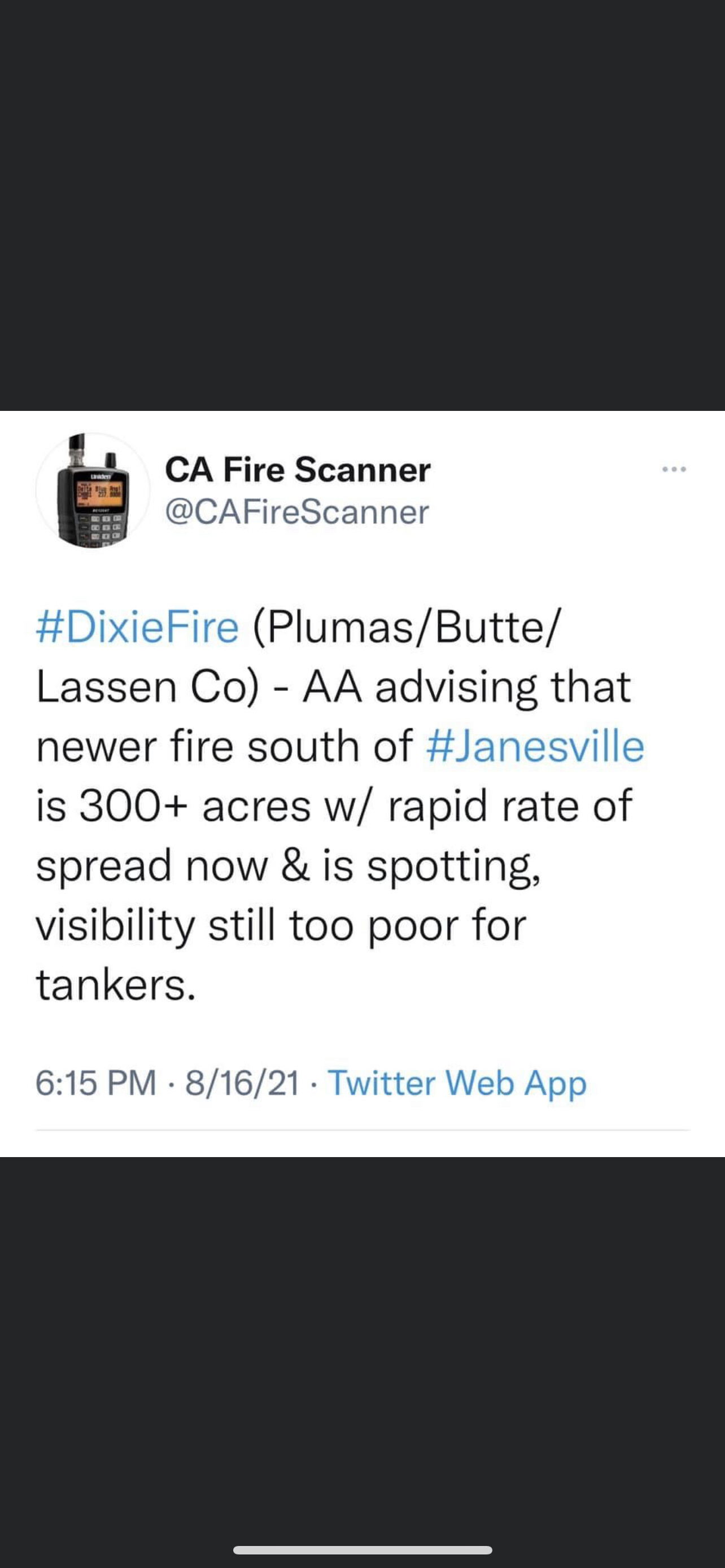
8/16/2021 - 6pm. Intel flight has discovered a 10 acre spot fire nearly five miles out from main front, 3.75 miles south of Thompson Peak.

4:45pm - From reliable sources:
No new threat to Chester, LAW, East Shore or Peninsula at this time.
As of about 4 pm, the bulk of the heat/column on the Antelope Lake side of the fire was not pushing hard on the eastern boundary of the fire, but burning hot up out of the Peters Creek drainage, and around Taylor Lake.
Fire has burned down to the lake on the south side of Mountain Meadows Reservoir from about Deerheart Creek over to Homer Creek, moving to east, not toward Westwood.
The heat from firing operation along Highway 36 between Rock Creek and Hwy 147 is blowing hard to the NE toward Duck Lake and into an area that already burned a couple nights ago.
Some new spot fires into Clover Valley, across from Silver Lake Road on A-21.
7 Likes

6 Likes
So is this officially the first recorded fire to entirely cross the Sierra Nevada? Or, for that matter, to traverse any major U.S. mountain range?
A dubious record, if so.
8 Likes
It’s the first recored one to start on the western slope and burn into the eastern slope. And that happened a while ago.
3 Likes
I mean technically, it crossed the Sierra Nevada and is now into the Cascades–so TWO major US mountain ranges. What a bad deal.
4 Likes
Didn’t the Creek fire last year cross the slope of the Sierra ?
1 Like
The fires at Morgan Summit have really blown up this afternoon, and their smoke column is shading northern parts of the Dixie Fire. This is a good thing for areas in the deep shade under the column, which looks like it includes a critical piece of the Susan River Canyon where there are worries about the fire running east to Susanville.


#DixieFire - 8/16/2021 6:36pm. Fresh mapping of the fire that is headed toward Susanville. This perimeter (red with orange outline) has outflanked the 2020 Sheep Fire, and is headed east.
It was captured at 6:36 pm, 8/16/2021, and was 6.5 miles from Susanville at that time.

6 Likes
East troublesome fire jumped the continental divide. Creek fire stayed on the west slope.
2 Likes
Just heard the airtac eastside say one of the spot fires/ or a new fire ? … is approximately 800 acres
9 Likes
There is a spot fire and a new fire. The spot is east of fruit growers boulevard 800 acres and the new start is on thompson peak above Janesville and is 20+ acres. This is per the evening update.
4 Likes
Being dispatched as a separate incident. Attempting to get resources from the Dixie but those are in short supply.
2 Likes
the seperate incident i believe is a 1/4 acre spot called in by a single resource along the 395 near a rest stop, did not catch the name or area
2 Likes
Slowly move away from town, as the fire seems to end up wherever you are. (
11 Likes
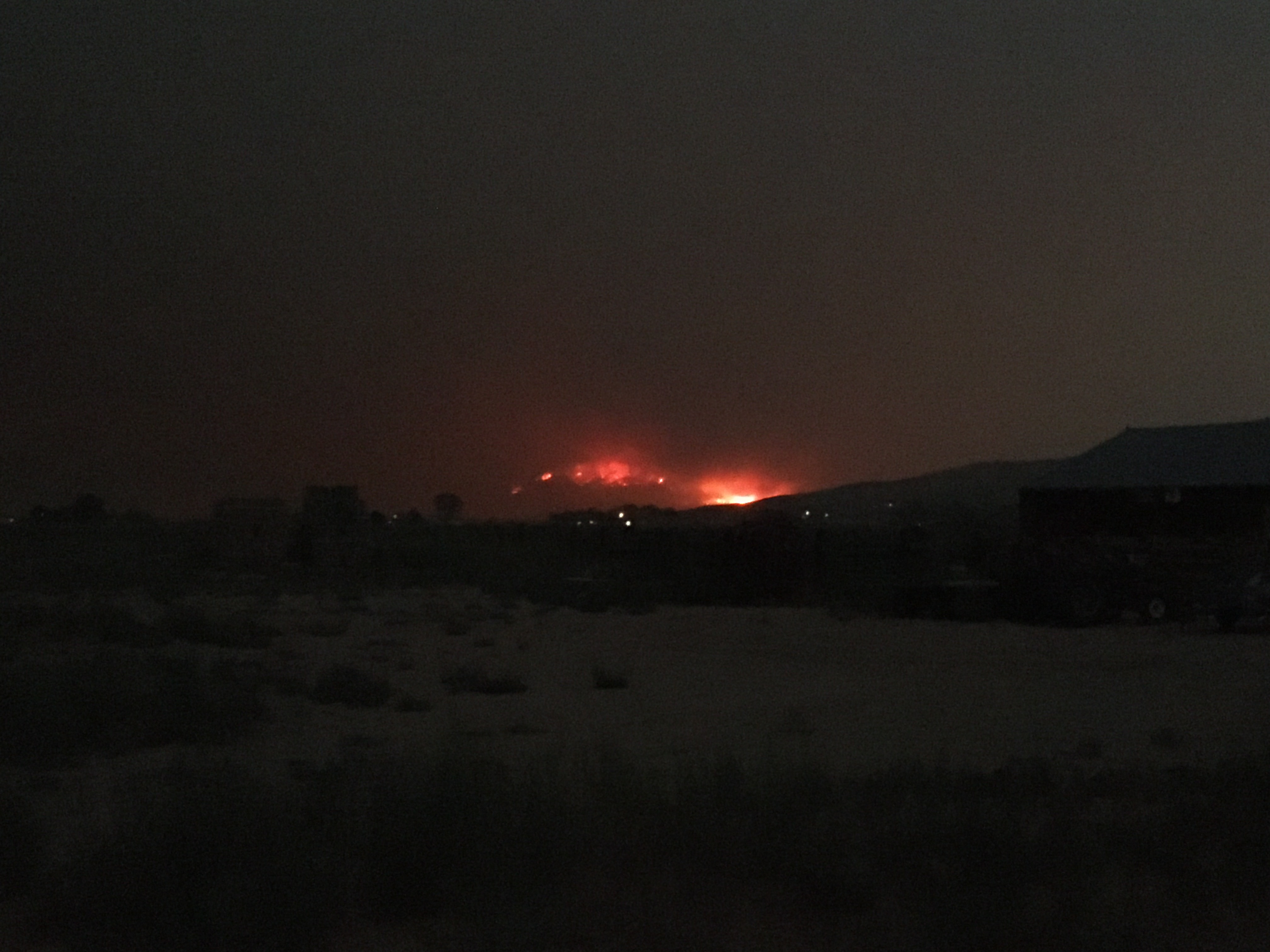
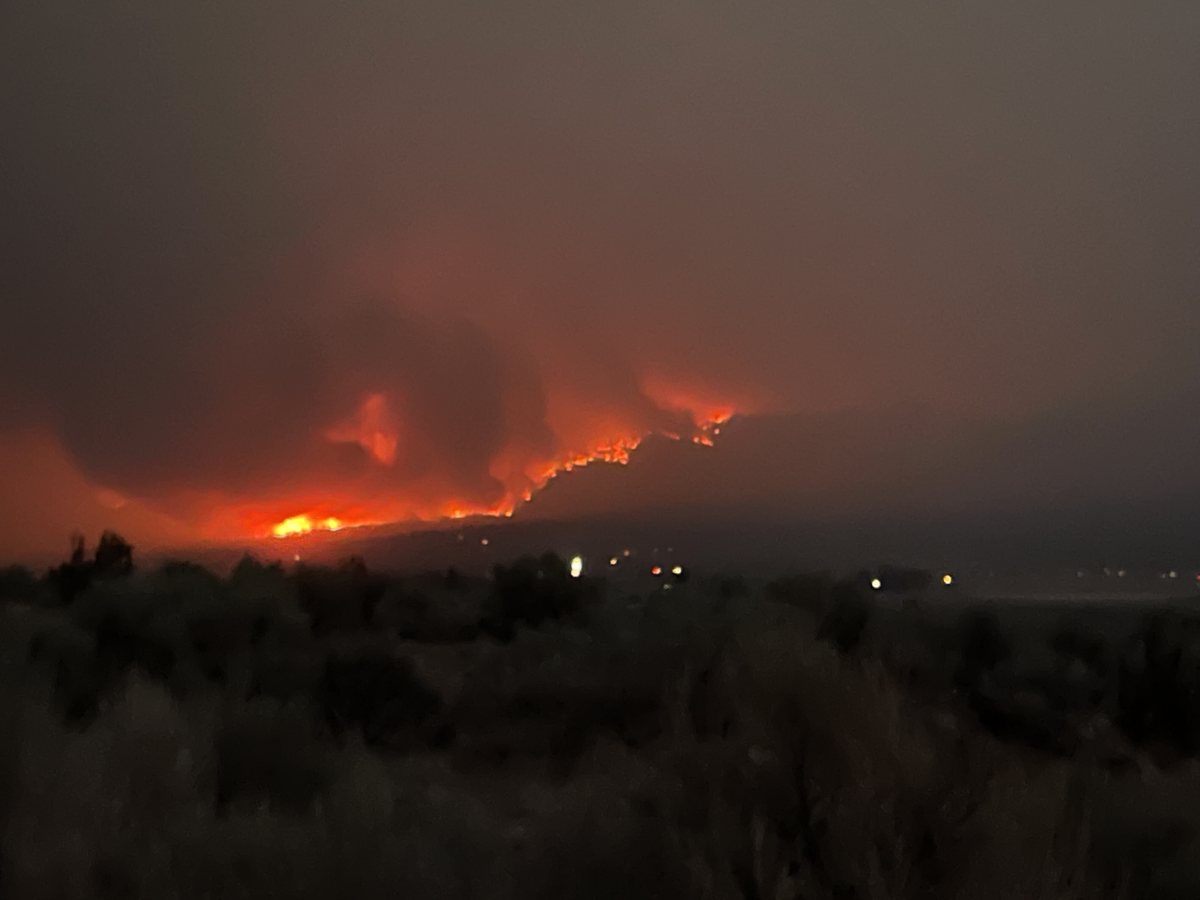
Is that coming down the Janesville Grade area south of town?
1 Like
They are saying it’s a spot and the new fire is coming off the escarpment now
2 Likes