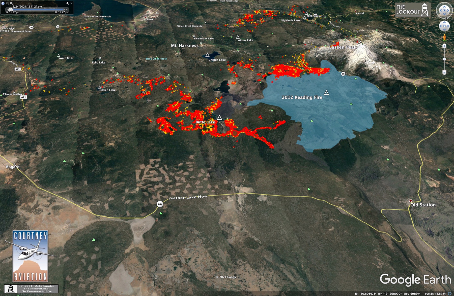
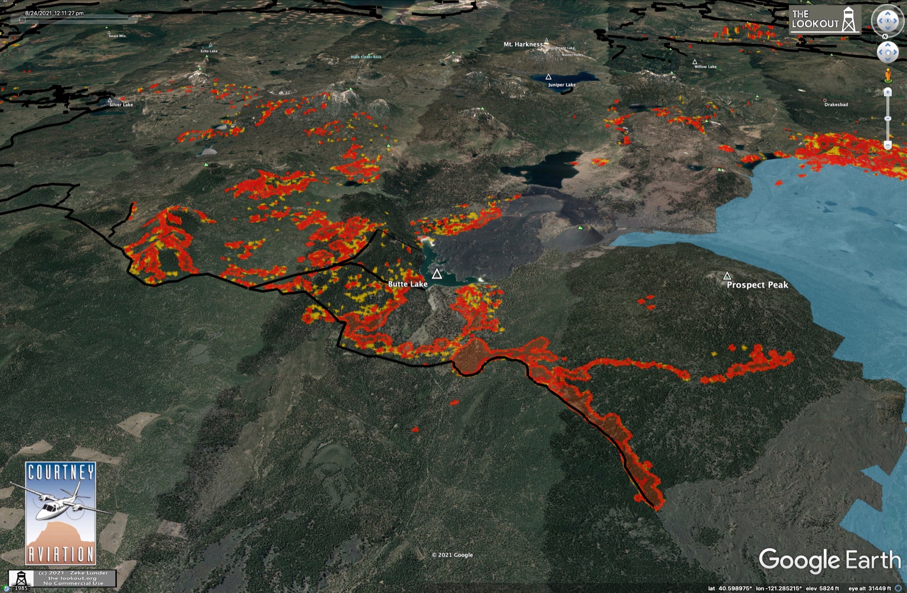
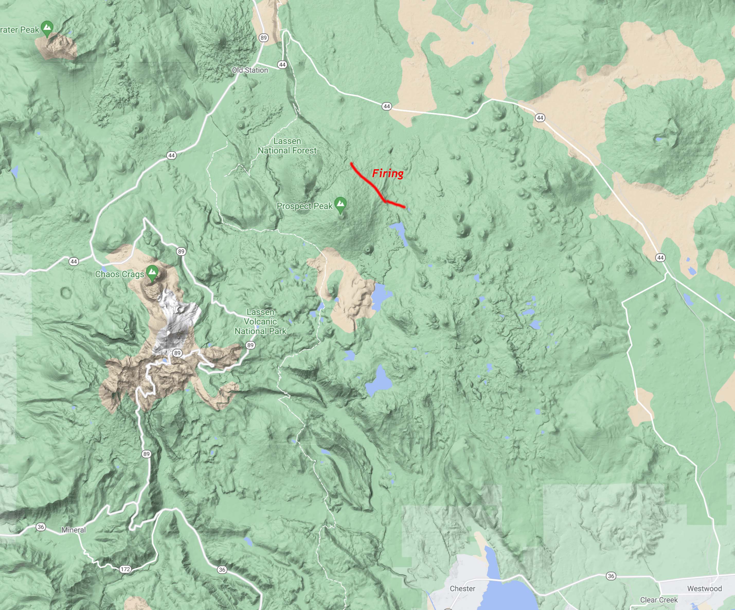
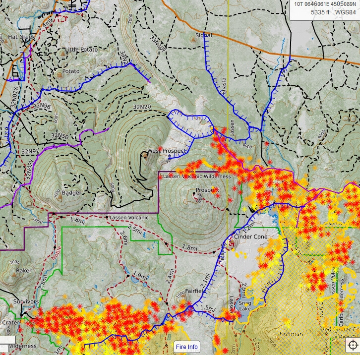
Quite a bit of new action on the far northern edge of the fire, outside of Lassen Park. A large firing operation has begun on dozer lines running to the NW on north side of Prospect Peak. It appears there is some slop of the firing over these lines and up onto the adjacent escarpment.
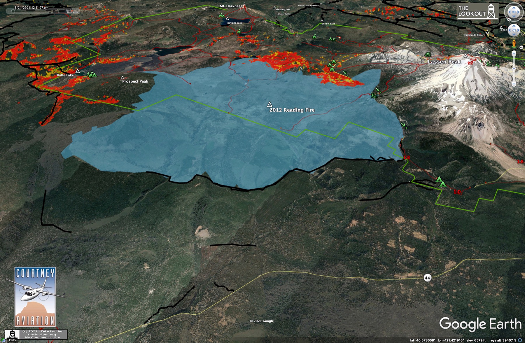
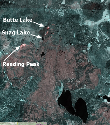
I heard 47k acres in the LNP so far, is that correct ? Looks like a conflict of interests, one line of fire following Park boundary, one line of fire headed for the dark spot NE of the Reading scar. What is that lava or an unnamed fire ?
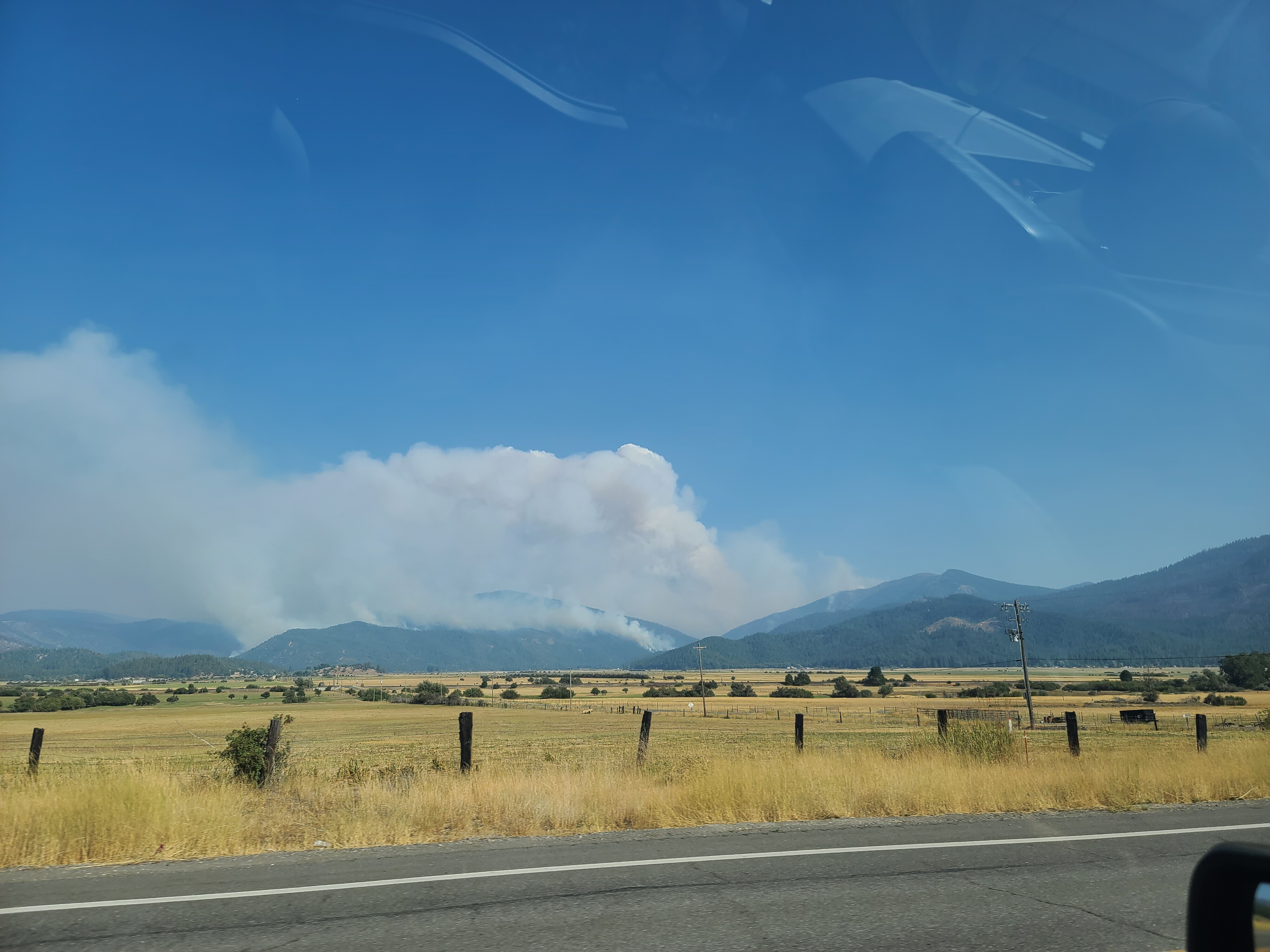
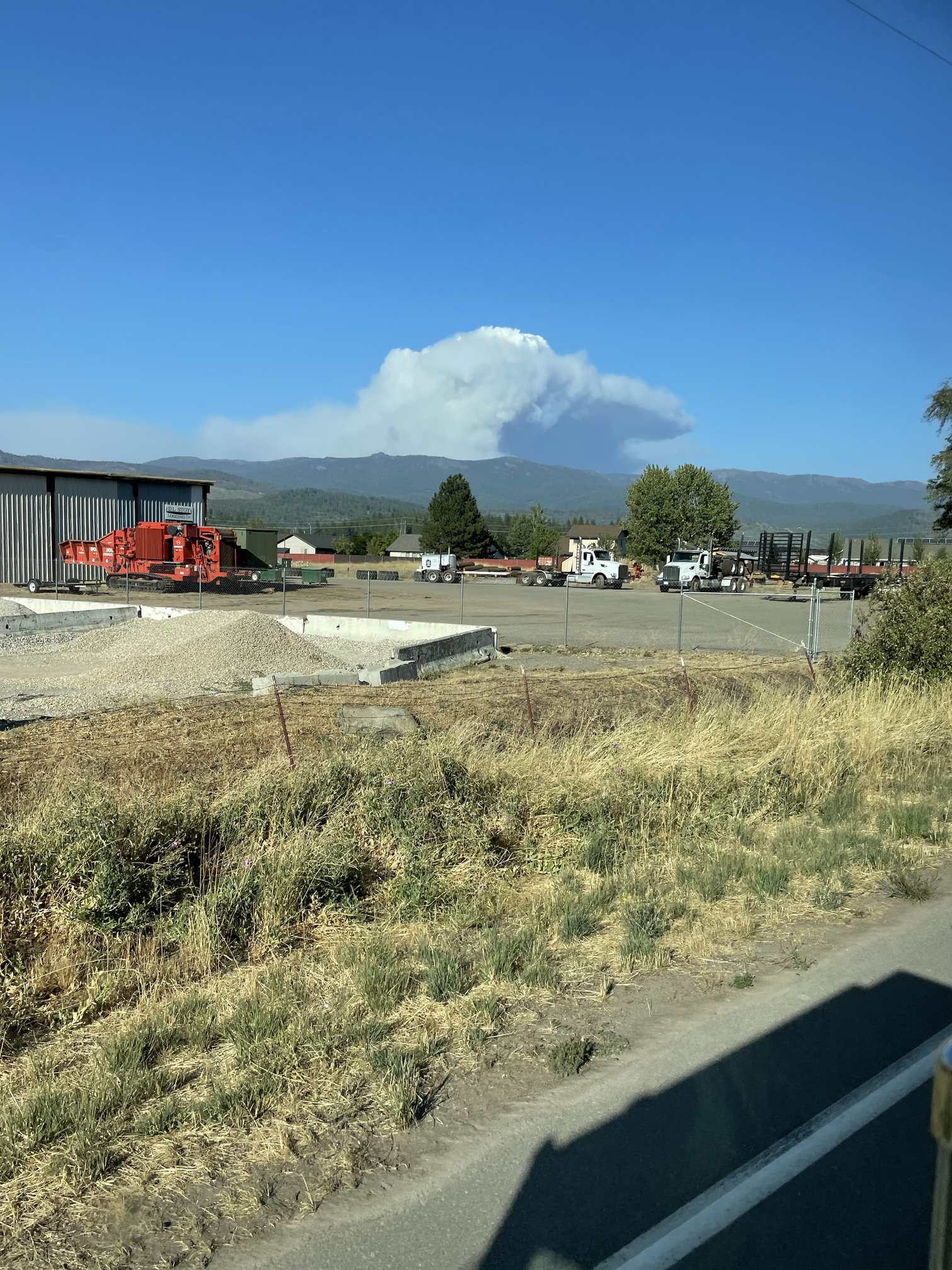
The Walker spot (east/left on FLIR camera) is really taking off and appears to be what is causing the huge plume over Grizzly Ridge from Quincy. Appears to be headed SE down Walker Mine Rd in the Little Grizzly Creek drainage area.
The new firing to north looks like it’s following a dozer line pushed out to a huge lava field west of the Hat Creek Rim.
Not sure what’s going on with the firing along the Park boundary.
Anyone remember the Bald Fire? The Hat Creek country is deceptive. What looks like a bunch of flat black lava is actually a big wind generator set on ‘Squirrley’.
People come from all over the world to soar The Hat Creek Rim with paragliders.
Here is some trivia - Hat Creek Rim is related to Mud Creek Rim, east of Chester. They both follow a system of faults that is responsible for a lot of the little spatter-cone volcanoes in between. You can trace the connection well on this hillshade, it runs from just east of Old Station, down thru Butte Lake, and then south to just east of Chester.
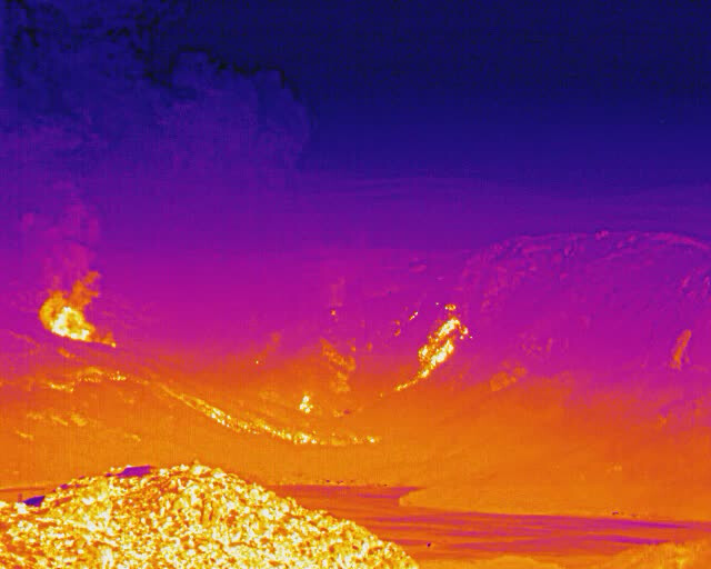
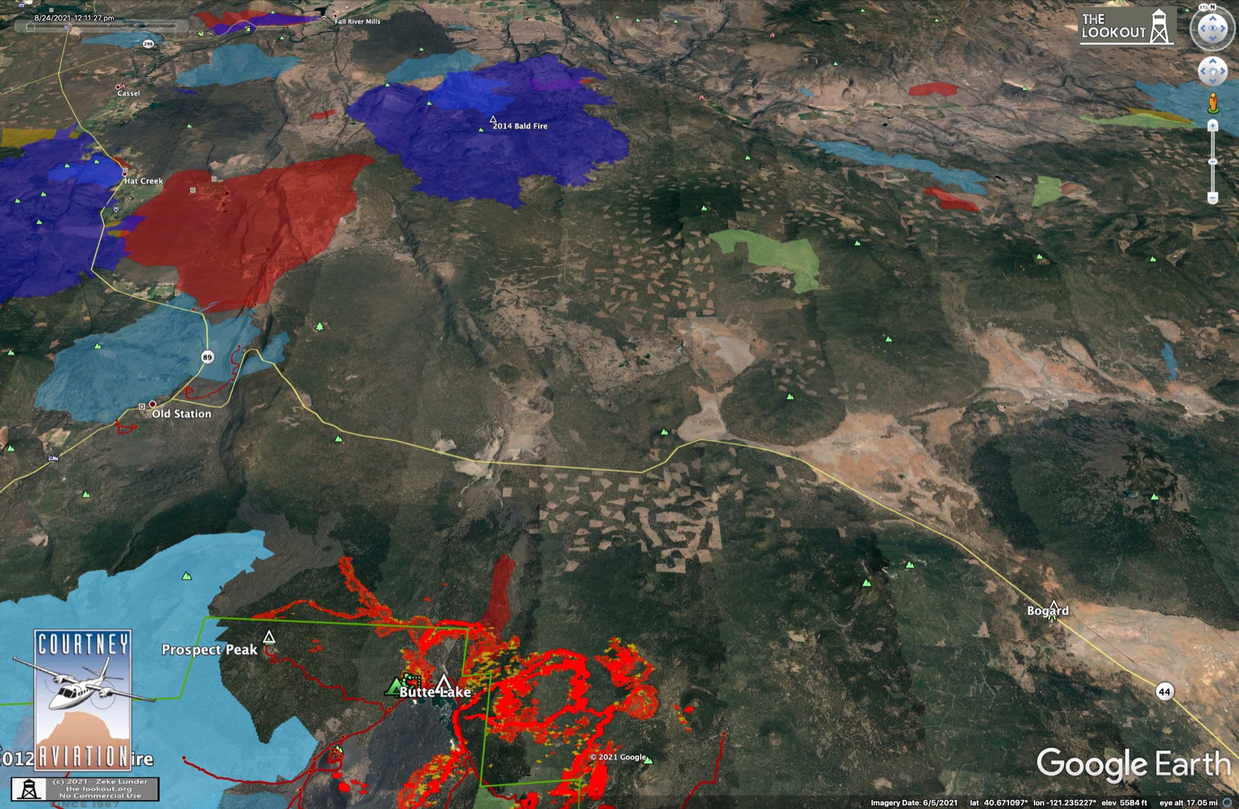
I’ve hiked the Reading Fire area extensively, very interesting to watch the regrowth over the years, trees were 6-8+ ft tall 2 years ago, lots of dead standing to watch out for and blow down to navigate, did some trail maintenance along the park boundary fringe near Badger Mt and Prospect Pk, didn’t make it there last year. Here is Sentinel long wave IR from 2 days ago showing LNP area:
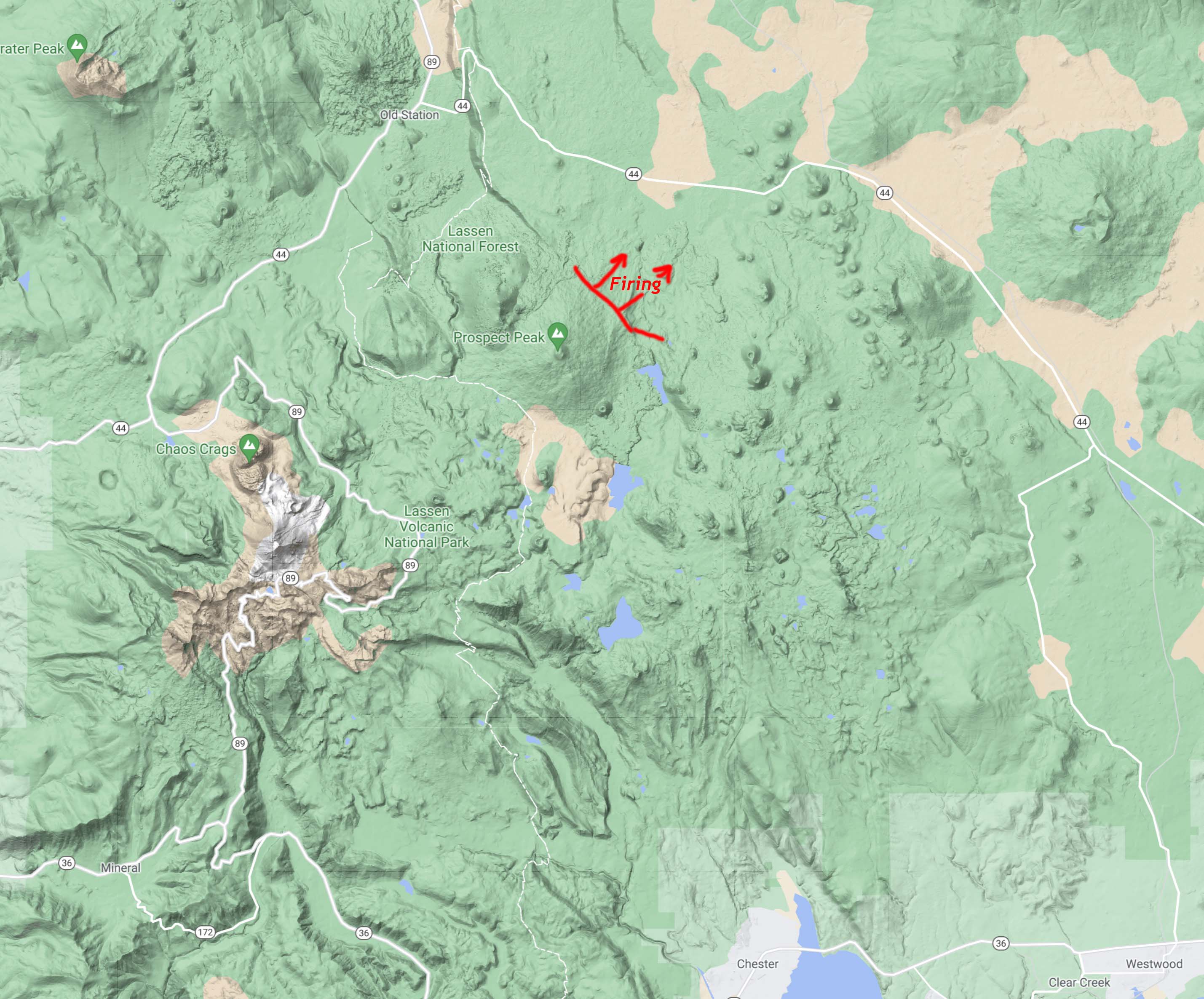
Sounds like the firing op on north edge we’re talking about blew out in a big way this afternoon. Has run about a mile on two different fronts. Headed for Highway 44 about where Butte Lake Raod heads south.
Nasty country thats hard on dozers and troops. However, on the FS side of the map there are many acres of Rx, group select thinning and fuels treatments in that area. Should lay down enough to get a line around it assuming better overnight Rh recovery now that Fall is approaching & days are getting shorter… Yes, i kno better than to assume anything but yall need a break to go your way given what you’ve been through on Dixie!
I thought the same thing in August 2014, what with 30 years of biomass thinning on the Hat Creek Ranger District and as much rx fire as anywhere in the State, relatively flat with roads everywhere. But the Bald Fire was absolutely resistant to control for days, burned 40,000 acres. Dixie could easily add 50,000 acres, much of it private timberland, before it hits the Bald Fire scar. No other recent fire history in between. Red shape in left-center is 1987 Lost Fire.
As soon as i pressed reply i knew someone - probably you - would swoop in and bring my wishful bloviation back down to earth & reality! I get it and i think - no, i know youre right! There was that line in Jurassic Park about “life always finds a way” and i believe fire(s) have shown us that it too will ALWAYS find a way. Its been finding ways to connect the dots between all our Rx burns & WUI’s & Landscape level treatments in each/every state & landmass. In a way it feels like all the work we & private industry has done over the last several decades has led us to this point. Who’d have thought the work we’d do in the name of firefighter safety and all kinds of other metrics & weasel words would lead OR contribute to what is happening now when fire becomes established in or crosses our treated areas. I certainly didnt. I was blessed to get picked up on the Hat Creek in 94 as an Apprentice and i stayed until 2010. Its been complex after complex since then…
Purple lines are completed dozer lines, blue lines with ticks were tagged as planned dozer and other lines in the data package from 8/23/2021. Why they have a line marked to go across a lava field twice…? shrugs
some entries don’t have a length listed in several categories, but from what is in the table…
1,578 miles of dozer lines.
Since you’re poking me with a stick on the math:
1 mile of burnout.
18 miles of fuel break.
89 miles of hand line.
30 miles of mixed construction line.
0.5 mile of plow line.
352 miles of road as a line.