That’s a whole lot of supp repair
Getting Evacution alerts for the Spring Garden area.
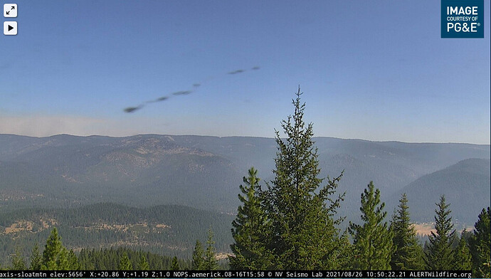
My bandwidth is too low for webcam right now but wondering what the Sloat webcam is showing?
I’m showing 6 miles from the front of finger that went through Genesee Valley to the Williams railroad loop in Spring Garden area.
I just realized if you can’t pull an image from the cam, can you see the image I posted? LOL It shows some haze to a distant ridge, should be Grizzly Ridge, then heavy smoke on north side of image, no significant column that I see.
Takes a minute or two to load the still image; the alertwildfire website just has too much stuff on it…neat when it works though. Thanks.
Plumas County Sheriff’s Office
49m ·
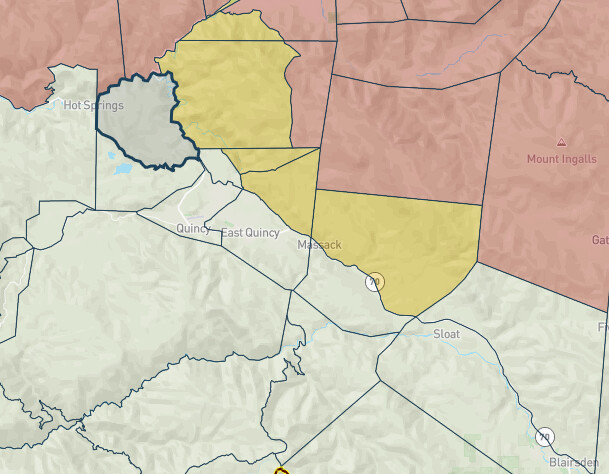
Due to the #DixieFire an Evacuation Warning has been issued for:
The north side of Chandler Road from Quincy Jct. Rd east to Hwy 70 and the north side of Hwy 70 from Chandler Rd east to just west of Massack [PLU Zone 17-D and 17-C]
AND
Hwy 70 at Massack, east to the east side of Lee Summit and everything north of those locations to the area of Argentine Rock and the south boundary of Zone 21. This includes Greenhorn and the north side of Spring Garden [PLU Zone 22A]
MAP LINK: https://community.zonehaven.com/?latlon=39.94117449793606,-120.81088728500578&z=11.082593822016985
And to put it visually:

From: Threat to PG&E power lines may leave Westwood without power for days
WESTWOOD, Calif.- Due to fire conditions that threaten PG&E transmission lines in Hat Creek, Westwood may experience a power outage for the next several days, the Lassen Municipal Utility District said.
LSUD transmission lines between Susanville and Westwood suffered fire damage on Aug. 18. LMUD has provided power to Westwood through Hat Creek since then.
There are repairs being made but if power is shut off to the Hat Creek line there is no way to supply power to Westwood.
Residents should prepare for extended power outages, that while not imminent, are still possible.
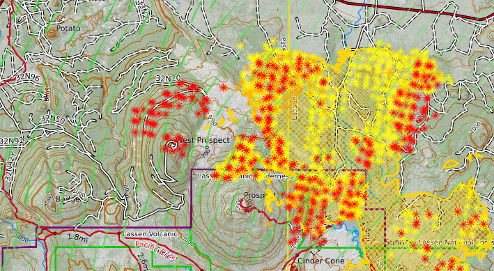
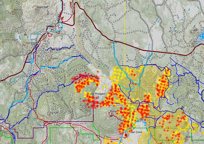
Things are really flaring up again southeast of Indian Valley.
I’d guess from this that they are firing around West Prospect lookout and from the road on north side.
Oh damn! Thats gonna get sporty for sure…
Soon this will make a run to the Dixie Valley and Little Valley Area in Lassen County. Curious to see if a southern wind will hit it more. Towards MacArthur.
Here’s an interactive damage map, using drone imagery:
https://geoacuity.maps.arcgis.com/apps/webappviewer/index.html?id=746e2a886f4e4924b98ef0d274d61579
You have to click on a spot and then click “More Info” to be taken to a 360 deg. aerial view, then hit the triangle “play” button.
A few examples:
Downtown Greenville:
Canyon Dam:
Team 1 took over from Team 3 today on Dixie West.
CIIMT TEAM 1 or Calfire IMT 1?
I would bet on CalFire Team 1.
Yes CF Team 1 has it now.


