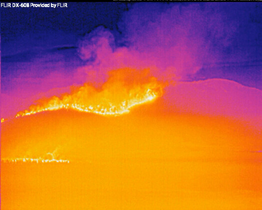
This is the fire front below Butt mountain
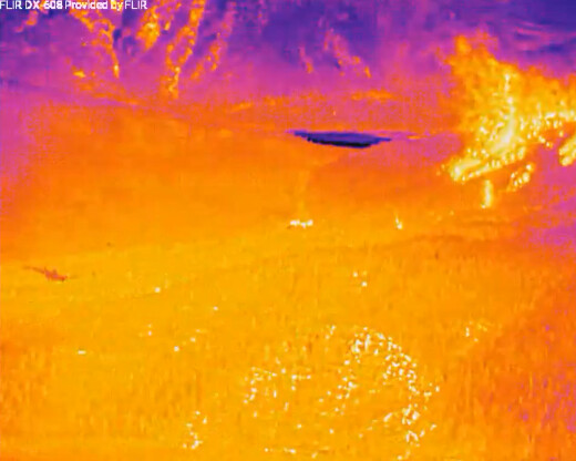
This is the fire front with spotting over the ridge above Greenville
Here are still FLIR images with where the camera is pointed:


This is the fire front below Butt mountain

This is the fire front with spotting over the ridge above Greenville
Here are still FLIR images with where the camera is pointed:
Alert on TV. Immediate evacs for areas around Greenville. Sounded like the were saying don’t pack leave situation.
Prayers for All.
I got the Dixie - East Zone CMD, TAC and AIR frequencies added to Lassen County Fire & EMS - Coverage may be limited as receiver is quite a distance from the incident (~25 miles w/ terrain).
northern flare-up: ALERTWildfire
fire moving toward greenville: ALERTWildfire | Shasta Modoc
Weather RAWS station in Chester,
click on daily summary, set date in window and submit (detailed break down on the hour):
https://wrcc.dri.edu/cgi-bin/rawMAIN.pl?caCCHS
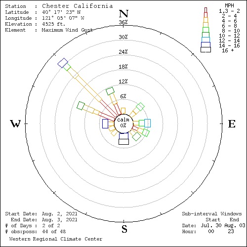
Had the site build a wind rose scale for winds over the last 44 hours and greatest winds are
out of NW between 12noon and 1700. This picture is for gusts in 2mph increments, peak 16mph NW:
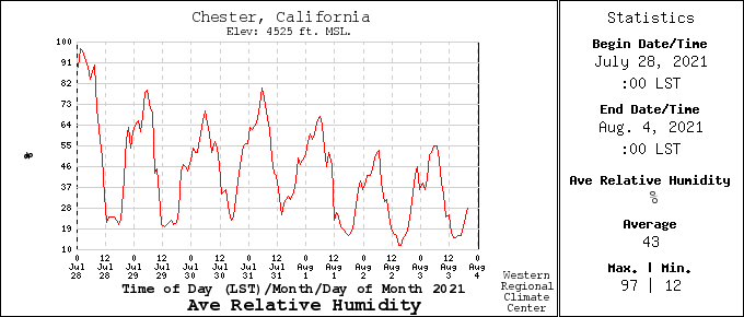
Very poor humidity recovery the last 3 days which has kept the 10 hour fuel stick very dry 5-3%
Just RH picture for last 7 days here:
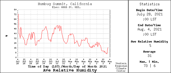
Here is Humbug Summit (within the west end of the burn near Jonesville) shows a different history for winds and humidity is very low but has the same trend as Chester:
https://wrcc.dri.edu/cgi-bin/rawMAIN.pl?caCHBG
RH is crashing here over last 3 days and effecting 10 hr fuel moistures 5-2% :
Wind gusts are out of W - SW (seems to be battling winds between Chester and here):
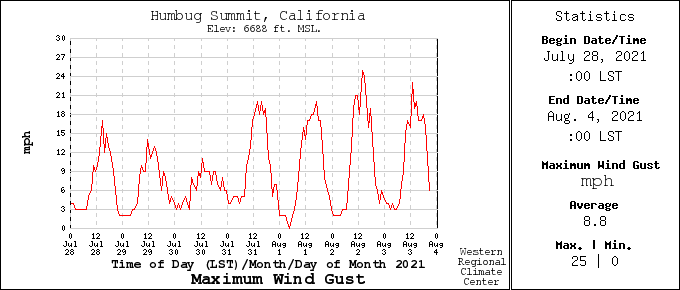
The site was not building a wind rose scale like I did at Chester.
Keep the pics flowing. Our family has a cabin in LACC on the lake and they have been extremely great full for the updates and pics.
Fire has blown past the 36, firewhirls reported crossing the highway
Running crown fire north of Hwy 36 near Bernard Lodge. 36 closed for all fire traffic due to conditions
I am pretty sure I am triangulating that correctly. The black diagonal is the channel crossing to the west. Appears to be flaring up good on the cam.
That is correct S of the Chester Airport by a few hundred yards