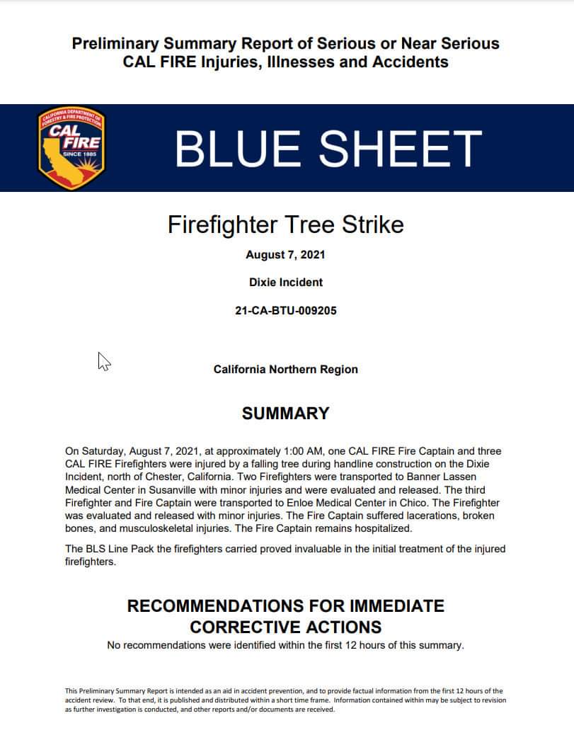
I know I saw the Blue Sheet on here, but I dunno when it was posted — glad he’s close to home and praying for rapid recovery!`
5 Likes
Add a couple of MAFFS and a VLAT.
1 Like
Incident occurred on Aug 7th.
Blue sheet came out 24 hours after.
6 Likes
Good sized pyro cumulus over the southeast corner of the fire near antelope lake. Won’t be long before this hits the walker fire scar.
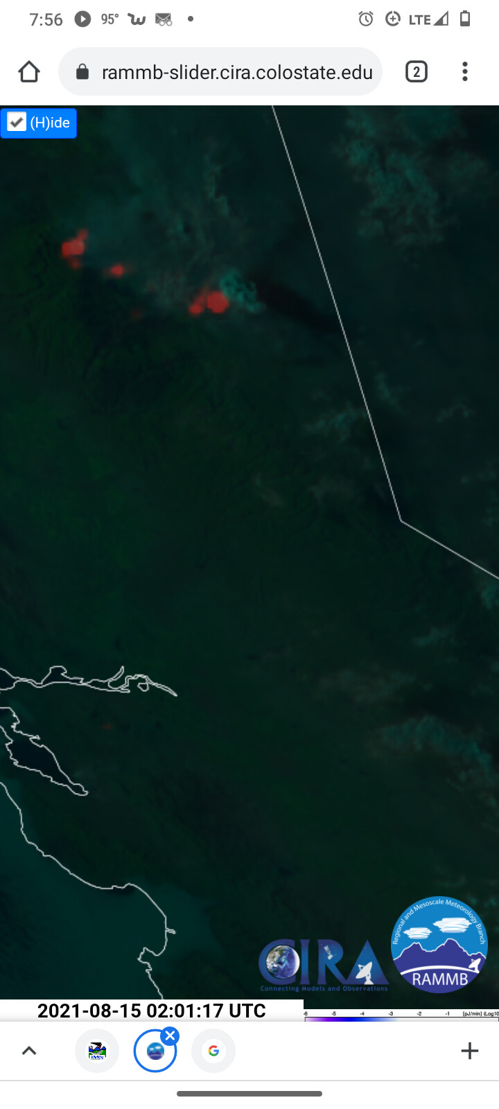
7 Likes
#DixieFire - 8/14/2021 Evening Update.
No major runs on the West Zone as of 6:30.
Drakesbad Lives (?)
Could Lassen Park save Shingletown?
And why we need to burn our forests to save them.
Read it all in The Lookout!
https://the-lookout.org/2021/08/14/dixie-fire-8-14-2021-evening/
25 Likes
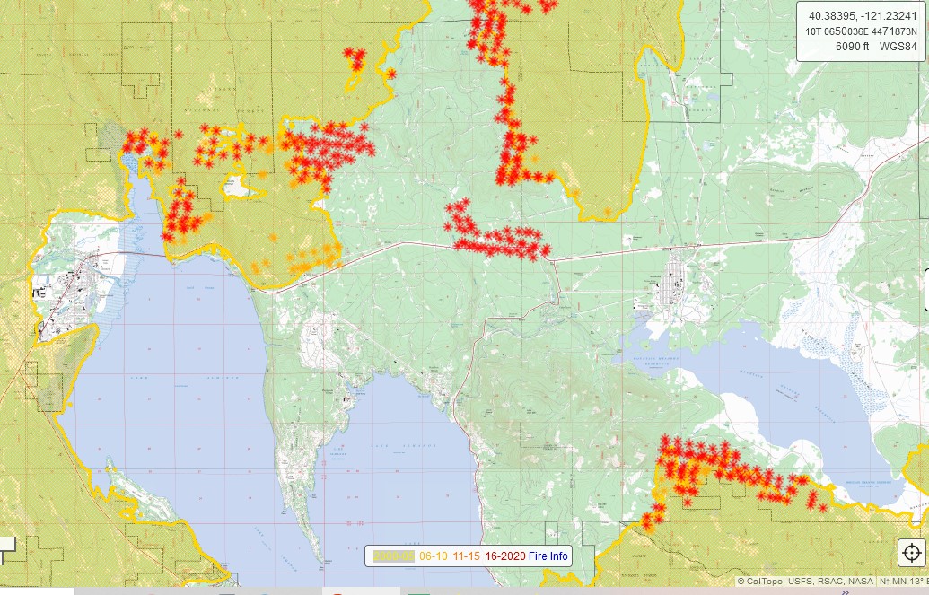
Dixie Fire - 8/15/2021 Morning Update.
New mapping of yesterday’s blowup near Antelope Lake. How thinning in 1980s-2000s changed forests around Westwood, the Walker family fire story, and how Dixie still poses a threat to Susanville. https://the-lookout.org/…/15/dixie-fire-8-15-2021-morning/
14 Likes
They are. I’m up in the Westwood area. Passing by it looked like they’re in mop up stage.
10 Likes
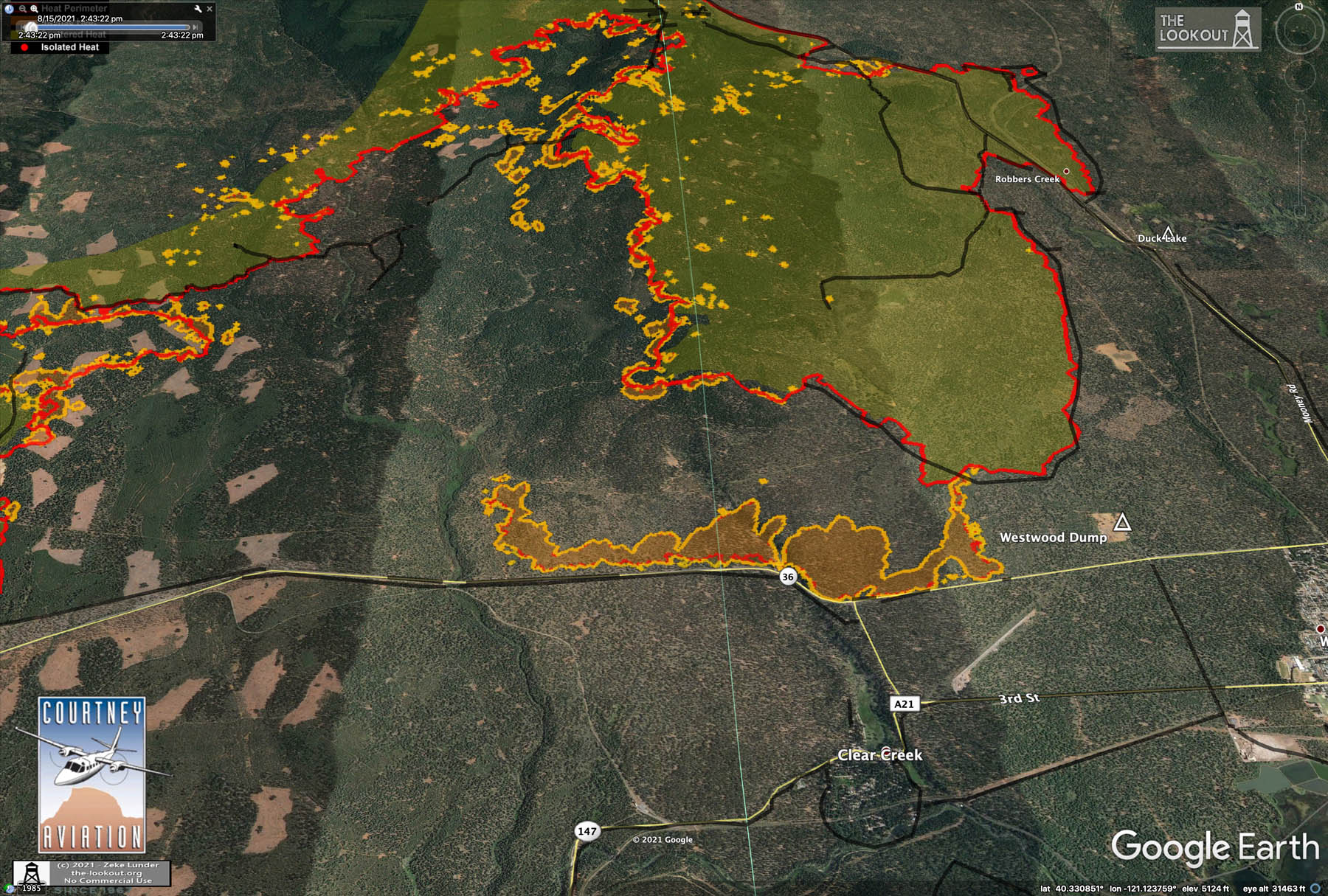
New IR maps from 2:30pm.
A new firing operation along Highway 36.
And commentary about why firefighters are damned if the do and damned if they don’t when it comes to putting fire on the ground under extreme conditions. 8/15/2021 – Afternoon – The Lookout
6 Likes
1830 Sunday: The L-1 fire on Morgan Mountain at 36 and 89 has decided to join the fray this afternoon. Morgan Group right at Branch 9/13 split, Div L/N split in far eastern Tehama County.
It is about to hit Hwy 36 just east of the summit. Multiple strike teams and resources setting up for structure protection in the 172/36 area, Childs Meadows etc. More engines setting up at the summit to make a stand. Lots of T1 rotor working out of an MRB. Shutting down power Hwy 36/172.
Winds are not in our favor for the communities up there. PGE Hwy36 WX right on the highway at the base of Morgan Mtn and Childs Meadows. NNW 9G17 with humidity dropping down to 15% from 33 at noon.
9 Likes
New IR maps from 11:30 pm last night. Fire active in all the same places, firing on Hwy 36 was holding, spread in Lassen Park is slow, Drakesbad survives, and weather forecast for next several days is really bad news.
https://the-lookout.org/2021/08/16/8-16-2021-dixie-fire/
9 Likes
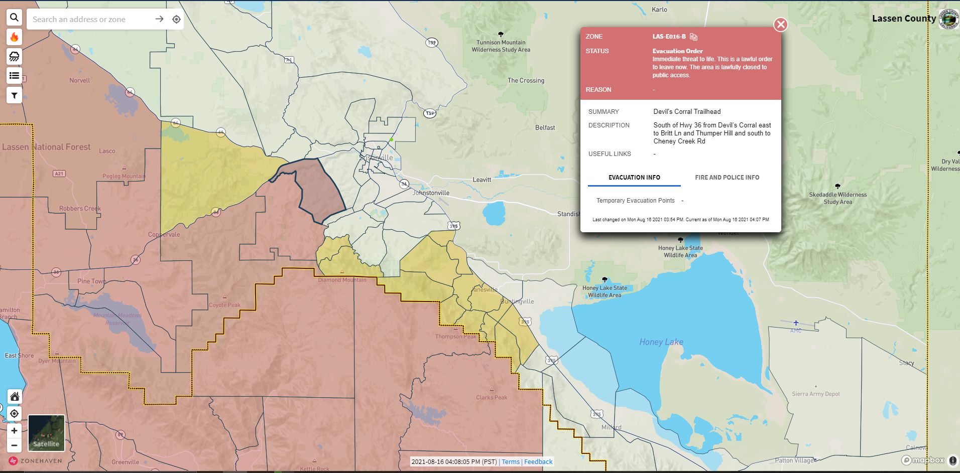
569,707 acres and 31% contained
5 Likes
Very little wind in Susanville but upper level winds have the column blowing directly over town, large PC visible over Janesville area
6 Likes