Their Dropbox is up now:
https://m.box.com/shared_item/https%3A%2F%2Fcalfire.box.com%2Fv%2FCALFIREIMT1
File folders are for the Dixie Fire, however have no files in them yet.

Their Dropbox is up now:
https://m.box.com/shared_item/https%3A%2F%2Fcalfire.box.com%2Fv%2FCALFIREIMT1
File folders are for the Dixie Fire, however have no files in them yet.
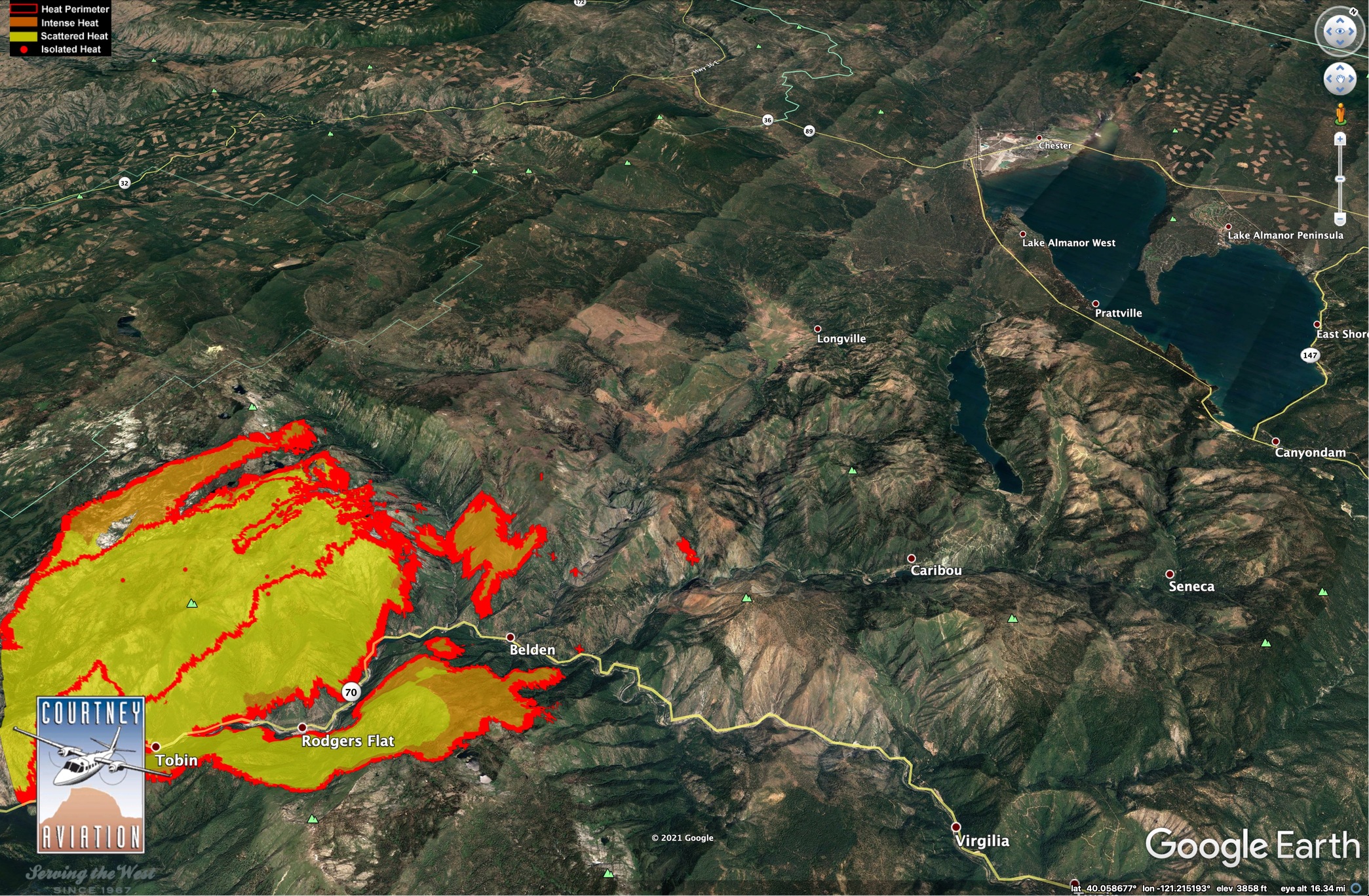
HelCo advising multiple spot fires into the Chip Creek drainage, Copters are working it but they don’t think they can hold it. Too smokey for Tankers in the drainage.
Spots are about 20 acres and pushing east.
One spot fire is about 20 acres. It’s said to be south of Morris Lake and not in the Chips Creek drainage.
Neither the Chips nor Storrie Fires held at the ridge where the dozer line is in Division R.
Hopefully the fact we’ve had 2 fires in this country in past 21 years will moderate the rates of spread a bit. A lot of the forest that survived during Storrie also survived the Chips.
BDU 9354L had been there for a day or two. I’m sure there are some others.
AA is ordering 4 LAT’s and 2 VLAT’s to start working this fire.
Caltopo current heat spots (still 3 hours old) power lines seen if you zoom in:
https://caltopo.com/map.html#ll=39.99465,-121.28168&z=13&b=t&o=f16a%2Cr&n=1,0.25&a=fire%2Cmodis_mp%2Cfeatures
Seems that it might be into Belden by now.
Quincy (East of Incident)
https://wrcc.dri.edu/cgi-bin/rawMAIN.pl?caCQUI
Click on daily summary and submit info for current day.
Jarbo gap RAWS: (way west of incident)
https://raws.dri.edu/cgi-bin/rawMAIN.pl?caCJAR
Winds gusts @ 1400 was 19mph
1800 now @ 10mph
15,000 acres, 15% contained this AM
AA-210 reporting the spots across Hwy 70 are well established & moving in all directions. This was reported in the Feather River Canyon. Tankers are working the spots but they are not going to catch them at this time.
Plumas County Sheriff has issued a Mandatory Evacuation Alert for the communities of Bucks Lake, Meadow Valley and Hwy 70 corridor from Rich Bar to Twain
From a CF Team 1 member supposedly 1300 acres across the river and 70, sounds like a whole new ball game
BCSO sending multiple deputies up to Bucks Lake mutual aid for Plumas SO/SAR for evacs. BCSAR is primary on the High Lakes side, Philbrook, Jonesville etc. Sounds like Cherry Hill campground is the line between Evac Order and Warning, with the Butte Meadows and Inskip communities falling into the Warning category now. LNF resources also doing notifications in the high Lakes area, Snag Lake etc.
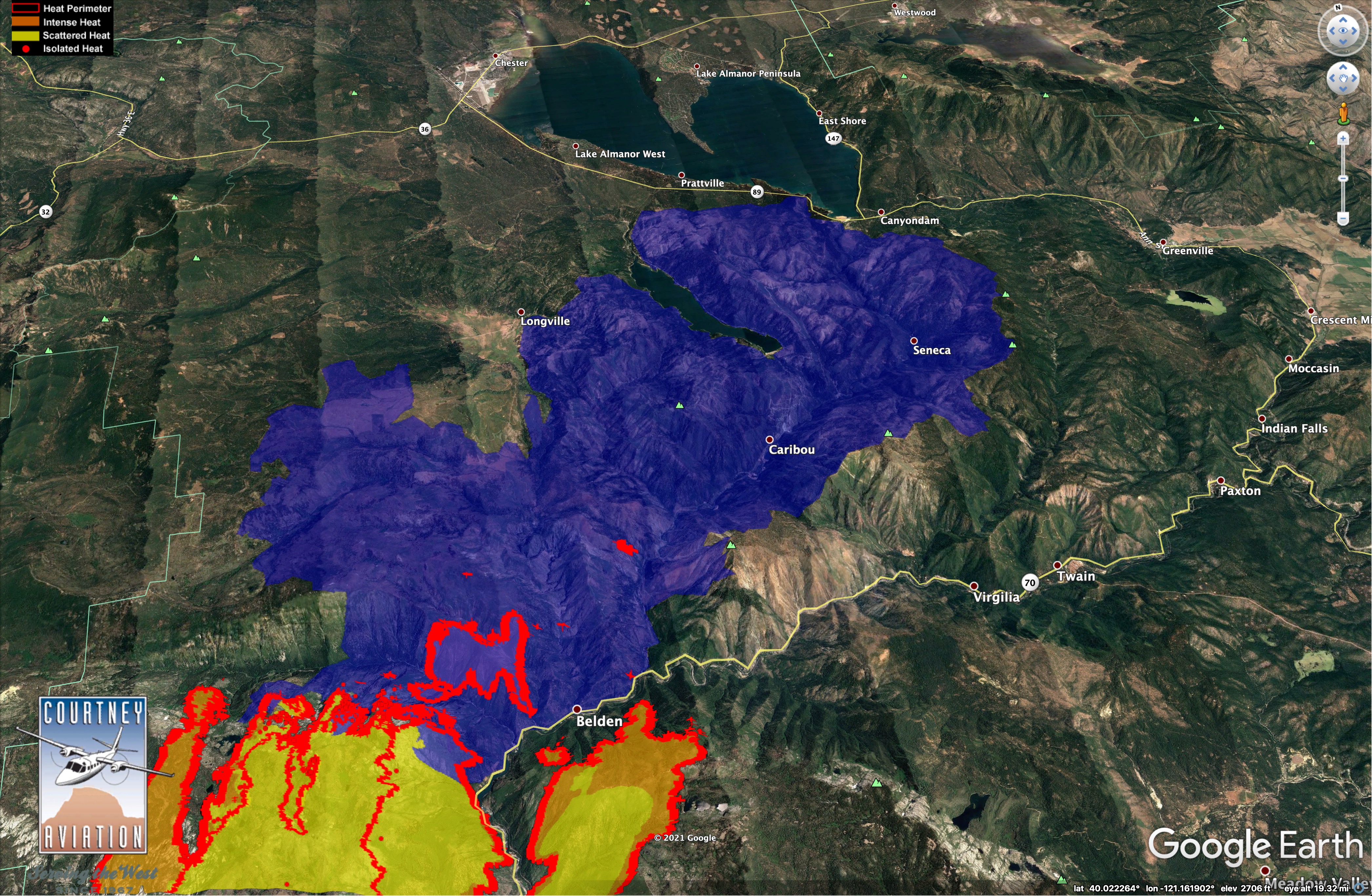
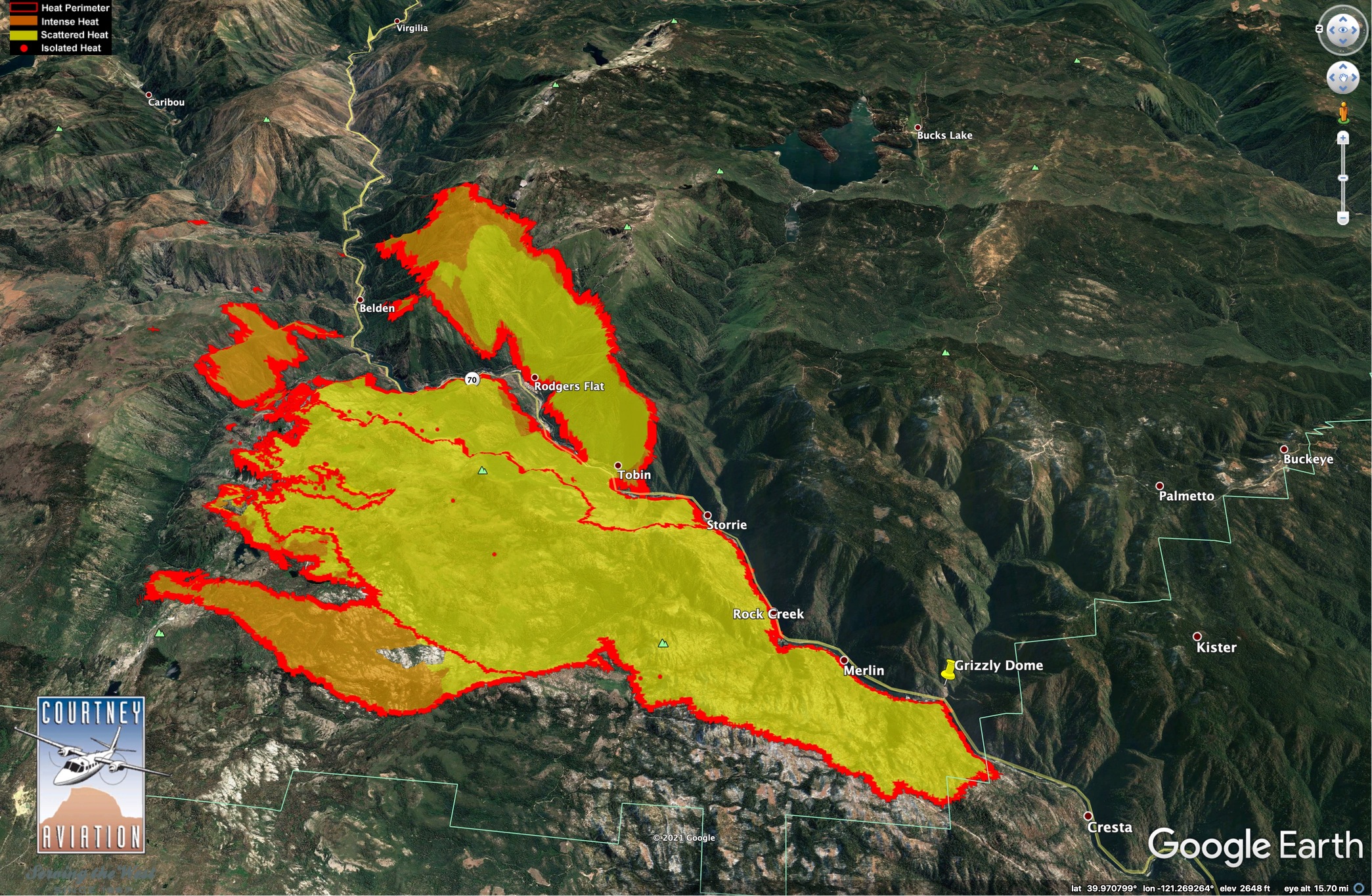
Three views of Dixie. IR from 23:45, 7/18.21.
Blue is 2012 Chips Fire. Data source: NIROPS (Courtney Aviation is Contractor).
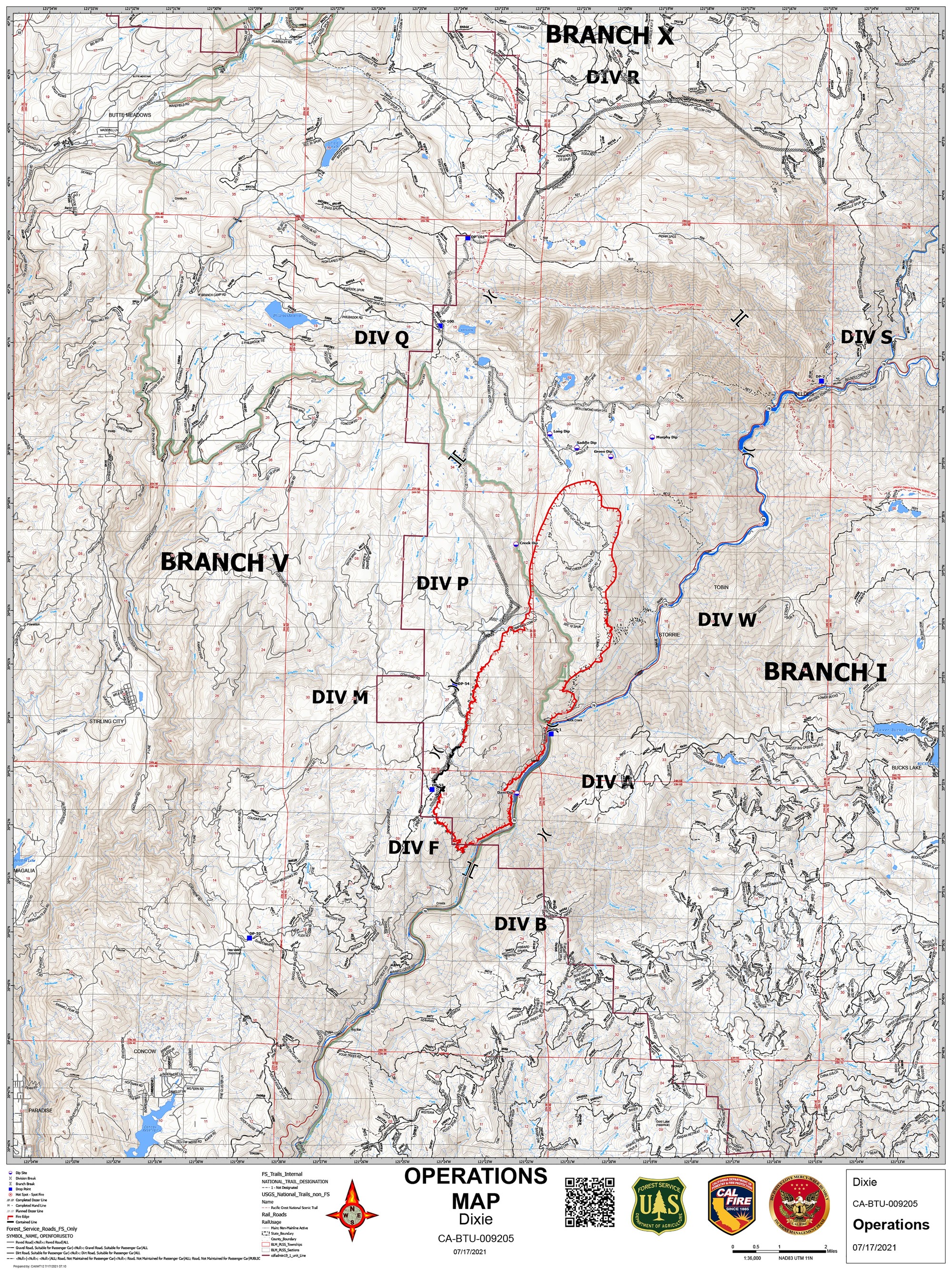
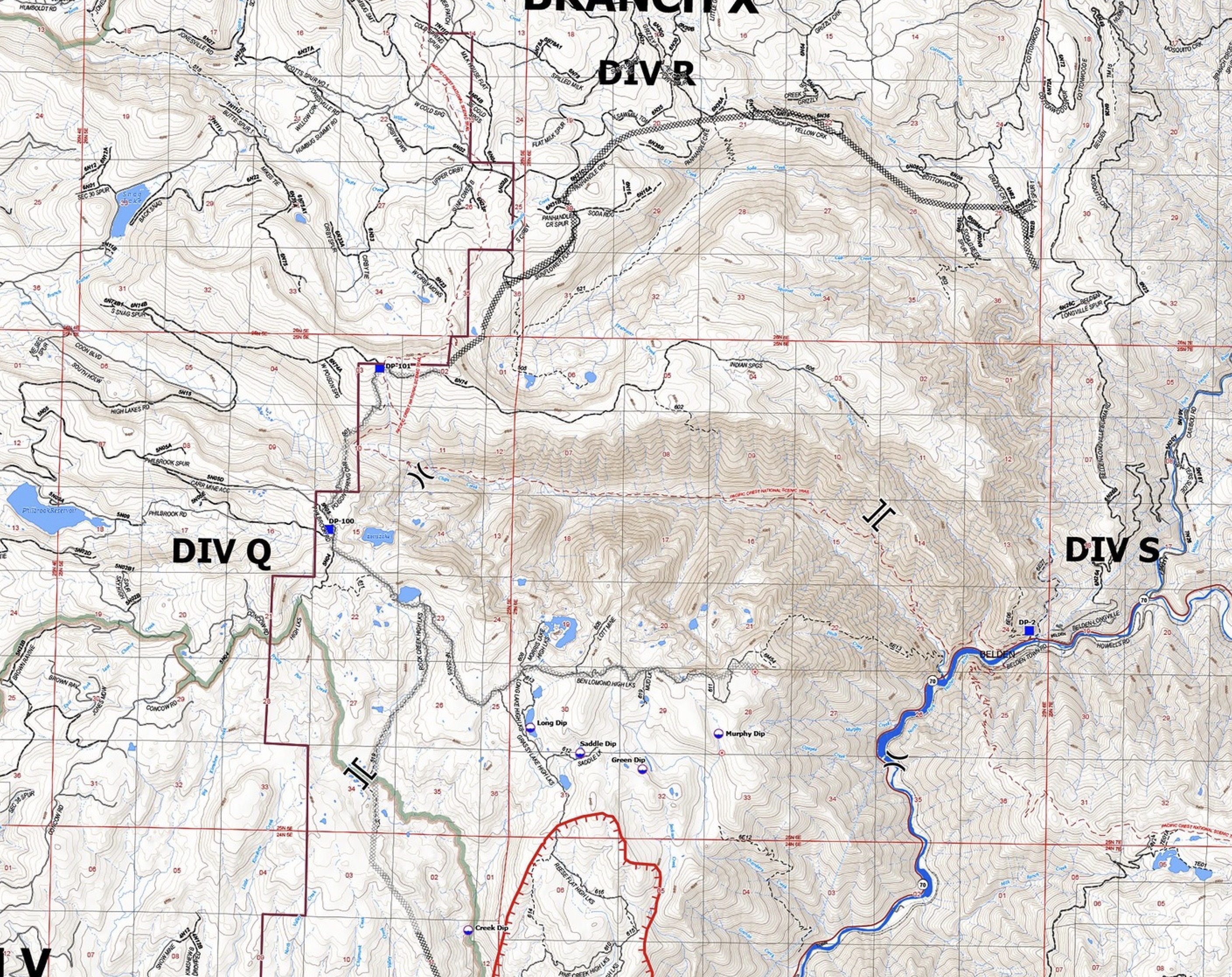
Ops map
Sorry your map was unable to be displayed, please try again
Not again