Thank you for the link and all of your knowledge, hoping people will hear that publication and take your advice seriously!! I live in PLUMAS county, Claremont was literally 5 miles from my mother’s home and about 15 from mine- so in awe of all that was accomplished with such short resources and such horribly managed and neglected forests!! And am aware of how easily that fire could have turned the other direction, we are so fortunate!! Thank you again and may I share the link?
Thanks @pyrodactyl! Yes, for sure - the guy who did the interview is named Matt Fidler. He put together some great local programming after the Camp Fire, and got funding from Sierra Nevada Brewing Company to produce a four-part radio series about fire in California. I was impressed with how gracefully he pulled together all the different interviews he did into a cohesive story. I highly recommend listening to it. It is called California Burning. https://www.californiaburning.net/
(Sorry to tie up the incident info thread, maybe mods can move this to ???)
5 Likes
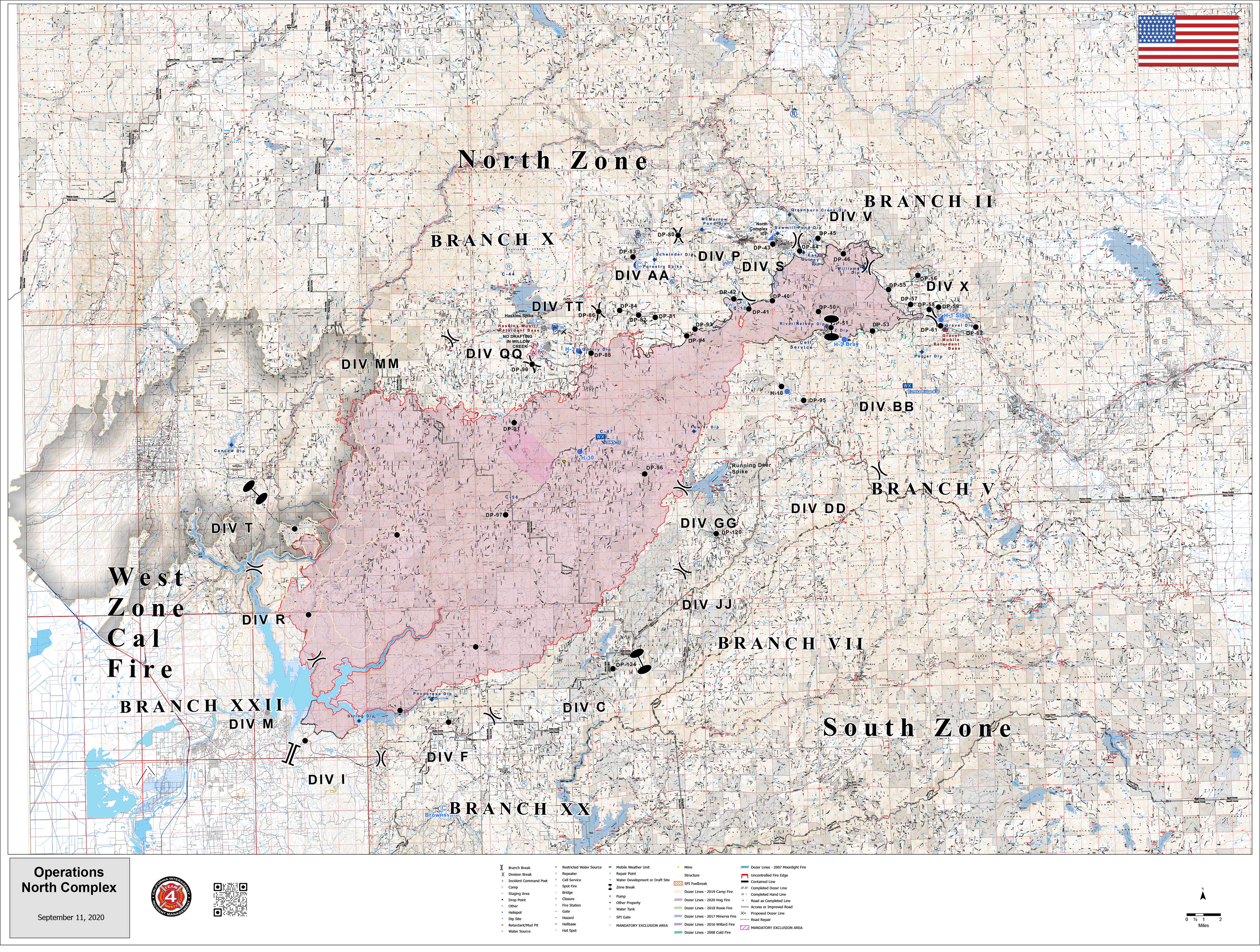
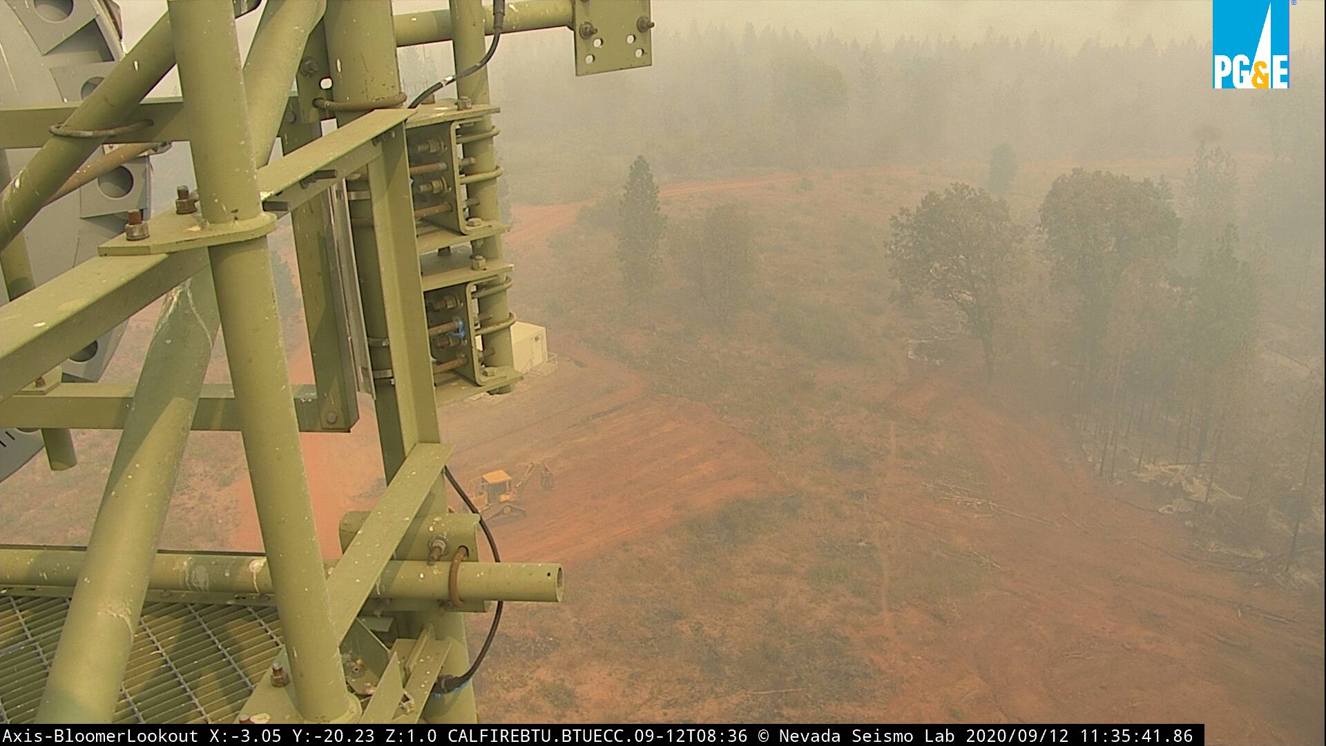
Here are a few images captured today, 9/11/2020, about 14:00.
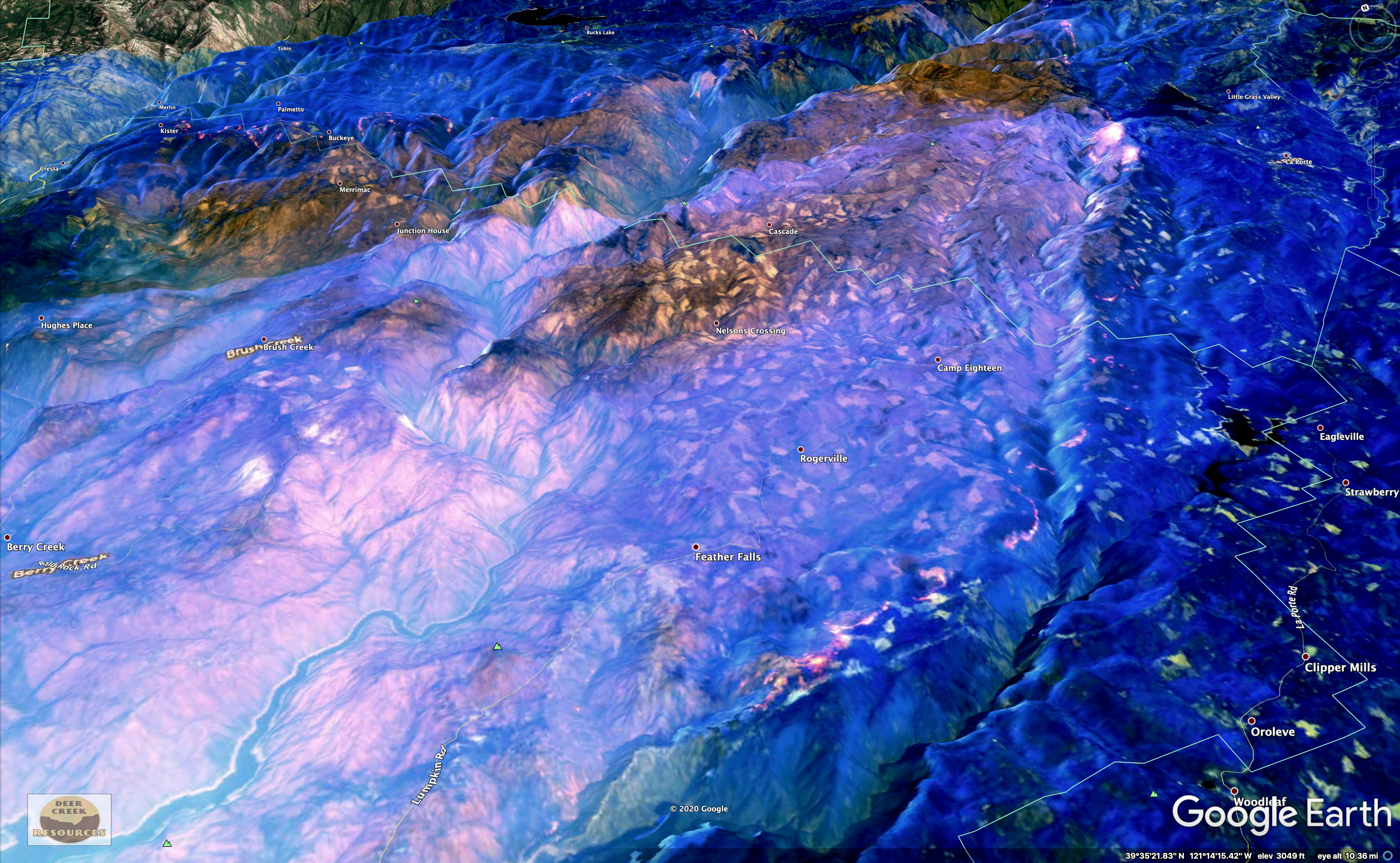
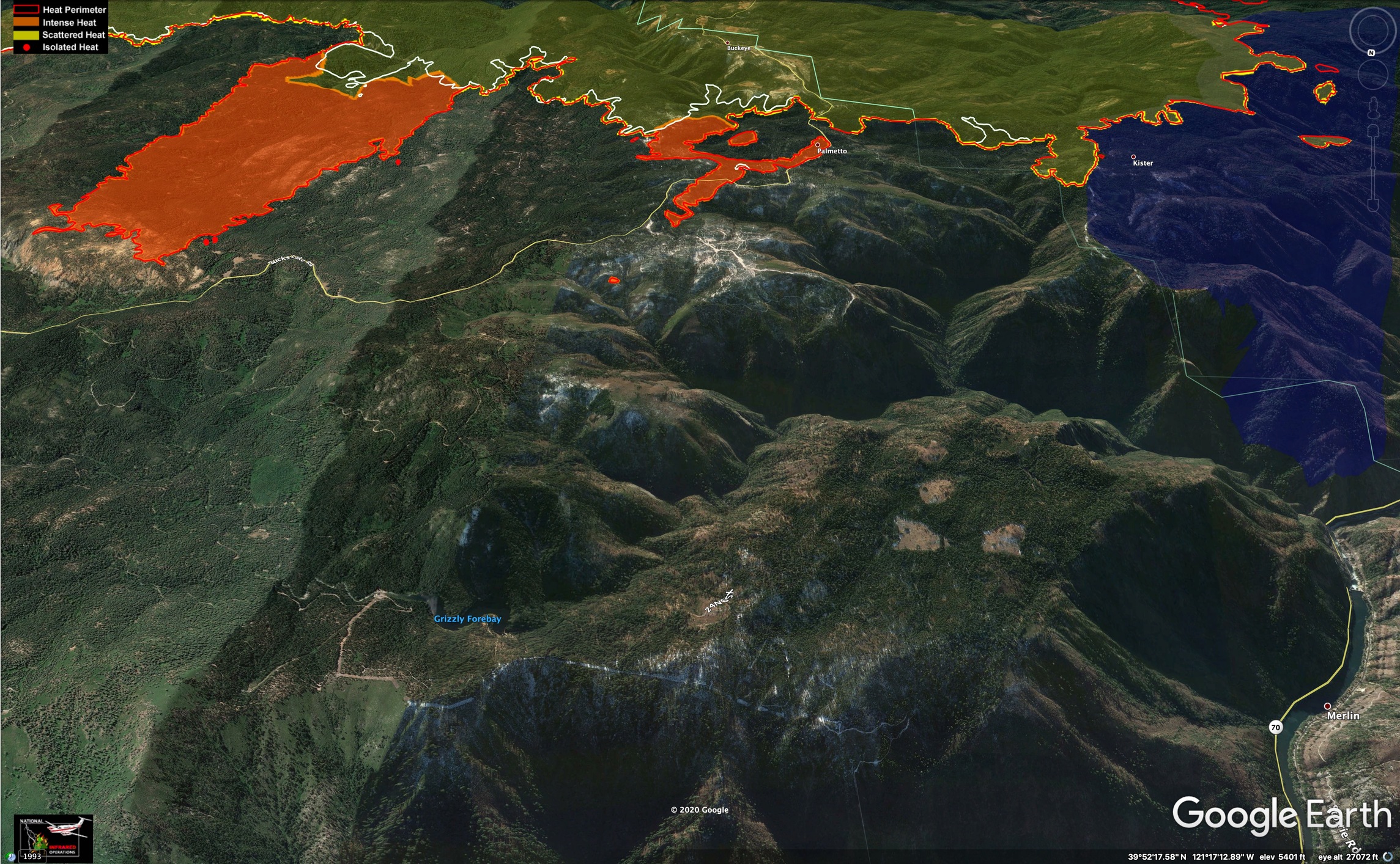
Some old-growth areas in the deep canyons of the Middle Fork Feather River didn’t get blasted in the initial run, and are getting backing fire. Not a lot of growth in past 2 days, hot spots are evident in the imagery.
For more images and interp, check out the Deer Creek GIS Facebook Page.

9 Likes
Thanks Zeke. Sad to see my old Division decimated…
2 Likes
With respect to the people posting, seems like a lot of the posts have gotten off track on this fire? It happens! Maybe the Mods can preserve those posts and get it back to the fire?
3 Likes
My apologies for the off-topic post. I should know better.
5 Likes
I saw the video that night, wondered where they got a dozer with a backhoe on it…now I see it was a track skidder
4 Likes
Ongoing Damage Assessment Map:
https://arcg.is/1WijH0
2 Likes
Jeebus!
 Fire into Oroville from Lexington Hill (Part II)")
There is another angle on the Alertweb Youtube site:
 Fire into Oroville from Lexington Hill (Part I)")
But wait, there’s more -
[EDIT]
Just noticed a 2 hour gap between 1800 and 2000 hrs. What are they hiding?

19 Likes
The video does a good job showing the huge column that pushed up over Berry Creek between 2 and 3am. On the GOES 17 animations, the smoke in the upper atmosphere from that column shows up at dawn, headed south down toward Fresno. Maybe from the peak of the downcanyon winds?
11 Likes
Incredible! On the first video it seems that you can see when it goes through Berry Creek by the explosions (of propane tanks?), in addition to the column. Last night, as I was looking at the map of the homes through that area, I was amazed at the number that survived. I couldn’t imagine any making it through that.
1 Like
Is there a QR code for this incident, if so can someone share please.

1 Like
Looks like they are hitting this one hard from the air now that the skies have cleared. 8 planes tracking over Strawberry Valley and a helicopter over big bend. Been watching the planes fly over off and on for the last couple of hours. Good to see them back up. They were delayed for a couple of hours this afternoon by Air Force One Trump landing at McClellan .
6 Likes
The fire is only really active on north and SE flanks, per IR last night. It looks like winds blowing thru a small saddle took a firing operation on NW corner off to the races yesterday afternoon or evening (finger and spot in center of image). Fire is now into Grizzly Creek, tough ground last burned in 1999, I believe.
5 Likes
Just saw this on FB…
At 1:15 pm, 9/16
The fire has spotted the containment line at Lost Creek in Bear Gulch and has moved closer to contingency lines (S, SW). Heli support requested are unavailable. Right now it’s a priority area for crew safety & catching spots.
@1:35pm- it’s past containment lines but just N of contingency line to the NE of S. Fork of Feather River along Lost Creek near Bear Gulch. Heading up the Creek. It’s making significant runs.
1:35pm Crews are requesting air support but it’s unavailable right now. Usually the fire lays down in the area around 4 PM.
Div-D IC is not comfortable with crews working along drainage due to terrain.
6 Likes
I am tracking a helicopter between Clipper Mills and Strawberry Valley and a spotter flying circles just west of Bucks Lake.
http://www.alertwildfire.org/shastamodoc/index.html?camera=Axis-EastQuincy
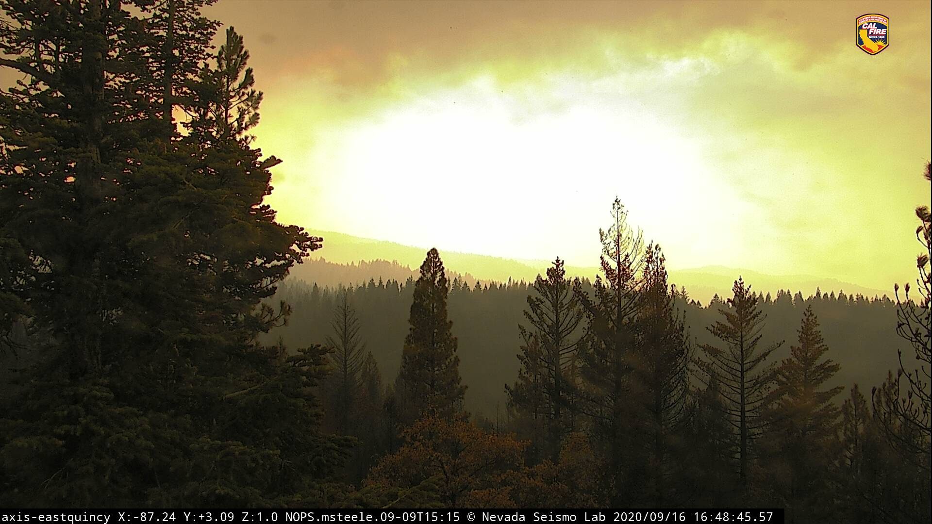
seeing a lot of smoke passing the East Quincy Camera
2 Likes
3 Likes