some timber still around the in the Jarbo Gap area . The area between Concow and Paradise is no trees , just brush and snags. wind is suppose to pick up after midnight. Hoping the Camp Fire scar will slow it down. If it gets up into Magalia there is a lot of town that escaped the camp fire above the pines(a HOA in lower Magalia) It would find a lot to burn there… cross your fingers the wind stops before it gets a chance at that. Alot of older mobiles and an area that has not burned in at least a couple of decades
thank you all for the information tonight. It really helped . I cannot thank you all enough !
Looking like it’s really layed down and not moved much that way, hope that continues.
That is good news, I am guessing it may have run into the camp fire scar and lost fuel to burn thru
The dark trail of smoke seems to be more up by Magalia than here now.
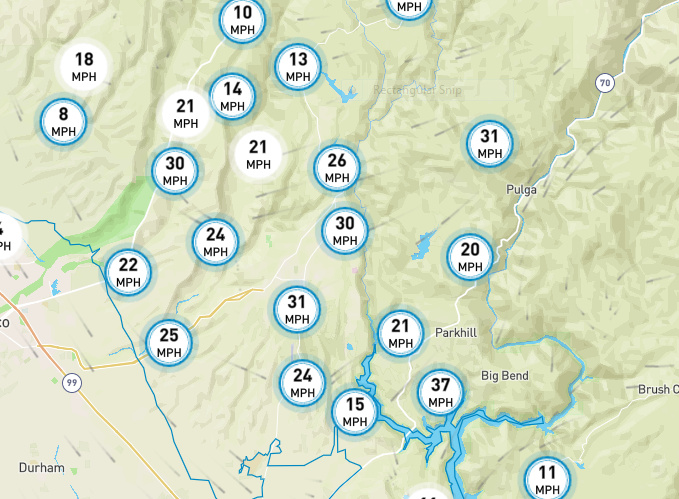
wind are still gusting this Morning ,
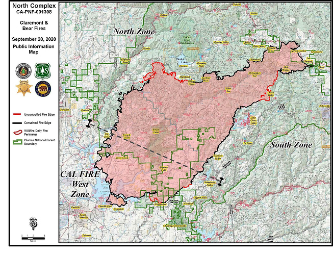
this mornings USFS update.
this mornings winds, these are the gusts

Within the burn op from a few days ago on the south side but haven’t seen it pick up like this in the past few days.
http://www.alertwildfire.org/shastamodoc/index.html?camera=Axis-SunsetHill2&v=81e004f
I dont know what they have for resources on this side? I know they moved the resources yesterday to prepare for the run from forbestown from the north
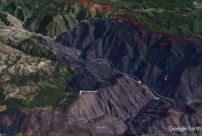
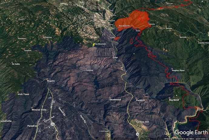
The fire has crossed back into Butte County at Bear Ranch Hill. Visible now cresting the ridge into the main canyon from Flea Mtn cam.
Camp Fire in blue, Bear Fire perimeter in red, County line in green.
http://www.alertwildfire.org/shastamodoc/index.html?camera=Axis-FleaMtn&v=81e002f
Looks like a spot out ahead of the main fire, at least a mile, toward bottom of the Canyon.
It’s moving fast.
http://www.alertwildfire.org/shastamodoc/index.html?camera=Axis-FleaMtn&v=81e002f
Man, it may be only a matter of time…
Good morning, everyone.
From Flea Mtn cam it looks like the fire didn’t move much downcanyon past the next major drainage south of Grizzly Creek, Bear Ranch Creek, though there is a well-established spot above Cresta Powerhouse.
NIROPS IR happened too early in evening to be much help, around 8pm.
Can’t tell from the cam angles if it crossed the NF Feather. Here is a perimeter from 3am VIIRs.
USFS AM Update
Crews continue to monitor fire lines throughout the north and south zones working to mop up hot spots and contain several small spot fires. Of highest concern is a large section of uncontained line within the Highway 70 corridor.Started as a spot fire late on Sunday afternoon and fueled by strong winds, the fire had become well established initially in French Hotel Creek, and now in Grizzly Creek, where it has grown to within several hundred yards of Highway 70 near Grizzly Dome Tunnel. This area will be today’s highest priority for firefighting resources.Firefighters will be aided today by calmer winds that have died down overnight and are expected to be 10-15 mph in the typical pattern of downslope/down valley at night, shifting to upslope/upvalley during the heat of the day. These conditions will allow for greater use of helicopters and other aircraft to fight the fire.
The fire fuel on north side of the Feather River canyon was consumed continuously and a high percentage, 100% in large areas in 2018. The south side was timber and burned with much lower intensity leaving significant fuels including dead and down, so fire behavior will be vary different if and that is a big if the fire establishes across the highway and river to the north side. With that said this is the Feather River Canyon and it is the air mass highway between the Ca Central Valley and North CA/Nevada desert so winds can be very different in the canyon than the general area.


