
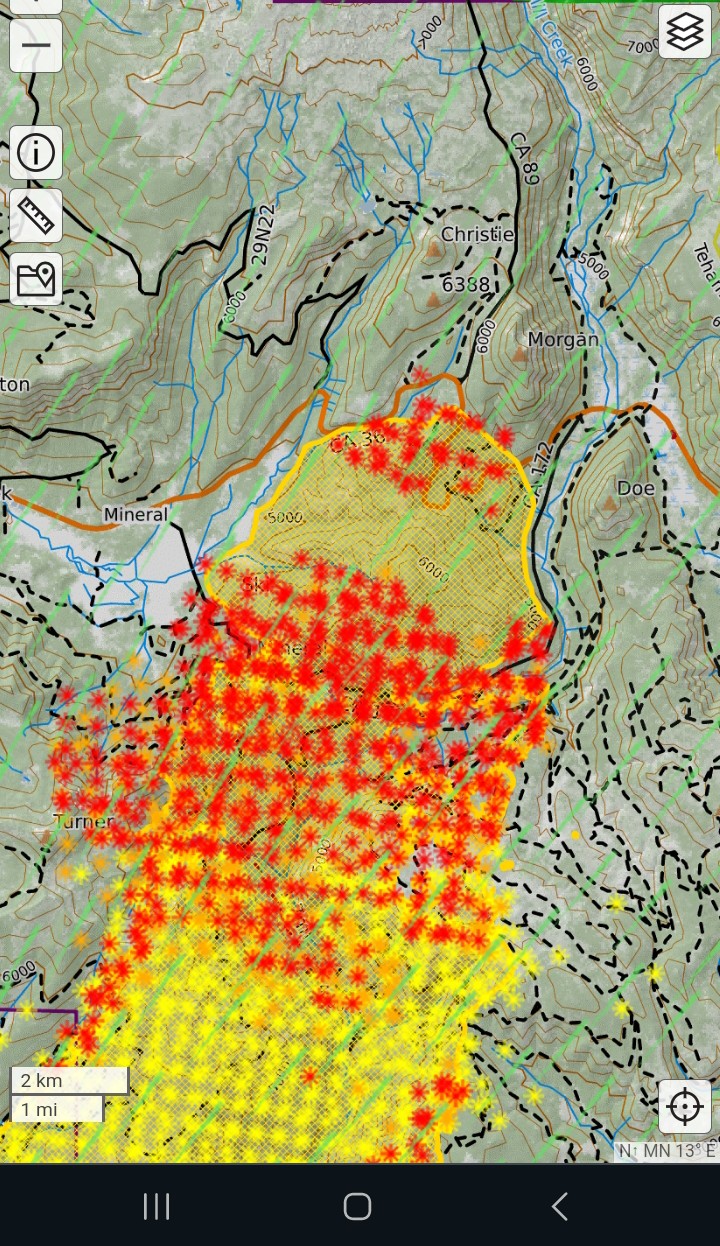
From caltopo. Some up there may say the shape looks like what happened in cases
11 Likes
Was it a firing operation around the Morgan Summit cam, or the fire front going through?
2 Likes
Looks like they fired it last night but was understory burn, still pushing fire up the hill
6 Likes
The firing op was along 172 and doglegged down the east and west sides of the Mill Creek canyon. Morgan Summit burned due to slopover near or in Jones Valley. VLATS tried to contain it but lost daylight. The words of my son, who was on 172 when it slopped over: “The place exploded.”
5 Likes
5 Lats and 1 VLAT ordered
2 Likes
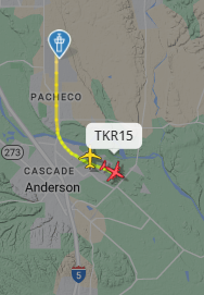
TKR15 just left Redding
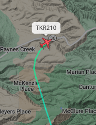
TKR 210 is coming out of Sac with TKR105 , 41 and 912 on their heels
2 Likes
My son was on the Dixie on a falling mod with dozers around and they got blocked off one day and ran out the next - several weeks into the incident! This thing will stop when IT wants to.
5 Likes
Live update given about 25 min ago…

4 Likes
Here is an afternoon update on the #ParkFire’s spread since last night:
7 Likes
Lost 2 Type 1 Air Tankers to the Crozier Fire.
That can’t help anything.
7 Likes
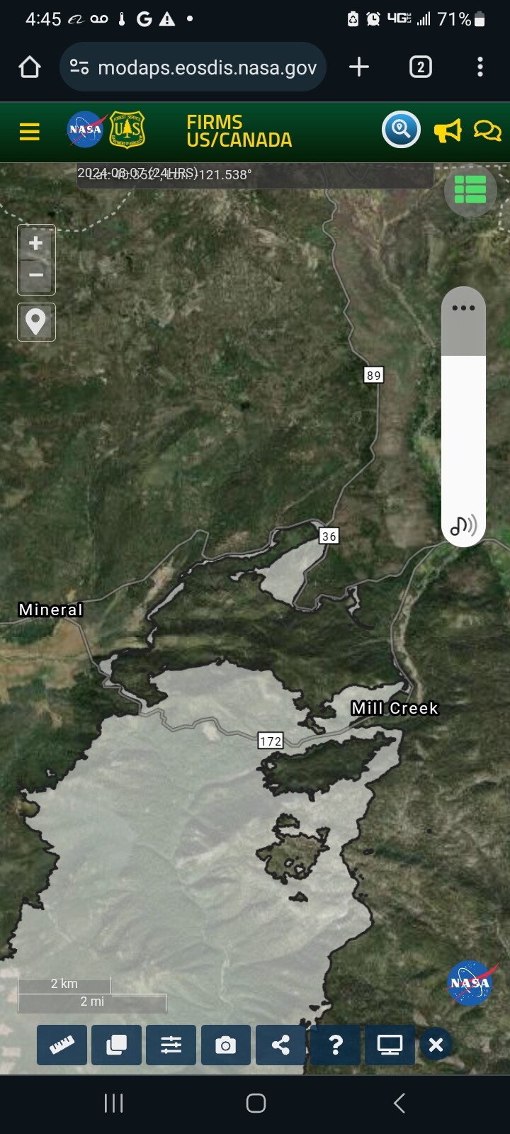
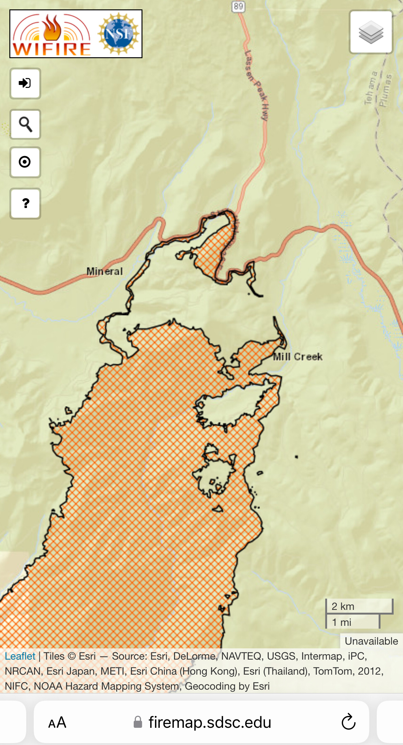
Here’s a corrected image from firms showing a firing operation along highway 36 down to 172 on both flanks. See my earlier post of the caltopo image.
3 Likes
Please don’t use the words “lost” and “tanker/s” in the same sentence. It freaks some of us out. Maybe say “reassigned” or “sent”? Thank you - my spider senses have calmed down now……
31 Likes
Oh, the updated map shows firing ops on 36 and the slopover on 172.
3 Likes
Thank you for update
2 Likes
Sorry I frightened you.
Glad you got the meaning of the sentence
5 Likes
The Inskip camera is watching something north of 36, is this a spot or a new start? Anybody have any information?
3 Likes
Looks like it’s in or next to the black. You can see retardant and black just left of the smoke
2 Likes
On the playback I saw a helicopter make a drop on it.
2 Likes
There’s been periodic smoke on that cam for days. It’s within the containment lines and shouldn’t be a concern
2 Likes