
Ah, Should have done that pretty clear on the time lapse.
2 Likes
several places, wildfire camera feeds are found:
- https://ops.alertcalifornia.org/
- https://alertwest.live/
- https://app.watchduty.org/ - they’re incorporated into Watch Duty’s map view
There’s other places too, but those are most of em
12 Likes
Tanker 914 (VLAT) northbound over the heel of the fire. ATGS requested it to start a retardant operation from Mill Creek rim to Deer Creek. (also requested 2 T-1’s and 2 T-3’ tankers, but they are not showing yet on radar.)
3 Likes
2 Likes
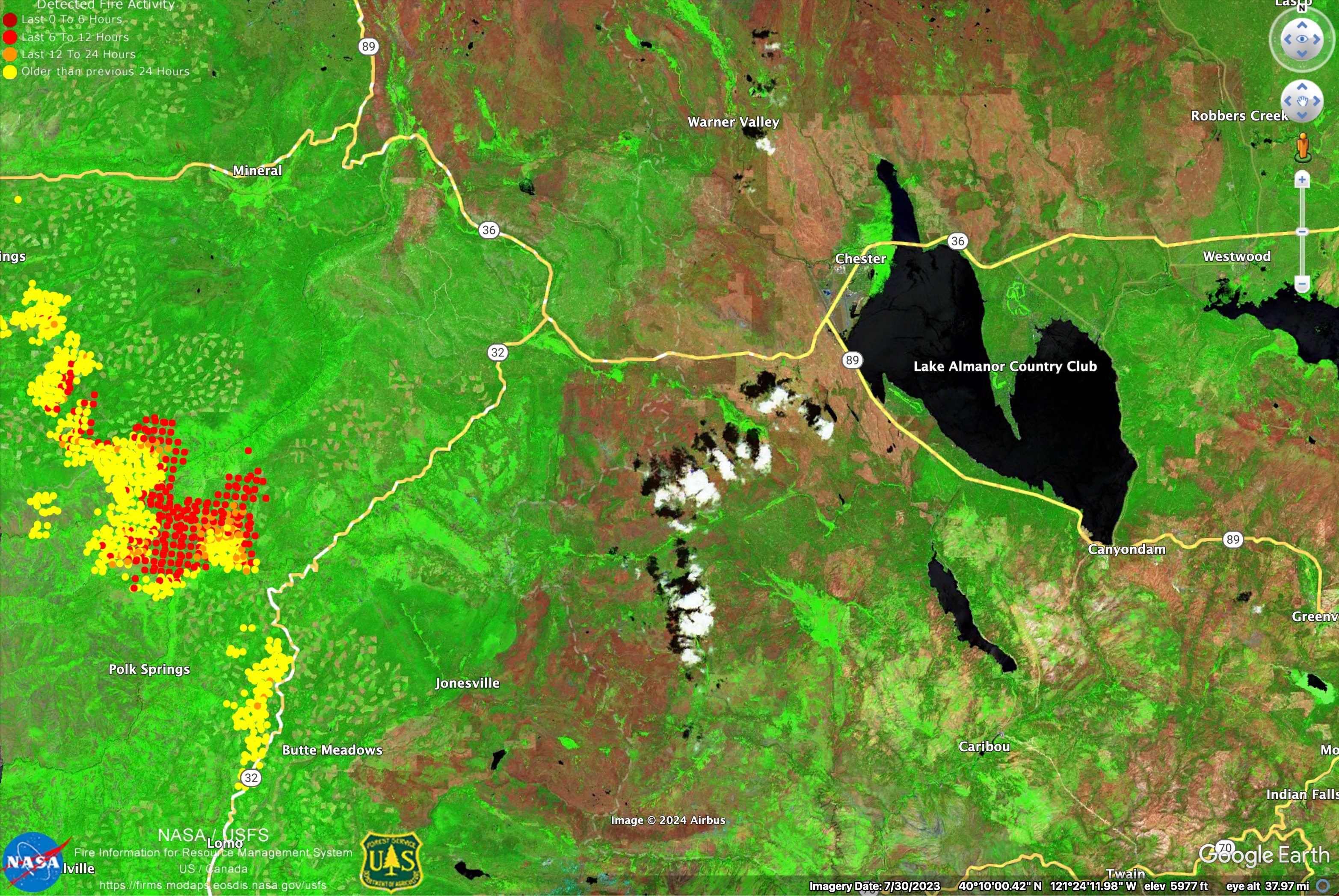
Here are a couple infrared vegetation images showing the high severity areas of Dixie Fire (red) and salvage logged areas around Chester post-Dixie that will protect Chester/Almanor from this fire if it gets that far.
The salvage areas are very cleaned-up.

9 Likes
thank you for update shot,
5 Likes
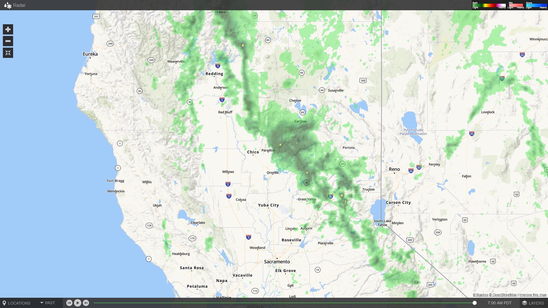
Good Evening. Any updates on the fire activity after the thunder cell went through?
2 Likes
I see no thunder or cells… the radar is deceptive in times like this, with very dry air below 10,000 feet. Practically nothing is reaching the surface. Also no lightning flashes detected from goes satellite that I can tell.
3 Likes
Thank you. I didn’t think there would be any rain but I thought the unstable atmosphere might affect the fire at the head.
1 Like
we have had zero weather today on this fire. closest lightning strike over 100 miles away. zero precip.
3 Likes
Got three drops yesterday in GR-002. Hoping for more today. Let’s clear this air.
3 Likes
We got some wetting rain on our way out this morning from Division Hotel.
8 Likes
To the extent this refers to something I posted a few days ago - there was no intent to question any strategic decisionmaking or monday morning quarterback - only a little peeve I had about an issue of local geography that was getting communicated with a lack of clarity in the press and public briefings, a few days in a row. Our local news outlets are not staffed to do in-depth reporting, and so some inaccurate info has been propagated at times.
I recognize that the command teams are not locals, and I was too flippant in griping about an issue that’s really of no consequence to the operational plan, when the person in question is managing a massively complex team which is truly doing incredible work on this fire.
Anyway - no more from me on the topic. Especially since in this morning’s ops update, he got it completely right. 
6 Likes
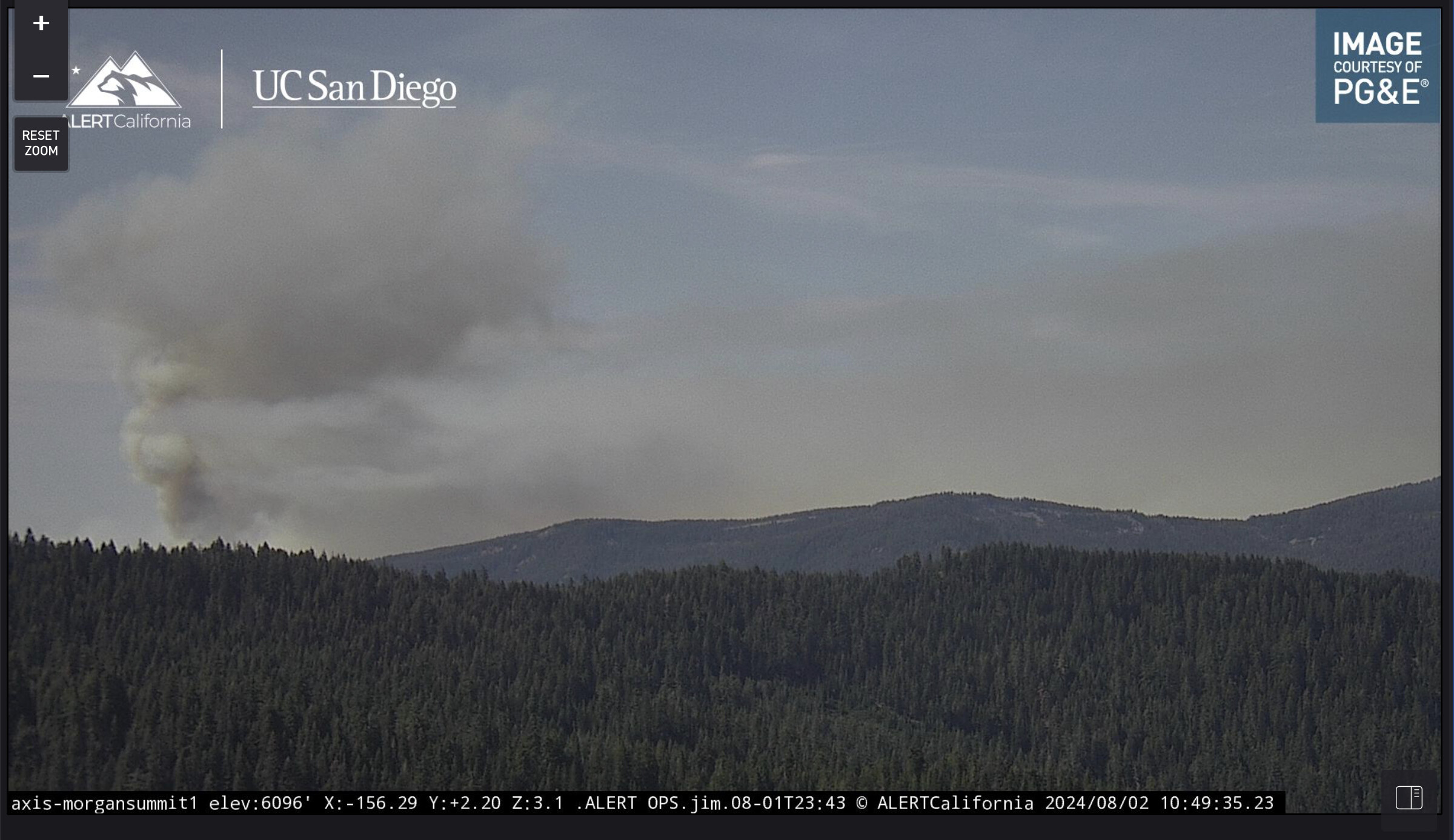
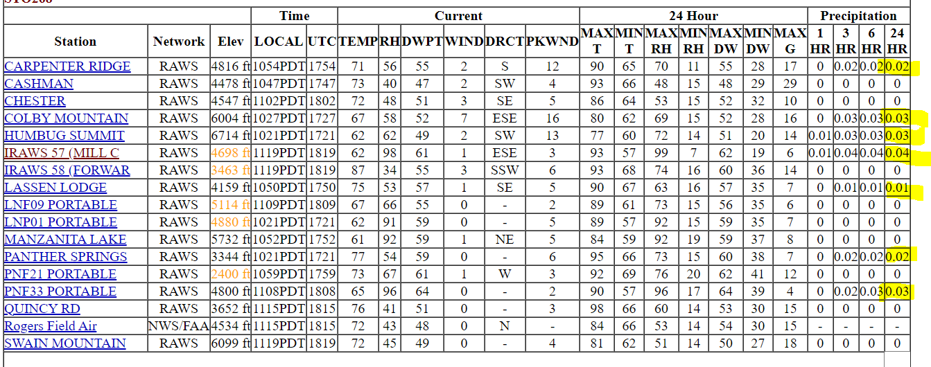
I thought you wanted to ease up on screen grabs for a spell?
21 Likes
3 Likes
I went out to Windy Cut on Hwy 32 about 1700 last night. It was socked in with smoke, visibility about 4 miles, low 70s for temp and dead calm. The FFs have a great window to take advantage of, and there are a lot of them out there. Looks like there is some well-established fire in really difficult parts of Deer and Mill Creek Canyons, but a lot of good work is getting done right now.
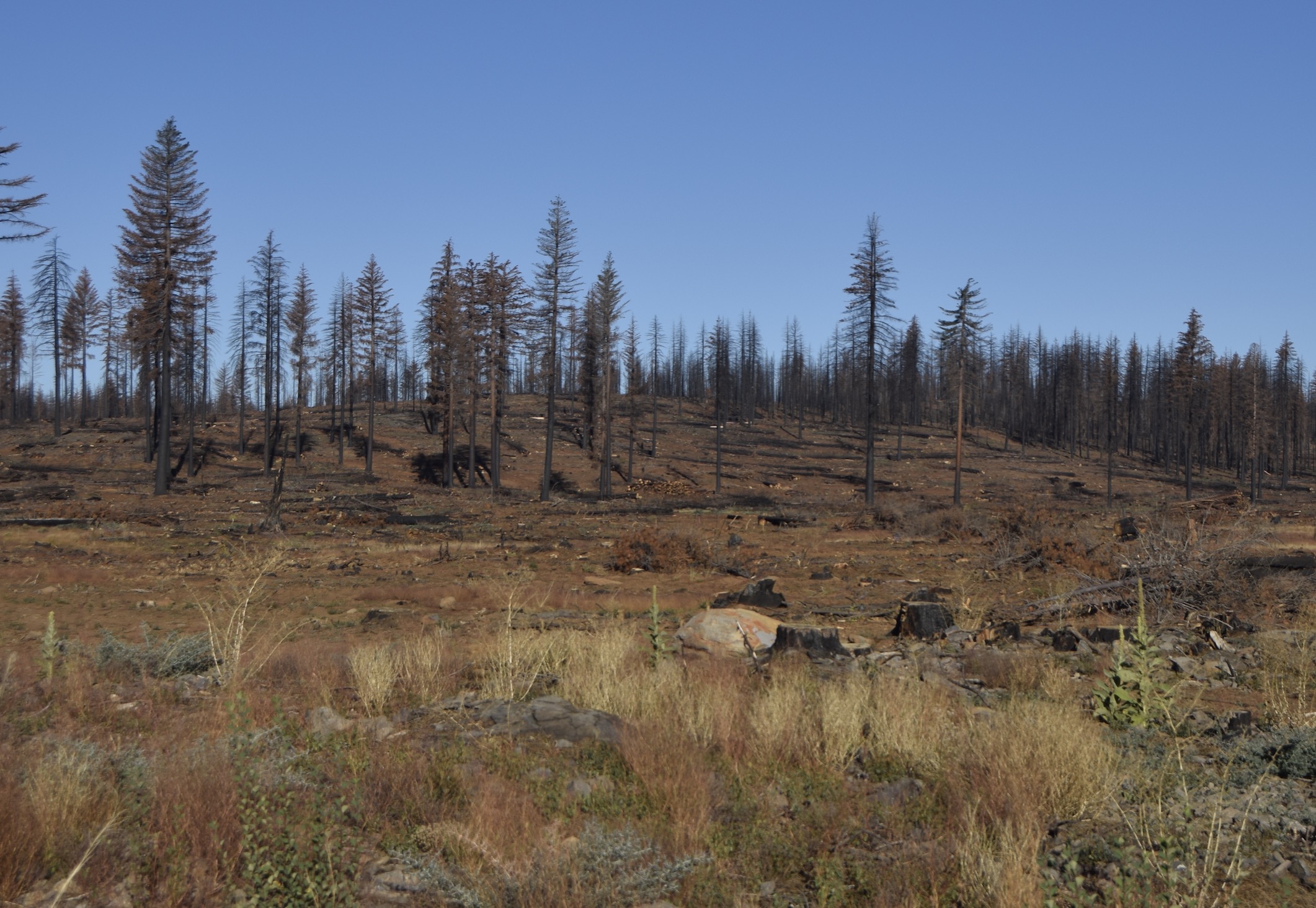
Interesting fire effects in the areas which were fired off upper Hwy 32! A lot of dense younger stands had higher survival than I’d have expected, and some of the heavily-thinned fuel break areas barely carried ground fire at all.
16 Likes
Sorry I’ m late but I want to see those Screen Grabs. After 38 years on the ground with crews I can in vision much more through them and don’t have the time (or ability, I’m old) to find them when they do.
18 Likes
some of the heavily-thinned fuel break areas barely carried ground fire at all
The IR perimeters were showing an island of green in there for days after the lighting operation. I kept hoping to wake up and find they had blackened it all overnight - finally seems to have filled in.
2 Likes