Here is Cal Fire’s 16:00 IR in red, with yesterday morning’s perimeter in white.
Thanks to @ajohansson for the data link:
Here is Cal Fire’s 16:00 IR in red, with yesterday morning’s perimeter in white.
Heard what involving DP40?
Think he is referring to the hose order. Sounds like a good time 
Ooooof that sounds horrid. Also, I’m not a mathematician. (See about 50 posts back for proof) but I don’t think you can pump that much hose 
It’s not a continuous hoselay. It’s connect the dots between roads in the road system.
Wow, really needed?
Tonight’s Lookout Livestream takes a map-based tour of current developments on the #ParkFire, which is burning in the Lassen Foothills Region of Butte and Tehama Counties, Northern California. We also talk about how prescribed burning on Cohasset Ridge may have prevented greater losses in adjacent structures in Upper Cohasset, look at the history of forest management in Deer Creek and the Almanor Basin, talk about burning trees for energy generation, heckle the Forest Service for asking us to like them for putting out lightning fires in the middle of huge burn scars, and review current satellite imagery of the Park Fire to evaluate fire effects. https://youtube.com/live/ud4m0m1jCyk 8:00pm, 8/1/2024
All,
I am not a Mod but there are a few comments on this thread over the last few hours that run the risk of taking this somewhere that is really not the place to go under the current circumstances.
Let’s please avoid personal opinions and Monday morning quarterbacking of command personnel while we are still in the fight please.
Agreed, let’s stay on point people.
One mission one goal…
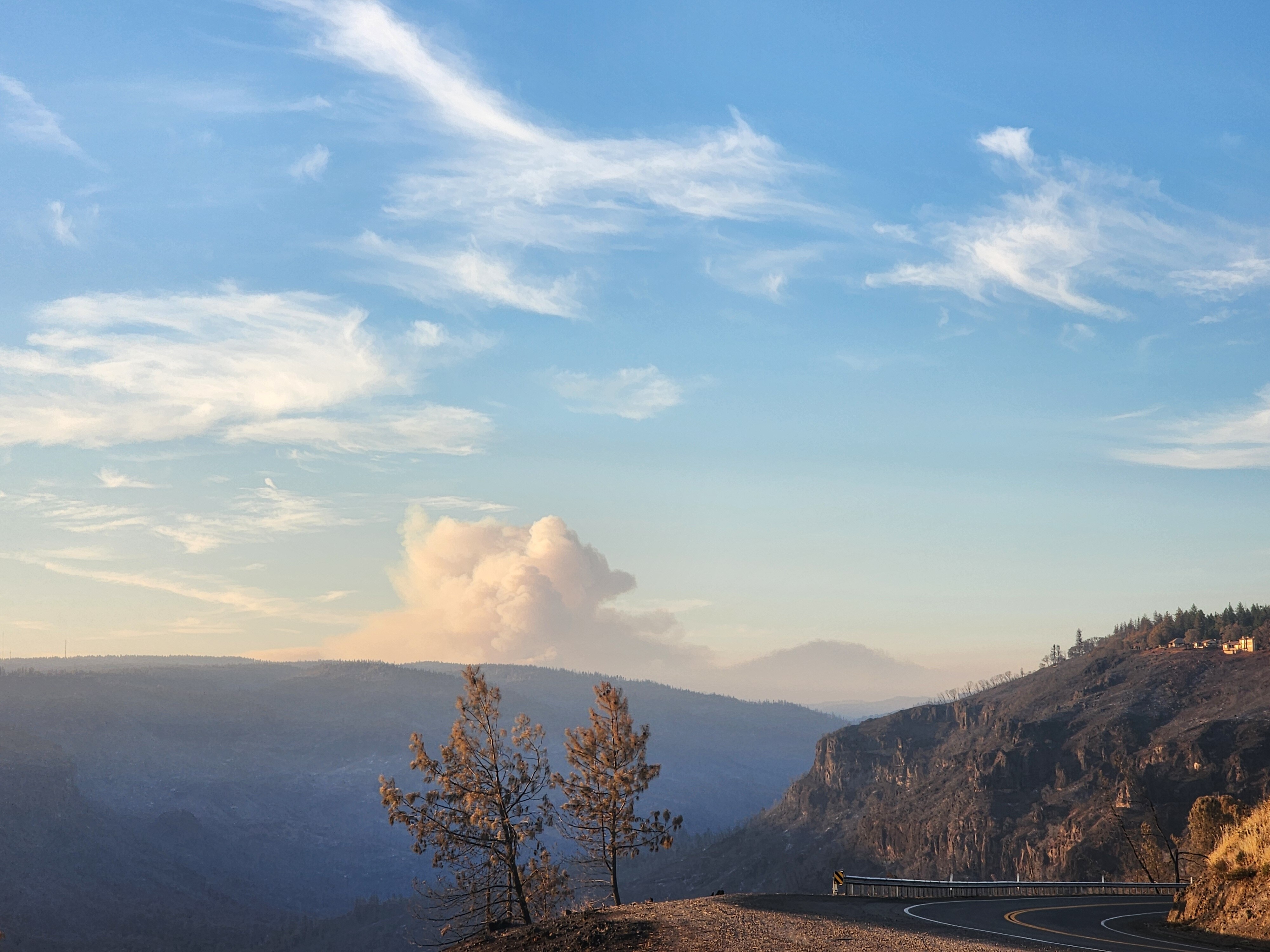
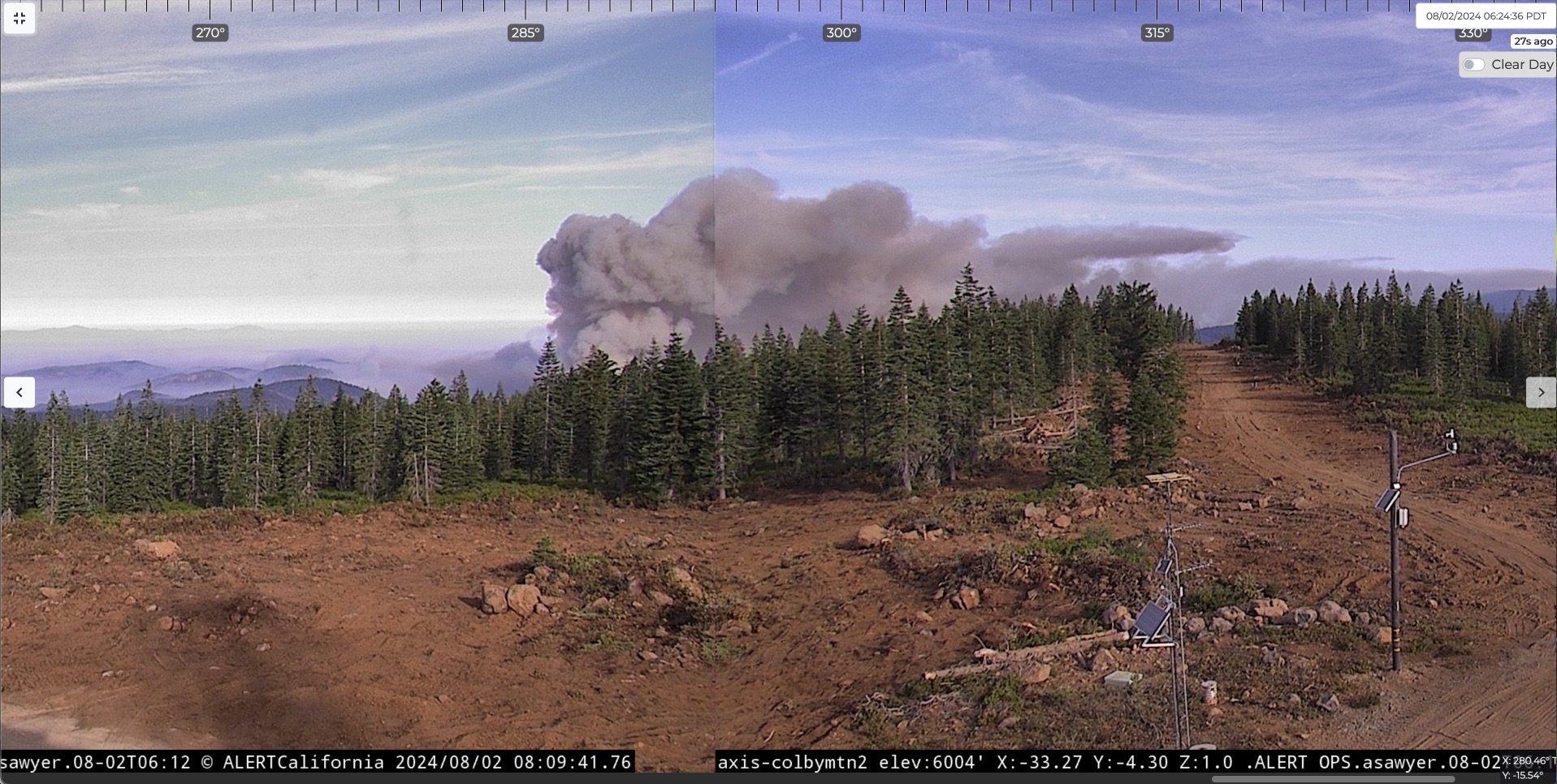
Burning with some intensity on the Colby Camera…is this firing or a run ?
https://cameras.alertcalifornia.org/?pos=40.0468_-121.5758_9&id=Axis-ColbyMtn2
Run in deer creek from what I can tell.
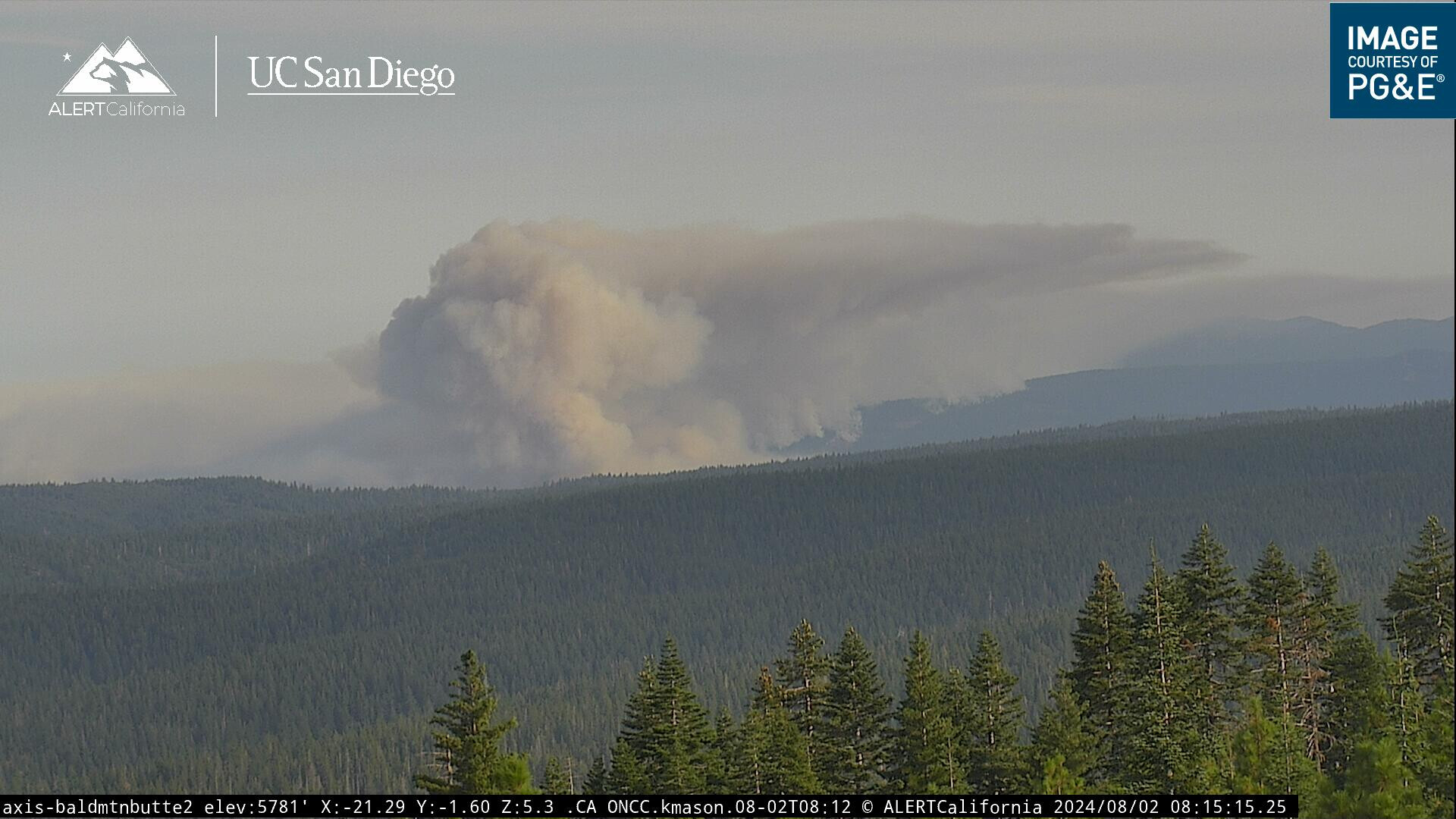
Chugging along this morning. Check Colby! It’ll be up early.
Yessir,
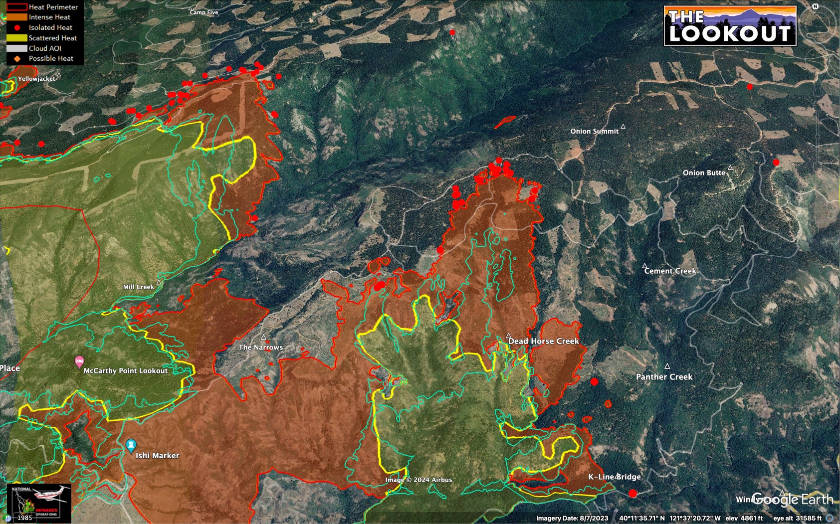
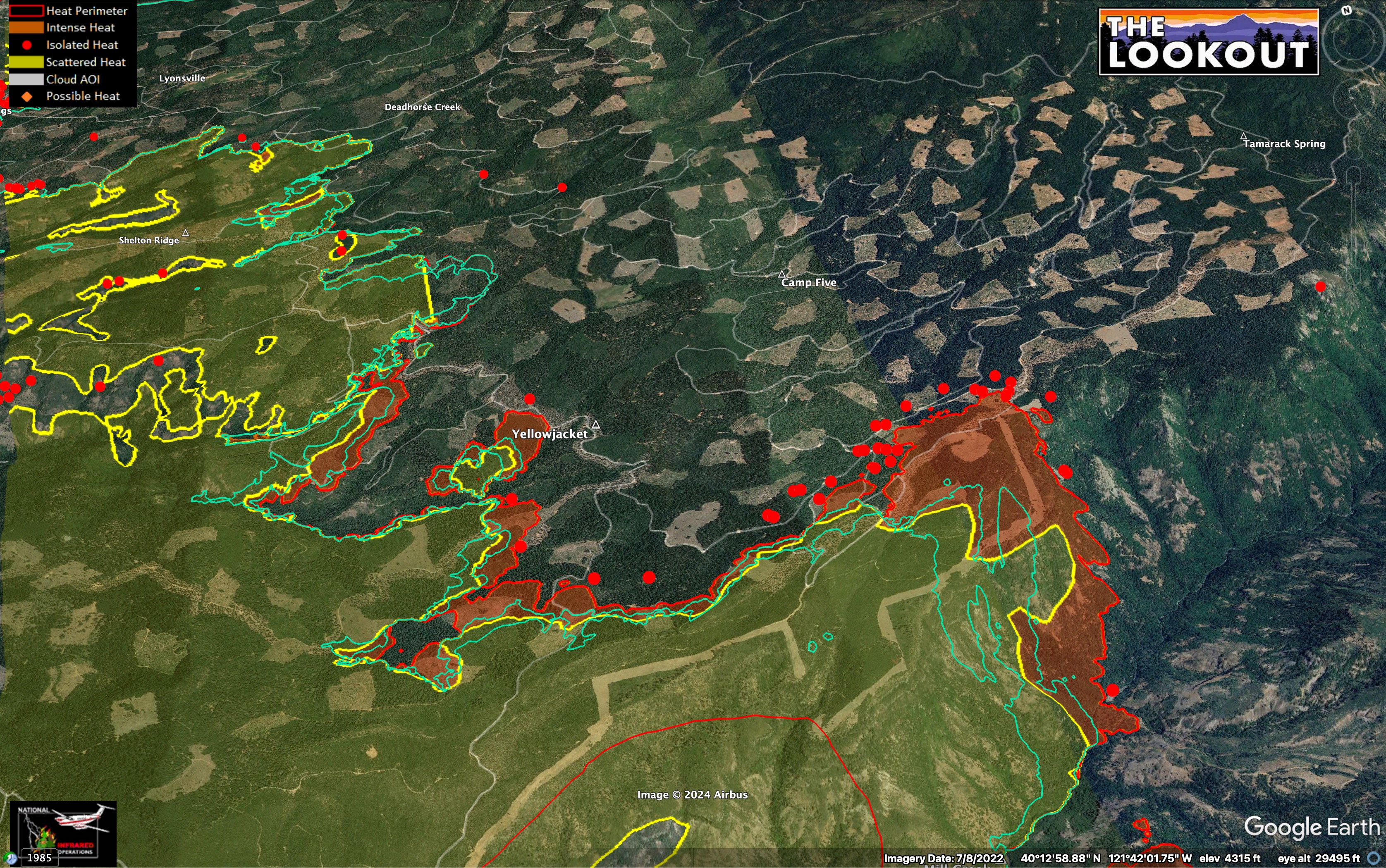
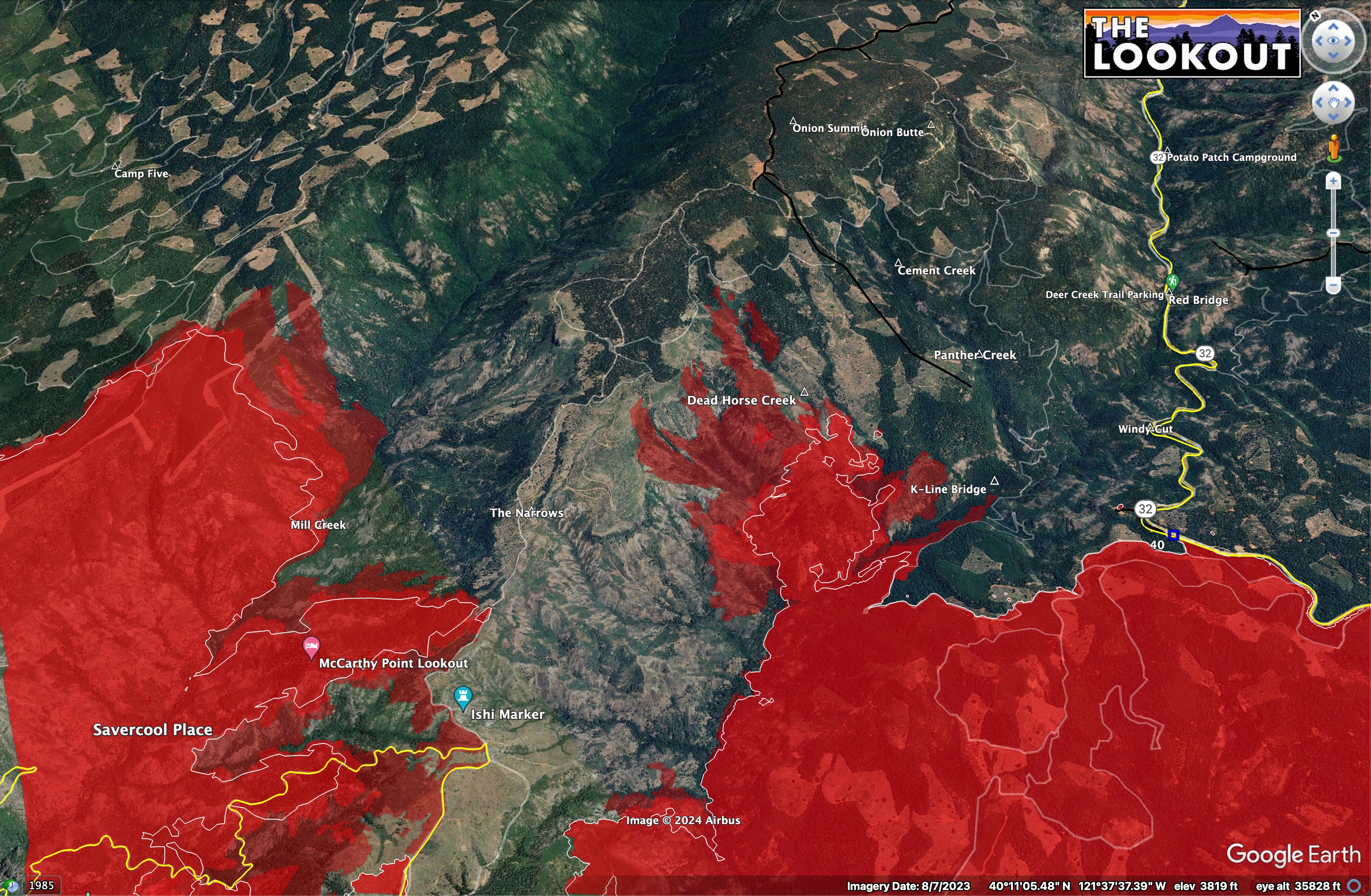
Here is last night’s IR - 21:45, with earlier IR in teal color from 16:00 and 9:45am.
Ran Dead Horse Creek out of Deer Creek west of the K-Line bridge and spotted into Mill.
Mill Creek was also active on both sides, and the large spot fire grew around Yellowjacket.
Back to the west in Antelope Creek, it looks like a lot of their direct attack has been holding.
There is also a Deadhorse Creek in Antelope Creek drainage. I guess it’s not an easy place to be a horse.
Is there a reason the live ops briefing isn’t available on the butte county YouTube channel?
It is but it’s super hard to find, I’m watching it right now and I can’t even remember how I found it: