I may have missed it, is there a team assigned yet?
Team 3. Mentioned several times.
CALFIRE Team 3
VLAT’s are all fed, so unless something has changed, it should 0900.
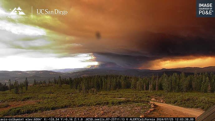
Watch the last 10-15 of the time lapse and tell me that column is not rotating
Correct. The request has been made a handful of times over the last week to early up Fed Type 1 Tankers due to a need or by the request of the incident. NICC has denied that request multiple times. With that being said. They are a National Shared Resource and have been extremely busy across ALL western states and flight time and pilot duties days need to be taken into account.
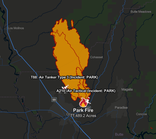
Cal Fire page has it at 71,489 acres now. Majority of growth since last mapping flight is to the northeast, with some spread along the eastern and southwestern flanks closer to the heel. As with all map commentary on this forum, I’ve no idea what growth might be a burn op and what’s not.
https://www.fire.ca.gov/incidents/2024/7/24/park-fire

Thanks. Thats a ugly fire.
Several of those spots in the low lands are getting pretty established in the drainages above Vina. Starting to see some resources headed that way
Looks like an arrest has been made in conjunction with the start of this fire. CNN has the article
1990 Campbell burned 139,000 acres in that same area and kicked butt the first 5 days. Probably do the same.
100k by 6pm seems very likley
My money’s on this thing being a Dixie or North Complex level ordeal for two weeks minimum. Based on the mapping, Campbell 1990 never extended this far into the denser treelines the way this thing is doing.
Will be a two team show soon……
I mean, just think what the view would be like if the column wasnt at least partially shading the fuels in the direction it’s wanting to spread now.
Is that a new start on the Deer Creek HWY 2 cam
Must by part of the fire


