Added tile view link to first post for easy access
Heel of the fire finding some new fuel
also pretty clear rotation on the Cohasset hill 1 cam
Oroville asking for Two tankers IA rated to be diverted.
Also anyone know how far past mill creek it has moved. Family has a hunting cabin se of Paynes creek.
They are being diverted to LNU-Acorn.
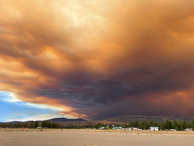
That’s some ugly looking smoke. Been getting uglier all morning. The wind’s dying down a bit, though, it was up to 20-25 kts most of the morning.
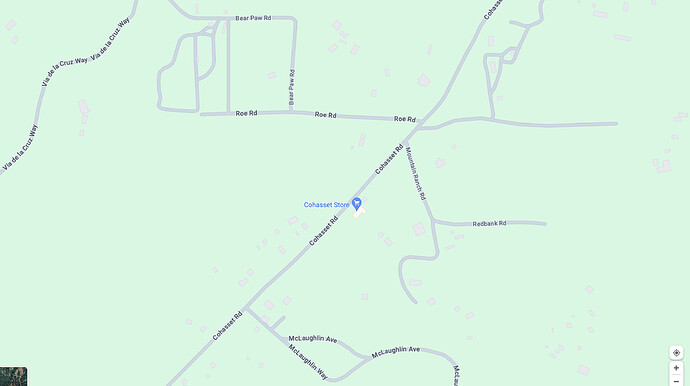
AA advised fire making a run out of branch 15 and will impact Cohasset rd near limpach rd in a little while. Will be doing structure defense drops along the ridge south of Cohasset rd
Looks like there was an agency copter doing some recon around the Paynes Creek area of Hwy 36. Curious as to what the viability of that highway would be if they’re maybe looking at using it as an option to try and catch this?
Looking at what the head(s) are doing under the smoke layers in natural color is wicked…
AA advising div Tango fire making a significant run
aircraft will not check the fire. Fire will impact Cohasset ridge in 20-30 mins
Update: AA losing a type 1 AT in addition to 89 and 93 to LNU
36 is not really an option due to the flashy fuels with this wind. The terrain there is very similar to what the fire has already exploded through.
Multiple spot fires on the Beckwourth cam. Any relation to the Park fire? I can find nothing about it.
https://cameras.alertcalifornia.org/?pos=39.7690_-120.4404_10&id=Axis-Beckworth
thats the gold complex i believe
Heard diverted another tanker min ago to a new start but didn’t know where it was to
The big run in Div T looks like it went right thru Campbellville and is continuing up the H-Line toward Highway 32, on Cold Spring Hill.
That removes the H-Line as any sort of escape route from Cohasset going forward.
Timelapse on Colby Mtn cam shows it. Unbelievable.
https://ops.alertcalifornia.org/cam-console/15547
The current setup, with fire hooking NW from Cohasset toward Butte Meadows looks like pretty bad news for much of the timbered area of Butte County that wasn’t already burned over by the 2018 Camp, 2020 North Complex, or 2021 Dixie Fire.
SPI is going to lose a lot of their forest here in the next couple days.
Yes Gold Complex on Plumas NF near Portola
Is this still burning on sra , or has it crossed over into NF yet ?
Zeke, any idea why there are no evac warnings or orders for Butte Meadows yet? I’m less inclined to shed tears for SPI as I am for homeowners in Cohasset and cabin owners in BM / Jonesville, and from what I can see it doesn’t look great for any of them …
Approximately 3-5 acre spot across Chico Creek, but is in alignment in Div X. Actively going direct but not sure that it can be held

