Looking over IAP it appears to have a good amount of Charlies and no Alphas. Is that accurate? Now I understand there 12 hour request needs.
2 Likes
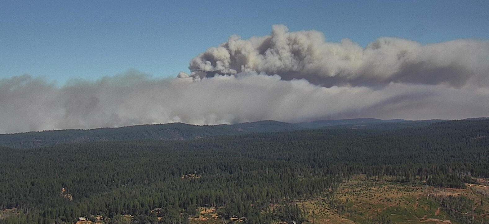
Good on the ground footage of the fire pushing Highway 32 yesterday. https://www.youtube.com/watch?v=JVRT-iDa9cg
6 Likes
What is the weather up there today?
2 Likes
Take a look at the IAP link…the forecast is in there.
2 Likes
Whatever Alpha strike teams that showed up yesterday (a number of them from SoCal) were deployed, there’s going to be reflex time to get those resources either bedded down and rehabbed or for new resources to arrive
3 Likes
From Royal Burnett: " We had interesting fire behavior yesterday on the head of the fire as it pushed North…rotating convection columns and fire whirls were observed. The general wind was South at 15mph, but local fire induced winds were clocked at 45 mph near one of the rotating columns. These fire whirls/fire tornadoes are dangerous! In addition to high wind, they can throw spot fires in every direction… even into the prevailing wind as they spit debris out of that whirl."
6 Likes
Something for everybody to keep in mind with regards to fire behavior. This fire has burned more acreage in 36 hours the the Camp Fire burned in its entirety during a major wind event. There are winds on this fire but they are roughly half of what we saw during the initial phases of the Camp.
27 Likes
I can’t seem to find the link
1 Like
1 Like
New start south of park fire
3 Likes
13 posts above this one.
1 Like
thread for it: CA-BTU-Clark 2024??? - California & Hawaii Hotlist / Questions and Discussion - Wildfire Intel
2 Likes
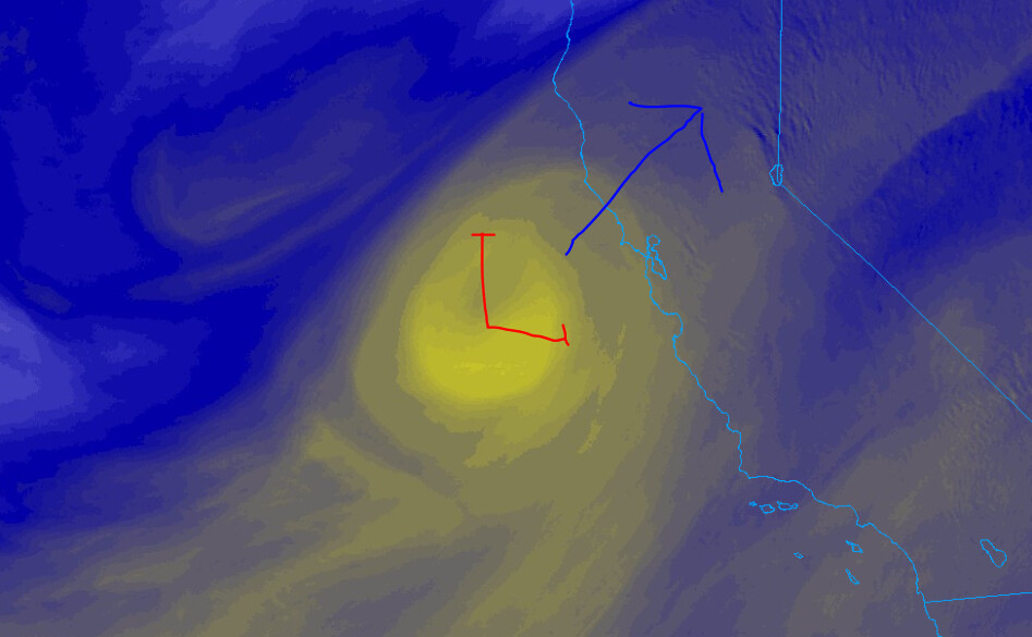
Weather on Tehama Zone
The 3 stations to keep an eye on today for the wind event up the valley, from south to north, and already starting to show a slight SSW influence at 10am:
Branch 10 - DIV E and H
- PGE Reed Orchid Road - mouth of Deer Creek Canyon at base of foothills
- PGE Conrad Lane - mouth of Dye Creek Canyon, north of Mill Creek Canyon. At base of foothills.
- PGE Red Bluff Powerhouse - the top of Hogsback Rd just above Red Bluff. This will give good indication of what the winds are doing at elevation above the canyons and influence across the top once this progresses north. Hogsback Road is one of the primary control objectives before Hwy 36. Will like be a large iron show.
Branch 15 deeper east in the foothills:
- RAWS LNF Portable - located at the eastern end of Hogsback Road, due north of fire.
- RAWS Panther Springs - located in Bucks Flat, DIV J area.
Purple line showing recent fire perimeter with Branch 10 stations
9 Likes
Juan’s morning update just posted:

10 Likes
Already running up the east side of Chico Creek Canyon towards 32 per the Platte Mtn. Cam.
Head on a swivel folks
8 Likes
And more coming from SoCal. Looking at how resources are being filled down here it is starting to look similar to what happened during the Caldor with smaller mixed TF’s instead of legit complete STEN’s, whether Type 1 or 3.
7 Likes
I think ventura county was sending some crews, they stopped in friant yesterday.
3 Likes
Still waiting on word for some San Bernardino county ST/TF to get sent. They may be holding on to some.
1 Like