Ventura County
1 Like
Yes. Ventura County. The resource could be Ventura County alone, or XVE, for a mixed LG ST.
2 Likes
Yep — here’s the whole list:
https://firescope.caloes.ca.gov/Governance/Group%20Documents/MACS-ID-Agency-List.pdf
2 Likes
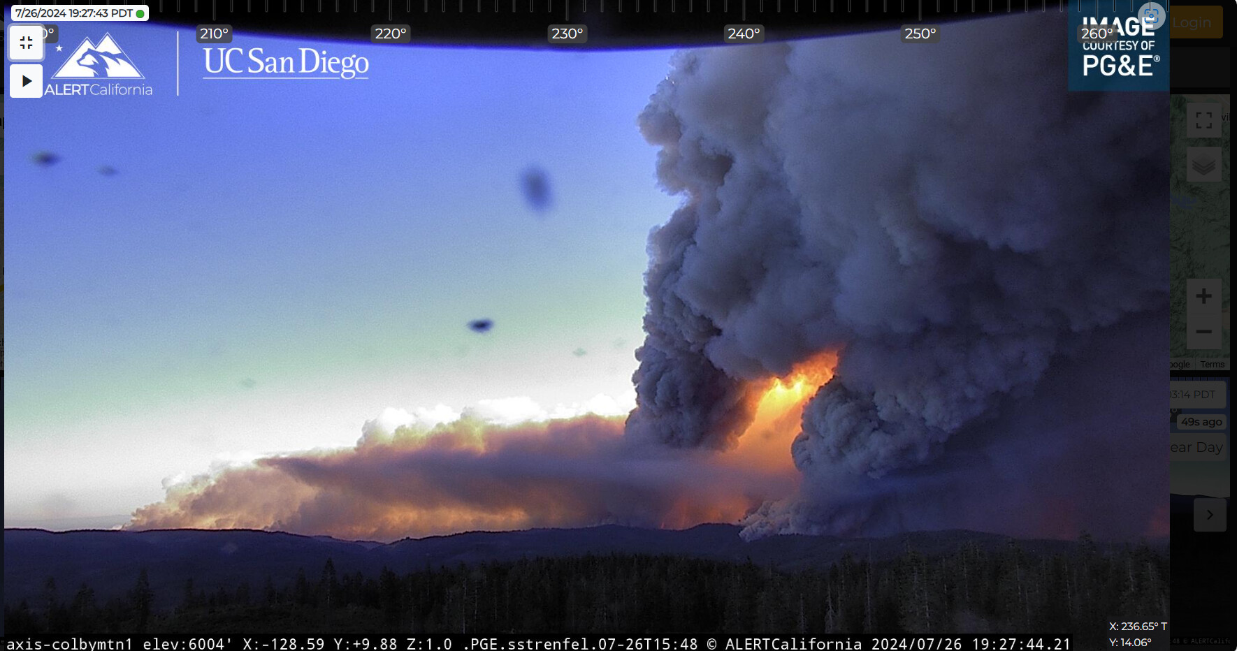
Jul 26, 7:08 PM
Radio traffic indicates the fire is now impacting Hwy 36 in the area of the Paynes Creek Loop in Tehama County.
4 Likes
There’s a school there and some residences.
2 Likes
What are you listening to it on? Sorry if this is redundant
1 Like
Watch Duty (App)
2 Likes
this feed is picking up most the traffic also including air ops
6 Likes
It has now spotted across 36
4 Likes
3 Likes
I thought I read it was up to 240k
2 Likes
AA just advised the fire has spotted across the 36 in the Paynes Creek area
2 Likes
Thanks…typo.
1 Like
cant remember what branch said columns not going up but rotating so heads up , that never good thing to hear
1 Like
IC asking for 10 WT’s to Paynes Creek CF station in Branch 10
2 Likes
Fire impacting structures along Moulton Loop and Oasis Springs Road, north side of 36.
4 Likes
Where is the most likely spot it could hit the Dixie Burn scar and could potentially(?) be slowed?
1 Like
Dixie scar provides no relief to Tehama County. Full green between fire and Manton, Mill Creek, Lassen Park, Shasta County, Shingletown etc.
9 Likes
The current path where it is impacting 36 would run it into the 2012 ponderosa fire. The north eastern spread has a bit before it hits the Dixie scar.
4 Likes