Evacuation ORDERS have now been issued for all Shasta County zones South off Hwy 44 in the Shingletown area that were previously Warnings, from the Black Butte Rd area east to just past Viola.
6 Likes
The 2012 Ponderosa fire isn’t going to slow it down. A lot of flashy fuels and a lot of tall brush has replaced what was timber before.
5 Likes
For refernce…Shingletown on the 44 is 50 miles as the crow flies from the start in upper Bidwell.
9 Likes
Ya was just answering the earlier question about the Dixie scar. If I could figure out how to post a pic I would.
3 Likes
The only thing that’s going to stop this monster is the Dixie scar. Everything between the fireline and Lake Almanor, all bets are off. They should be evacuating everyone between both points.
4 Likes
Is there any concern for Red Bluff or Redding? Or does the wind never shift that direction enough (or ever)?
1 Like
Were they able to hold Hwy 32 on the east flank somehow? Or has it now crossed?
1 Like
Still fighting spots per radio traffic. So far holding. Have been non stop all afternoon with aircraft also.
3 Likes
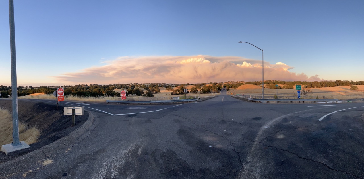
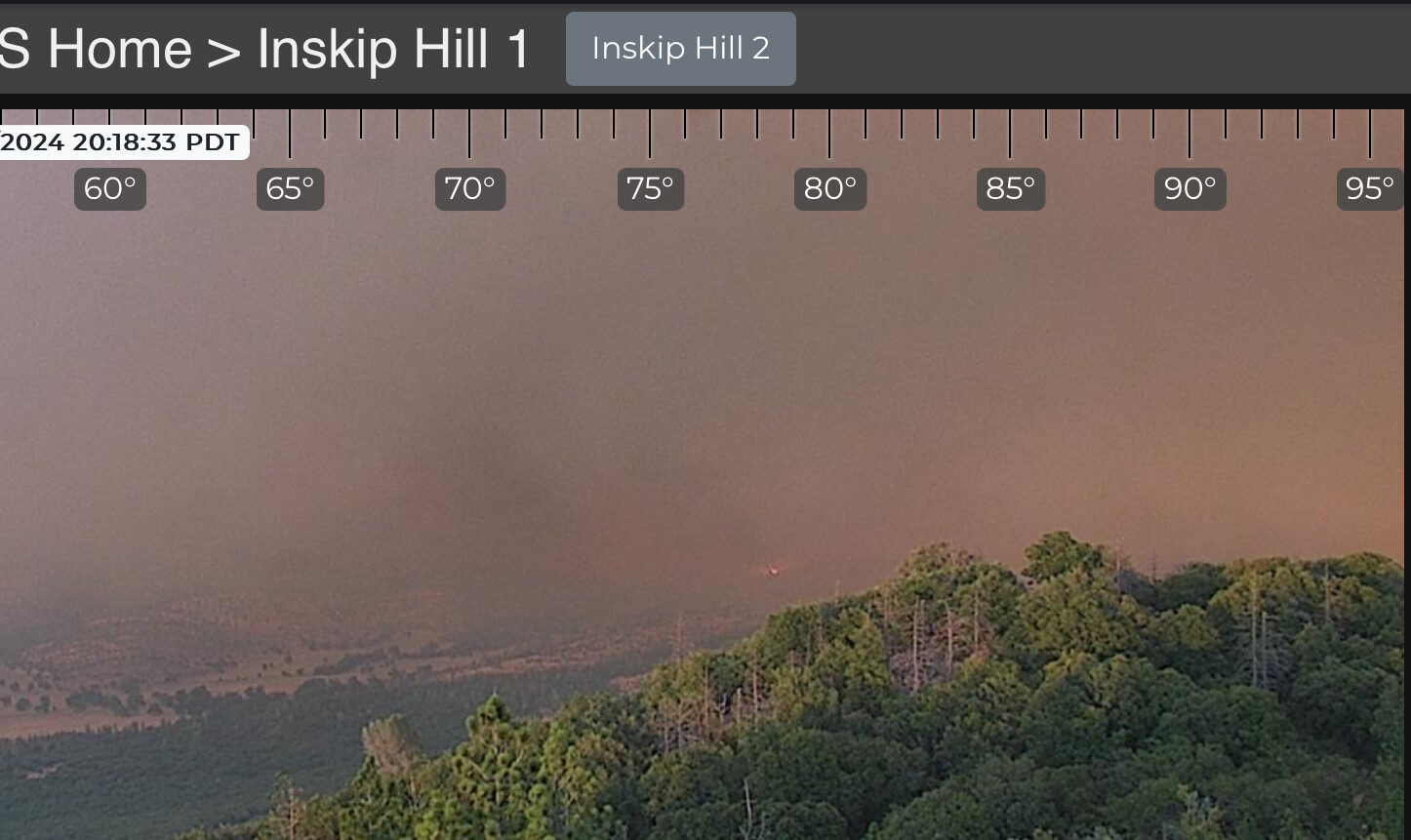
Fire seen on the Inskip Camera now - validates the earlier fire traffic of Moulton Loop at Oasis Springs Road. Slowly and surely marching north.
2 Likes
I don’t want to speculate, but Butte Co. SO announced mandatory evacs on the north side of Paradise about 1945.
1 Like
3 Likes
That’s incredible. What an effort!
1 Like
Hearing IMT 4 being activated for this fire also
3 Likes
I am very confused about the Paradise evacuation. I don’t see a NW wind event coming up.
3 Likes
KCRA had their copter up earlier this evening there looked to be a well established spot south of 32.
1 Like
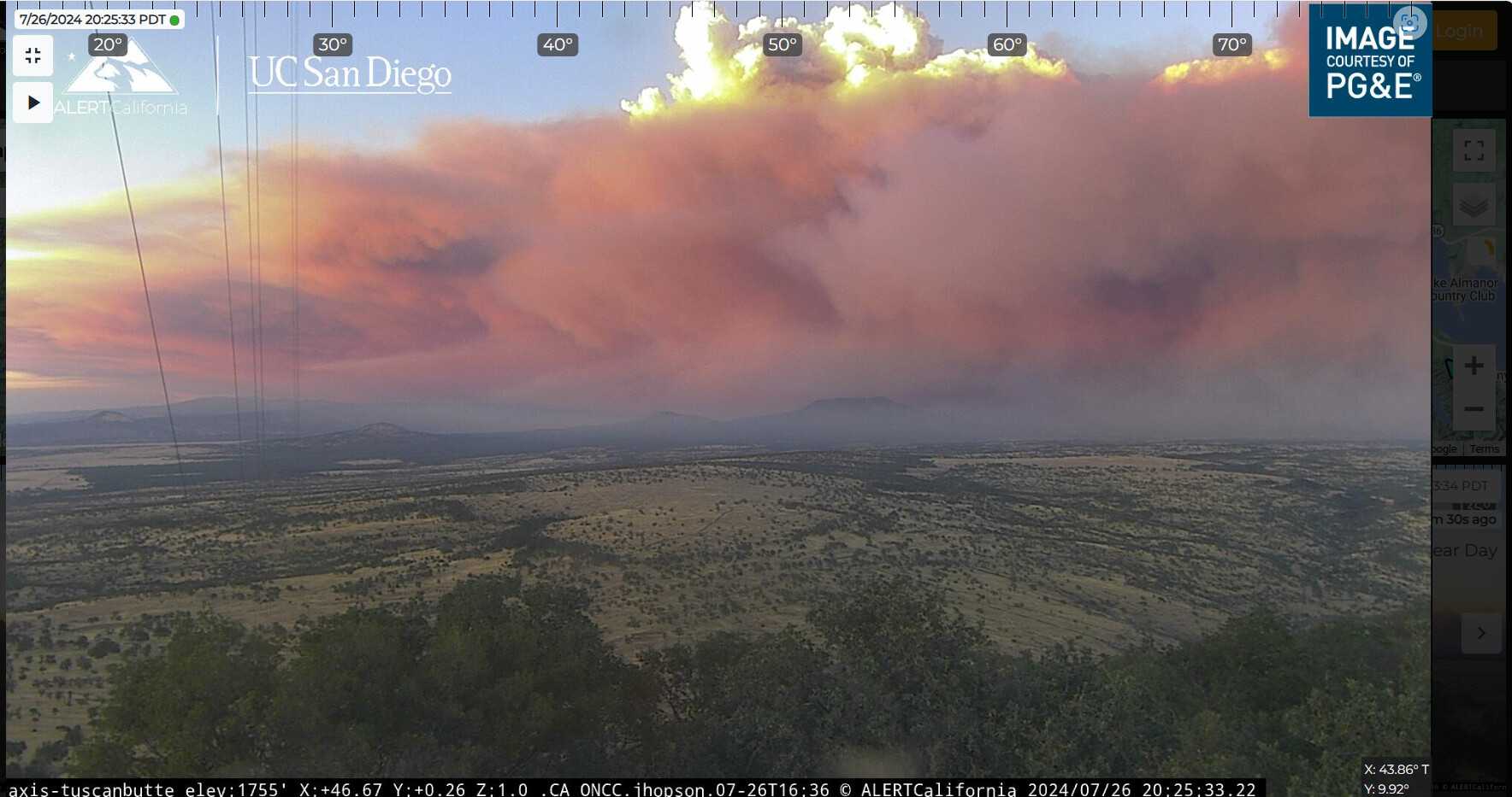
The Morgan Summit cam will be a great indicator as to if and when it gets established past the 36 as it’s staring straight down the 36 towards Mineral and it’s still under the column so you can actually see. That confluence of drainages at the 36 and 89 is seriously concerning with this wind, could just blow torch up the 89 and barrel straight through Lassen NP. Keep your eyes peeled. Praying for all those out there truly putting themselves on the line to try and stop this freight train.
6 Likes
Fed or state?
1 Like
State Team 4
1 Like