So total guess but what I’m seeing from Inks Ridge Camera it looks to be about to reach the Battle Creek drainage
1 Like
I see that now? Idk, I musta caught it in the middle of a glitch?!
1 Like
Does anyone have any knowledge on why, thought the fire was being held at Hwy32 and winds were blowing in sse direction. What changed.
2 Likes
Winds have been blowing FROM the South/Southeast
1 Like
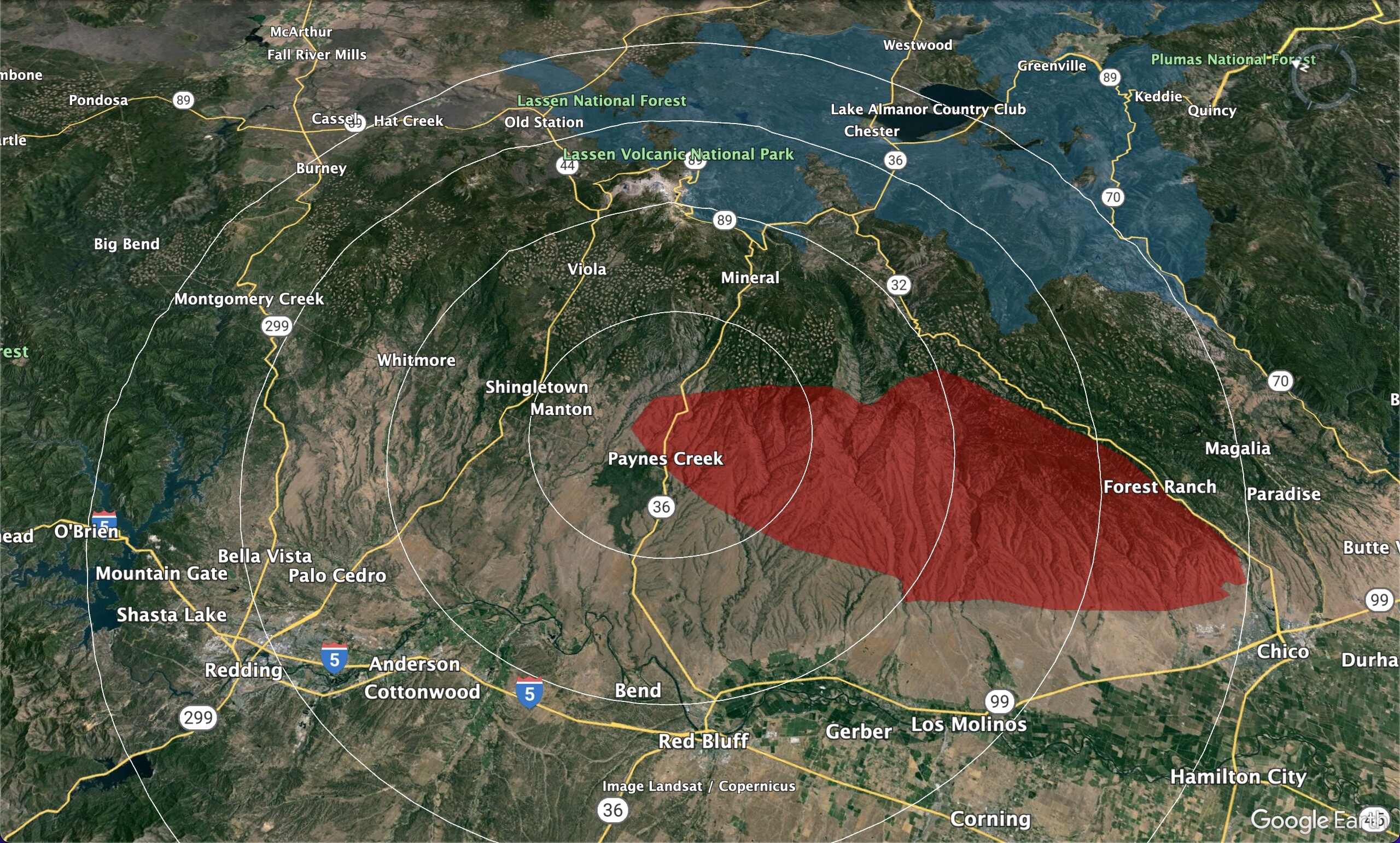
The fire has burned over 40 miles in about 54 hours. By my estimation it is now over 300,000 acres. Here is a map showing what else is within 40 miles of the most active portions. (Rings at 10 mile intervals).
2021 Dixie Fire in blue, at top.
Not saying it’s going to Burney, but just wanted to share this for a sense of scale.
37 Likes
So the big question is: When it hits any portion of the Dixie scar will that slow it enough to get a handle on it? I am hoping it could be at 89 above Mineral?
1 Like
YES! Unfortunately most humans need to be schooled that there is the fire in whatever shape/form, there is safety & there is risk! Those are 3 separate things. This reminds me, wouldn’t it be helpful as heck if everyone understood power of fire vs power of the wind concept? This is bueno!! Thanx for sharing…
1 Like
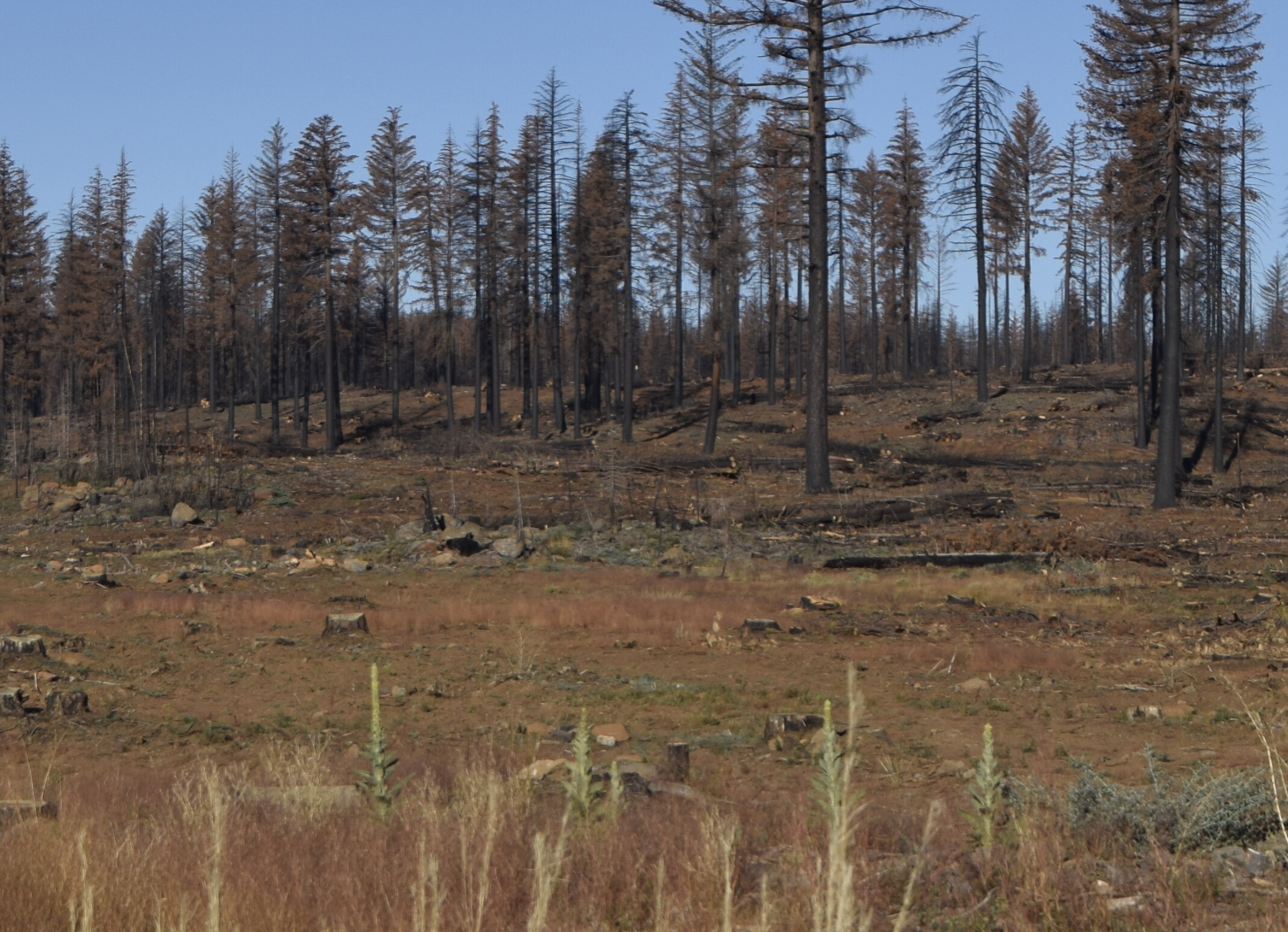
Dixie footprint west of Chester on 36 is stumps and dirt. Dixie in general is some grass with scattered live brush and snags. I cant see it burning through that uncontrollably.
10 Likes
Yes…can someone please tell us why or what has changed for the entire Paradise ridge to be suddenly under an evacuation warning?
2 Likes
Yes, here is a picture taken west of Chester in the Dixie Fire salvage area.
And here is severity mapping of Dixie.
Pink areas look like the photo above, but without all the snags (really good slash cleanup occurred in most of the salvage areas)
Red areas were severe burn. There is a lot of young brush in the burn below 6,000’ or so, but most of the pink areas have been sprayed with herbicide to reduce brush competition with the seedling trees.
11 Likes
2 Likes
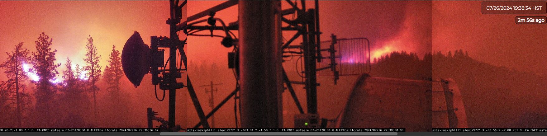
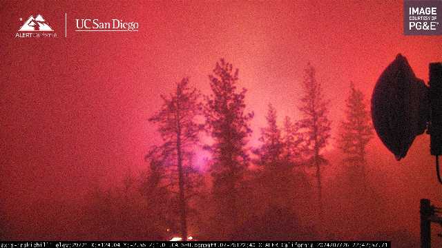
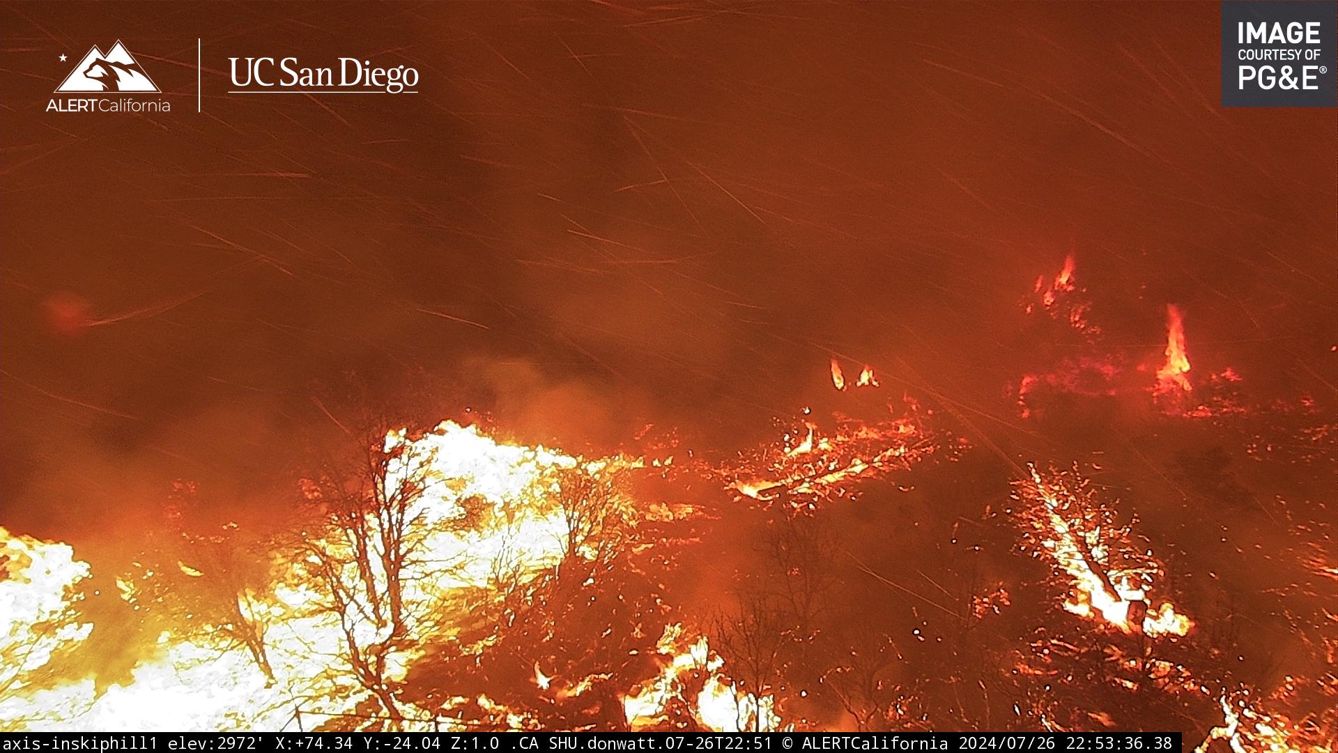
Inskip Cam is getting lit up, we saw it coming… colors are interesting:
https://ops.alertcalifornia.org/cam-console/2690
5 Likes
In the dictionary under really bad places to be right now = Inskip!!
2 Likes
Those two 500kV lines are out right now with no estimated time to restore. Even if the other 500kV line were to relay, we have sufficient generation capacity to meet the demand. But getting those lines back is critical. There was an attempt to restore them today, but the fire tripped them again.
12 Likes
What scanner feed is everyone listening to? Is there one that gets the command without btu dispatch? Or is there an SHU feed thats better? Thanks. Stay safe
1 Like
Not the first time a fire has threatened this corridor. PGAE will have to do a full patrol/inspection of the lines before attempting to restore it, so yes it’ll be a bit before it is restored… especially with the heavy smoke and difficulty accessing that right of way.
2 Likes
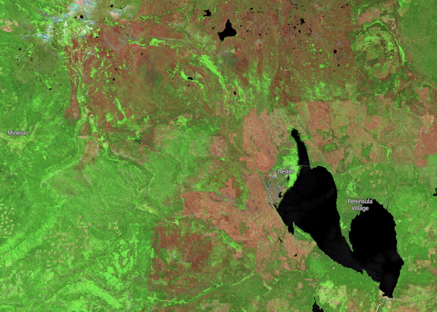
Next camera to be impacted appears to be Tuscan Butte
1 Like

no, this one:
5 Likes