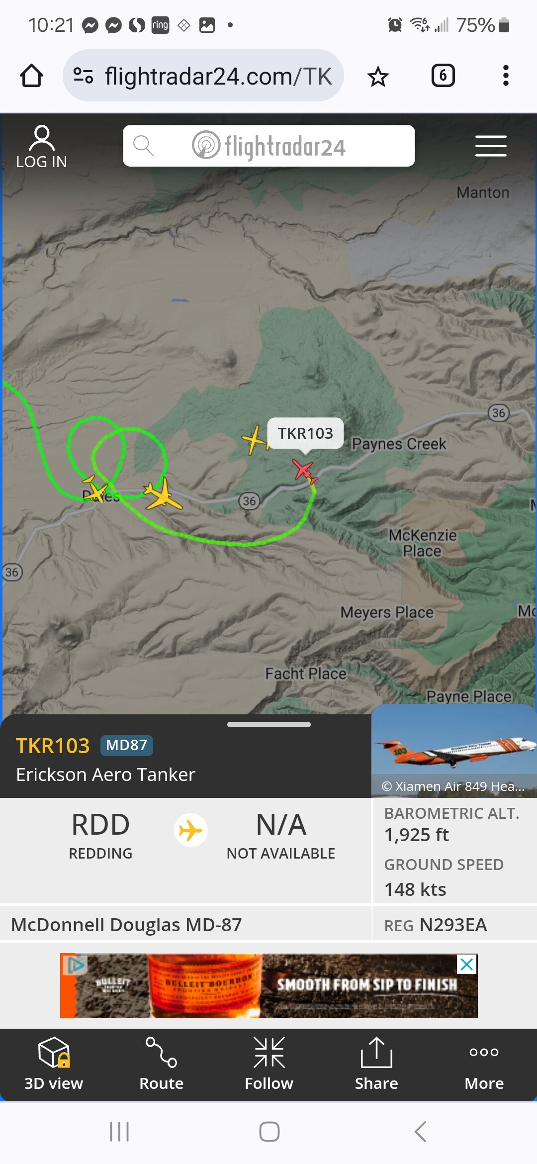
6841A is still rostered as the Gold Complex. Heard traffic they were going to demob and head to Park, but not official here at SND. No other units are heading north as of now.
1 Like
6841A is here and headed to division Oscar.
5 Likes
I double checked with him.
He said it’s 40A the other XSD Type 1 they’ve got I guess.
1 Like
I did a livestream this morning looking at tactical possibilities on NE side of the fire. Also did a reconstruction of the firing of Humboldt Road during Dixie that went bad, and talked about how scenarios like this have colored Ops folks’ willingness to put big firing operations on the ground.
20 Likes
2 Likes
Not seeing the same production as it was yesterday morning.
6 Likes
The Delta influence got switched on in a real big way!
7 Likes
Should only last a day correct?
1 Like
What does the delta influence mean to those of us not familiar with the area?
4 Likes
Given the imet horsepower helping to inform/curate this thread - im not qualified to answer that, at this time?! I think you are on to something tho - shortlived reprieve…
I can offer this link as a last peep outta me on delta breezes…
Part of the answer(s) to why fires at times do what Park is doing & delta breeze influence, skip to the Conclusion - in the last sentence of the 1st paragraph replace the word “thunderstorms” with the word Fire. I found this to be helpful as heck…
3 Likes
Norcal’s air conditioning system is how i’ve come to broadview it. But its way more dynamic than its name implies.
.
6 Likes
It’s when the predominant weather influence is from the cool, moist air traveling into the San Francisco Bay, up the Sacramento River delta region, bringing cooler temperatures and higher humidities. Great explanation with illustrations from this Sacramento Bee article: https://www.sacbee.com/news/bee-curious/article261322247.html
11 Likes
Keep it on a swivel up there and see ya when you get South.
3 Likes
→ I marked up this map from Local Watersheds 101 — Butte Environmental Council (becnet.org) to show some basic onshore flow patterns from the SF Bay Delta.
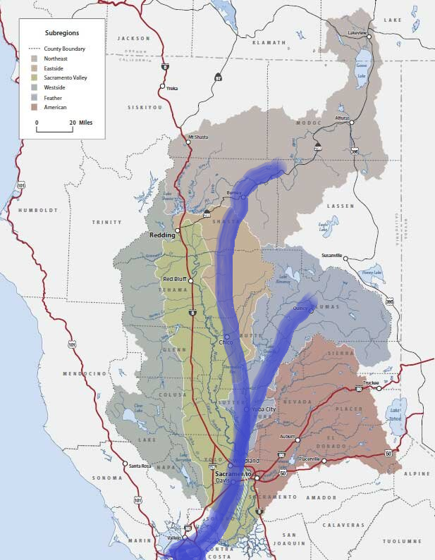
The Delta Breeze, and its evil offshore twin, the Diablo Winds, are part of a larger weather and climate pattern that is very, very old. Two major watersheds, Feather River and Shasta, that drain into the Central Valley, have been, essentially, carved out of the relatively young Sierra Range by this basic weather flow pattern.
Although onshore atmospheric river paths may be more variable in terms of decades, and even centuries, the most basic features and influences of onshore/offshore climate are relatively stable. Heat still rises, rocks still roll downhill, water still seeks its own level.
Compare the Sierras with a much older, smoother and ‘worn down’ range like the Appalachians and it isn’t difficult to see evidence of subduction of the Pacific Plate (the ocean) under the North American continental Plate, which continues to slowly and gradually push the coastal ranges upward. Once upon a time, California’s Central Valley was an inland sea.
The upward push is eroded by the Pacific raining down upon it, washing softer material down into the Central Valley, and resulting in a West Coast with some of the highest peaks in North America, but an ‘average’ height somewhat lower than other ranges.
It seems very unlikely that climate change reshapes the basic features of the Pacific Ocean, the Pacific Plate and the North American Plate fast enough to watch in real-time, per se, even if we occasionally point to indicators, like how we manage the vegetation cover and how that affects erosion.
The thing about the term “climate change”, as an abstraction, is at these scales, what may look like a minor variation in geologic time is very important in our time.
9 Likes
I’m not writing this thing off quite yet…
4 Likes
Shingletown camera is back up. Is it raining??
3 Likes
Interesting to watch the GOES 18 loop and change in upper air flow today:
https://rammb-slider.cira.colostate.edu/?sat=goes-18&sec=full_disk&x=13380&y=3082&z=6&angle=0&im=14&ts=2&st=0&et=0&speed=230&motion=loop&maps[borders]=white&p[0]=geocolor&p[1]=cira_natural_fire_color&opacity[0]=1&opacity[1]=0.5&pause=0&slider=-1&hide_controls=0&mouse_draw=0&follow_feature=0&follow_hide=0&s=rammb-slider&draw_color=FFD700&draw_width=6
6 Likes
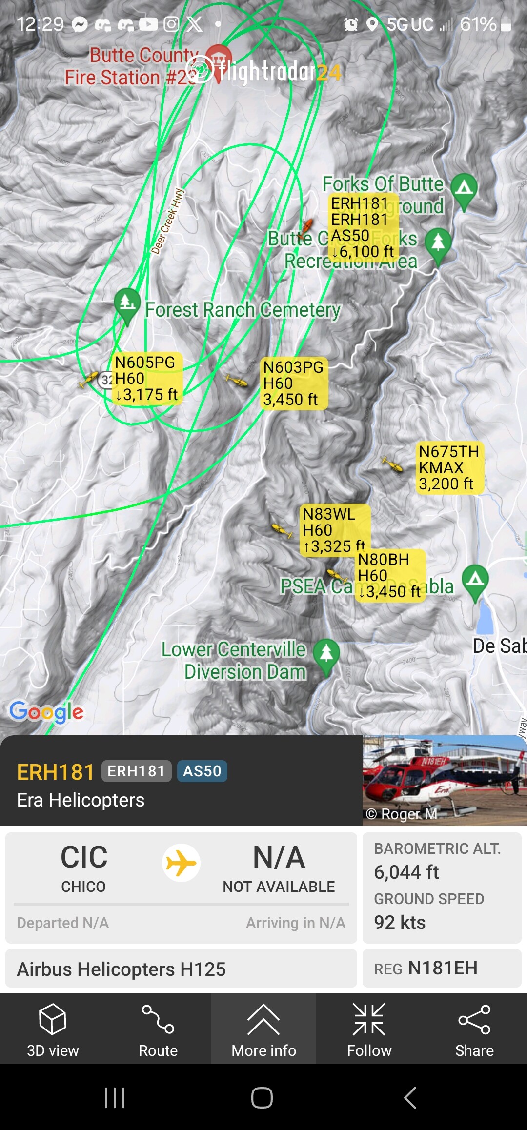
They’ve had a flare up along 32 in the area of stage road. Quite the airshow going on to prevent the slop over.
1 Like
The fuels in the WUI areas of Upper Forest Ranch (Stage Road) are beyond insane. The higher you go on Highway 32, the greater the annual precipitation and vegetation productivity. Stage Road is pretty much the sweet spot for annual rain, hot weather, and lack of winter frost/snow to grow veg like a MFr.
18 Likes