
Just noticed this on cam looking across 32
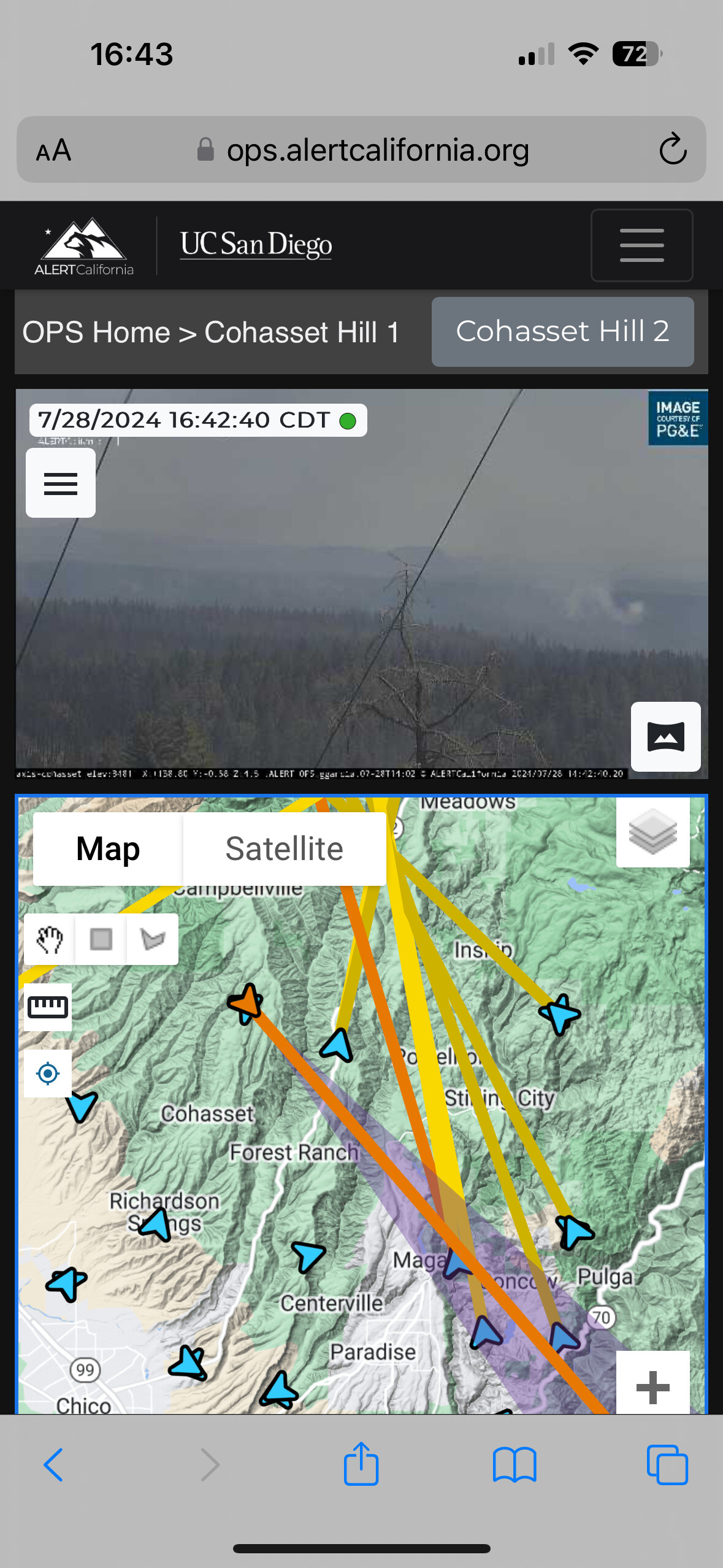
3 Likes
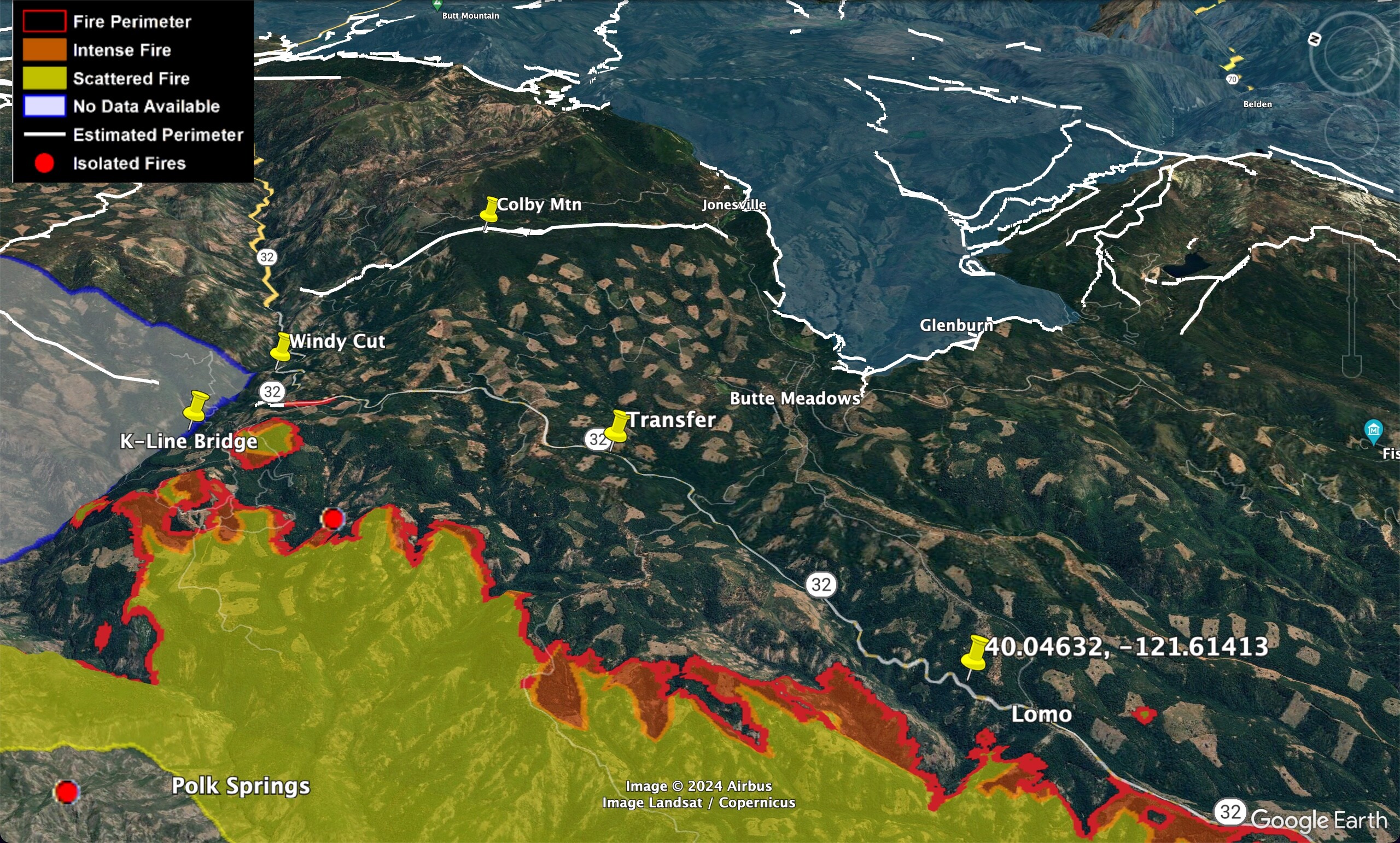
Seeing a lot of heat building on GOES 18 on the 32 side, along with the 36 side on the NE section of the fire
8 Likes
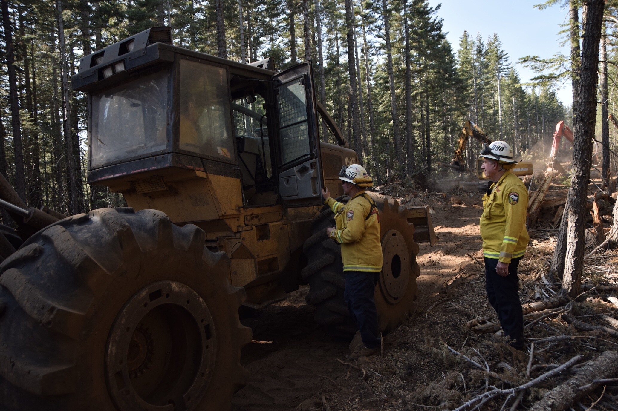
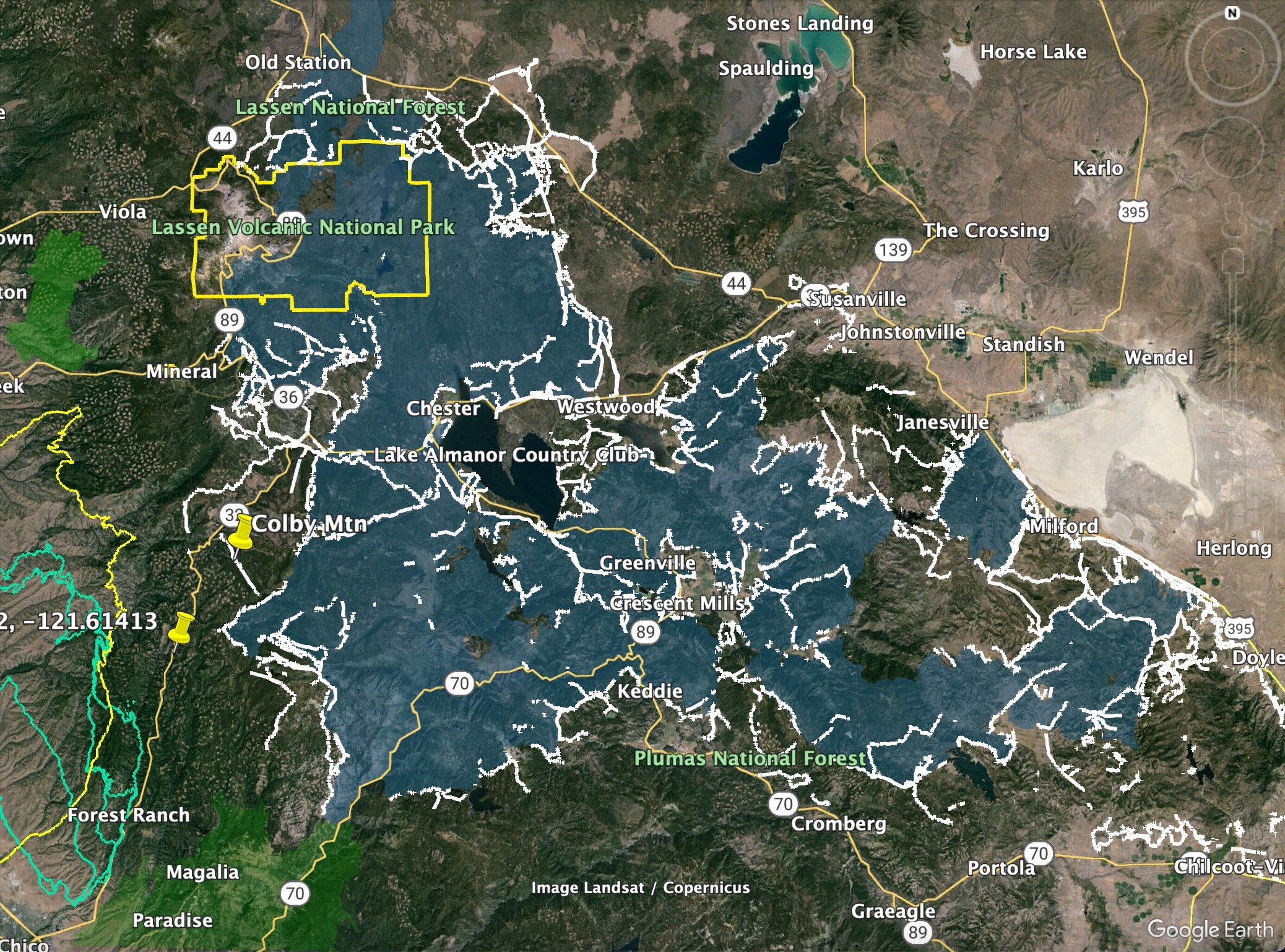
The dozer line on top of Colby will protect the lookout and giant comm site, but it could be a half mile wide and not going to stop a headward run unless they have time to fire it, or the fire lays down before it gets there.
13 Likes
Indeed, I’ve been sitting here (scratching my head) looking at that expecting to see more iron move down that line? Dunno
4 Likes
Division TL has a lot going on right now, i hope there is a good outcome.
6 Likes
Good job by Helco and command working through the bad coms signals.
7 Likes
Like Zeke said, i would think widening the area around the lookout is about protecting the tower and the guy in it in case of burnover. That road switches back down the mountain, isn’t well situated to serve as contingency line I wouldn’t think.
4 Likes
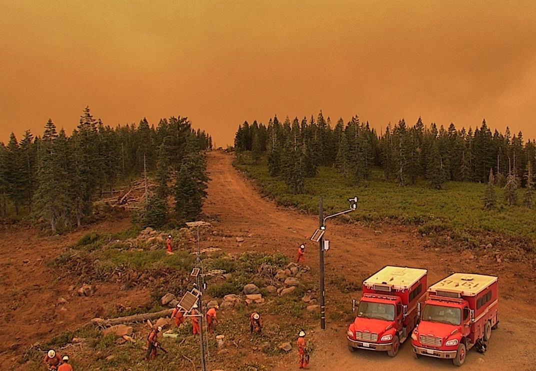
A huge amount of money was spent rehabbing the Dixie Fire dozer lines on Colby Mountain. In a lot of these timbered places, if they are in strategic places, it seems like we should just waterbar them well and leave them, rather than spend months with excavators, skidders, and masticators trying to cover them back up, just to have to re-open them a couple years later. I know the Forest Service doesn’t want them to become new OHV trails, but it seems like our forests have bigger issues at the moment…
32 Likes
I agree, but wasn’t referring to the road to the tower, but the line going out here where you can see the crew buggies now.
8 Likes
they the best of the best…
3 Likes
3 Likes
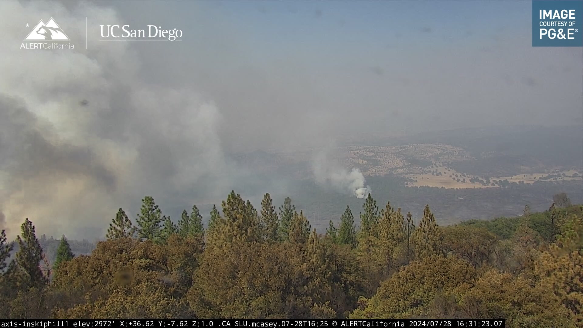
Looks like spot fire on Inskiphill1 camera.
1 Like
Is the burning on the Inskip Hill cam for the last 3 hours on the interior?
https://ops.alertcalifornia.org/cam-console/2690
Sure hope the north end isn’t off to the races again.
1 Like
The fire is now 360,141 acres per CAL FIRE.
Radio traffic indicates some increased activity in the Mill Creek drainage on the N/E side of the fire.
Additionally current camera views from Inskip Hill show some increased fire activity in that area as well (Northern section).
5 Likes
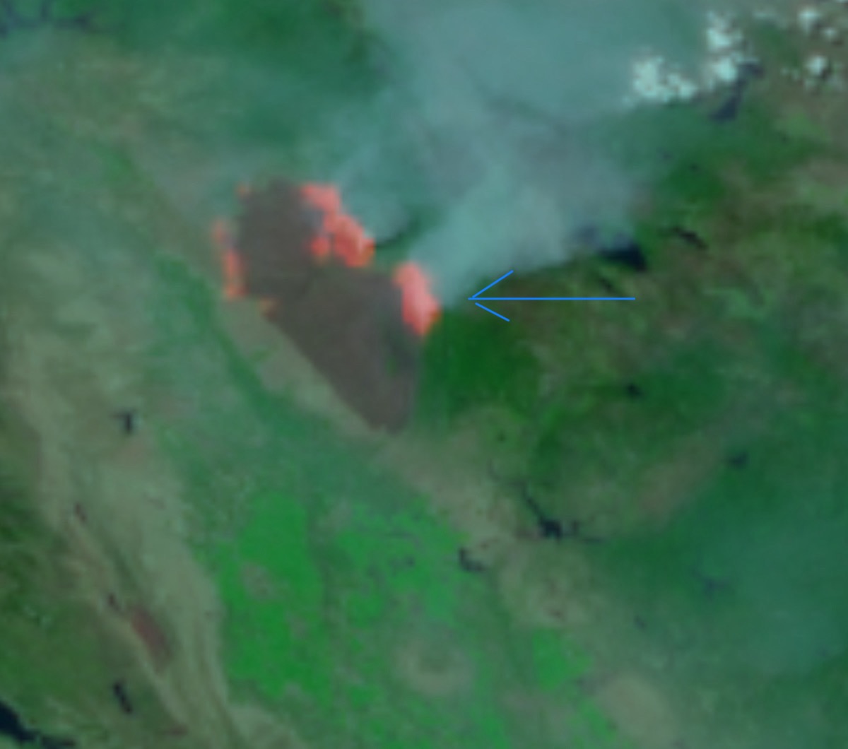
If its a spot its not alone!
1 Like
I believe so. Very dirty burn in that area it looks like.
2 Likes
Looks like black to the right of it when you zoom in. Maybe just a little pocket going off ?
3 Likes
Yes that’s the area. Its not far from the main fire and running parallel.
3 Likes