Strong work
Pete the daily briefing vid is usually posted daily in Watch Duty as well.
I’ve seen them post press briefings and operational updates - maybe I’m missing something but I haven’t seen a morning incident briefing on WD …
Pete I think you’re right. Appears to be just press briefings and operational updates
Quiet much of the day, but some action in the late afternoon in Mill Creek and Deer Creek canyons. Satellite images suggest a run down into Deer, maybe across and up the other side toward Mill (hard to tell), to the northwest of the recent firing operation. Certainly creates a risk of a run up Deer Creek canyon, hooking the fire after all that work they have done to try to stop it above Lomo.
Just heard radio traffic that they have crews down in Deer Creek canyon putting in direct line around that run. There is some access down there, a camp you can drive to downstream from the K Line bridge - but the canyon sides are steep, rocky, brushy, poison-oaky, and just generally gnarly. Big ups to the guys cutting that line in the dark tonight.
Tonight’s Lookout Livestream is a long-form tour of the Pyrogeography of the Lssen Foothills Region, where the Park Fire is burning in Butte and Tehama Counties, Northern California.
Warning: It is 2 hours long!
It includes time-series photos of Deer Creek Canyon from Windy Cut going back to 2002, aerial panoramas taken from a commercial jet of the Lassen Foothills from Mill Creek to Cohasset, and viewer-provided video footage from Michael Steinberg @norcalstormchasing of a spicy tactical firing operation on the west side of the fire from 7/29/2024. We also discussed the use of prescribed fire on lands managed by the City of Chico, and viewed post-fire photos of a forest in Cohasset which was prescribed burned in the past several years which survived the Park Fire and may have helped prevent further destruction on neighboring properties in Upper Cohasset.
8:00pm, 7/30/2024
Does anyone have the link to the recording for this mornings briefing? I can’t seem to find it on the IMTs YouTube channel.
It’s on CalFire Butte County’s YT channel, but you have to hunt for it - they are in the “live” tab
Oh copy. Thanks for that.
Impressive amount of drift smoke here in Reno, NV.
Does anybody know if they’re doing mastication/breaks/burning in preparation for the weather for Shingletown?
Proposed dozer line that way on IAP. specifics unaware on though.
However, based on @pyrogeography video, looks like not a lot of heat on the north parts that would impact that area. It appears they’ve been cooling down that slop on the 36 significantly.
Seems mill creek could run towards NE if it really picked up winds and dried up some.
Absolutely. Happens every summer. It all settles in the valley until our evening winds kick up. Then the next morning it’s all back again and the cycle repeats till November 
Thank you for the great information. I have not looked at the IAP yet. Been out for a few weeks covering and bouncing to the smaller fires.
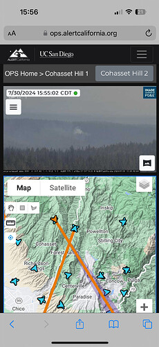
ALERTCalifornia - Inskip Hill 1 Check the 3 hour loop. Looks like a spot fire N of Payne Creek. Hard to tell if this is in the current black or outside.
Looks like the tanker painted that area if you zoom in , that’s what it looks to me
In the black go through the 24 hrs loop, they’ve been there a couple days.
Yes, lots of equipment working in there.

