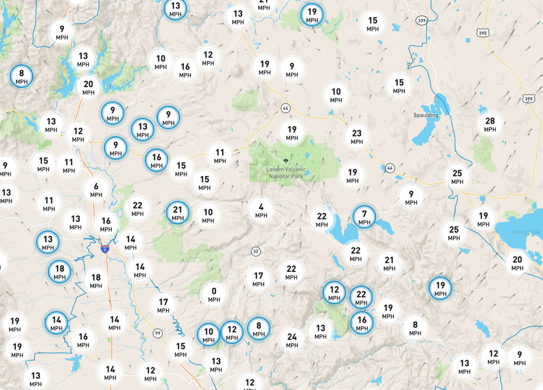
Winds are picking up
5 Likes
What website did you get the wind speed from ?
1 Like
check out Windy.com
5 Likes
PG&E weather app Here is one as well . Zoom in to see the speeds
6 Likes
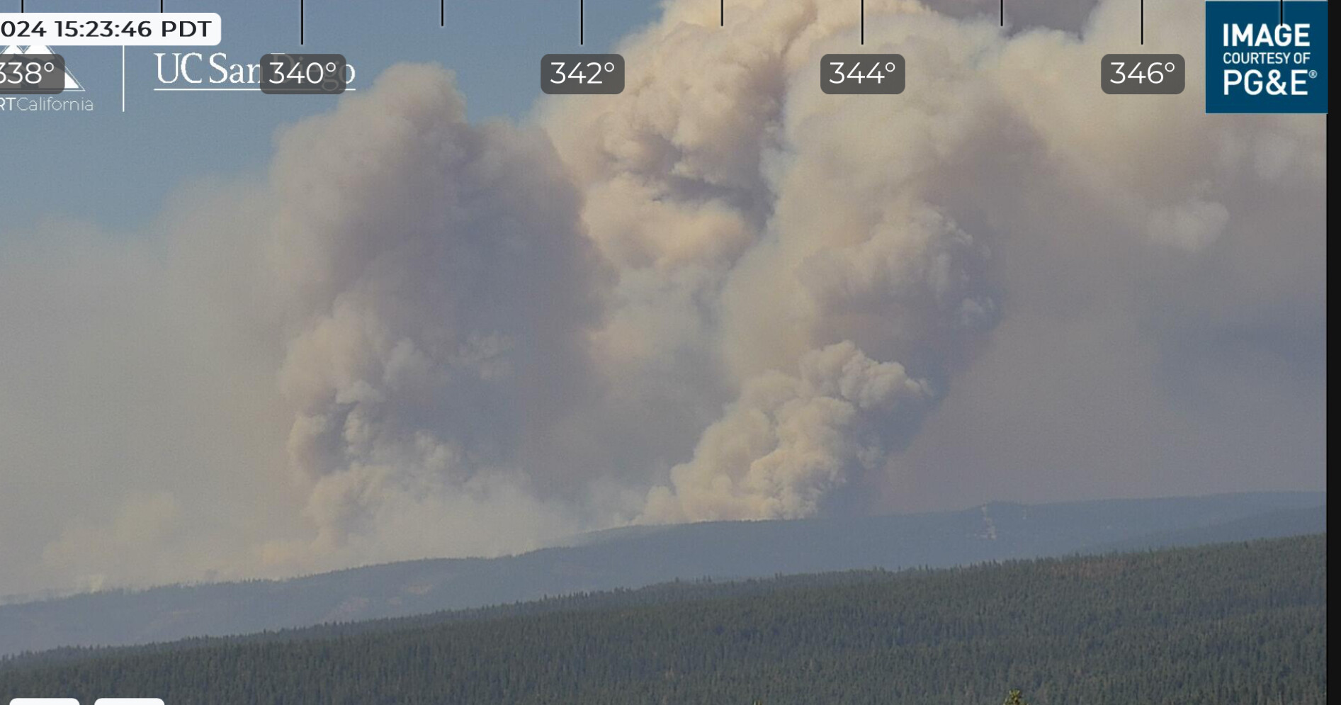
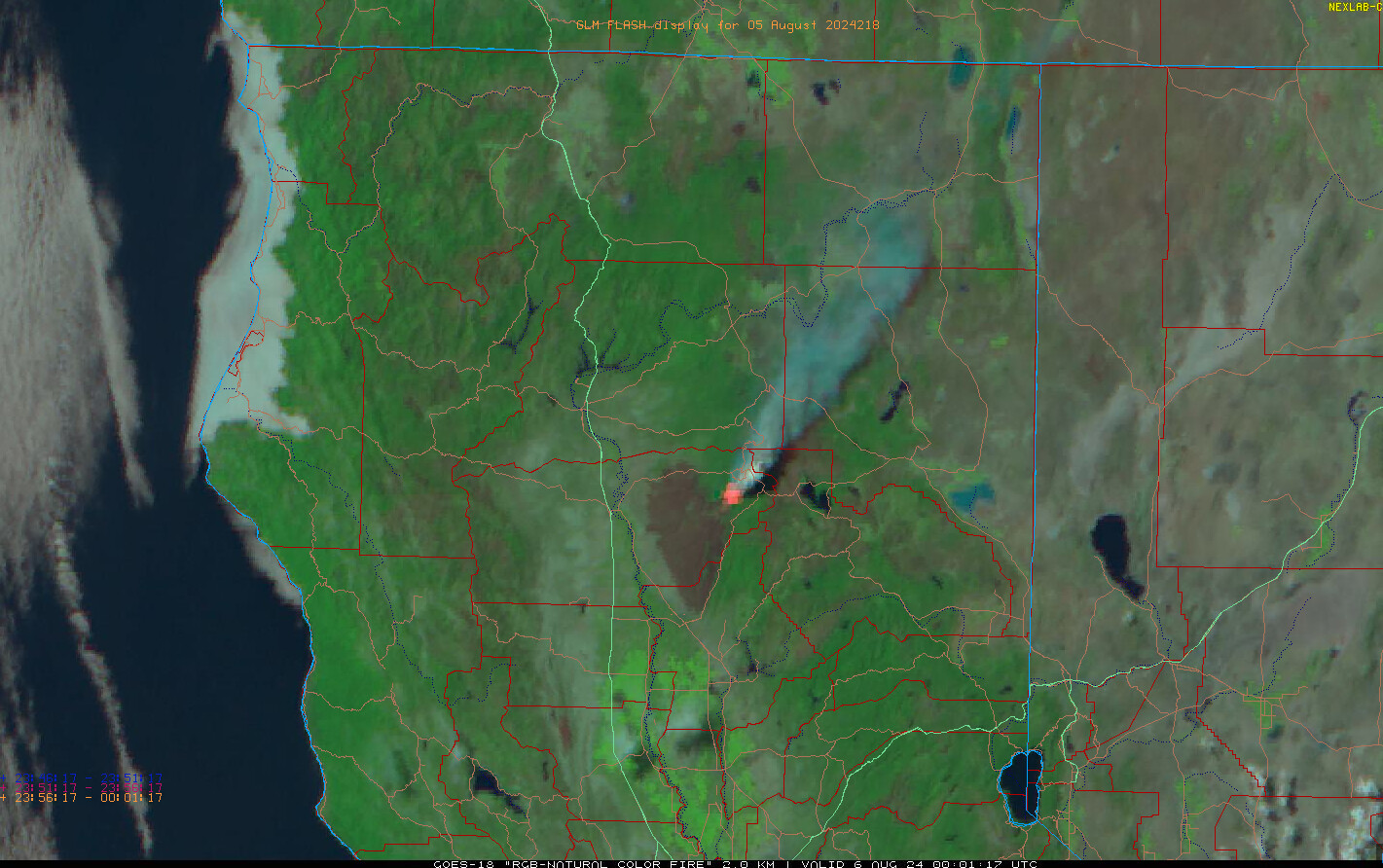
heat signature is growing again
https://napsg.maps.arcgis.com/apps/instant/media/index.html?appid=a483112967f84db096e1c954f8249ad6
4 Likes
Sure looks like it wants to wear out the public & our responders a bit more today… CalTopo - Backcountry Mapping Evolved
4 Likes
sorry for the double down…
1 Like
Just water? Retardent?
1 Like
Been listening to the scanner - they’ve pulled all resources from Div TW out to Mineral to regroup. A lot of resources were at DP-24, which was impacted by the fire. They’ve got accountability for everyone in TU and TW.
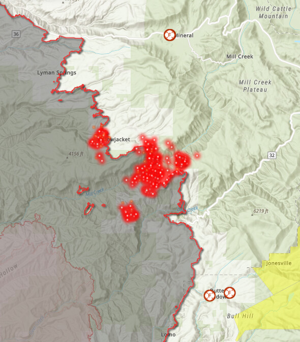
The fire has moved about 2 miles up the Mill Creek Canyon on the north side of Mill Creek today.
The large spot on the south side of Mill Creek crossed about a mile of the L-Line on top of the ridge, burning toward NE. That Division will be tying in with HelCo to see if they can re-engage to pick up the slop over L-Line.
Thinking this action is west of DP-41.

14 Likes
That thing is Mahatma Gandhi, the resource orders might be flowing in soon as a lot of resources are timing out
4 Likes
Lots of type 1 getting cut loose tomorrow and crew swaps on Wednesday.
4 Likes
maybe we should have a gallery forum for screen grabs. i’m on the fire and having to load all these images sucks with our limited signal. don’t mean that to be mean.
18 Likes
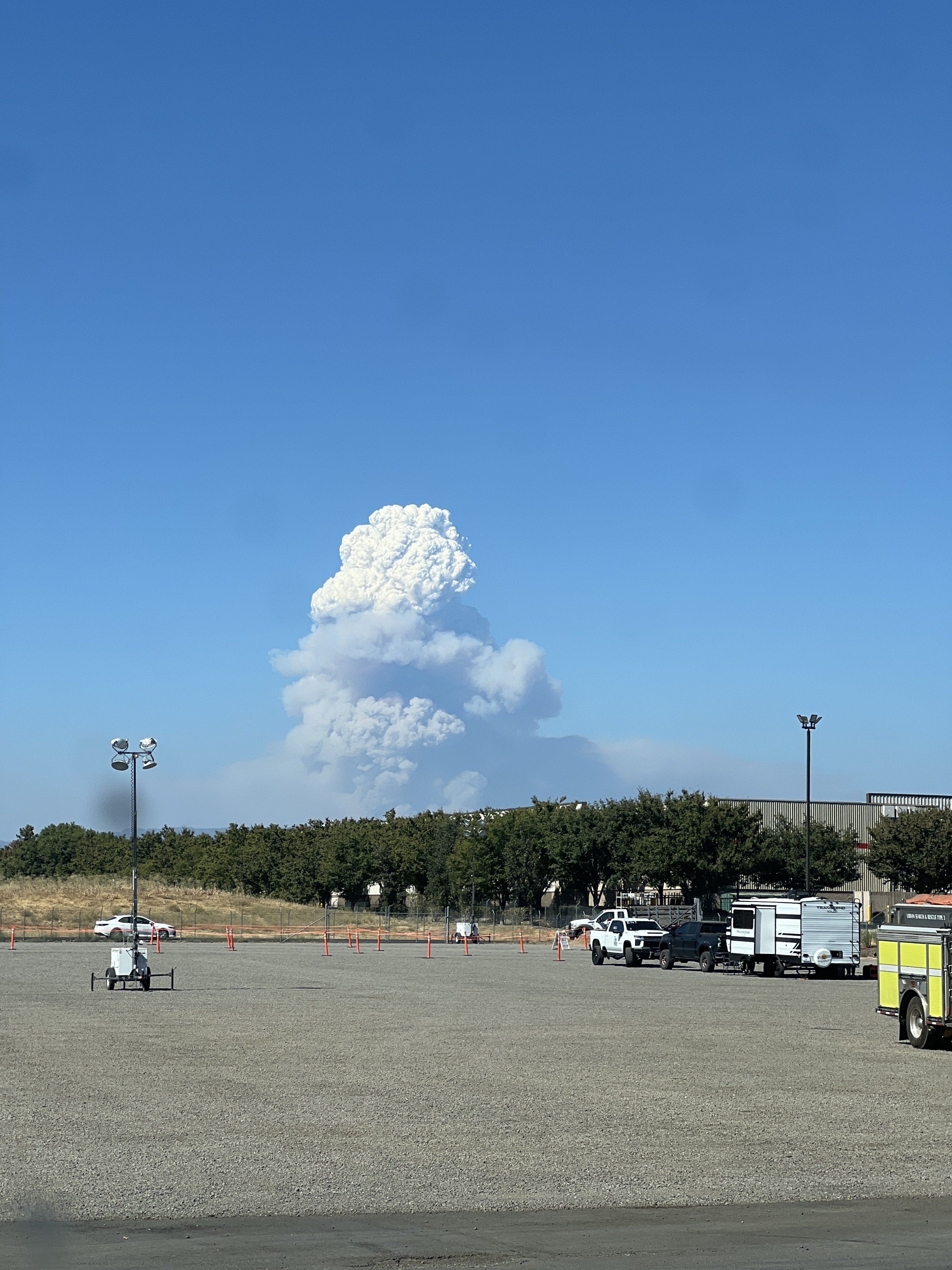
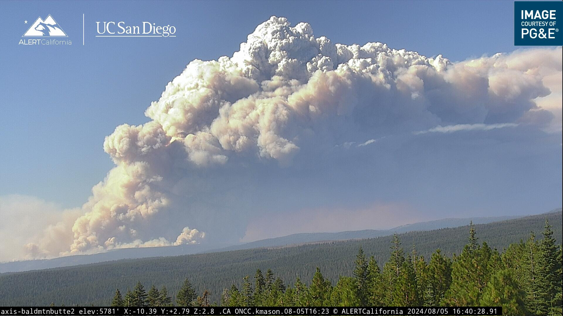
Perspective of size of incident and referance of the current run. Components of the Dixie scar visible in proximity. Give or take 5 air miles
13 Likes
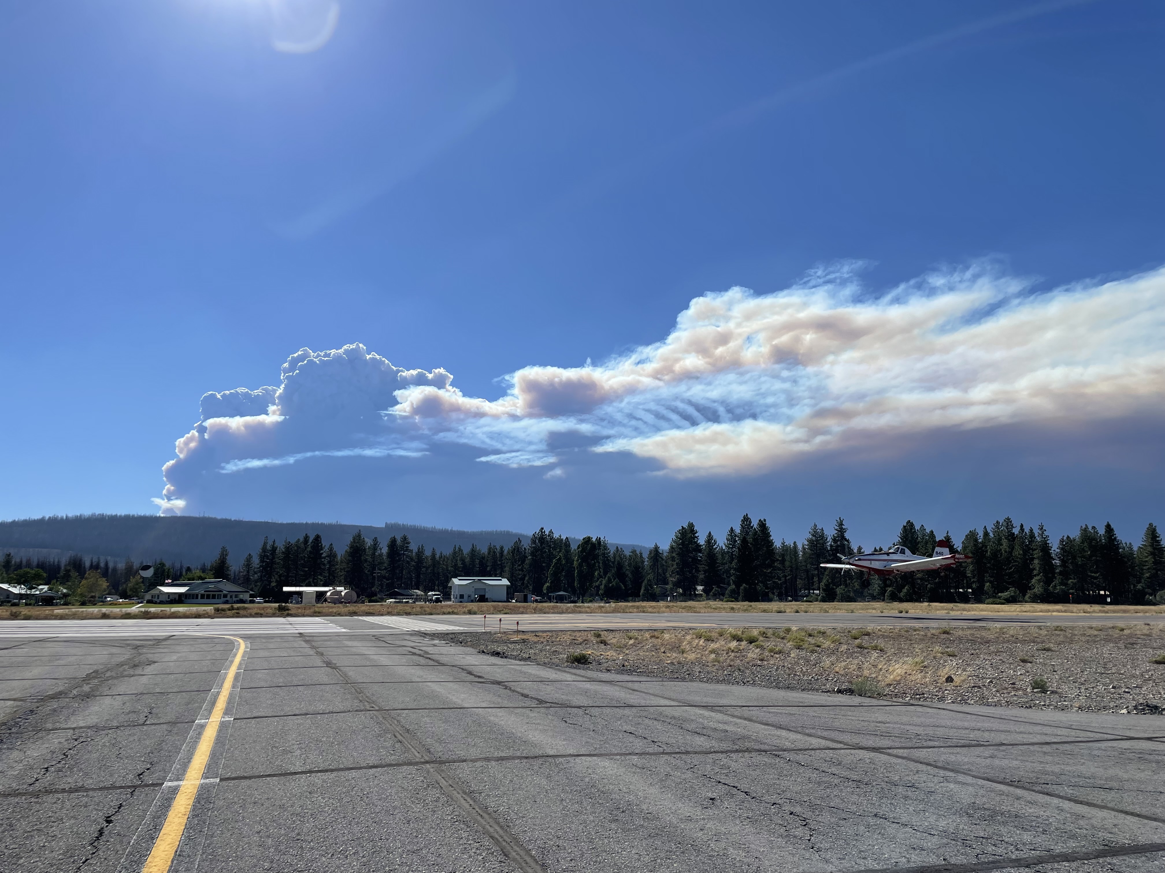
I appreciate the pictures, thank you!
7 Likes
Guessing but that seems to be a 7-10,000 ac run.
4 Likes