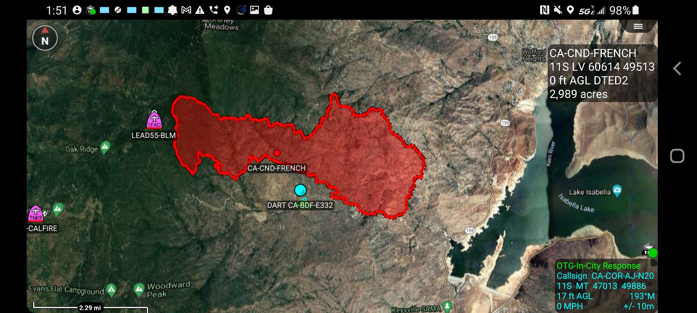
2,600 acres and 0% contained.
3 Likes
CAIIMT 12 assigned to this incident. In-Brief tonight at 1800 at Kernville District Office
2 Likes
Looks like the inversion is starting to break
2 Likes
New evac warning for everything south of 155 from rancheria to wofford heights Blvd.
1 Like
The push out to the north should not be a surprise. There are usually two wind forces at play. The one I described yesterday was the desert heating up faster than the SJ Valley and pulling air up and over the Hwy 155 area and then down slope to the lake and flowing out over Walker Pass to try and reduce the lower pressure from the thermal low. The second one that locals know about is affectionately called a “toilet bowl effect.” Air is also drawn up the Kern River Canyon and flows clockwise around the lake until it gets to the same Hwy 155 area. That’s where a majority of it is then entrained into the flow coming down the Hwy 155 area. So there is always seems to be an odd lateral movement of fire. That is what makes this area so complex, as we saw, fire rapidly runs downslope during the day, then upslope at night. Then you have this side slope that can turn the northern flank into a head fire fairly easily. Occasionally the fires burn into the Wofford Heights area if there is enough of a side slope wind vector remaining. It isn’t super common, but there have been several that have. This is the year you may see all sorts of “abnormal” events. We have had a burnovere in Kernville to the north many years ago. If any odd fire behavior events can happen anywhere, it is possible to happen here. It is a complex piece of ground, and very - very dozer unfriendly.
12 Likes
I was just able to freeze frame a shot from the Shirley Peak cams. An S2 just dropped to protect the tower. On the 15 min loop.
1 Like
Not sure why since it is not immediately threatened. But at 16:17:51 you get one frame of the Lead and then 16:19:16 PhosChek with the dirty bird in the background.
2 Likes
AA on briefing on 167.9875 was discussing the dropping mission yesterday:
Building line from the heal out along the right shoulder was not completed due to smoke out around 1700. All indirect.
Shirley peak radio site mostly boxed in with retardant. Some one is concerned about it’s value to vital communications.
Helco work was going on as they stated there was a 5mile clear of smoke path for the copters to get from helibase or airports to support ground troops.
AG 170.075
I find it unusual given the fires complexity that I hear so much traffic during the day on the SQF ch.2 command channel but drops off to near no radio traffic at night.
3 Likes
Command- BLM Channel 4- 169.7750
Tac’s- NIFC Tac 1, 2, 7, R5 Tac 4 and 6
A/G- 170.075
3 Likes
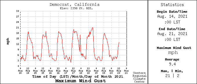
Peak of the wind gusts each day is now…Democrat RAWS due west of incident.
1 Like
CCD update transmitted 40 minutes ago to inciweb is 4200 acres. Now that’s add another 1 or 2k for todays run.
3 Likes
Caltopo scans have been updated with Shirley Peak at the northern most heat signature. Zoom out and pan around for more:
https://caltopo.com/map.html#ll=35.70575,-118.5605&z=13&b=t&o=f16a%2Cr&n=1,0.25&a=mba%2Cfire%2Cmodis_mp
Updates for winds:
VentuSKY the big picture for winds/gusts near gound level are centered over Shirley Meadows:
4 Likes
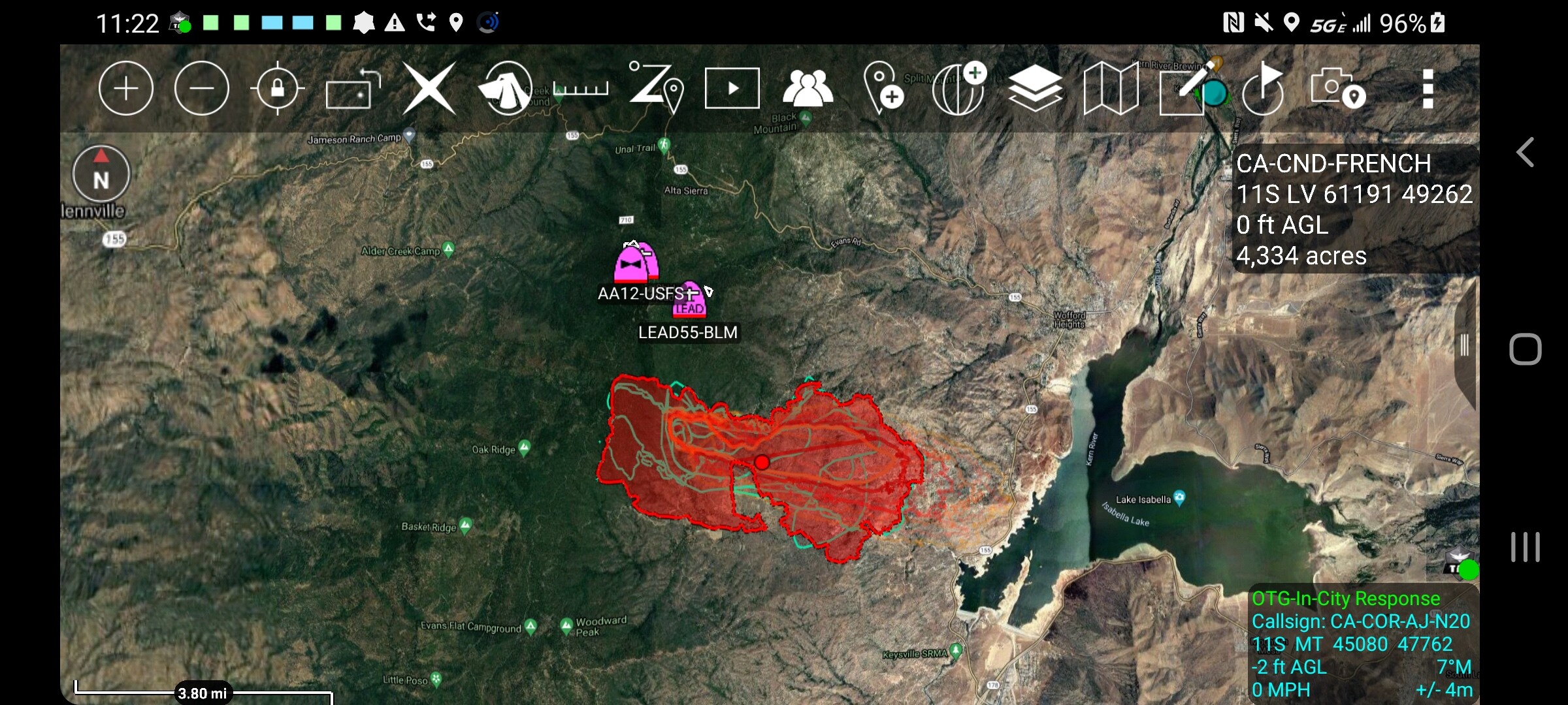
10,061 acres and 5% contained.
6 Likes
Showing on Tobias Peak 2:
http://www.alertwildfire.org/sierra/index.html?camera=Axis-TobiasPeak2&v=fd40736
Making a big run on the southern side right now; winds are picking up on the valley floor, and we have new mandatory evacuations for the area of Wofford Heights around old state road. Old state is closed at hwy 155.
4 Likes
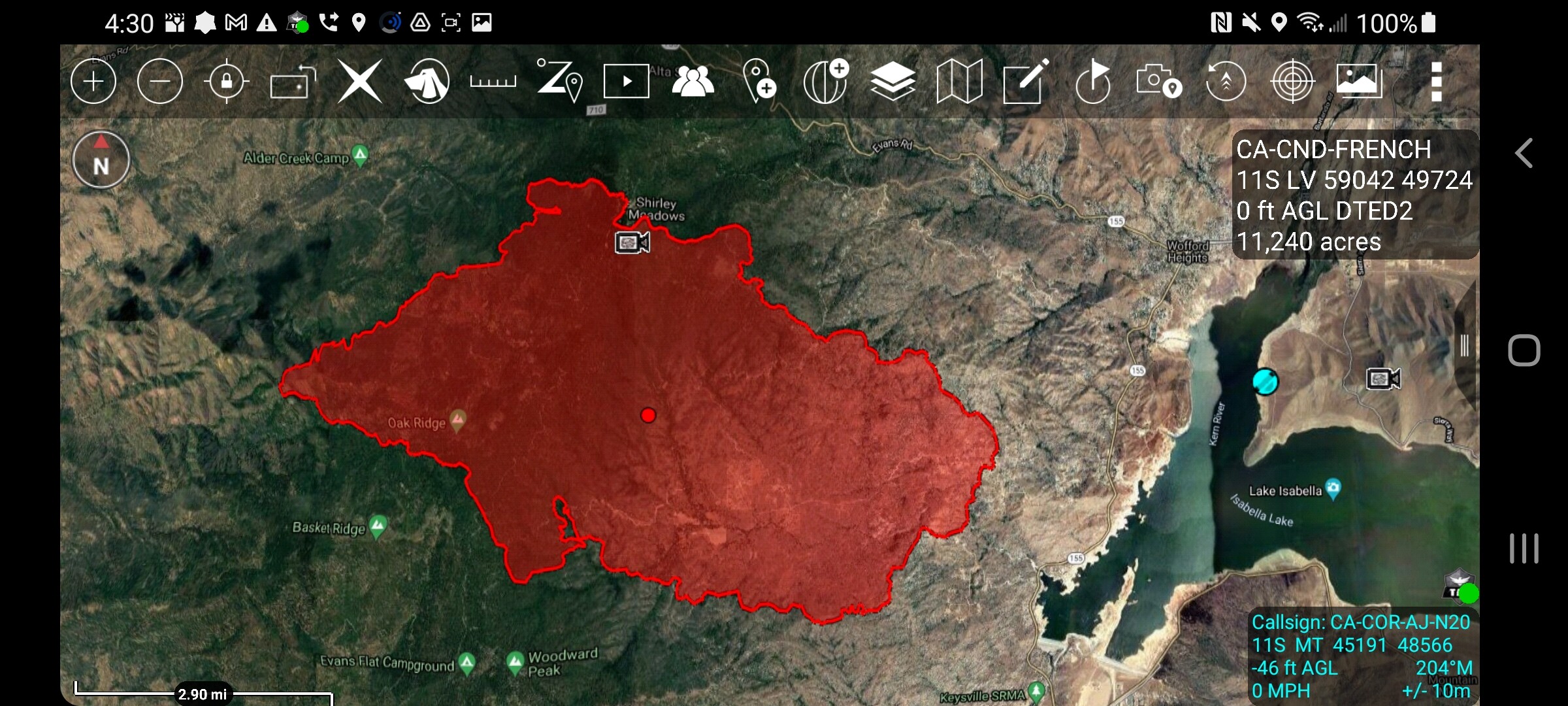
12,037 acres and 5% contained.
4 Likes
Sounds like a new spot was just reported and they asked for a immediate need task force response to Alta Sierra area if I’m not mistaken.
1 Like