There are no Type 1 teams available. A few Type 2 teams are just now coming off R&R.
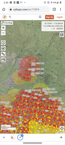
If Caltopo is accurate (thanks @APX8000) then the beautiful timber at Shirley Ski Area is getting hit now.
https://caltopo.com/map.html#ll=35.71267,-118.55402&z=16&b=t&o=f16a%2Cr&n=1,0.25&a=mba%2Cfire%2Cmodis_mp

There is a CF T1 team available!
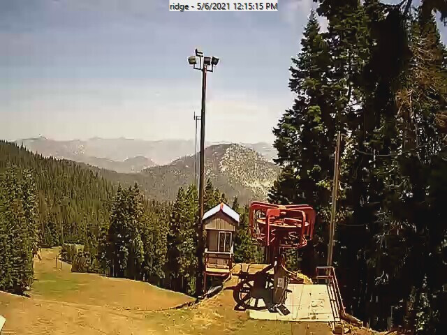
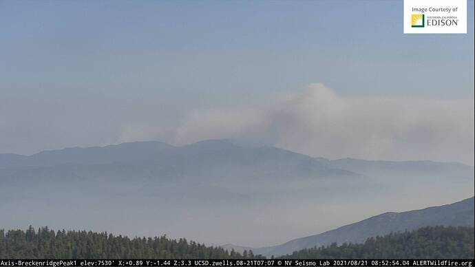
The Shirley Cam was working a few ago…do a time laps on one of them:
Moderate rate of spread across the hill. Retardant slowed it down but burned right up to the camera tower.
http://www.alertwildfire.org/sierra/index.html?camera=Axis-ShirleyPeak2&v=fd40737
I watched the whole time for the last hour. The ski area cam is down though.
CAIMT 12 just took over this morning, Give this team a chance to get some work done…
In the IA thread around post #30 I heard the deputy IC on the Kern Command channel:
“Hearing the deputy IC on Kern Command 3 confirming the IC is coming down to the office to discuss the options for a type 1 team request.”
That was the first night around 20:00. FYI… it was being considered day one.
As with any other resource, just because you want/need it does not mean you will get it. There are no Type 1 Federal Teams available nationwide. There are CalFire Teams available, and several are operating on incidents on FRA, such a deployment will have to be negotiated at all levels.
½ of Cal Fires IMT’s are currently committed, one that historically would have been a fed team. I don’t think we are going to give up another team and the type 2 teams do a great job. Give them a chance.
Little altitude from the RAMMB with Fire temp and Geo color at sunset:
Smoke is circling around, north then back south… I have it rocking back N forth motion…
The other glow is Walker fire. Comm’s from them is spot contained and improving hand line.
Wofford heights RAWS reading gusts starting up at 1100 from 10mph to 1900 up to 23mph out of the west.
RH low of 14% and high of 55%. At least there is a recovery. Fuel stick is still down.
Go to daily summary and click submit.
https://raws.dri.edu/cgi-bin/rawMAIN.pl?caCWOF
Now that the fire has reached/passed Shirley peak, there’s a very high chance of this thing running down the Tillie drainage in the afternoon winds tomorrow. Very heavy fuel loading of dead standing timber and very steep and rocky at the top and heavy brush all the way to Wofford Heights.
Caltopo is showing a separate heat source along the south side of Hwy 155.
Is this firing ops to burn off the intervening fuels to keep from advancing north…anyone have that intel…maybe?
https://caltopo.com/map.html#ll=35.7162,-118.54899&z=13&b=t&o=f16a%2Cr&n=1,0.25&a=mba%2Cfire%2Cmodis_mp
Alertwildfire cams on Shirley and Rocky point off line… no reliable backup power or damaged?? 10:00 hrs
Not damaged. Power good. Working through networking issue with WISP. Hopeful to have up soon.
Edit: Back online @ 1127
Looking at the Tobias cam, where is that smoke coming from…I’m pretty sure that is north of 155. Wild guess tiger flat?
From Bodfish looking toward the west it appears to be on the west side of rancheria road. Haven’t seen it get to the east side of the ridge line yet.
Wind here is from the south 20-30
There is a tremendous amount of bug damage on the west side,and I suspect that is the cause of smoke.
And that is not a good thing when the wind changes. It’s not called Windy Gap for nothing!

