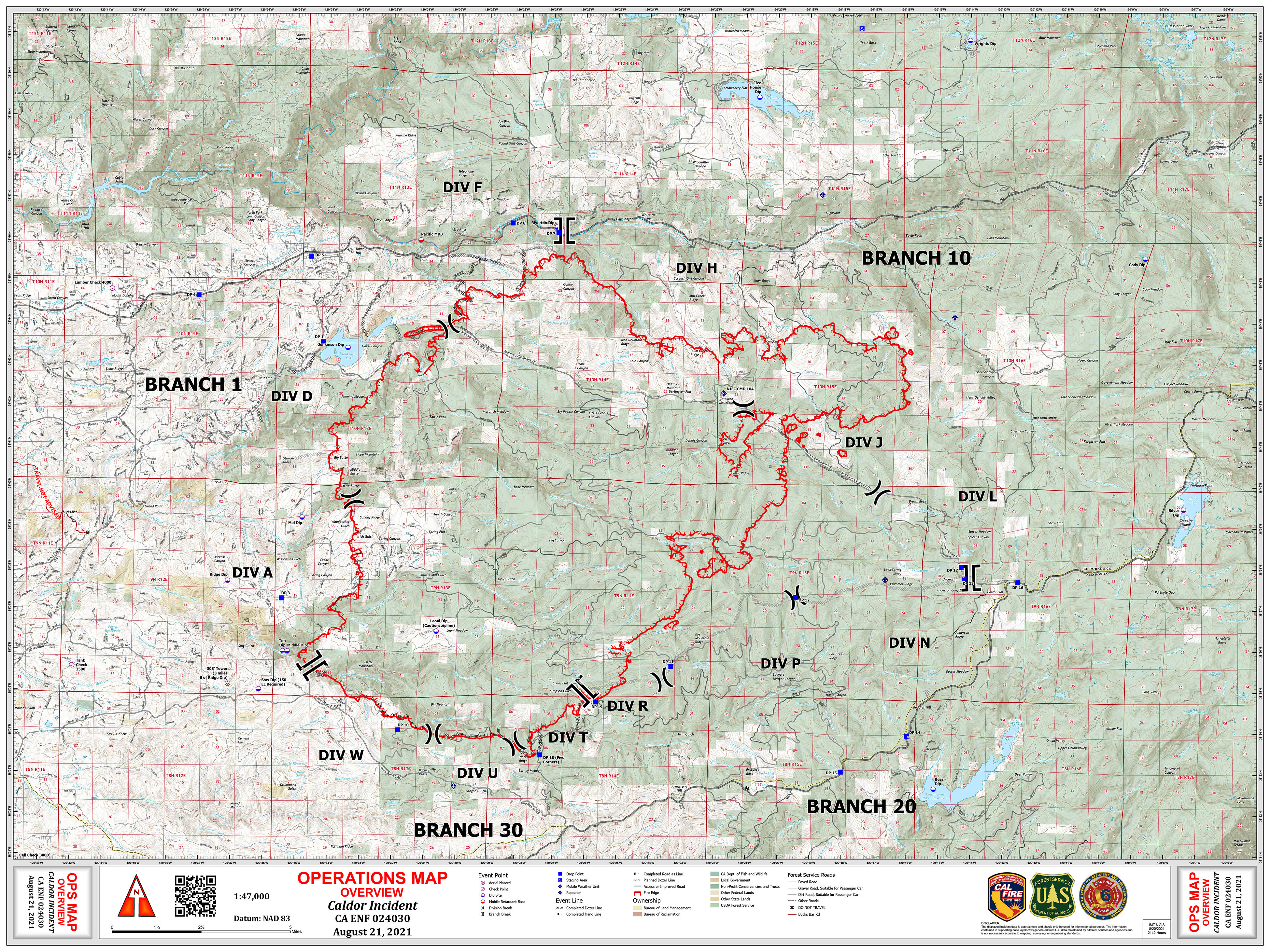
Ok. Setting the record straight here. DIV W is near Omo Ranch Proper. DIV T is the West and South edge of the fire. The fire is North of Hwy 88 and North of North South rd, way North of Bear River reservoir. Bear River reservoir is being used as a dipsite for the helis on Whiskey and Tango.
10 Likes
DATA PACKAGE IS UP FOR THE CALDOR - MAPS.TAKSERVER.US
6 Likes
From the morning update:
82,444 acres with 0% containment.
No change in resources assigned from yesterday. Still at 1558 personnel assigned with 142 engines, 22 dozers, 14 water tenders, 29 crews and 20 copters.
245 structures destroyed and 13 damaged with damage assessment still ongoing.
12 Likes
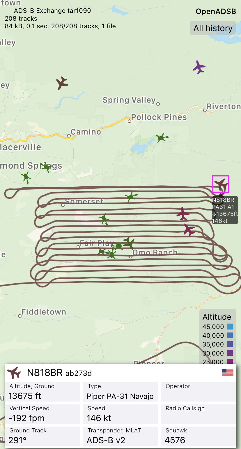
14h49 AirOps just ordered 2VLATs and 4 LATs as visibility is improving
15h01 - Order filled
DC-10 T914 - entering TFR
BAE146 - T15
MAFFS3
C140 MAFFS5 - entering TFR
MAFFS8 - Launched KMCC
Tankers gonna be tanking in SW area for structure protection as code red evac was called for ground crews on Farnham ridge around 15h00
2 Likes
Think I heard the French inc got the other VLAT about 10 min before the Caldor request.
1 Like
T911 and T102 are assigned to French Fire
2 Likes
15h32
Branch 10 Div L
Spot over Hwy 50 @ East of Silver Fork Rd
Well established
15h41 - ground crews: 3 acres inaccessible to both ground and air resources
4 Likes
Spot across 50 in Kyburz area. Well established. Branch 10 en route. Request immediate air attack.
7 Likes
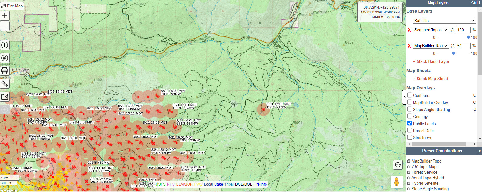
#CaldorFire making major runs to the east today. Between 8pm last night and 2pm today the fire has run roughly 2 miles, mostly downhill. Starting major upslope run out of Silver Fork toward Bald Mountain at 2pm.
Maps from 2pm, 8/21/2021.
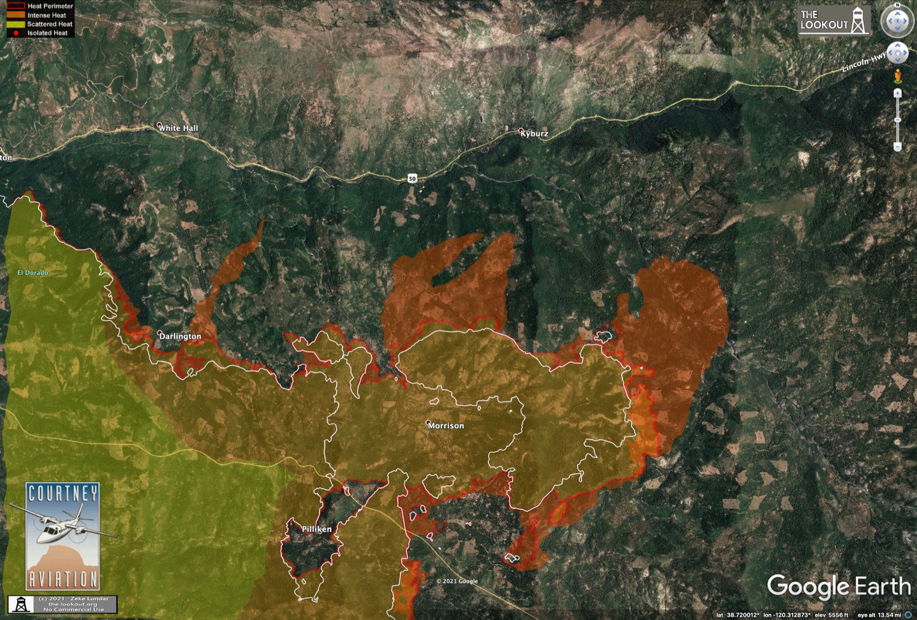
Detailed maps on The Lookout. Caldor Fire – 8/21/2021 – The Lookout
Spread looks to be more toward NE than east at this time.
12 Likes
Jumped highway to 50 near Silver Fork
Correction. near Kyburz
Spot update:estimated 3 ac. Above a rock face. No foot access from below. Both Br 10 and Div L en route.
2 Likes
Airborne and cycling
DC-10 T914
BAE146 - T15 - cancelled for mechanical
C130 MAFFS3
C130 MAFFS5
C130 MAFFS8
Tankers working Div A south of Omo ranch. Code Red evac called at 15h00 for ground crews as fire made run to top of Farnham Ridge
MAFFS2 filled order for T15 on maintenance hold
3 Likes
Caldor FLIR Live Video: Caldor Fire FLIR Live Feed - Danaher - YouTube
6 Likes
Live helicopter video: Kcranews: "LiveCopter 3 is over the Caldor Fire that has burned more than 80K acres in El Dorado County. Get the latest here >> https://on.kcra.com/3y81HiM"
2 Likes
Looks like mapping mission in progress
N31NW over fire
1 Like
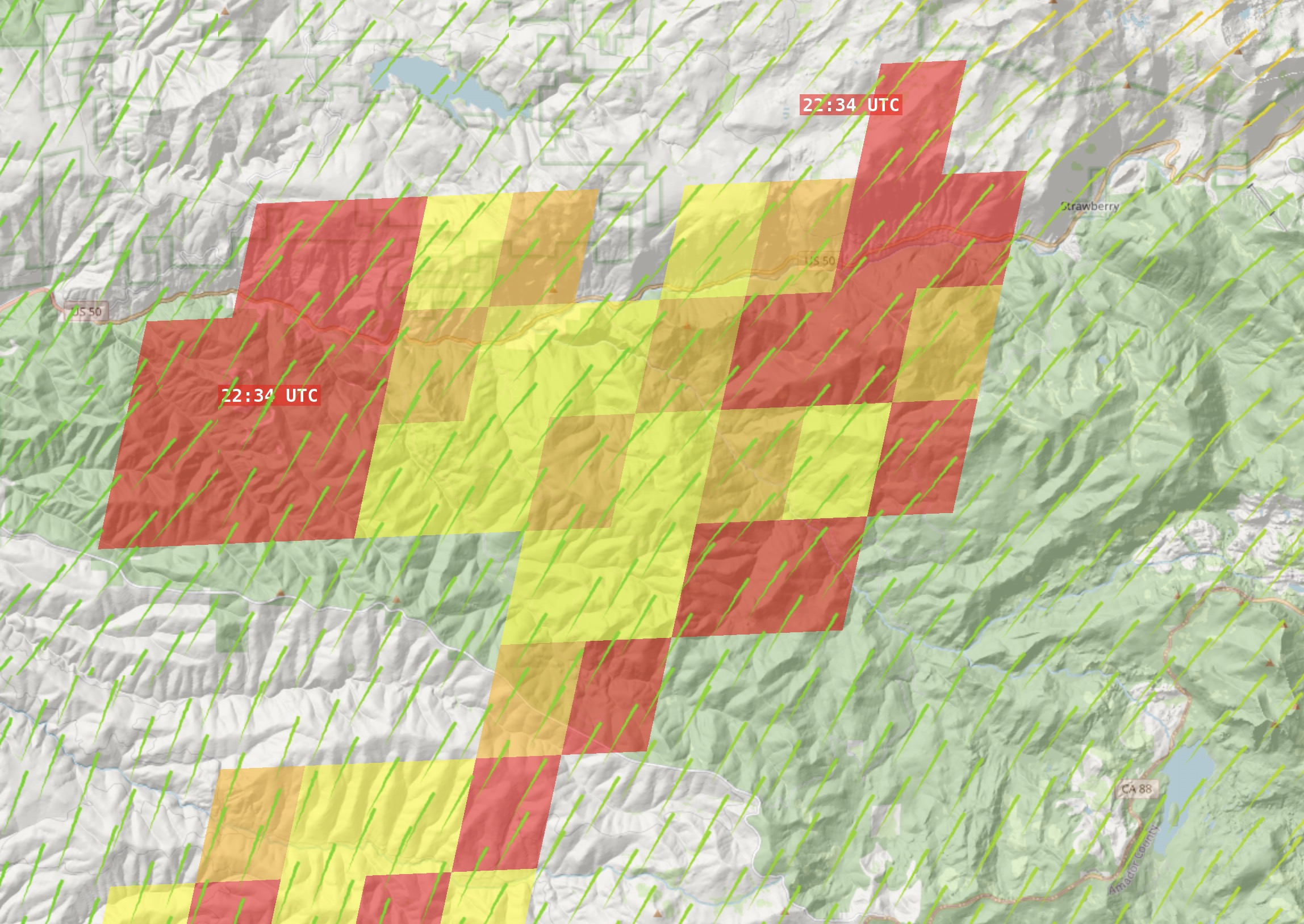
The Armstrong Lookout 2 and Leek Springs Cameras have pretty clear veiws of the fire making it’s run to the NE now.
3 Likes
90,107 acres and 0% contained.
8 Likes