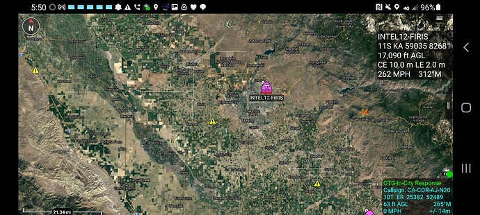
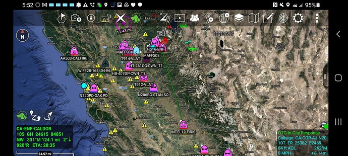
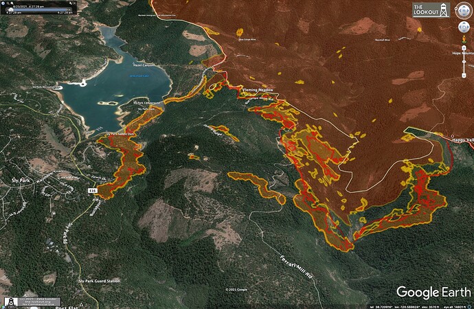
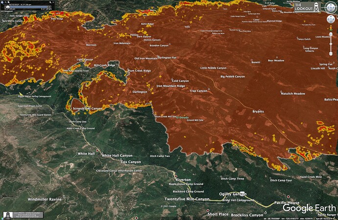
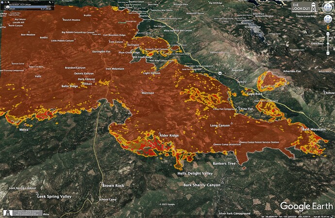
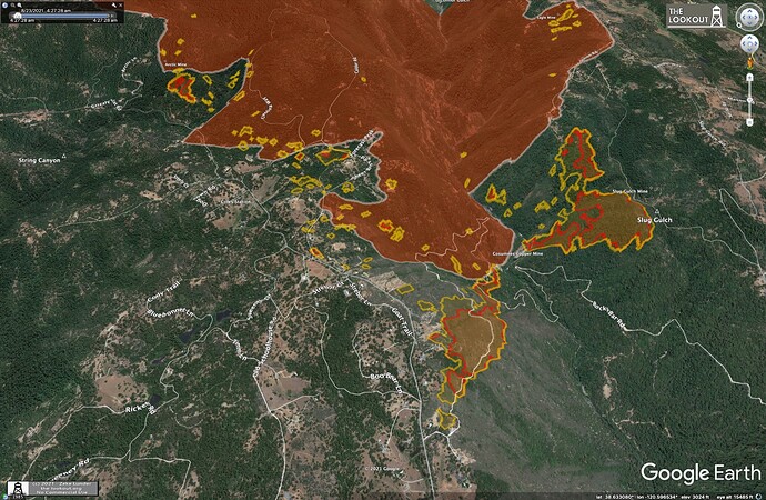
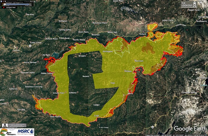
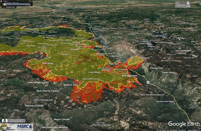
9110, on that first picture/topo map, is that depicting wind speed or heat? Active fire location?
Some spotting on the Armstrong cams as well.
Two strike teams of engines out of AEU to form up at the fire in the southwest area that is making a push toward homes.
Reporting location Drop Point 3 at Grizzly Flat and Caldor
West side taking off again ALERTWildfire | Tahoe
Its T&E program just getting some reps but looks like the landed at Mclelland. False alert.
104,309 acres and 5% contained.
Transition to Helco night ops completed
3 rotor helitankers airborne and cycling
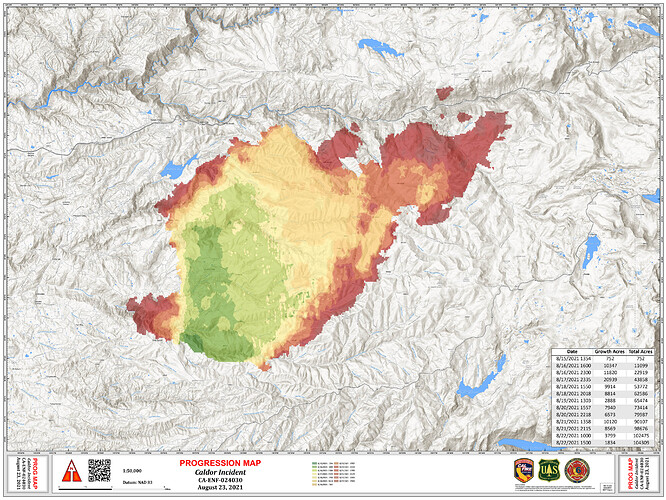
No new growth to the east, some spread to N & S on east edge of the fire. Fire grew slowly to SE, mostly less than 1/4 mi. Longest run was a mile. Westward spread in M. Fk. Consumnes near Omo Ranch and Camp Creek.
Maps here:
https://the-lookout.org/2021/08/22/caldor-fire-8-22-2021-evening-update
Firing operation under way in Division Delta
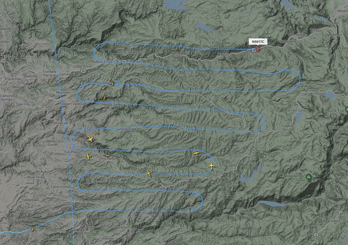
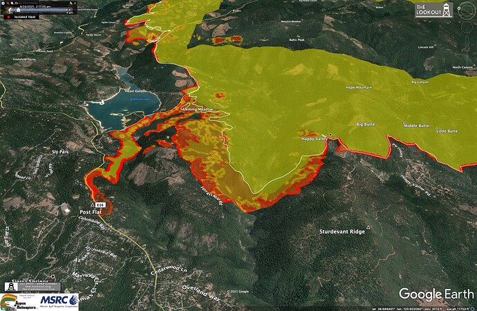
Maps from IR flight at 4:30 am, 8/23/2021. There were firing operations early this morning around Sly Park Res. Slow, steady spread on the north and southeast flanks of the fire.
More maps and analysis here:
https://the-lookout.org/2021/08/23/caldor-fire-8-23-2021-morning
Current Resources on the fire and Critical Resource Needs as of this morning’s 209:
1,745 Personnel Currently Assigned
Critical Resource Needs in order of priority:
20 - Hand Crew ST’s
20 - Hand Crews - any Type
18 - Dozers - any type
16 - Type 3 Engine ST’s
10 - Type 5 Engine ST’s
10 - Type 6 Engine ST’s
30 - Type 1 Engine ST’s
75 - Type 3,4,5, or 6 Engines
10 - Water Tenders - any type
10 - Masticators
4 - Skidgine
3 - Feller Bunchers
AirOps:
1- Helco
1 - HEBM
1- UAS with PSD Aerial Ignition Module
Overhead:
1 - Federal FSC
3 - OSC
4 - OPBD
17 - DIVS
5 - TFLD
6 - FELB
12 - HEQB
4 - FALM
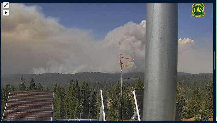
Big column building at 13h15
Looking North
http://beta.alertwildfire.org/region/tahoe/?camera=Axis-ArmstrongLookout2
Looking West
http://beta.alertwildfire.org/region/tahoe/?camera=Axis-Leek
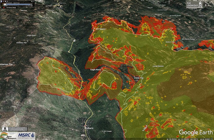
The Leek Springs camera is facing north toward hwy 50 as well now. (The exact direction is 6 degrees.) The center of the view field crosses hwy 50 roughly halfway between Kyburz and Strawberry.
Live video: LiveCopter 3: Here is a look at the Caldor Fire, which continues to threaten structures - YouTube
Helco operators playing whack-a-mole triage all day cooling the finger heads, supporting structure protection efforts in multiple divisions and addressing dozer line slop-overs. A grow operation or two might have been discovered. UAV operations active in river canyons. VLATs cycling all afternoon, 2 DC10s, 5 MAFFS, blah blah blah. Day helos off, transitioning to night ops helos. Well choreographed deconfliction within the FTA with the aggressive aerial effort today. 
114,166 acres and 9% contained.
Yesterday was an active day on the Caldor, with major runs along SE flank, and new runs to the east. Firing operations continue along Road E-16 to keep fire out of neighborhoods NW of the fire. Maps and analysis at Caldor Fire – 8/24/2021 – The Lookout
