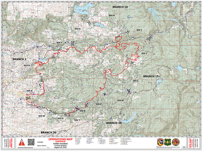
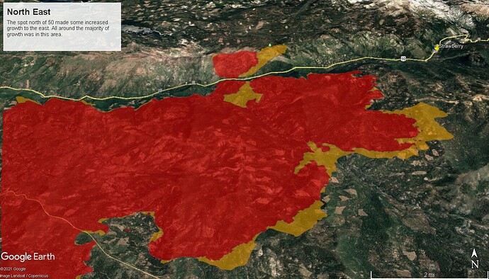
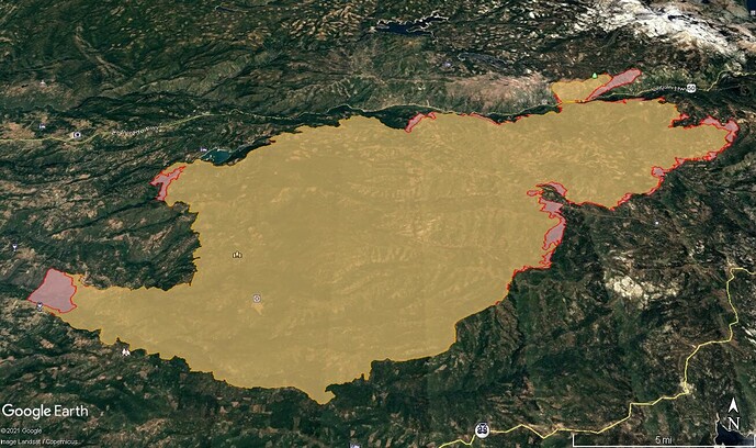
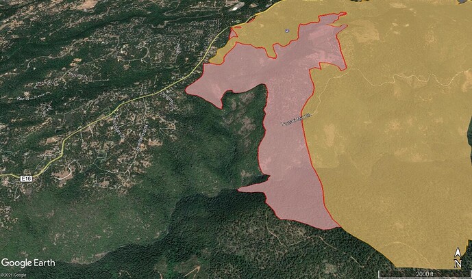
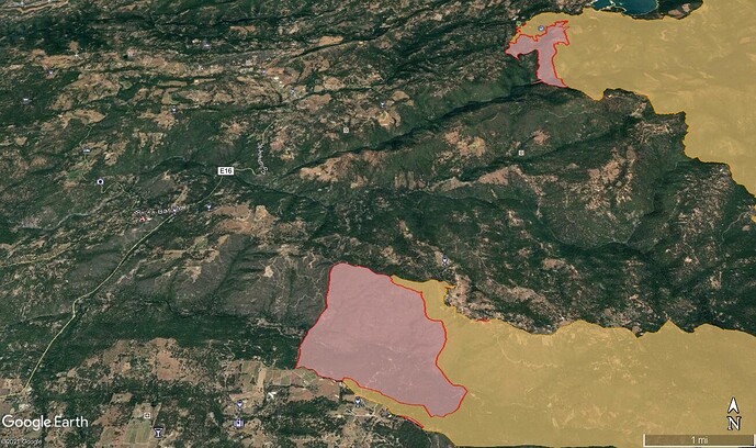
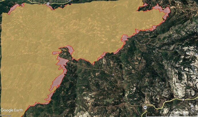
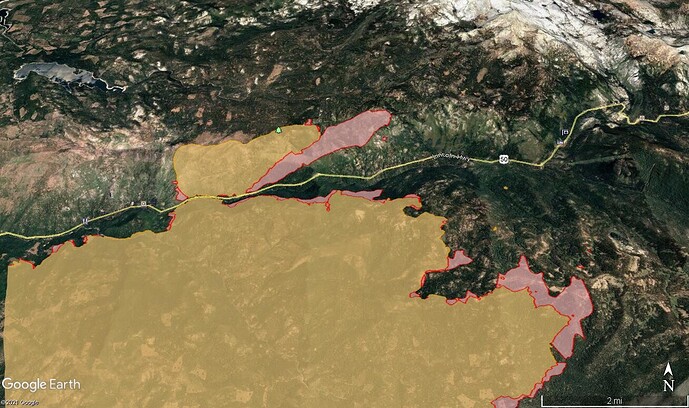
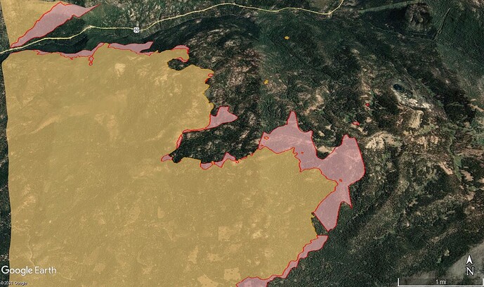
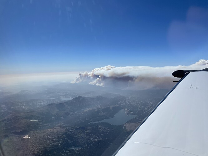
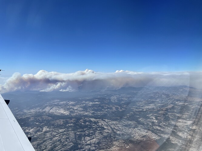
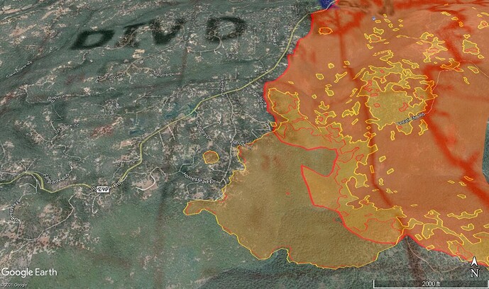
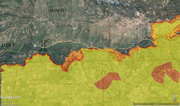
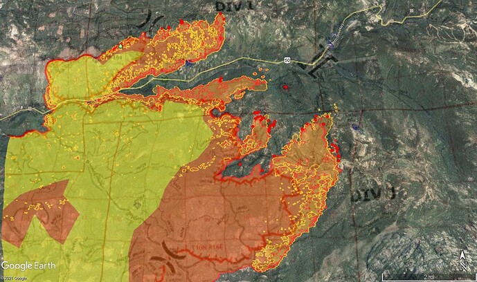
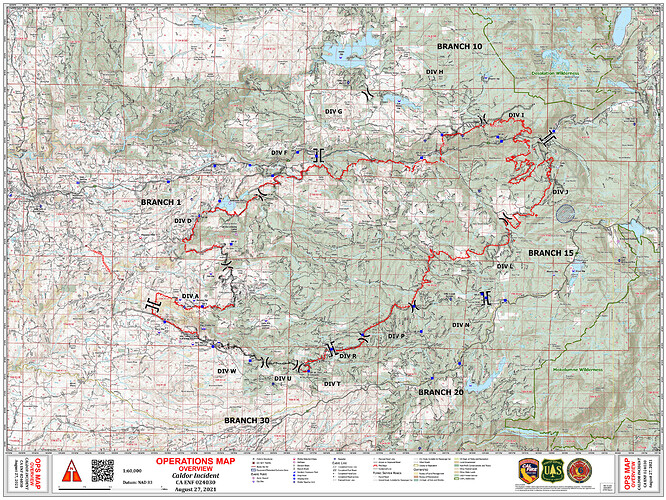
Today’s 8/24 OVERVIEW OPS Map:
They haven’t started the damage assessment in that area yet but it will be shown here when your place is checked. If you use Facebook or Twitter some freelance media people are willing to check for you if they can.
Per FB News conference another 700ac spot fire off the original spot fire N of 50.
Approx 2100 acres on N side of 50 between the 2 spots
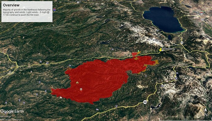
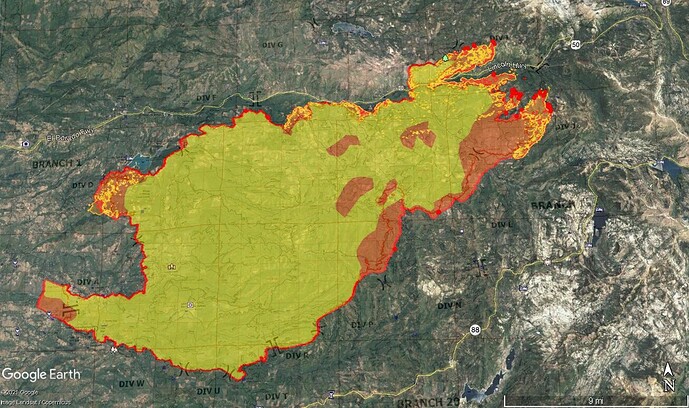
1500 Progression. Utilized different colors - didn’t have much time today.
Some major growth all around.
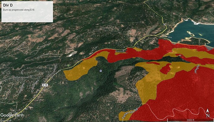
Div D - fire continued to progress through the drainage.
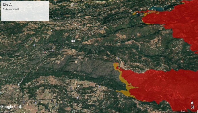
Div A - fire made a good run through slug gulch
Div N, L, J - fire continued to grow in all directions
Spot Fire on the North side of 50.
Several small spots ahead of the main fire
Notes from IR interp @ 0023: Northeast island merged with the main perimeter over the course of 24 hours and continued to grow eastwardly. Further expansion of the main perimeter in the NNE section, also in an eastwardly direction. West perimeter saw minor growth to the west. Southern perimeter remains unchanged. Scattered heat throughout the incident, with intense heat around the NNE and SSE.
Imagery is a composite of an IR flight on 20210826 @ 0023PDT with 0620PDT IR flight.
pict20210726-121204-0.pdf (192.5 KB)
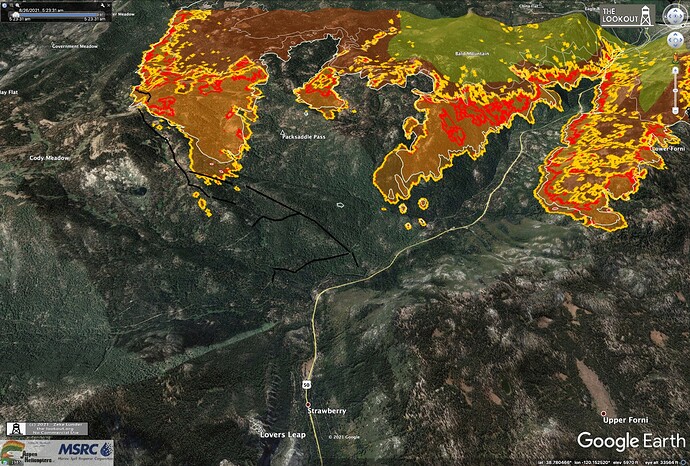
A mapping flight flown about 6am, 8/26/2021 on the #CaldorFire, shows extensive spotting over the bulldozer firelines into Cody Creek, southwest of Strawberry. Dozer lines are black in this map.
Branch 10 requesting 10 engines to Div H for structure defense in the 36 mile tract
A post was merged into an existing topic: CA-ENF-Caldor?
Threw together a map with new IR data from about an hour ago (8/26 1435): Caldor Fire
Hello everyone
I’ve been active in the Dixie forums, thoughts I would contribute to the Caldor Fire as well.
This is a KML containing all data tagged as a completed line from today’s posted data at:
https://ftp.wildfire.gov/public/incident_specific_data/calif_n/!CALFIRE/!2021_Incidents/CA-ENF-024030_Caldor/GIS/IncidentData/20210826/2021_Caldor_CAENF24030_Event_ArcPro_2_7.gdb.zip
And this one contains data flagged as planned dozer and hand lines:
These can be imported into Google Earth or CalTopo, great for combining with other data for seeing a perimeter that stopped at lines, slopped/spotted over lines, or is heading toward lines or no lines.
There was minimal spread to the east last night. The fire moved a mile downcanyon in Camp Creek, on the NW side of the fire, growing about 400 acres. It is now 1.5 miles east of Pleasant Valley. The 2019 Caples Prescribed Fire may help slow fire spread on SE.
Maps here: https://the-lookout.org/2021/08/27/caldor-fire-8-27-2021
Critical Resource Needs by priority per PM 8/26 209:
9 - Dozers any type
3 - Hand Crew Strike Teams (G)
20 - Hand Crew any type
18 - Type 3 Strike Teams
9 - Type 6 Engine Strike Teams
15 - Type 1 Engine Strike Teams
27 - Type 3, 4, 5, or 6 Engines
6 - Masticators
6 - Feller Bunchers
1 - HLCO
1 - HCWN
1 - Federal FSC
1 - OSC
3 - OPBD
14 - DIVS
9 - TFLD
6 - FELB
9 - HEQB
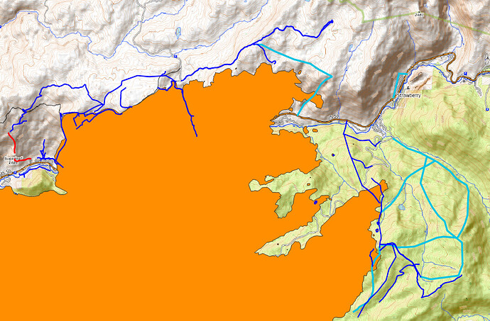
From this morning’s data package. For east end of fire:
Orange = Fire
Blue = Completed Lines, all types
Cyan = Planned Dozer Lines.
Red = Planned Hand Lines (just one spot, left edge by Sugarloaf)
The lids come off and she looks to be off to the races again. Winds are pushing SW up canyon as usual but with slightly greater velocity. Leek springs and Armstrong lookout have decent views. The firing in DIV J doesn’t appear to be holding but let’s hope that it is, there also appears to be some heat sources detected NORTH of the 50 in DIV G, let’s really hope not as there’s no contingency line between there and ice house and we’ve seen what this thing can do with lateral crown runs.
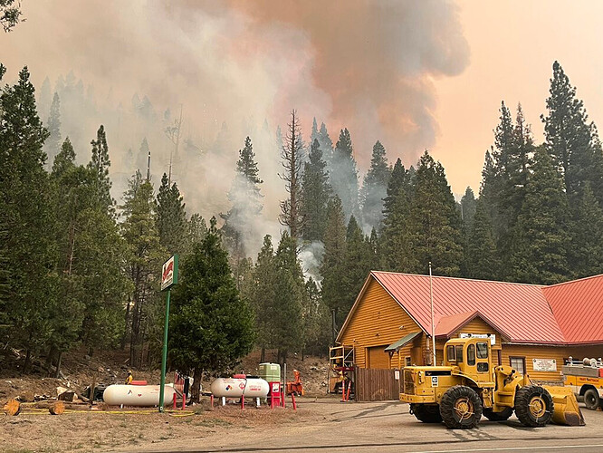
The fire has reached Strawberry, not with ferocious intensity but it’s there
