
we have a new spot, anyone confirm location? by meyers grade on the west side of hiway 50?
1 Like
Yes, XSA4152C.
You probably know… just replying because of the ? part.
3 Likes
KCRA coverage, commentary with copter 3 flying the south side
San Bernardino ski resorts did it twice for fires in January. It helped.
5 Likes
Per Douglas County, NV: https://www.douglascountynv.gov/government/departments/emergency_management/current_emergencies/caldor_fire
Road Closures
US 50 West Bound at Spooner Jct (S. Carson St & 50)
SR 207 West Bound at Foothill Rd
SR 28 and US 50 Jct West Bound on 50
Per Douglas County, NV FB page: Redirecting...
Non-essential travel is NOW PROHIBITED into Tahoe’s east shore.
Per Nevada DOT https://nvroads.com/ :
- Road Closed (Wildland Fire) - on US-50 westbound from mile post 0.0 in Douglas County to mile post 7.6 in Carson City County in Nevada.
Current as of: 08/30/2021 01:33:46 PM PDT
- Road Closed (Wildland Fire) - on SR-207 westbound from US-50 Junction to Dagget Pass Chain Up Area in Nevada.
Current as of: 08/30/2021 01:35:50 PM PDT
Zephyr Cove Elementary School and George Whittell High School will be closed for the rest of this week. We will continue to monitor conditions created by the Caldor Fire in the Lake Tahoe Basin to determine the appropriate next steps, taking into consideration mandatory evacuation orders, air quality, etc.
We hope our Lake families can now focus on what’s most important, and that is on their health and safety. You are all in our thoughts and prayers and we are here to support you in whatever capacity we can during these challenging times.
Per [Tahoe Transportation District] (Redirecting...)
August 30th, 10:30 am: Please be advised that TTD is assisting with evacuations. Routes 19X and 22 are re-routed to evacuation services linking Stateline Transit Center and the Douglas County Community Center. Routes 50 and 55 will continue to operate and bring evacuees from the City of South Lake Tahoe to the Stateline Transit Center. If you need transportation and are not near Routes 50 or 55, please call 911.
4 Likes
Not sure where to put this question,
Is Basecamp still in PVille at the Fairgrounds?
Looks like everybody who wanted to get out has, traffic very light compared to before. Google traffic showing some green vs purple from earlier.
3 Likes
Watching live TV, traffic is bumper to bumper.
It was as of last night
Where? Ski Run and the Y are pretty vacant? A couple of hour ago it was bumper to bumper on the Cal trans Cameras
That is true. They have gone dark!
Looking at live shots just east and downslope of Echo (along 50), the wind looked nominal. Feeling a bit optimistic especially with the amount of equipment in there.
1 Like
Saw a live feed with very gusty winds…must be very specific areas
I hope things come together for everyone working that area. That will be a big strategic win.
6 Likes
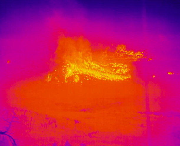
It’s showtime folks. Reports of spots dropping in on Meyers
4 Likes
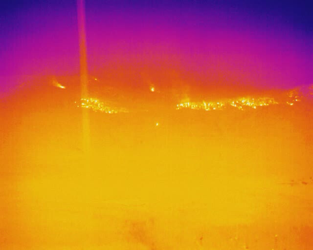
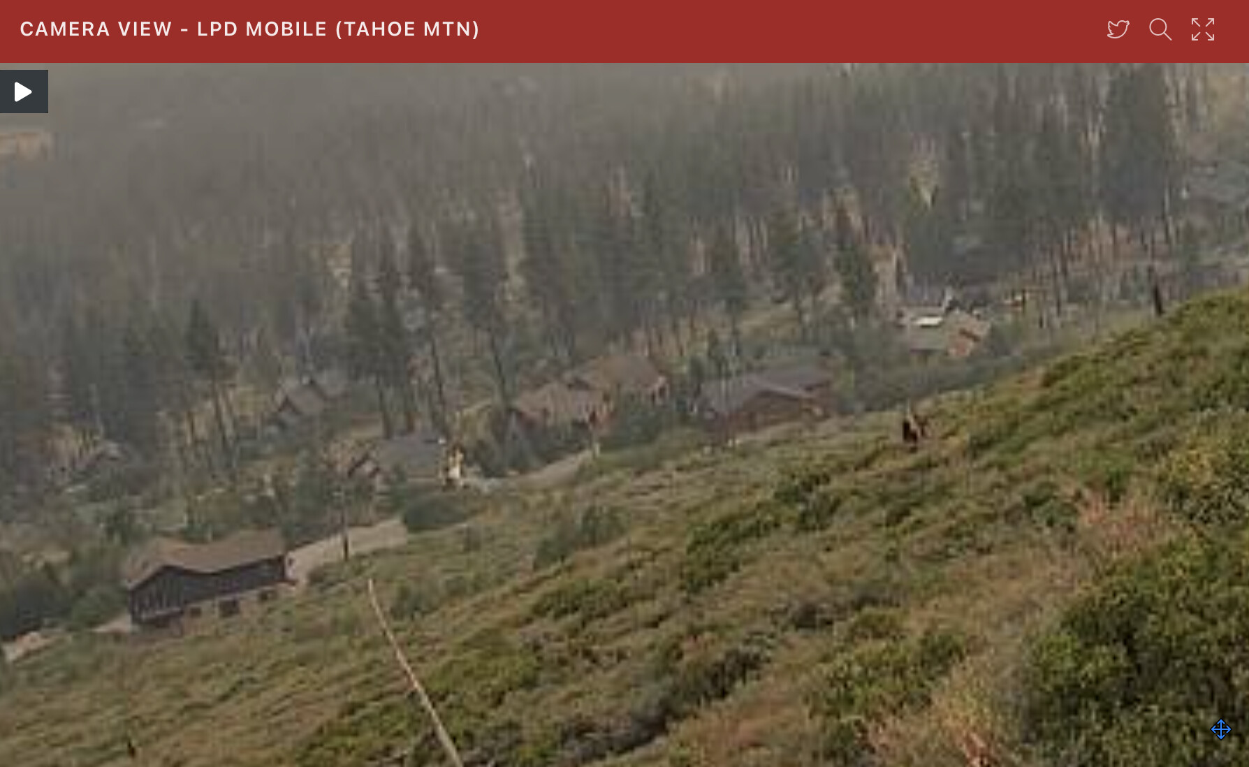
LPDMobile1 CAM - This cam is showing how close and large some of these homes are. I hope the plan works.
3 Likes
Also keep in mind the view from the FLIR Heavenly cam is likely blocked below what we can see hot in that image. Look at Heavenly visible cam for confirmation.
1 Like
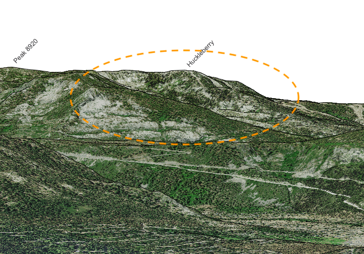
Ok, clarified one more time and you are correct. Those pictures are of the west side…also confirmed the spot on the eastside of 89. My apologies to all
6 Likes
1 Like