Looking at live shots just east and downslope of Echo (along 50), the wind looked nominal. Feeling a bit optimistic especially with the amount of equipment in there.
1 Like
Saw a live feed with very gusty winds…must be very specific areas
I hope things come together for everyone working that area. That will be a big strategic win.
6 Likes
It’s showtime folks. Reports of spots dropping in on Meyers
4 Likes
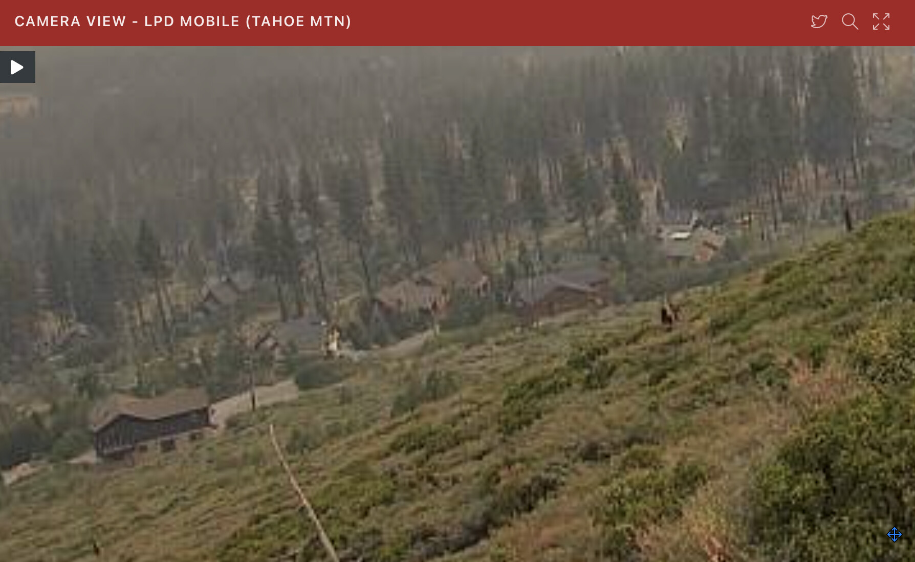
LPDMobile1 CAM - This cam is showing how close and large some of these homes are. I hope the plan works.
3 Likes
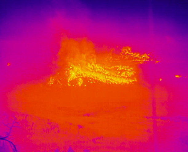
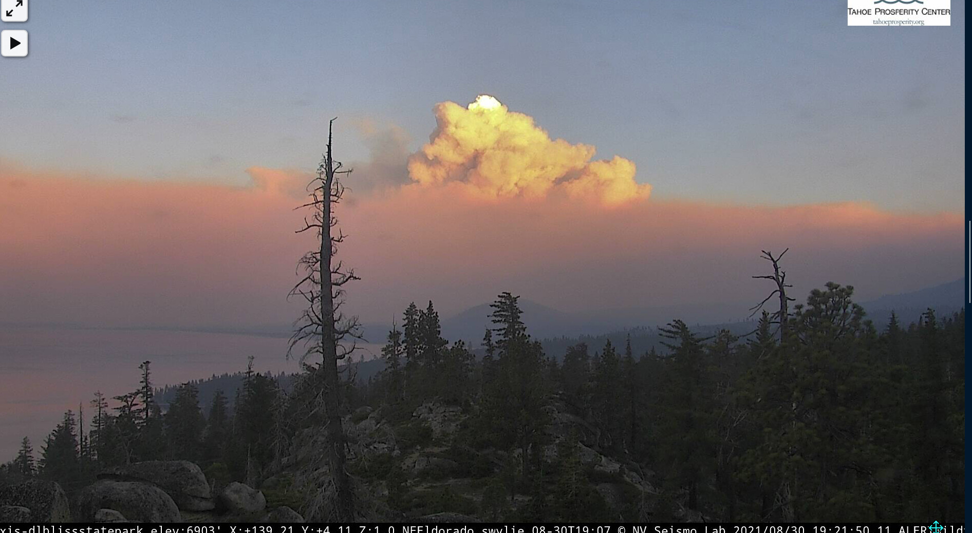
Also keep in mind the view from the FLIR Heavenly cam is likely blocked below what we can see hot in that image. Look at Heavenly visible cam for confirmation.
1 Like
Ok, clarified one more time and you are correct. Those pictures are of the west side…also confirmed the spot on the eastside of 89. My apologies to all
6 Likes
1 Like
Very true, especially further south much of Christmas Valley is obscured.
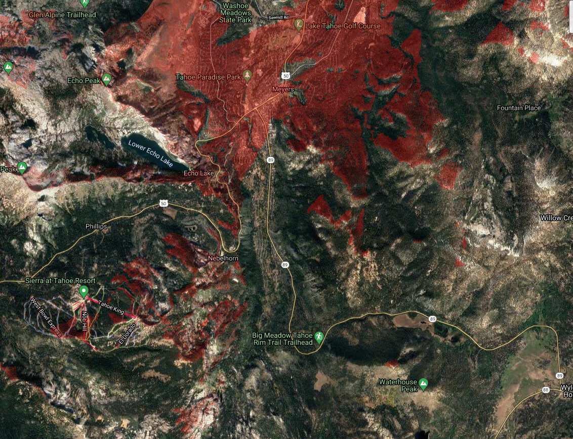
The toe of the large slope that is burning actually goes into Lake Audrain which is still set back a bit to the west from echo summit.
2 Likes
I predict it will run to 395
3 Likes
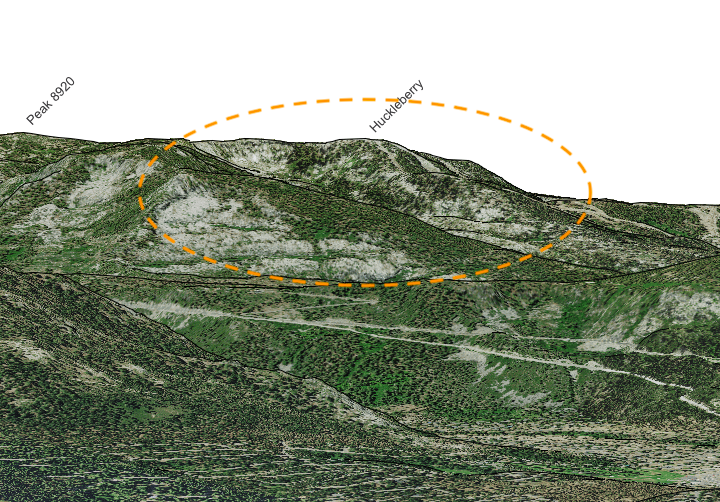
Here is the approximate viewshed of the heavenly flir. That is to the ground. Any fire with heat will show up on the FLIR 100-300’ agl.
6 Likes

Based upon your viewshed, is that fire on the west side of Fountain Place… i.e. 2 miles east of 89?
1 Like
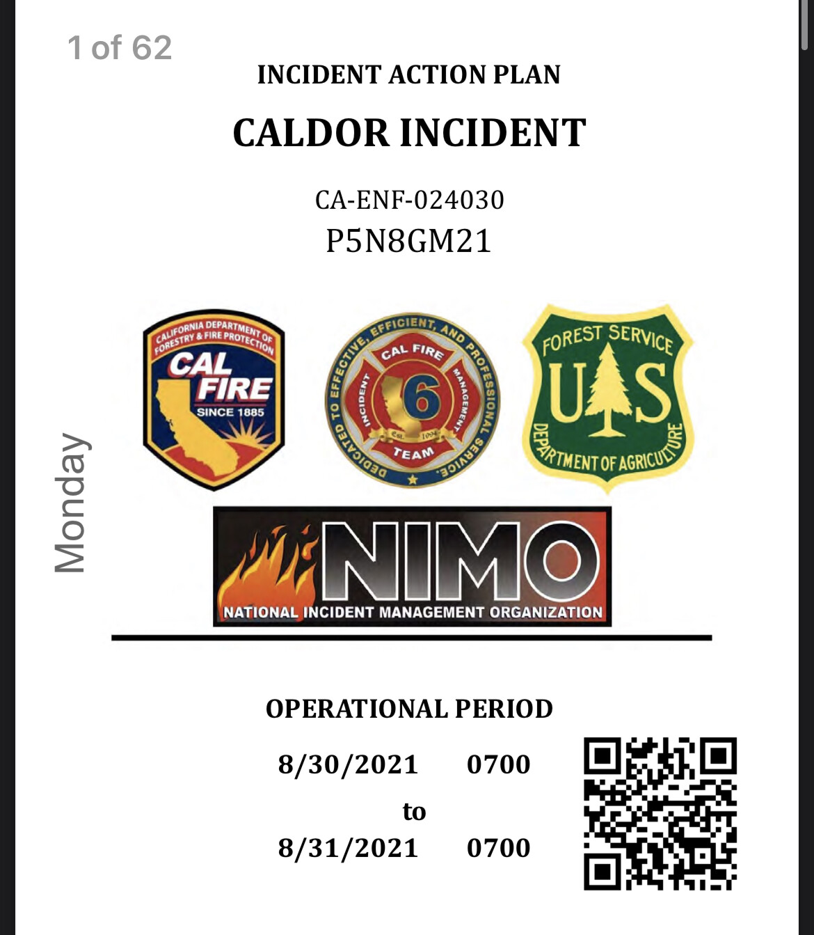
Anyone have a QR Code for the IAP?
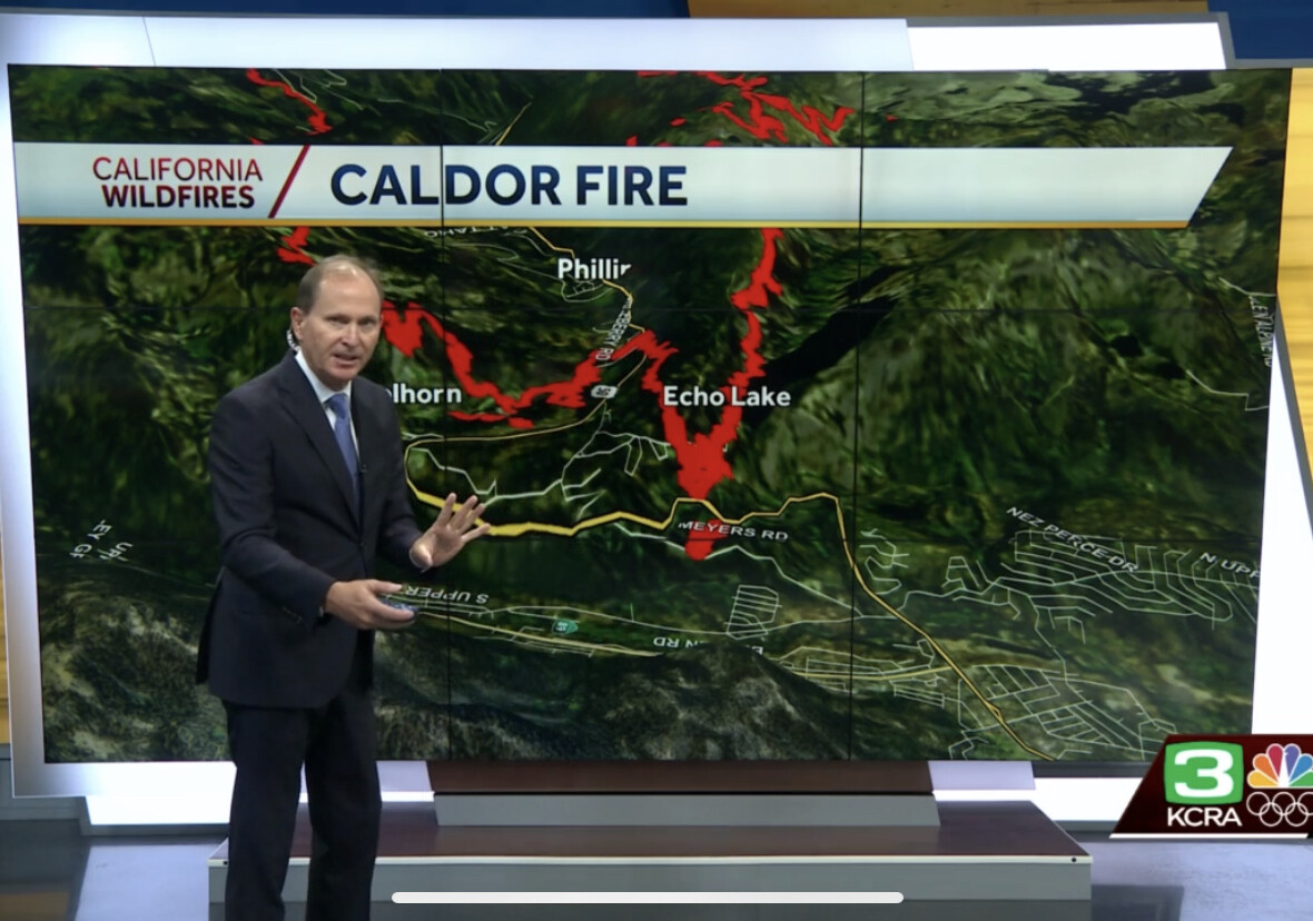
KCRA just showed the fire, well established, on the hillside above the fire station on the east side of SR 89.
4 Likes
The FLIR is obviously wrong this time
1 Like