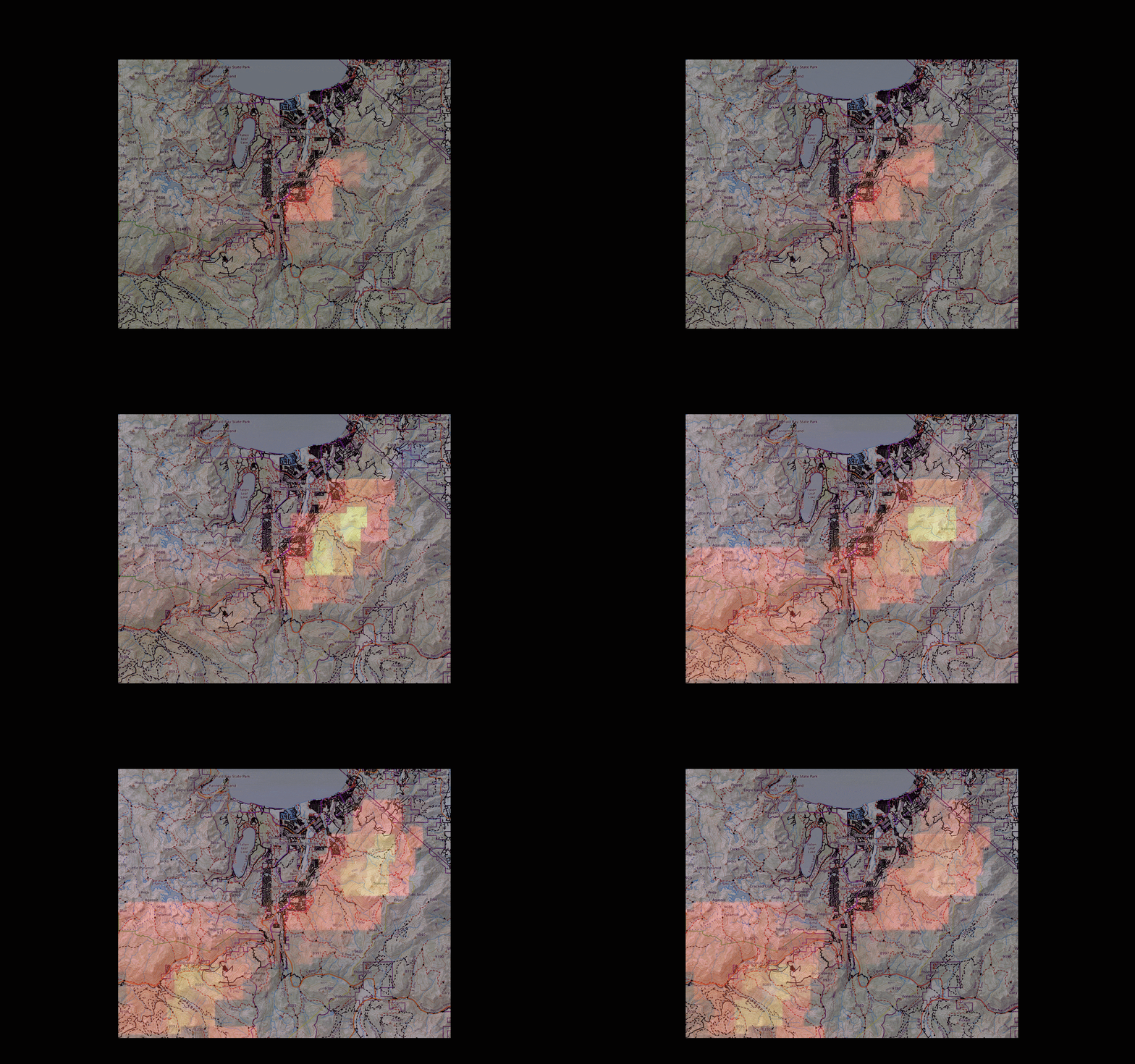
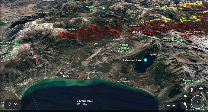
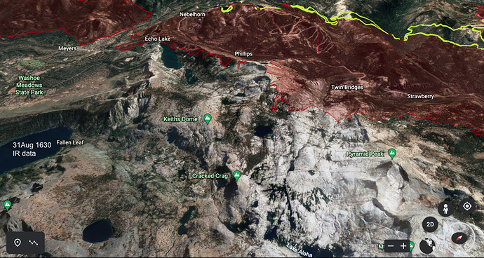
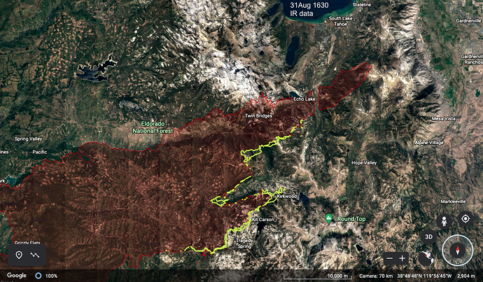
This has a low level of geospatial precision, but GOES loop from 9AM to 4pm shows the fire moving NE, skirting developed areas. Looks like there’s now heat building between Sierra at Tahoe and Strawberry Creek.
Douglas County NV. Evac order
WHAT: Evacuation Orders
WHEN: Effective Immediately
WHERE: Douglas County, Nevada
The following Evacuation Orders are being issued for the areas below.
The following affected communities in Douglas County, Nevada (excluding Stateline Casinos) are
• Upper Kingsbury (South)
• Upper Kingsbury (North)
• Central Kingsbury
• Lower Kingsbury
• Round Hill region and roads including Lower Elks Point
• Lake Village
• Lower Olivers, Kahle Drive region and roads
These Evacuation Orders will include areas from Highway 50 at Lake Parkway, East to Elks Point Road (excluding Stateline Casinos) and State Route 207 (Kingsbury Grade) from Highway 50 to Tramway Drive, including all area roads North and South of Kingsbury Grade.
Quick request: What is the best source for long-term surface-wind forecasts? Like 2-7 days? Windy or the NWS text forecast or a particular weather model?
When in doubt use the NBM which is a blend of all models.
Air Tankers are working around Wrights Lake. First time I have seen them North of Hyw 50
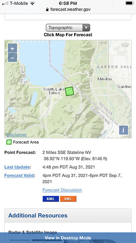
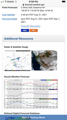
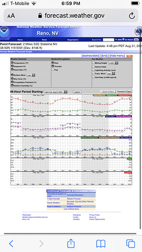
I wouldn’t say it’s the “best” per se, but if you do a point forecast on the nws site Reno NWS link, after you click on a specific area, you can scroll down to “Additional Resources” and there is an Hourly Weather Forecast that goes about 6 days out (2 days at a time and a button on the bottom right to go “Forward 2 Days”. I use this a lot to see what time changes are expected in a local area (for example, wind shift from frontal passage).
Some hopefully self explanatory screenshots below
Ops briefing just said fire has spotted over their control lines north of 50 headed towards Wrights Lake.
Did the fire already go through that general area ? Seem to recall something mentioned about Wrights Lake
Just swagging it off the IR earlier, the perimeter was about 3 miles away.
Edit: I believe Wrights Lake Rd was an originally attempted eastern control line.
Any one know why Tnkr914 is doing donuts, northeast of Ice House (not Union Valley) Reservoir?
Flightradar24: Live Flight Tracker - Real-Time Flight Tracker Map
(edit… maybe just waiting for a lead plane… I hope)
Just waiting for the lead plane and airspace to clear.
It was a rough day in Div M (SE/Kirkwood) and Div G/H (North) with ground crews in both fleeing to safety zones and significant assignment of VLATs to Div G/H (3 MAFFS, T914 and T105) Structures lost along the Hwy50 river corridor at Whitehall (between Plum and Bull creeks) and orders filled for heavy eqpt (7 dozers, 3 masticators and 7x type 6 and type 3 engines) to DP23 near Pyramid Creek trailhead to address flare up in areas with structures lost today and more at risk.
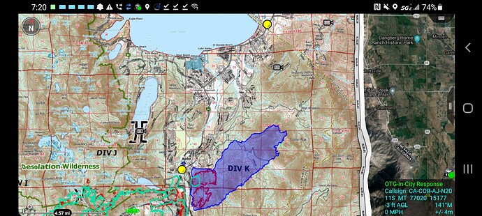
Is there a source to get Dozer line maps? I saw that @tornadokat has shared quite a few via google drive – are those hand created, or is there a place where they are published or at least accessible to the public? I’m particularly interested in Div K lines (SLT) since I’ve heard about quite a few being cut
When the fire is over, there will most likely be a BAER team (Burned Area Emergency Response) that will be assigned to help map, assess and rehabilitate any damaged Forest and wilderness areas. They will make a plan for both runoff and erosion protections as well as vegetation recovery. Many dozer and handlines will be rehabilitated to reduce their impact. (repaired or covered over) Contact your local Forest representative and ask about the process.
I am the BAER coordinator for the ENF. You are correct there will be an assessment of the severity of the damage to watersheds and threats to Forest resources. For this fire, BAER is likely to work in conjunction with the CalFire WERT (Watershed Emergency Response Team) assessment which looks primarily at off-forest values. However, addressing suppression impacts occurs earlier in the incident during READ (Resource Advising) activities.
Two of the OES Type 6’s from down this way from Sierra Madre and Arcadia were deployed this morning.
Lots of acronyms, lots of work to be done. All great resources! Don’t want @mwtahoe to be worried they will just mark up the landscape and leave it that way.
Anyone know of any outstanding resource requests?
