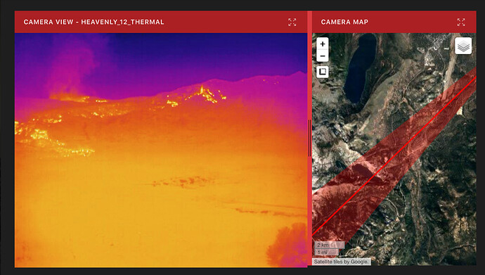
I’ve got no new IR to pull out of my hat. Working on new IR from Dixie and took a nap.
GOES-17 shows it headed hard for Nevada. RAMMB/CIRA SLIDER: Satellite Loop Interactive Data Explorer in Real-time with GOES-16 and Himawari-8 Satellite Imagery
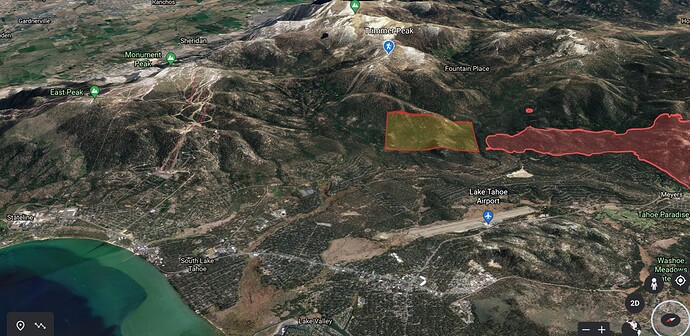
With Trimmer Peak and reference box below as a reference
Note: Reference box is for visualization only, unk exact location/perimeter of fire
nice job on the map, great SA for those that struggle with topo
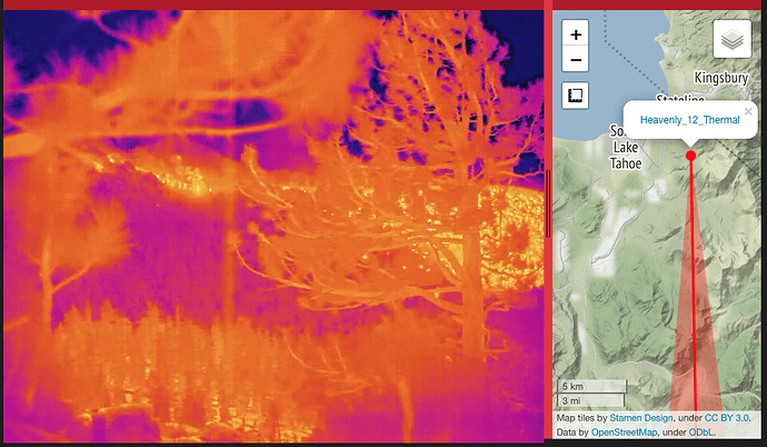
Yes, GOES seems to show it much further east than 0930 IR… Heavenly camera has been pegged on a south west view for hours, straining to see through smoke while the Heavenly IR view is showing canyons beyond crowning out. If you stare at it long enough, you can match up the large tree and dead tree in the visual picture with the zoomed in IR view… it’s definately moving around the bottom of SLT/Heavenly.
Thank you. KCRA 3 Noon news had what I think was a doppler loop showing the event, and it looked like it was headed hard for Nv.
Here is a look from the Bald Mtn, Nv camera. ALERTWildfire | Tahoe
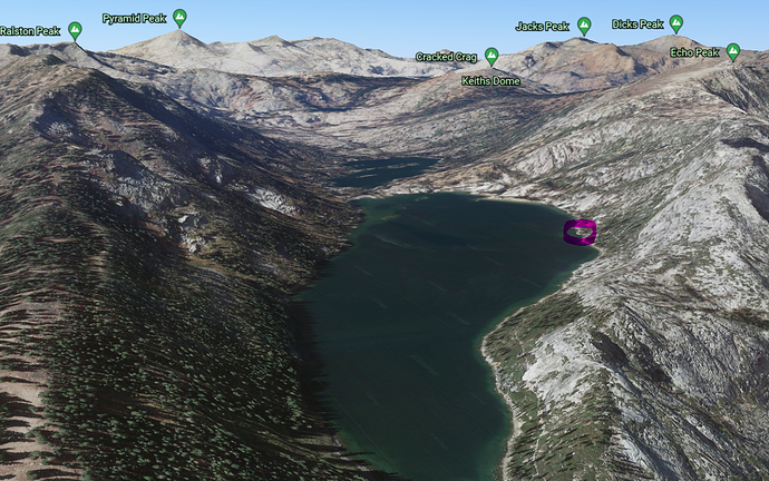
And crucially, what’s going on above Echo Lakes and at Echo Peak? Is it hung up on the granite up there? As fischop suggested above, if it spots from there over the lake and down into the neighborhood along N Upper Truckee Road, could be dicey. From the satellite, it looks like a lot of dense growth there in that neighborhood below the Angora scar / not much thinning. And if the SSW flow continues, that would point the gun right at the heart of South Lake, even if the other head running up toward Trimmer/Heavenly/Monument stays out of town.
Happily, it looks like the new mobile cam is pointed right at that N Upper Truckee Road neighborhood, and shows nothing but haze – no smoke plumes, no flames. Seeing absolutely nothing happen on that cam might be best news to hope for. But please correct me if I got this all wrong.
Video from Echo Lake this morning. https://fb.watch/7KqpokKfNT/
Not sure if it helps, having a hard time loading google maps, but we’re patrolling the whole Apache, Chippewa, Zapotec area and it’s all looking good. I believe they’re still holding it at Oneidas and 2N01A with a mostly plumbed dozer line. Dozer contingency comes from 2N01A SouthWest towards the Chippewa subdivision and behind all the homes towards Zapotec and Oneidas. They have some handline behind all of the Iroquois area that’s plumbed with crews on it. Haven’t seen any structures lost or damaged from where we’ve been patrolling.
Can anybody ID the location of the near and far plumes on Mt Danaher Camera? The near one looks too close for the basin.
http://www.alertwildfire.org/sierra/index.html?camera=Axis-MtDanaher&v=fd40736
Can anyone provide a more up to date modis map, than the 0300 version on Caltopo. Gota a lot of Nevadans trying to figure out evacs etc. Please and Thank you.
Just caught a FLIR image in the direction of Echo Lake. Looks like it is somewhat active but still high up there in the granite. Good to see I think.
Best advice is not to rely upon infrared images of current fire location for your evac intel.
https://www.douglascountynv.gov/news/what_s_new/caldor_fire___evacuation_warning
UPDATE: Warnings changed to Orders… link above is old - persistent page did not update. New link to updated page:
https://www.douglascountynv.gov/news/what_s_new/caldor_fire_tahoe_evacuation_orders
Sierra at Tahoe cam in 15 min replay had active tree torching going on. Can’t copy link sorry
Right now there is no indidcation it has made it to Echo Peak area or crossed the lakes. It seems to be hung up in the Ralston/Becker/Talking Mountain area. Given the terrain between ralston peak (almost zero vegetation down to echo lakes) it would take a mighty spot to carry across and however unlikely it is, we’ve certainly learned this year not to count anything out, especially with the forecasted winds. There is some vegetation on the SW slope of Echo Peak that a spot could take off in and then theoretically carry up to the peak and into the Basin.
If winds shift more from the south, then I’d worry about something spotting directly over 50 from Christmas Valley/Echo Summit.
There is some thick vegetation between the north upper truckee neighborhood and the peaks.
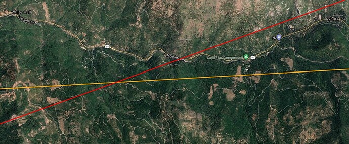
@tumbleweed → Can anybody ID the location of the near and far plumes on Mt Danaher Camera? The near one looks too close for the basin
Cross with Sumerset Cam puts it (somewhere near) south of 50 between White Hall and Kyburz. Closer to, or beyond Kyburz given that the smoke is left of center on Somerset (red line).
EDIT: Uploading photo with viewshed turned off 
You can see it on GOES17 start to build:
https://col.st/7eDYG
You are 100% correct, only trying to use it for intelligence gathering. They have several trigger points set up for the valley side of Douglas County. thnx.
Yes. I was counting on good ol Ralston Granite to keep our friends cabin safe (red circle) on the North Side of Lower Echo.
Must be a island burning off, sure putting up some steam.
