State ID:
3 letter designator:ENF
Fire name: FORK
Location: Northwest of Gerle Creek Divide Resevoir.
Reported acres: 75
Rate of spread: Rapid in Timber
Report on Conditions:
Structure threat:
Resources:
Hazards:
Weather:
Radio channels:
Scanner link:
Webcam link: http://www.alertwildfire.org/tahoe/?camera=Axis-Bunker
Agency Website:
4 Likes
Aircraft cancelled due to too much turbulence
1 Like
Approximately 75 acres at about 1145 per Eldorado NF twitter.
Anyone have a little better location ?
https://www.broadcastify.com/scripts/playlists/1/16015/-6398366704.m3u. Command Frequency
1 Like
Using “camera on target” for the two closest cam’s it looks like it might be in the valley below Ice House road burning down towards Stumpy Meadows Reservoir
From the questions thread:
The cross on the cameras put it about a mile west northwest of Gerle Creek Divide Resevoir.
AA reported 100 acres RROS with potential for it to go “very big” moving westward into the rubicon drainage
1 Like
(38.9868930, -120.4058661)
Google maps, center of AA pattern.
Dry lakes trail & S Creek rd
1 Like
Location.
1 Like
The Fork fire is 100 ac w/ significant growth potential. Located off Wentworth Springs Rd. and the Gerle Creek access.
E. of Gerle Creek, S. of South Creek Rd. Evacuations are in place for Loon Lake, Gerle Creek and Rubicon trail areas per ENF twitter.
1 Like
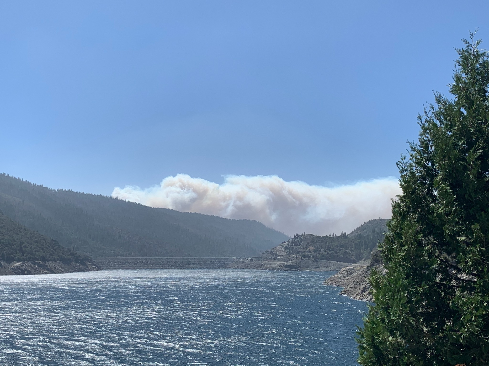
Picture from a buddy at French Meadows PH, looking southwest over Hell Hole reservoir and dam at 13:45, right before he left. Said it’s been blowing 40 all day.
3 Likes
Type 2 Team on order
400 acres…
1 Like
Just updated 800-1000 acres
2 Likes
It looks to have crossed the Rubicon. Any intel on that?
Minimal Intel so far, this from Inciweb a few ago:
The Fork Fire in the Pacific Ranger District is now 400+ acres and is spreading toward the 2014 King Fire burn scar in the Rubicon drainage on the Georgetown Ranger District.
The fire cause is under investigation. It began off Wentworth Springs Road, east of Gerle Creek and south of S. Creek Rd. Evacuations are in effect for Loon Lake, Gerle Creek and Rubicon Trail Area. Initial attack in progress. An incident management team is being mobilized.
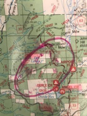
Initial Rough Map:
2 Likes
That is truely a rough drawing of the perimeter…
8 Likes
I think it is across the Rubicon.
3 Likes