Looks to be a new start west of 395 and Big Pines in the Taboose Creek drainage. Its showing heat on the GOES-17 satellite. Here is the latest spot.
Probably close to 10 acres now inaccessible some cabins out in front has a good wind on it it’s just south of birch creek base of the sierras CAL FIRE crews on it as well as USFS engines tonight fixed and rotor wings ordered up for tomorrow as well an USFS strike team.
Will be interesting to see what acreage shows in the morning. The current heat signature is impressive. Similar if not more notable than the Tenaja and Walker fires at this time. Seems like some type of fuels switch was tripped today with increased activity up in Oregon and Idaho as well.
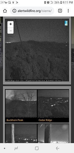
Shot from the McKenzie ridge camera looking to buck rock lookout. The bright white spot under the + - is the taboose fire.
Solid glow through out the Owens valley so I’m sure activity has picked up sounds like evacuations taking place for Aberdeen
See what the winds do tonite and tomorrow. Could get real interesting if they get thunderstorms tomorrow. Don’t know if that would be in an old burn scar or not. Wind can really crank through there.
Per south ops 125 acres, 0 % contained, structures threatened.
2 type 1 tankers are flying it currently.
2 Heavy’s just lifted off of FAT fresno to this. Are these these them.
I believe 162 and 163.
Affirm that’s them.
Hearing reports of heavy rain in Big Pines.
Did this fire take off tonight? Big heat signature showing up in this area.
Something’s happening there. A lot of fire traffic on the radio for that area.
The McKenzie ridge camera is showing a much larger glow than it did two nights ago coming from that area.
http://www.alertwildfire.org/sierra/
Heard something about possibly 200 acres outside of the line but there is also a possible active shooter on the same feed so trying to decipher between the two.
Radio traffic just stated two areas have slopped over, several hundred acres each.
Its gonna run a bit. Oak raws.
https://www.wrh.noaa.gov/mesowest/timeseries.php?sid=IDPC1&num=72&banner=gmap&raw=0&w=325
Oak RAWS at 8 Sept 0042 hrs 08 Sep 12:42 am 73 23 15 WNW 24G53
That is temp 73 F RH15% sustained wind 24 gusts to 53!
4,000 acres, 10 contained, mandatory evacuations in place, 40+ mph winds, type 2 team on order.
Tankers 76 & 78 working the fire.
