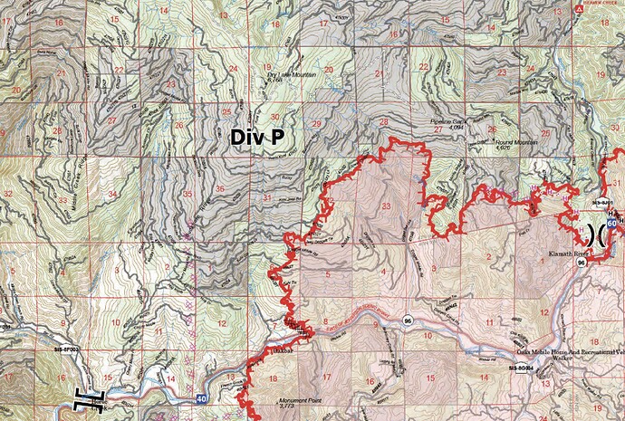
Got quite a bit of precip last night. Direct line going in everywhere. Things looking good on east and north flanks…
No clue… above ‘my’ paygrade 
New video/virtual tour of McKinney Fire is up on YouTube, showing current mapping as of about 10:30am on 8/2/2022. Also, I talk about ‘big-box firefighting’ or the difference between direct and in-direct attack, fire history, and fuels management.
NOTE: There is a glitch in the livestream (I’m a rookie), so once the audio ends, jump ahead to 16:40 for coverage of the China, Shackleford, and Kelsey Fires.
Quite the active day on the fire line despite there being limited fire activity
A friend sent a msg saying as they were wrapping up their shift in Div P, in 2014 Beaver Fire scar on NW quarter of the fire, a massive rainstorm about washed them off the mountain, caused a landslide. Anyone have video of this I can use? If so, send it to wildland.zko at gmail.com or email me for a Dropbox link. All submissions kept confidential.
A reader sent me these videos of the flash flood in Div W.
How many structures have been lost?
Interesting that the story changed from the town of Klamath River to the town of Klamath Falls.
Just stupid reporters that don’t check their facts
Or auto correct, not correct. Anyways we can agree, reporters should have done a better job.
CALFIRE DINS (Damage Inspection Specialists) are still gathering the numbers.
Over 50% done according to Klamath NFs FB page. 87 residences destroyed. 132 total structures destroyed.
Interactive ArcGIS map of McKinney Damage Assessment. Very useful for accurate information on structures impacted by this fire.
Minimal growth showing on last night’s IR for McKinney and Yeti.


