State ID:CA
3 letter designator:KNF
Fire name: McKinney
Location: East of Scott bar on McKinney creek road
Reported acres: 300
Rate of spread: moderate to rapid
Report on Conditions: significant spotting
Structure threat:unk
Resources:unk
Hazards:
Weather: thunderstorms in the area
Radio channels:
Scanner link: Northern Siskiyou County Fire/EMS Live Audio Feed
Webcam link:ALERT Wildfire, Fort Jones 1
Agency Website:
3 Likes
InciWeb page is up here. As of 7:36 p.m. committed resources include 5 crews, 12 engines, 5 water tenders and 2 dozers as well as aircraft with additional resources on order. Zonehaven evacuations map is below. Red is evac order and yellow is warning.
5 Likes
Spots 3/4 mile ahead, wind picking up, pulling off line and onto structure protection, supply order to Walker bridge was redirected to community center.
6 Likes
Looked like the column collapsed on the camera.
2 Likes
Fort Jones 1 camera shows quite the glow.
5 Likes
Can someone please start a new thread for CA called the #EvansFire. Evans Mtn area south of Hwy 96 - Seiad Valley Siskiyou County. 2 lightning fires. One fire is at 5 acres and the other fire is at 5-7 acres. Watch Duty [watchduty]
1 Like
Fire on north side of river now and probably the highway. Expanding evacs, shut down highway
4 Likes
“Highway 96 is severely compromised”
4 Likes
Fire to Beaver Creek, retreating to Collier rest area, if I am not mistaken that is I-5.
5 Likes
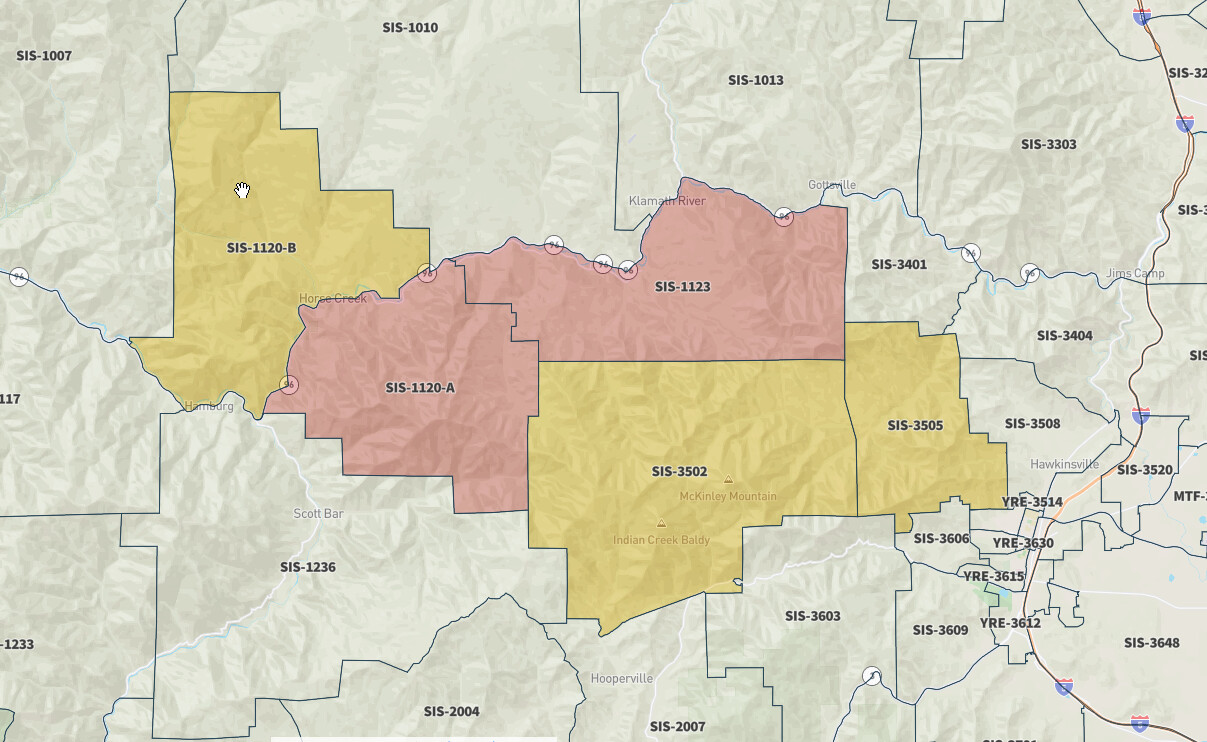
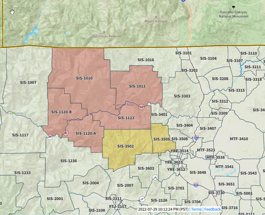
And the mandatory evacuation area expands again with three more zone, one of which never even had a warning:
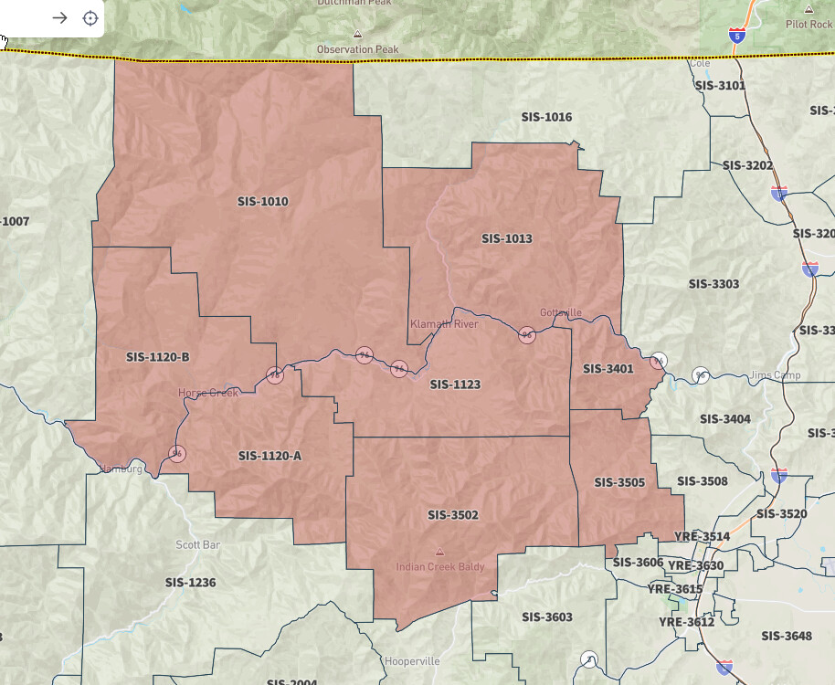
2 Likes
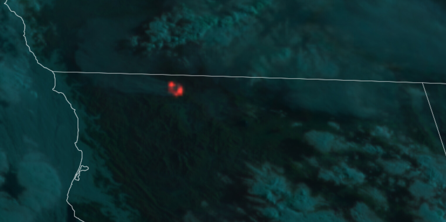
Not a lot of cameras in that part of the state, but the show on the few that are there is impressive. Tile display is here.
5 Likes
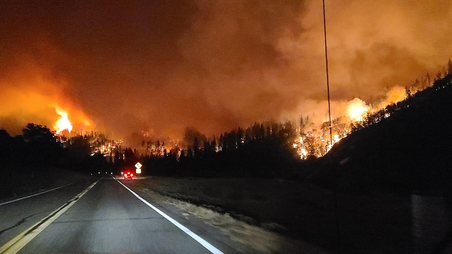
Fire was on the ridge above Scott bar, all incoming units stage in yreka.
3 Likes
IC stating fire has laid down in the grass this morning but still burning in the timber, 17,000-18,000 acres.
Also new veg dispatch hwy 96, 2 miles into oregon
6 Likes
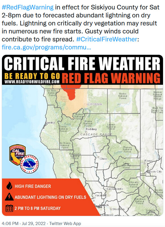
From North Ops 0715CA-KNF McKinney Fire: 17,000 acres, brush and timber, 0% contained. structures are threatened with evacuations orders and warnings in effect. Critical communications and water infrastructure threatened and Highway 96 remains closed. A Red Flag Warning in effect today for abundant lightning and dry fuels. Type 2 CA Team 10 (Mack) is assigned, In-brief today at 1400.
4 Likes
There’s a webcam in the Yreka area offering a view from that direction. Page has to be manually updated and has a multitude of other cams on it. You’ll need to scroll down just a short bit when it loads to find the Yreka cam. Not super handy, but it’s nice to have another cam view.
4 Likes
Spot Forecast for MCKINNEY…IA YICC
National Weather Service Medford OR
236 AM PDT Sat Jul 30 2022
Forecast is based on forecast start time of 1400 PDT on July 30.
If conditions become unrepresentative…contact the National Weather
Service.
…RED FLAG WARNING IN EFFECT FROM 2 PM THIS AFTERNOON TO 8 PM
PDT THIS EVENING FOR ABUNDANT LIGHTNING ON DRY FUELS…
…FIRE WEATHER WATCH IN EFFECT FROM SUNDAY AFTERNOON THROUGH
MONDAY MORNING FOR ABUNDANT LIGHTNING ON DRY FUELS…
.DISCUSSION…Unstable conditions will continue today with
scattered thunderstorms expected to develop over the area in
the mid to late afternoon and continue into the evening.
Surface winds out of the east to southeast will become westerly
in the afternoon today.
A slight chance for thunderstorms is expected Saturday night into
early Sunday morning. Then, additional scattered thunderstorms are
expected Sunday afternoon and evening. Temperatures will trend
slightly lower on Sunday. However, humidities will remain relatively
dry. Surface winds are expected to be light Sunday morning then
out of the west in the afternoon with strong, gusty winds near
thunderstorms. A slight chance for thunderstorms will continue
into Monday over the area.
Of note, gusty outflow winds of 30 to as high as 50 mph will be
possible with stronger thunderstorm cells Saturday and again Sunday
into Monday.
.TODAY…
Sky/weather…Sunny in the morning, then partly cloudy with a
slight chance of showers and thunderstorms in
the afternoon. Haze through the day.
Max temperature…105-112 valleys and 95-100 ridges.
Min humidity…10-12 percent.
Eye level winds…East to southeast winds 2 to 7 mph becoming
west to southwest 3 to 7 mph in the afternoon.
Gusty and erratic winds expected near
thunderstorms or in the vicinity of pyrocumulus.
Wind (20 ft)…East to southwest winds 4 to 12 mph becoming
west to southwest 6 to 12 mph in the afternoon.
Gusty and erratic winds expected near
thunderstorms or in the vicinity of pyrocumulus.
Mixing height…Up to 12000 ft AGL.
Transport winds…Southeast to south 6 mph becoming south
to southwest 10 mph in the afternoon.
CWR…4 percent.
LAL…3.
.TONIGHT…
Sky/weather…Partly cloudy. A chance of showers and
thunderstorms in the evening. A slight chance
of showers and thunderstorms overnight.
Min temperature…Around 65 valleys and 75 ridges.
Max humidity…35 percent ridges and 55-60 percent valleys.
Eye level winds…West 3 to 7 mph with gusts to 12 mph early in the
evening, becoming southeast to east winds 2 to 3 mph,
then becoming light and variable after midnight. Gusty
and erratic winds expected near thunderstorms or in the
vicinity of pyrocumulus.
Wind (20 ft)…West 6 to 12 mph with gusts to 20 mph early in the
evening, becoming southeast to east winds around 5 mph,
then becoming light and variable after midnight. Gusty
and erratic winds expected near thunderstorms or in the
vicinity of pyrocumulus.
Mixing height…9000 ft AGL decreasing to 1000 ft AGL after sunset.
Transport winds…Southwest 10 to 15 mph lowering to east 5 mph
late in the evening.
CWR…5 percent.
LAL…3.
6 Likes
Showing some heat for 8am:
6 Likes