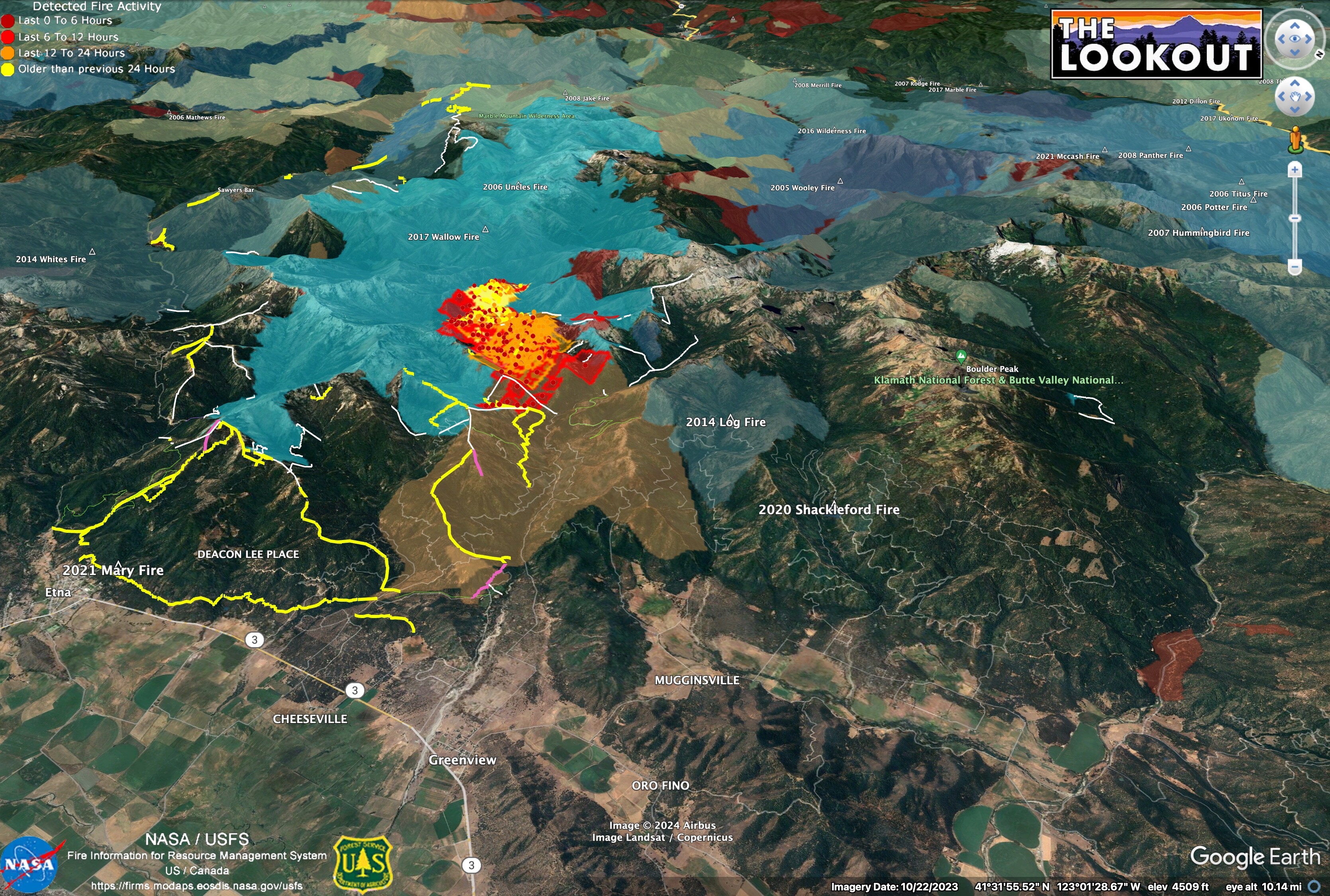
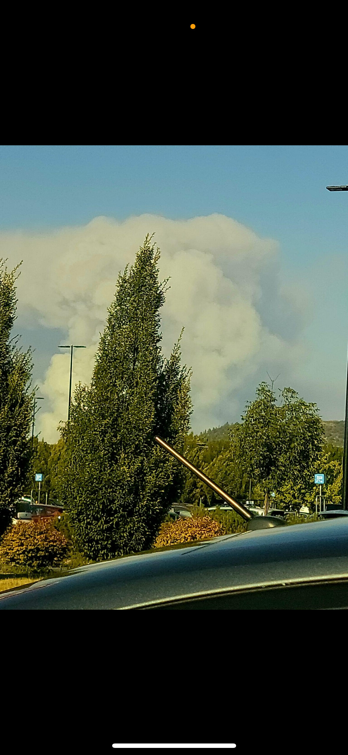
Given the forecast weather, it’s hard to see how we aren’t going to burn the entire northwest side of Scott Valley in next week or two. Yellow lines are 2017 dozer lines. White are 2017 hand lines. Need to look for 2014 firelines…
Most of the area outside to the north and east of the fire hasn’t burned in 70 years.
13 Likes
Zeke,
2014 Log Fire
We accessed across Shackleford. There were temporary culverts put In to allow engines to cross.
Fire was mostly held on the ridge with a few slops….
It was a stand replacement on much of that ridge, but I imagine 10 years of white thorn and snow brush has replaced it.
4 Likes
On the FT. Jones Cam there " appears" to be a VERY LONG range spot under the column
8 Likes
Lead 53 just reported fire near Mugginsville, a response is being sent to the area, he is going to put some helicopters on the fire too, possible spot fire. Lead 53 is on station again trying to see if Tankers are viable, he called in the new start or spot. He wasn’t sure.
7 Likes
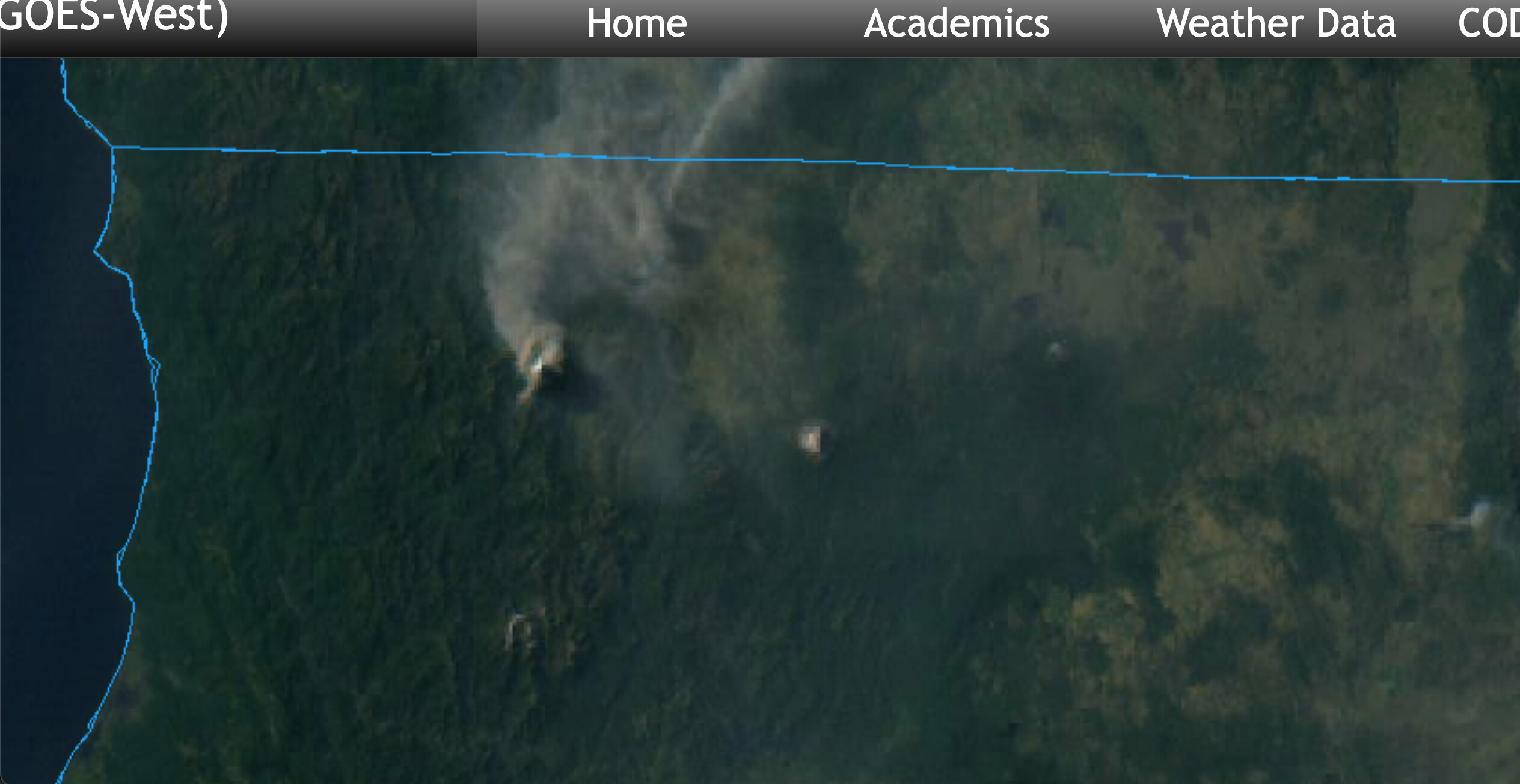
Pull up the Fort Jones Cam and play back about 15-30 minutes. Almost looks like rotation in the column and it is throwing spots all over.
It will be Fort Jones # 2 https://ops.alertcalifornia.org/cam-console/1651
4 Likes
Radio traffic indicates the fire has crossed and is now well established on the North side of the Kidder Creek drainage and is well established on both sides of the Babs Fork drainage.
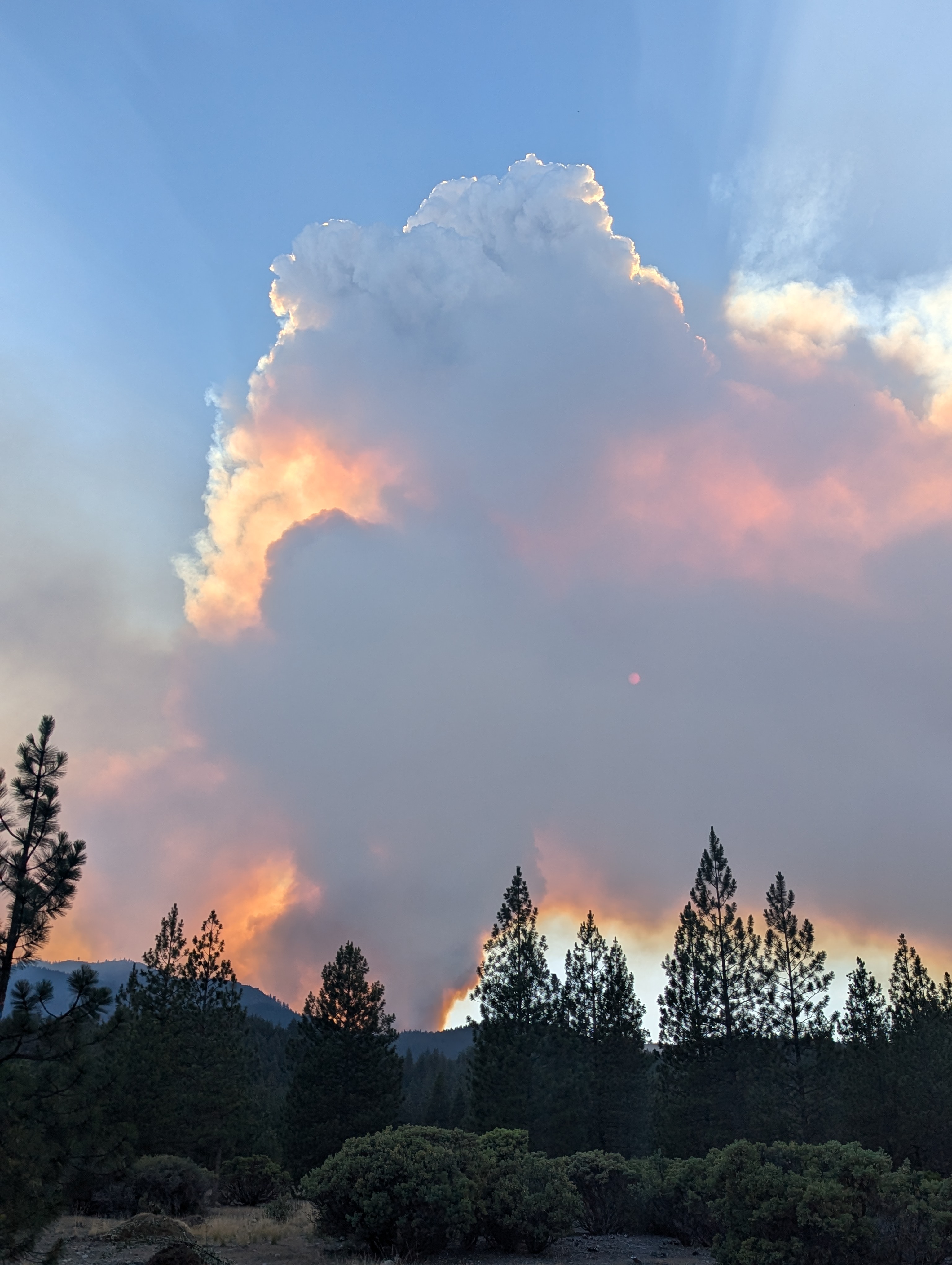
The fire is making a significant push to the East with spotting out to 1 mile.
7 Likes
ECC is currently toning out the entire county for immediate need to the Shelly.
6 Likes
CAL FIRE INTEL 641 up mapping should have updated perimeter soon
2 Likes
I worked in SKU in 17 and spent a bunch of days on the 2017 lighting complex ( names escapes now) our first few days were putting line on the Kidder Creek area so by the SRA boundaries. At that time the thought was it would come down Kidder and another long Canyon towards Scott valley, but it never did. However the south end of that line west of Etna was fired out. I don’t know how much further north the fire show went. What I did learn is that I never want to ever go back to the KNF!
7 Likes
Resources are definitely being “drawn down” across the state. East coast has already sent some engines.
Long response times and UTF time. Box gets bigger.
6 Likes
Yeah I spent a good chunk of time on the KNF in 2014 during some of those big complexes and I never was happy in Happy Camp🙃!
9 Likes
Thus the lack of Type 1 tankers for this fire.
2 Likes
At least one VLAT and one T1 have been flying out of Medford for this.
2 Likes
The fire has now been mapped at 2,409 acres by Cal Fire Intel 641.
Additionally current radio traffic indicates the fire is approx 3 hours / 2 miles from impacting the first structures in the Kidder Creek drainage area.
2 Likes
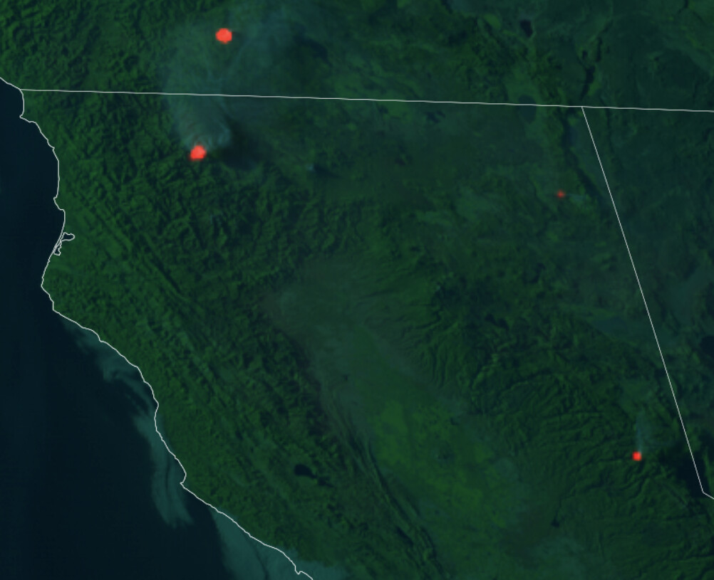
The Royal incident is visible west of North Tahoe on this GOES image.
Does any one have intel about the fire north of the Shelly or the fire west of the Warner Mountains in Modoc County?
3 Likes
The fire in Modoc County is the North Fire.
4 Likes