Yes I live it Medford, it’s called the Salt Creek Fire. 800-1000 acres. Started around 4pm.
3 Likes

Over doubled in size in three hours - ouch!
6 Likes
100% Also, this same behavior & spread on the LPF fire yesterday afternoon. If i could invent words i’d call it “rapid rotational cross slope sheating spread, w/ prolific spotting” or something like that…
17 Likes
If I heard that in a report on conditions I’d go back to the station 
20 Likes
Thanks all for the info on other fires.
4 Likes
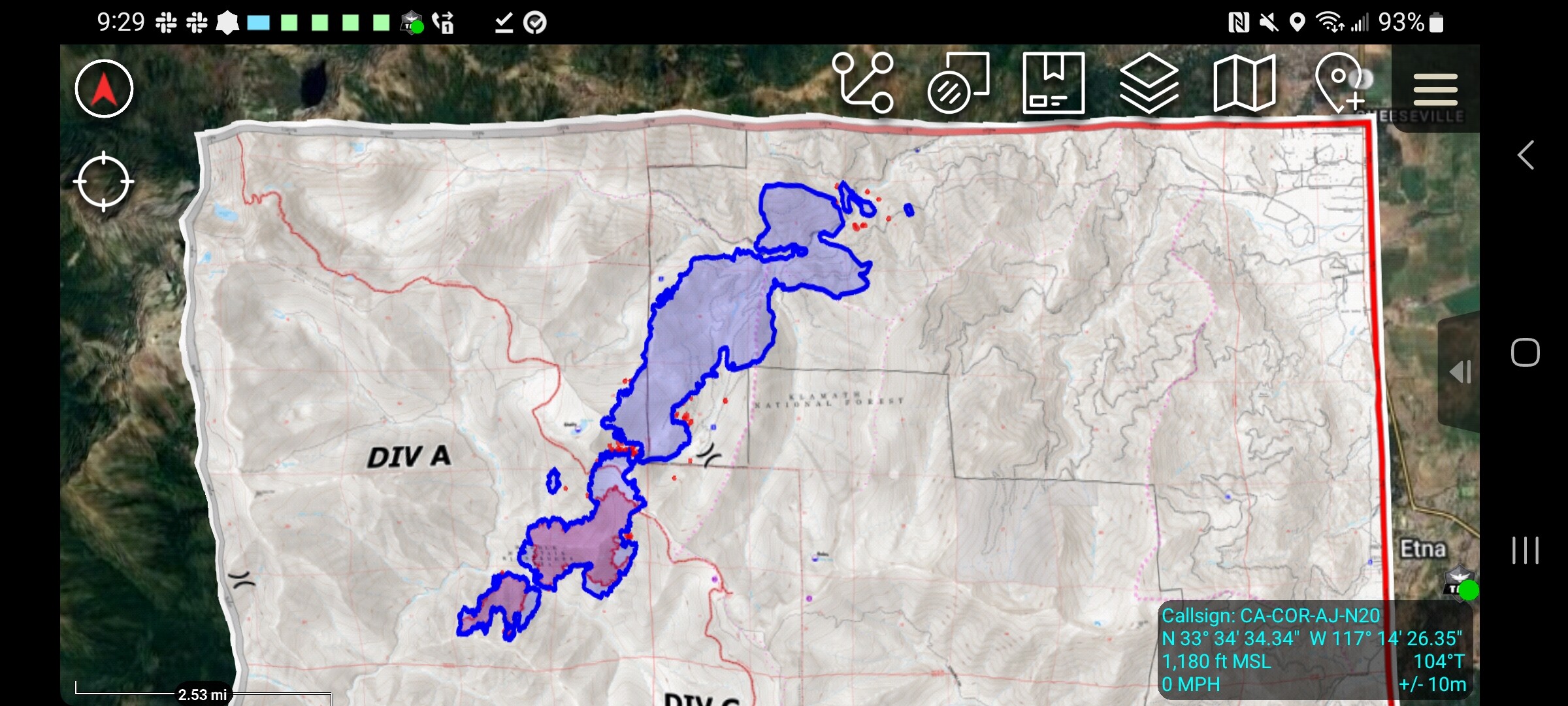
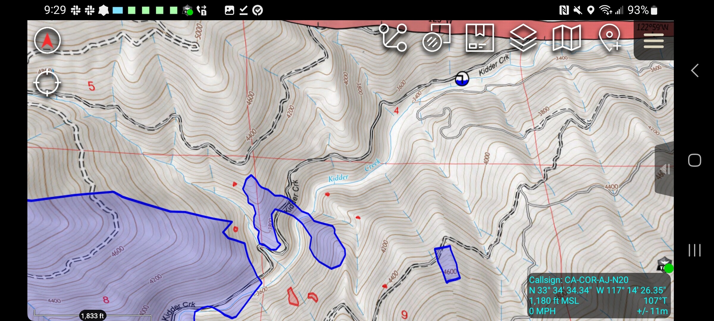
So the perimeter is on the FTP site under the IAA folder. CAL-FIRE flew it but did not publish it in their public facing feature service. Maybe because its not their incident? Anyway its on the FTP to use.
3 Likes
Can you publish a map with it, or can it be loaded onto the “other” app? I am not near a computer to view it. Thanks for all your help
1 Like
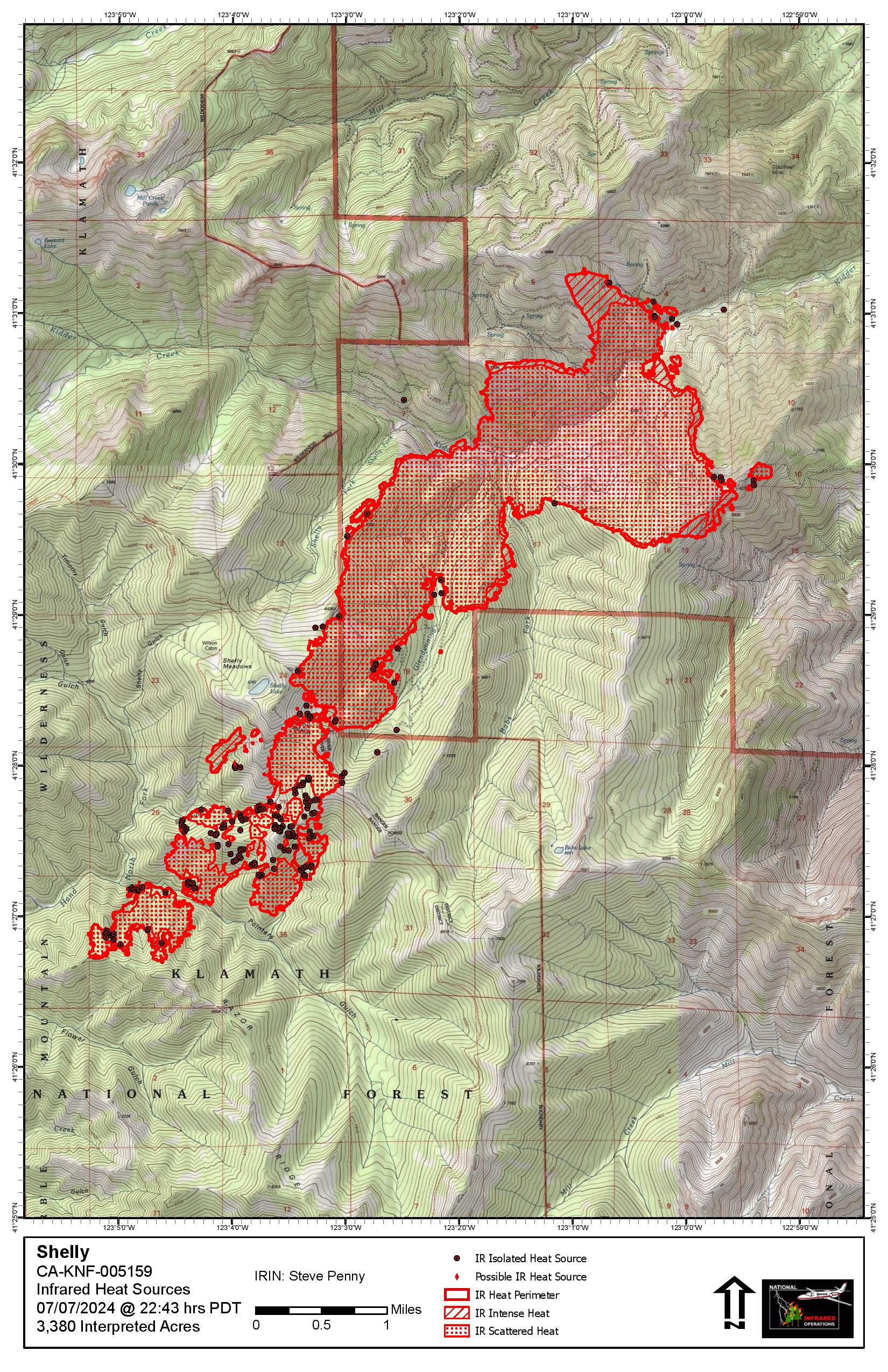
2,400 Acres
4 Likes
Emergency Demobed from Thompson Enroute Shelly, 4226C
5 Likes
Night flying helo is up… very cool to watch it drop!
Hard to tell with the camera in night mode, but it doesn’t look like it has moderated a whole lot. Still cranking at 2300…
3 Likes
It appears the Fort Jones cameras have been turned away from the fire? Any info on why?
1 Like
Very active already this morning (and all night) on the Ft. Jones. ALERTCalifornia - Fort Jones 1
3 Likes
After so long, most cameras are programmed to return to a preset home position after a predetermined length of inactivity.
4 Likes
2 Likes
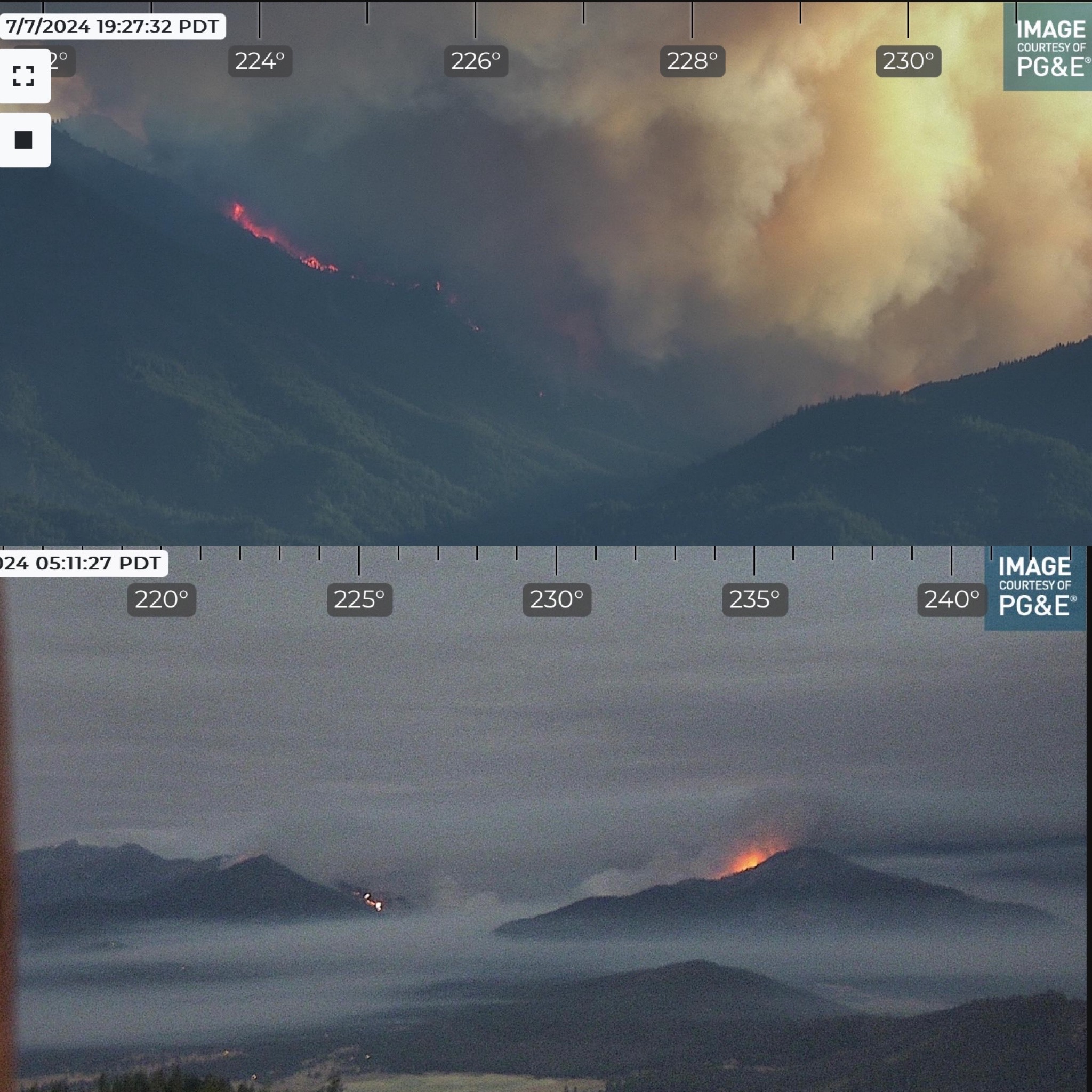
Still smoked in on the Fort Jones cam, but weather satellites show it building an ice cap. COD: Satellite and Radar
9 Likes
XLC1202A enroute (STEN PAS, STEN-T PAS, GLN E22, GLN E26, PAS E34, ALH E71, ARC E106)
4 Likes