XLC (PAS & SGB) Type 1 REMS Team enroute
OES 2804A is scheduled to respond to this as well, STL from Santa Clara, OES 359, OES 2111, OES 404, OES 365, and OES 400.
Lookout Livestream, with last night’s IR.
OES 1815A departed LA Basin area today at 0600. STEN DNY, STEN-T TOR, OES 389 DNY, OES 378 SFS, OES 341 MRV, OES 396 OXD and OES 345 VEN.
OES 6840A and XSD 6440A and 6410A assigned from San Deigo this AM.
Where’s base camp?
Yreka Siskiyou fairgrounds
Hopefully the ICP location stays smoke free. 
No Klamath crud with the past fires here.
XST- 4202 left Stanislaus County early this morning
125 Horn Lane, Etna CA 96207
Is what we’ve been told…
Isn’t that the federal base camp and the Cal Fire one is at the fair grounds.
Correct. Feds in Etna. Cal Fire is at fairgrounds.
I was on the Kelsey Complex as Situation Unit Leader for 32 days. Smoked in from August 6 through Labor Day which kept all aerial resources grounded for weeks. Days were in the 40’s and below freezing at night, everyone had Klamath Crud.
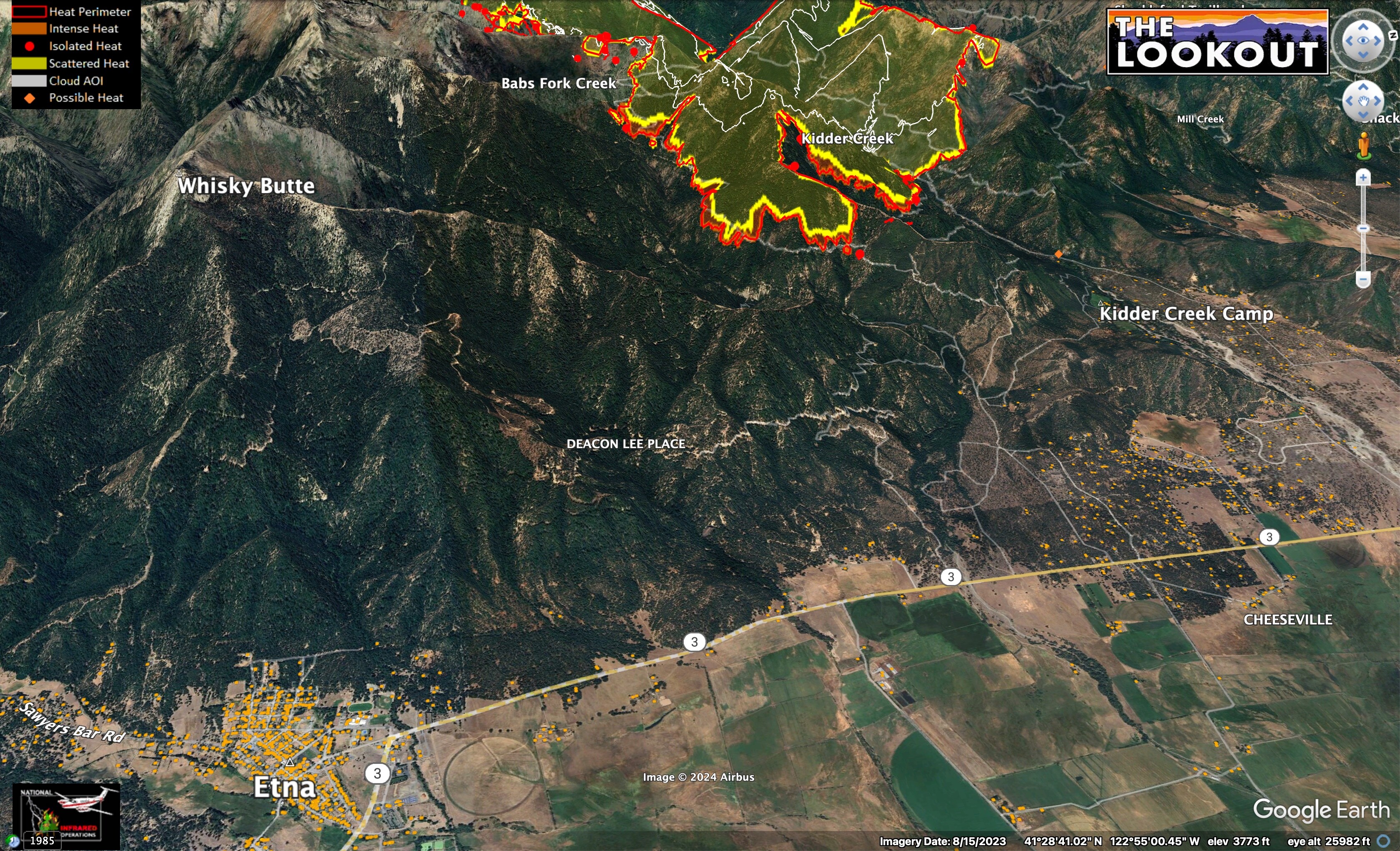
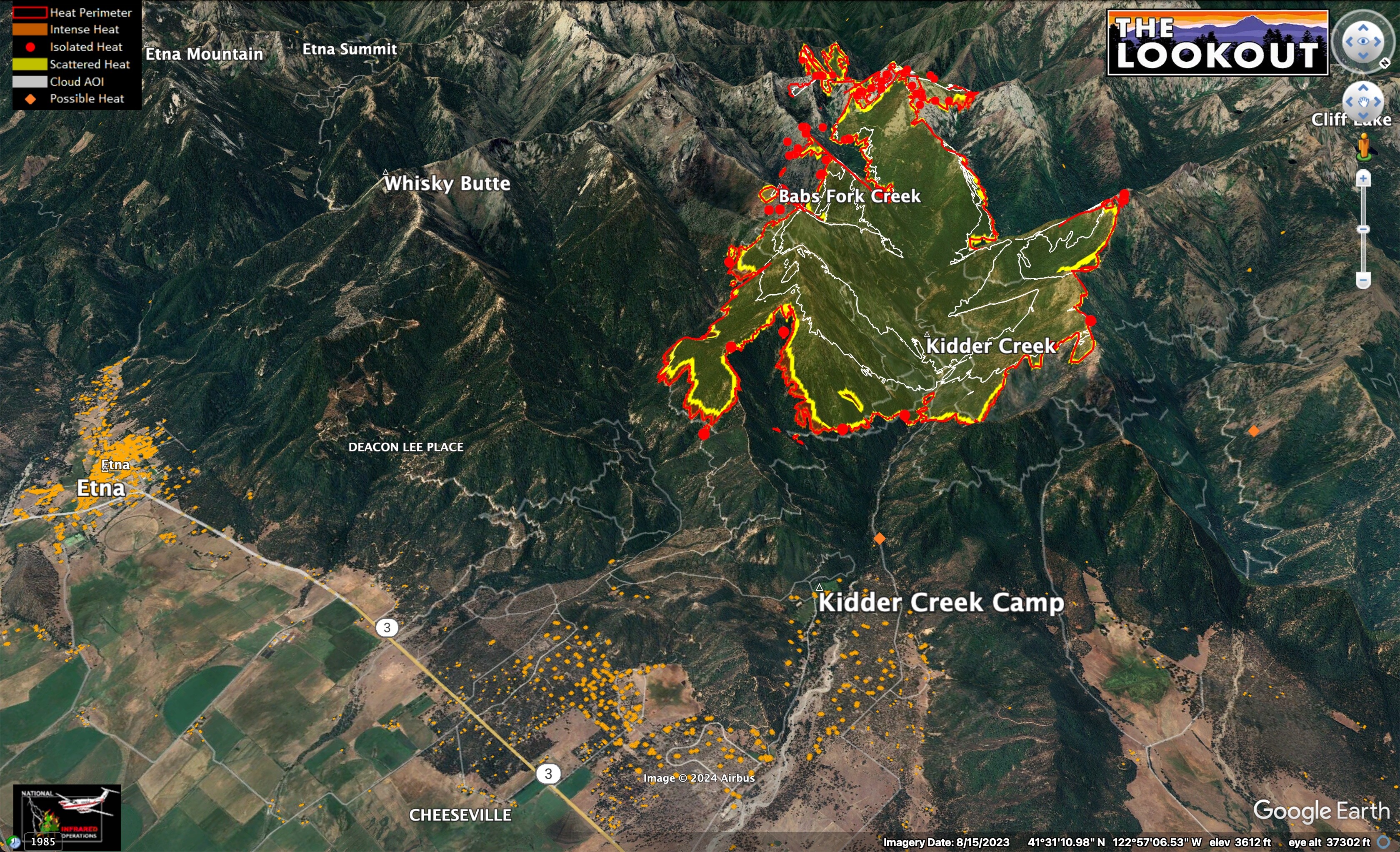
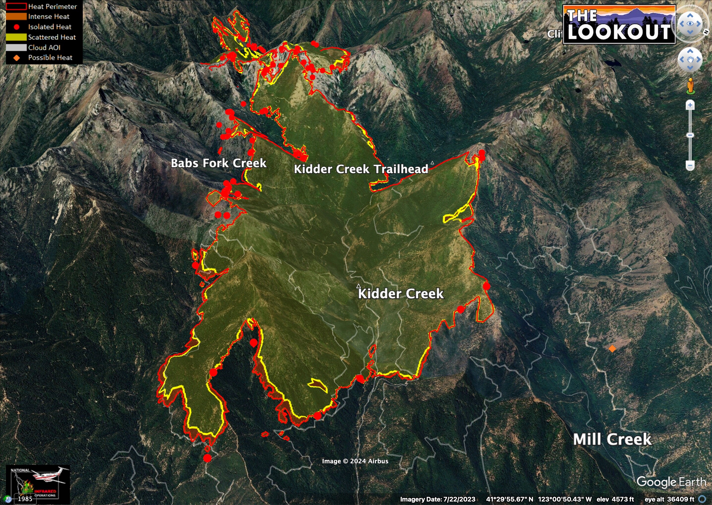
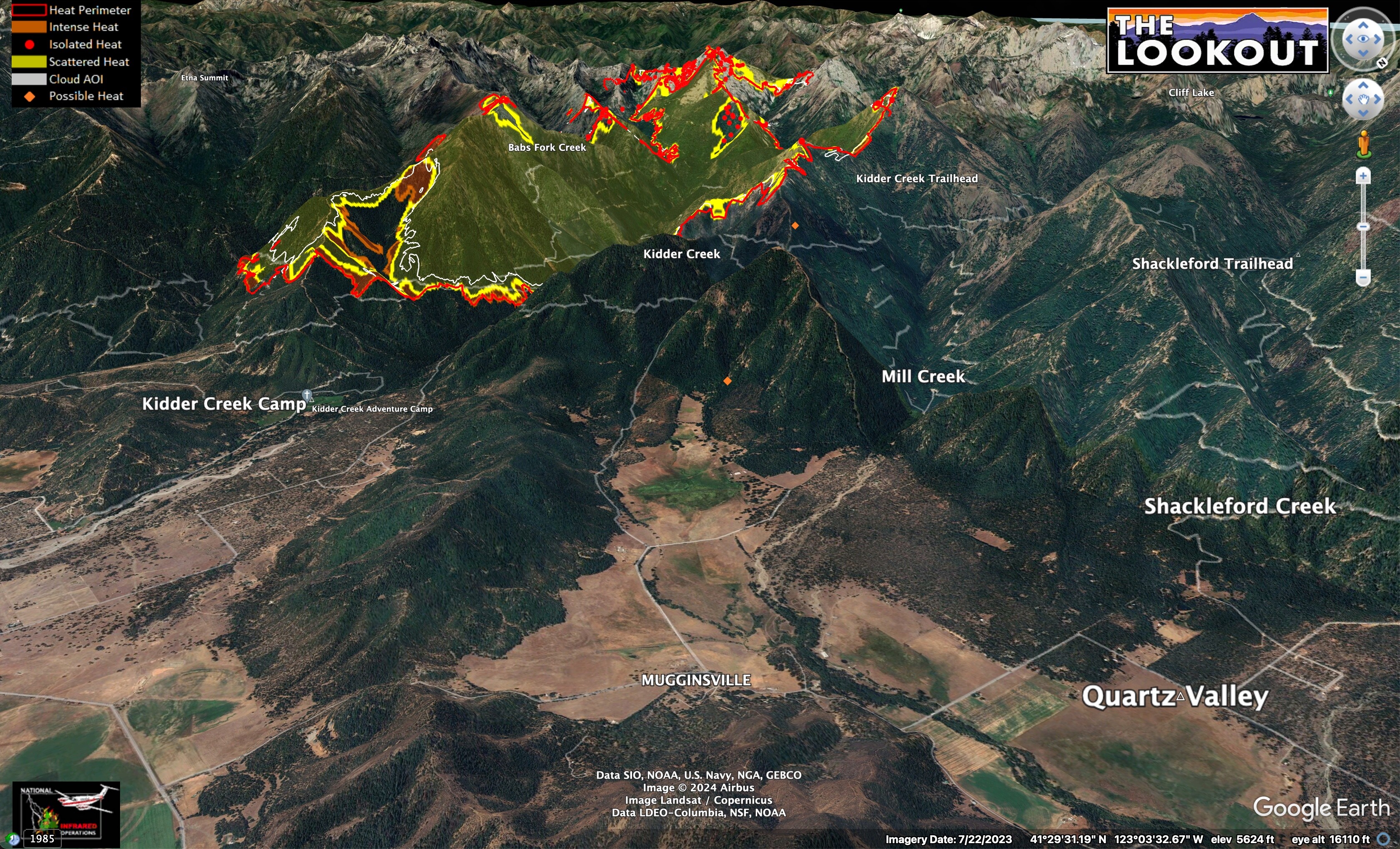
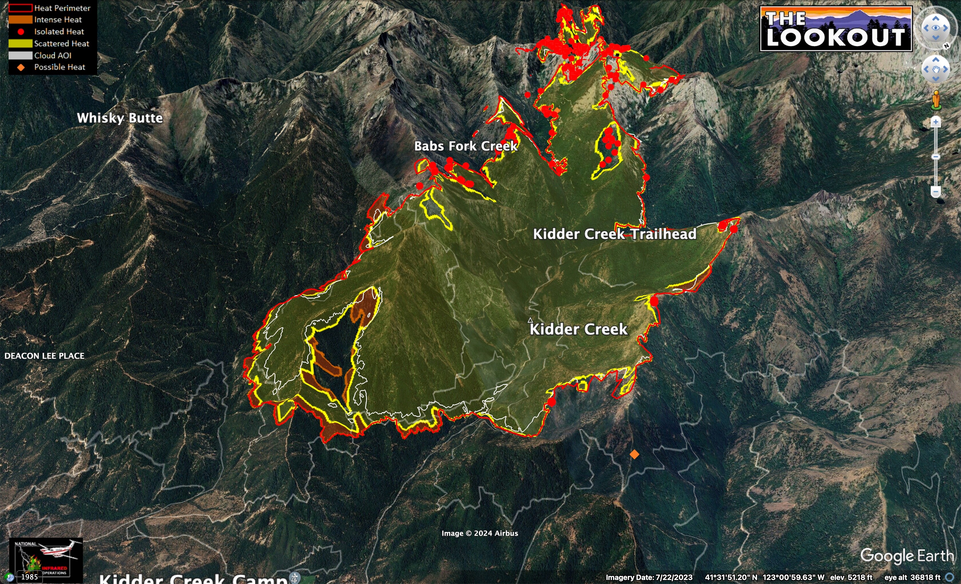
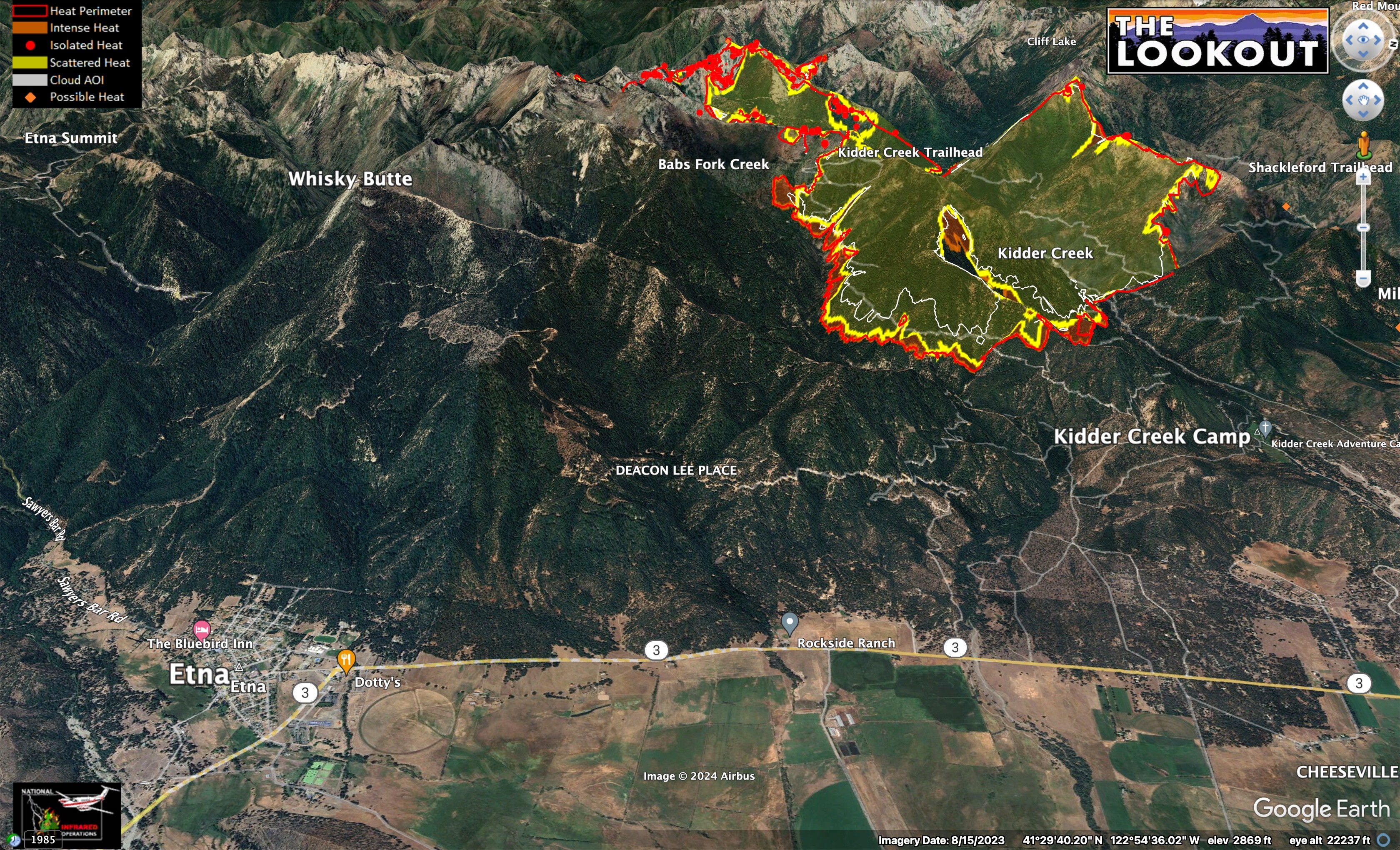
The fire spread about 1.5mi SE into Patterson Cr. yesterday. At midnight, it was 2 miles from structures in Cheeseville, 1.5 miles from Kidder Creek Camp, and except for a small slop, hadn’t crossed into Mill Cr. 7/10/24. White lines show 24 and 48hr spread.
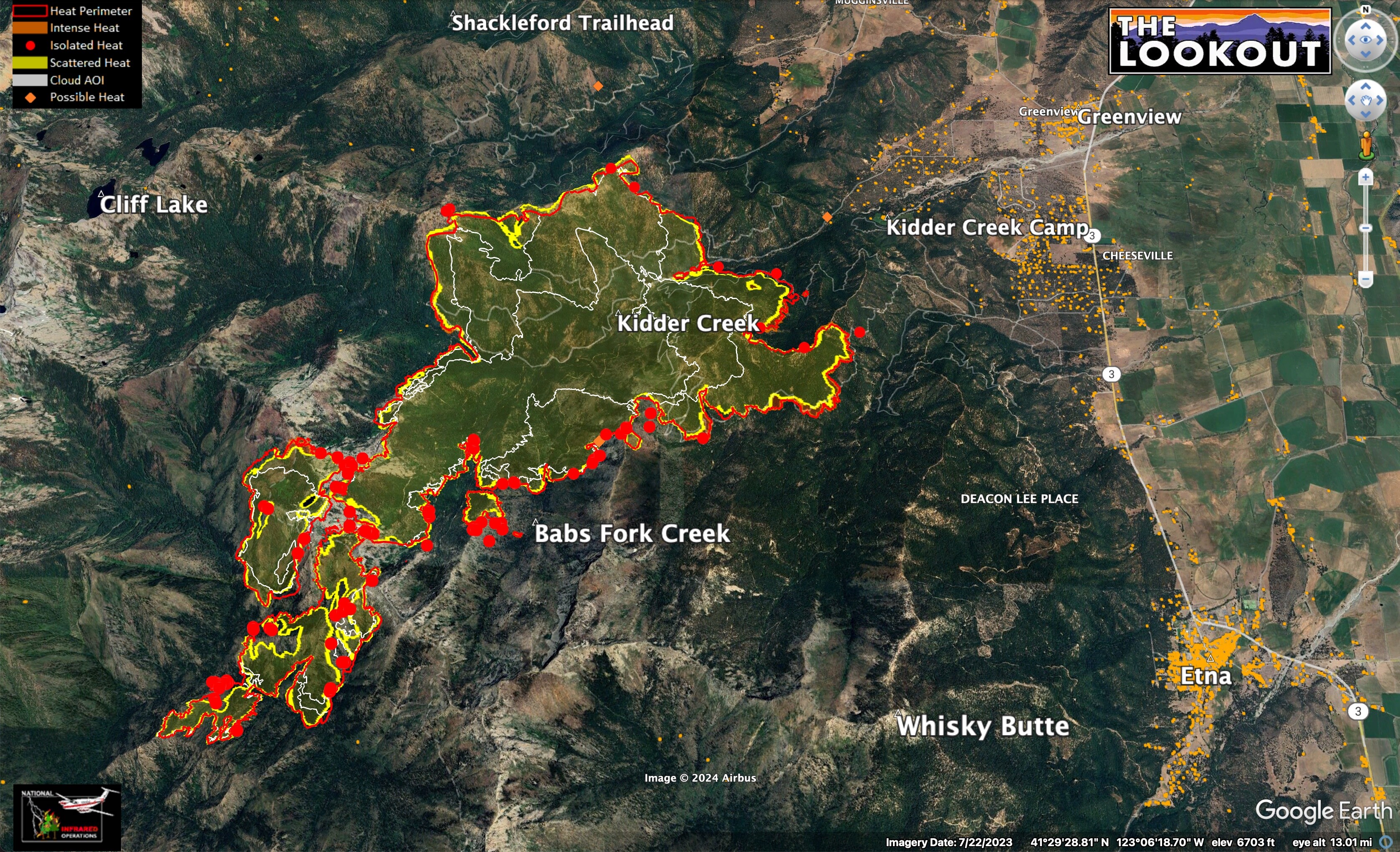
Does anyone know what resources are on the ridge between Kidder and Mill Creeks? The fire seems to have hung up there over past 24 hrs or so.
According to solid local source:
The northern flank fire is holding on the ridge between Kidder and Mill Creeks. Last night they put crews and dozers up there and did direct attack on the fire along the top of the ridge. This held throughout today.
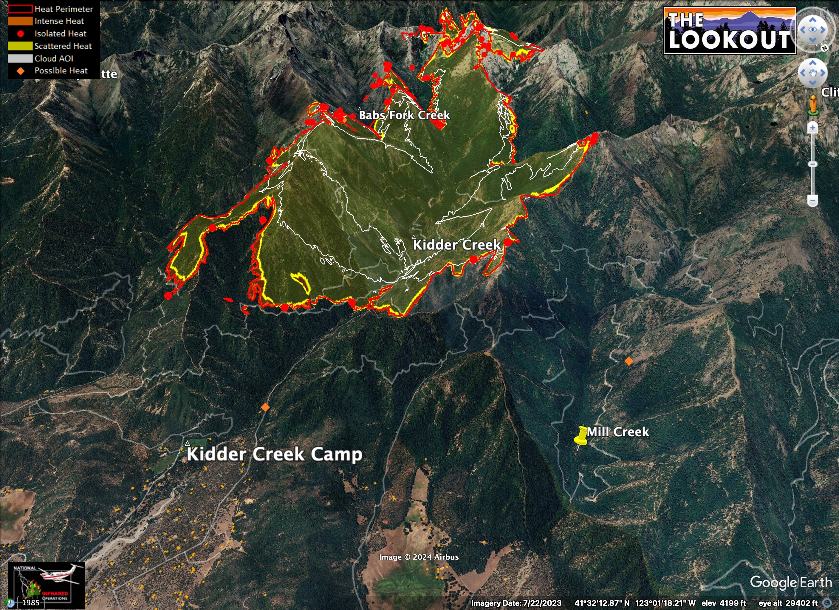
7/10/24 - 01:00 IR.
The fire is established in the bottom of Kidder Creek, near Kidder Creek Trailhead, and crews are working direct in there, also. It may still spread up out of Kidder Creek into Mill Creek later, but it sounds like that didn’t happen today.
Places to watch: The north end of the fire in the wilderness is still tough. There is a lot of dead and down material in the 2017 Wallow Fire burn scar, and it is dangerous to put crews in there because of the snags. They have mobile retardant bases set up and will be using helicopters to douse that edge of the fire, if visibility permits.
Trying again: I was also on the Kelsey Complex. Persistent inversions made doing burnouts very difficult; only possible at higher elevations and/or late at night.
Overnight IR intel shows the fire hung up on the ridge between Mill Creek and Kidder Creek, where crews are going direct. The fire backed steadily/slowly into Patterson Creek, toward Etna. White line shows 24hr growth. 7/10/24, 10pm.
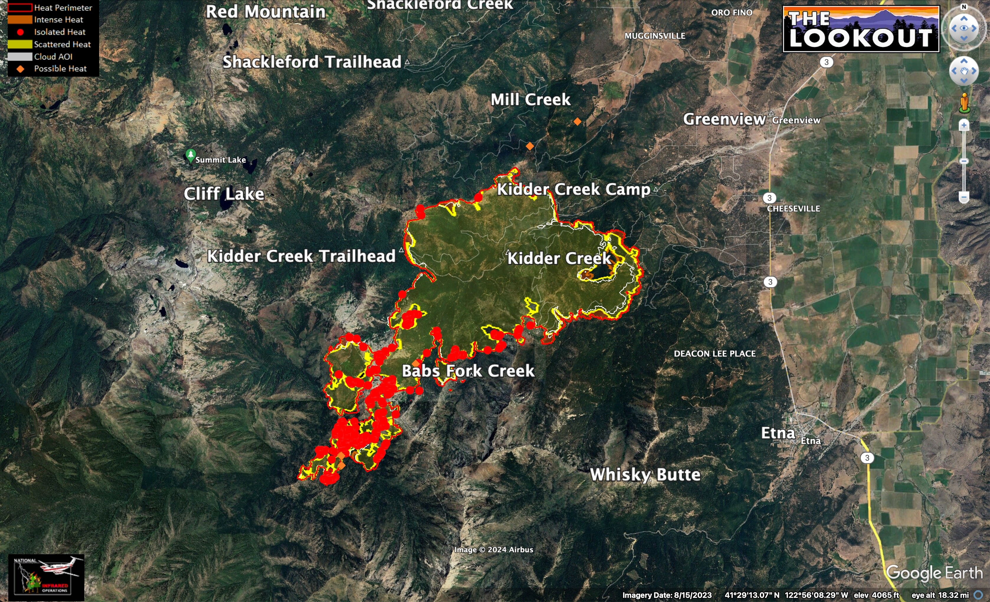
The fire has now burned across about 6,000 acres of the 18,000 acre ‘Scott River Whiskey Improved Forest Management’ (IFM) Carbon Offset Project (red area on map). As far as I know, this is the largest forest carbon offset project which has burned in California.
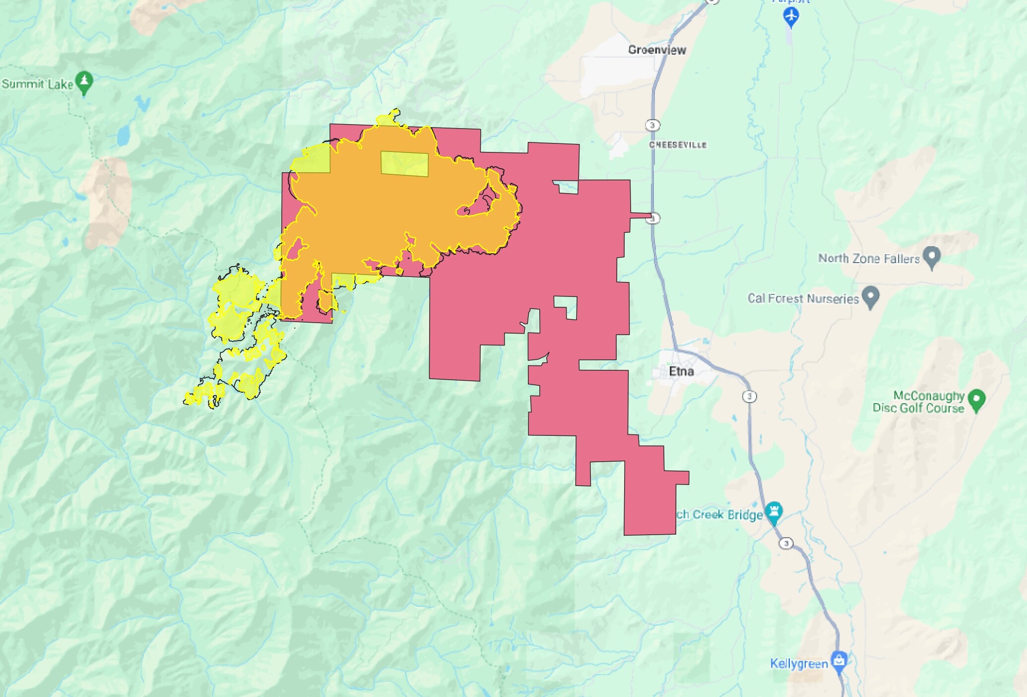
In 2022-2023, the landowner was able to claim their improved forest management removed 300 million pounds of CO2 from the atmosphere, and sell that carbon to a polluter or company that wants to say their operations are ‘net-zero’.
It sounds like the landowners who developed the carbon project are using the proceeds to help finance restoration work that moves their forests from dense second growth toward more old-growth characteristics, but it’s hard to tell if there is really enough money in the offsets to pay for that much work. We’ll be digging into this a bit more on the-lookout.org
Keep an eye on the thunderstorm potential over this fire over the next three days.
Got some intel from a good contact up on Shelly today, and pieced together some of the story, using some fresh satellite imagery of the burn taken yesterday. Here is a little video of that.
