CA-KNF-Shelly ???

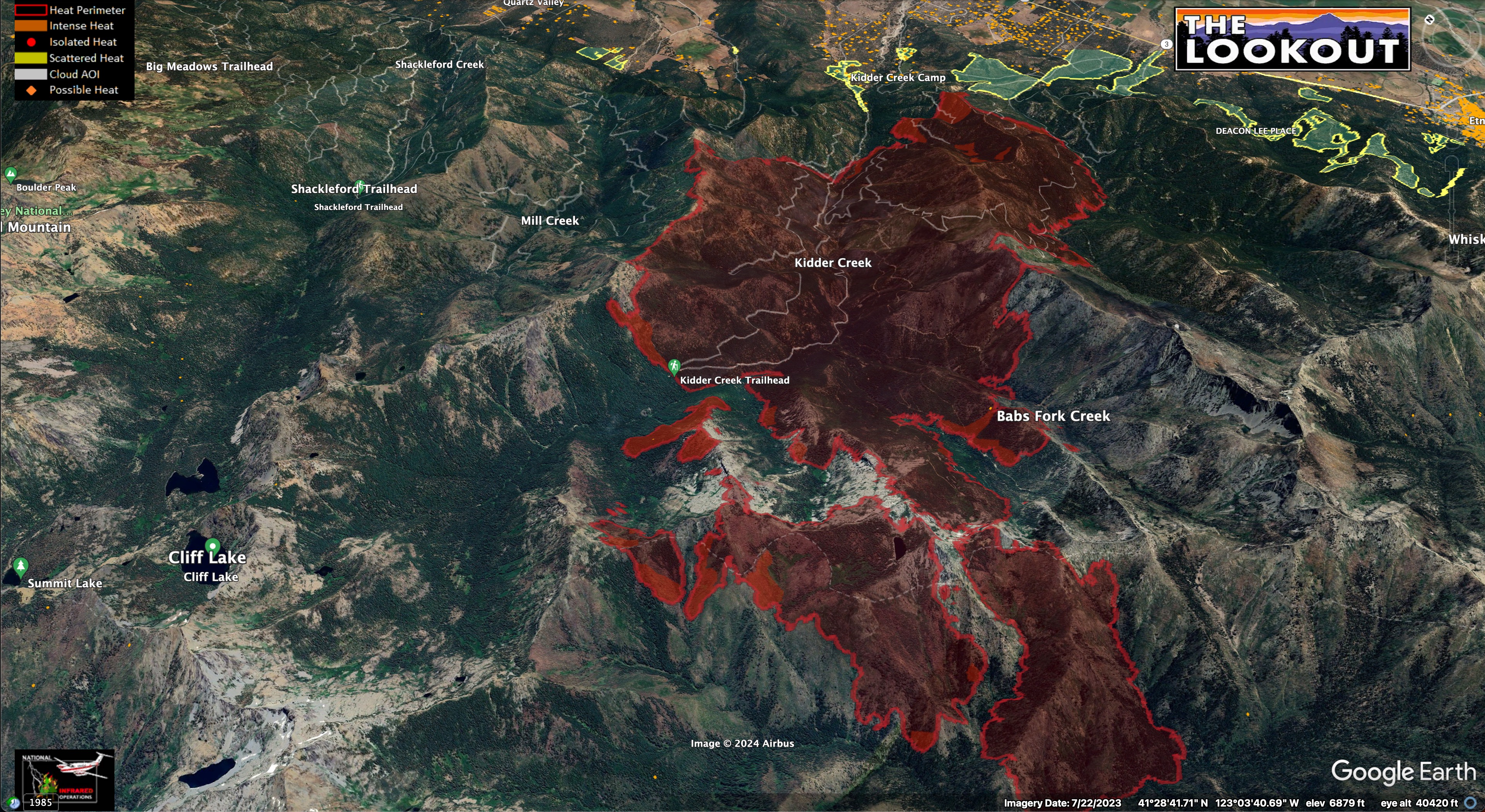
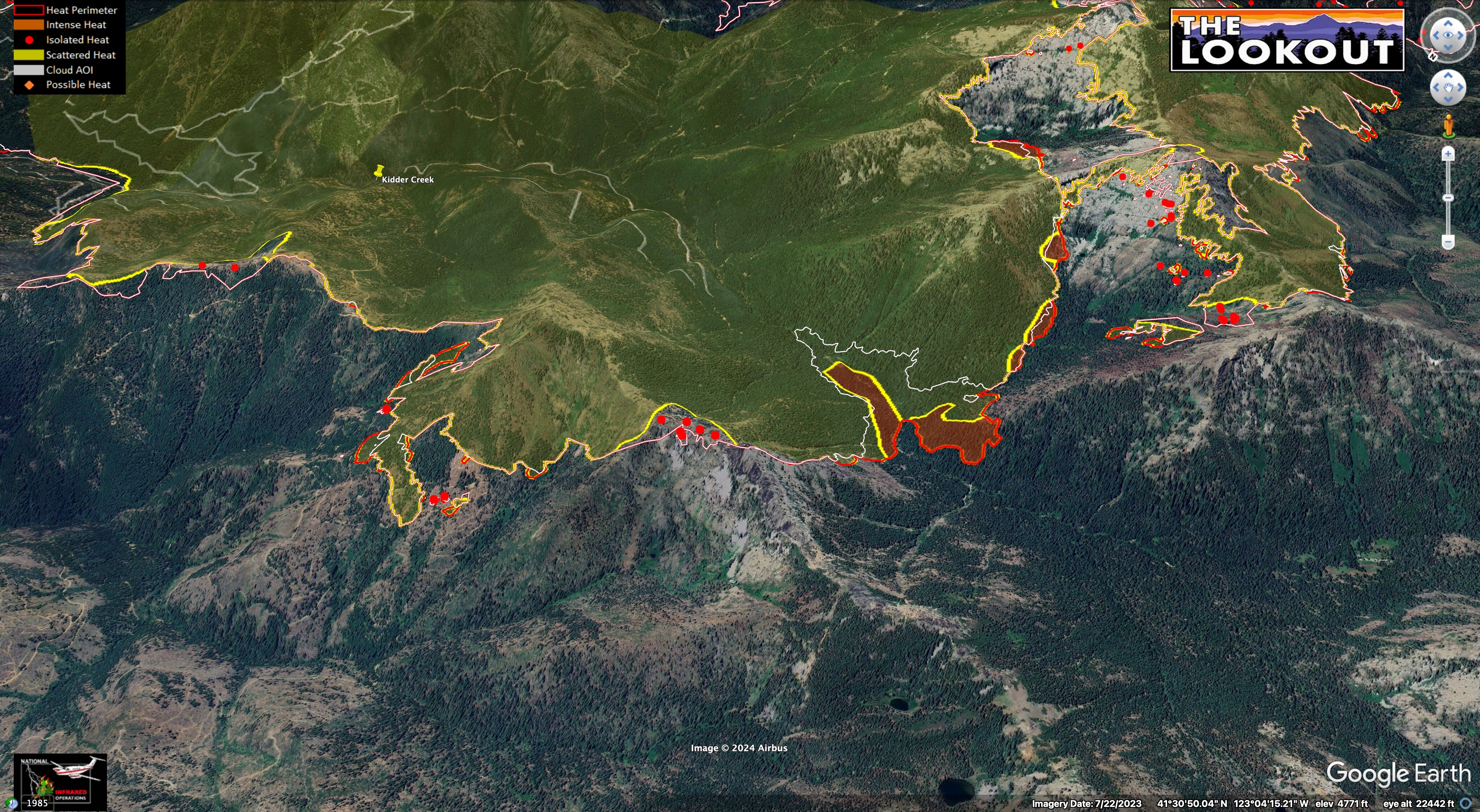
Here are maps for the Shelly Fire, as of 2am, on 7/12/24.
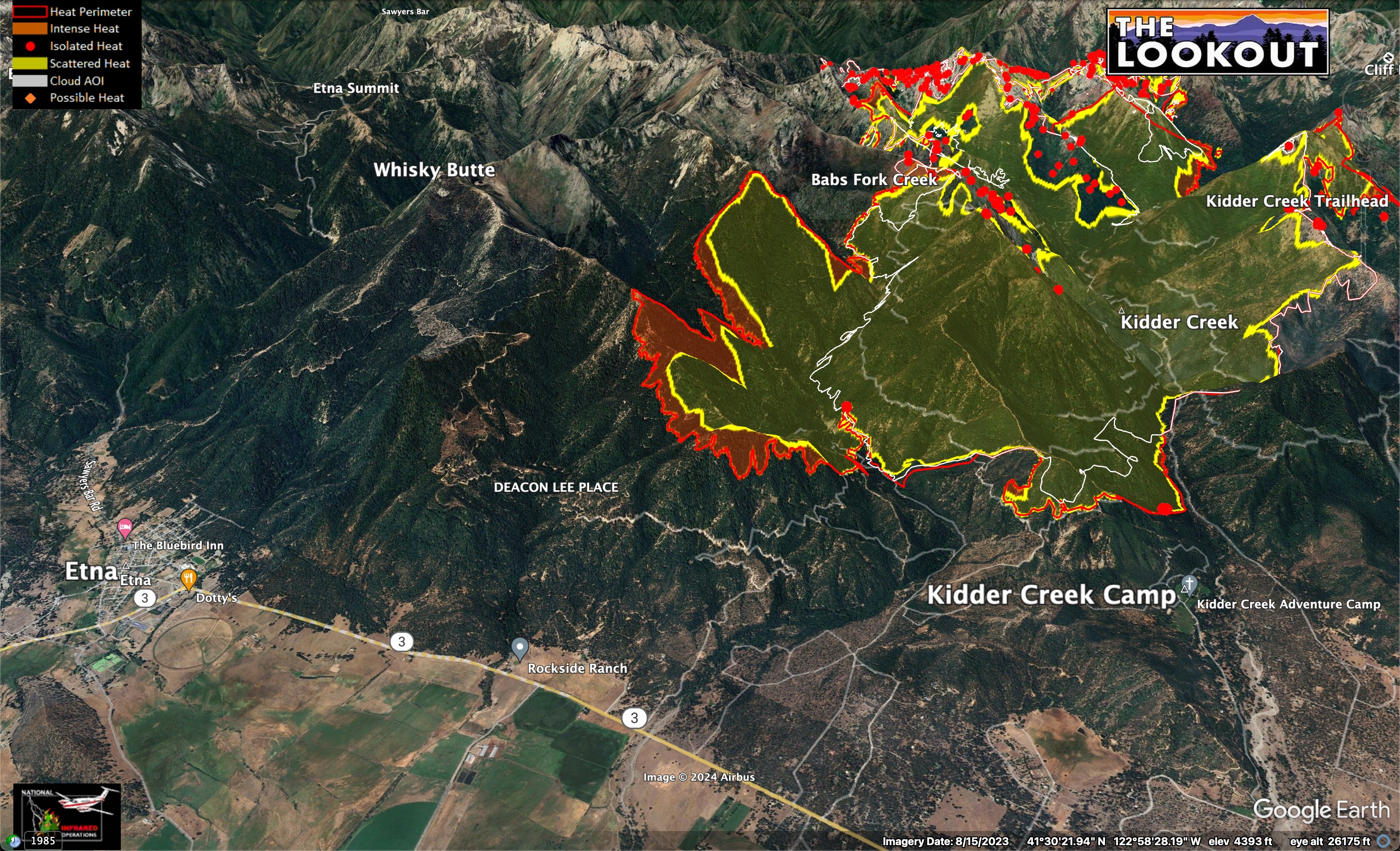
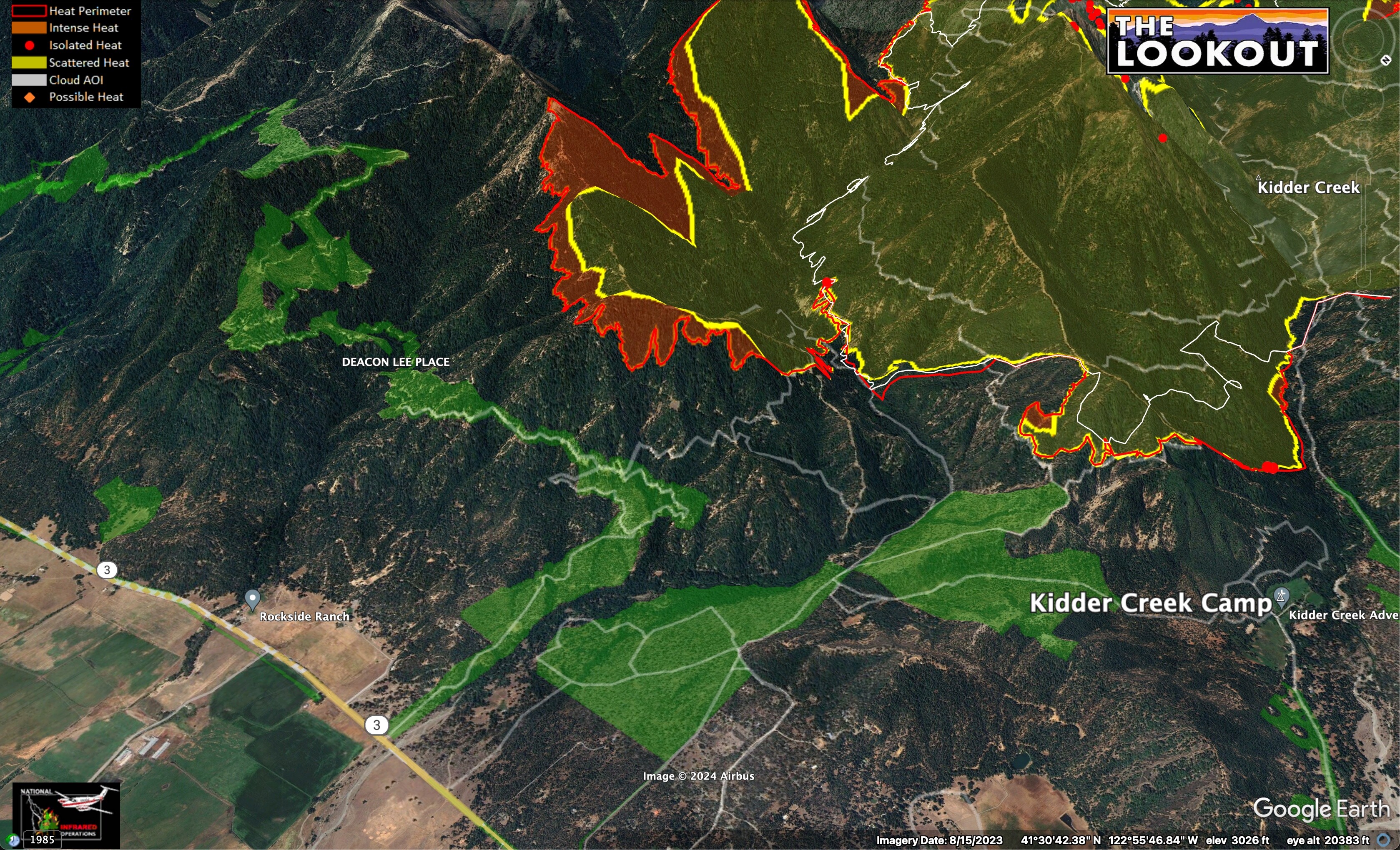
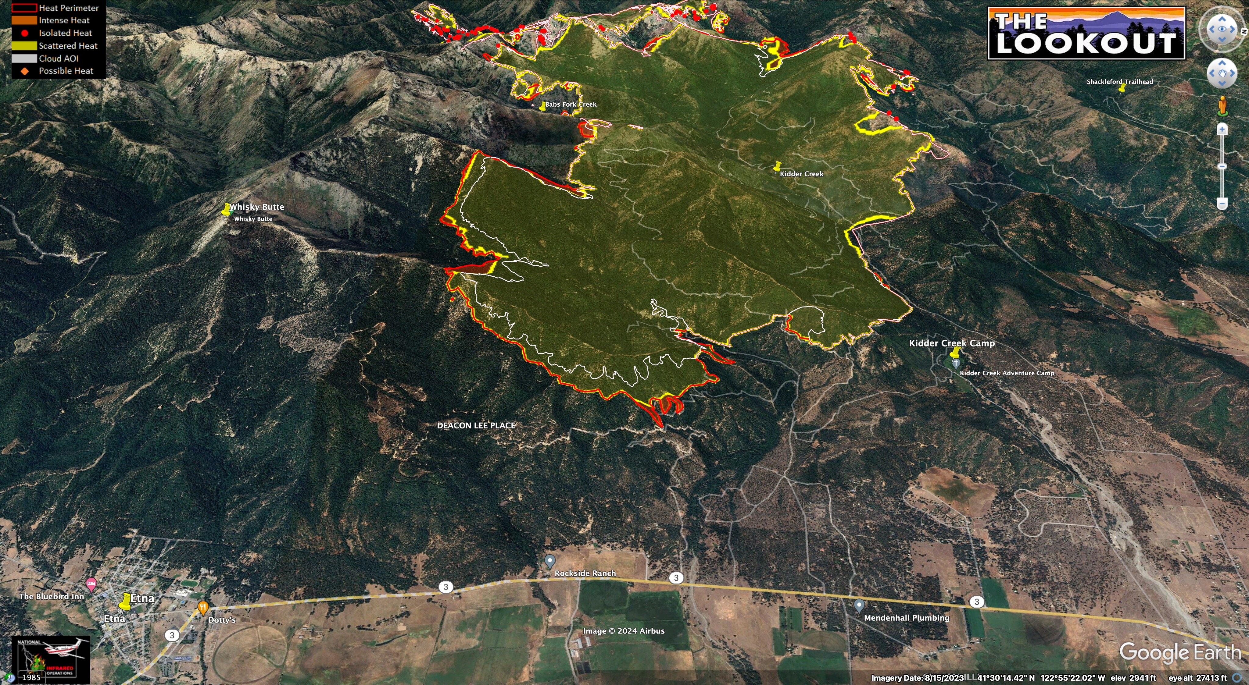
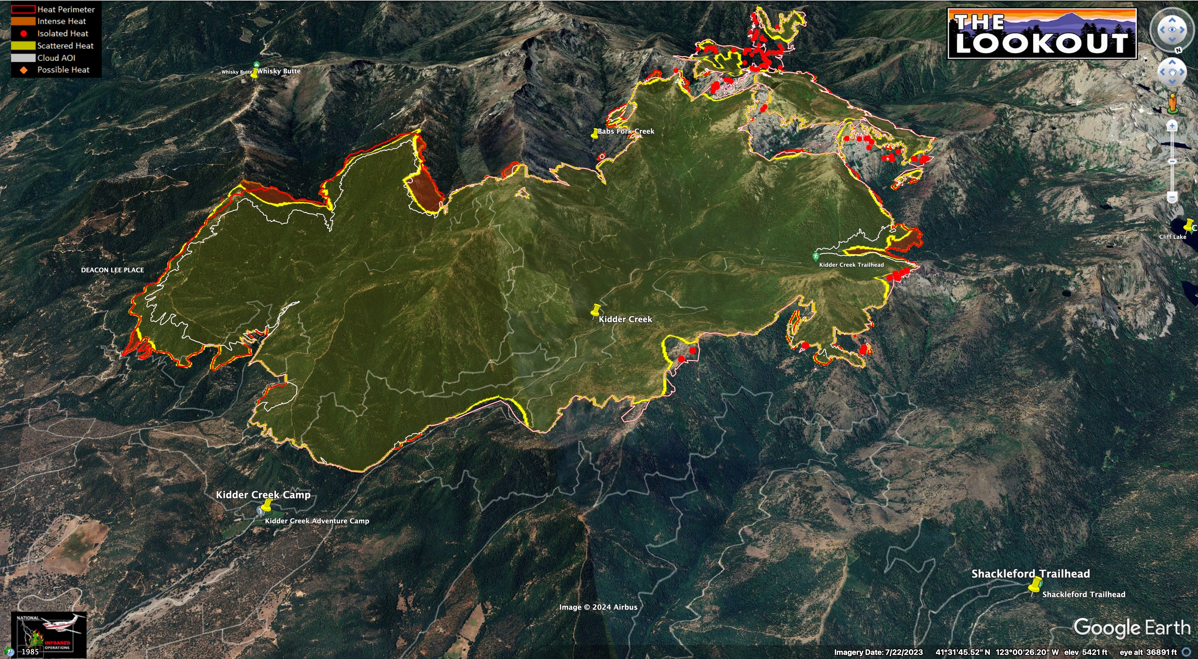
Yesterday, the wilderness portion of the fire ran east, and became established in Upper Kidder Creek.
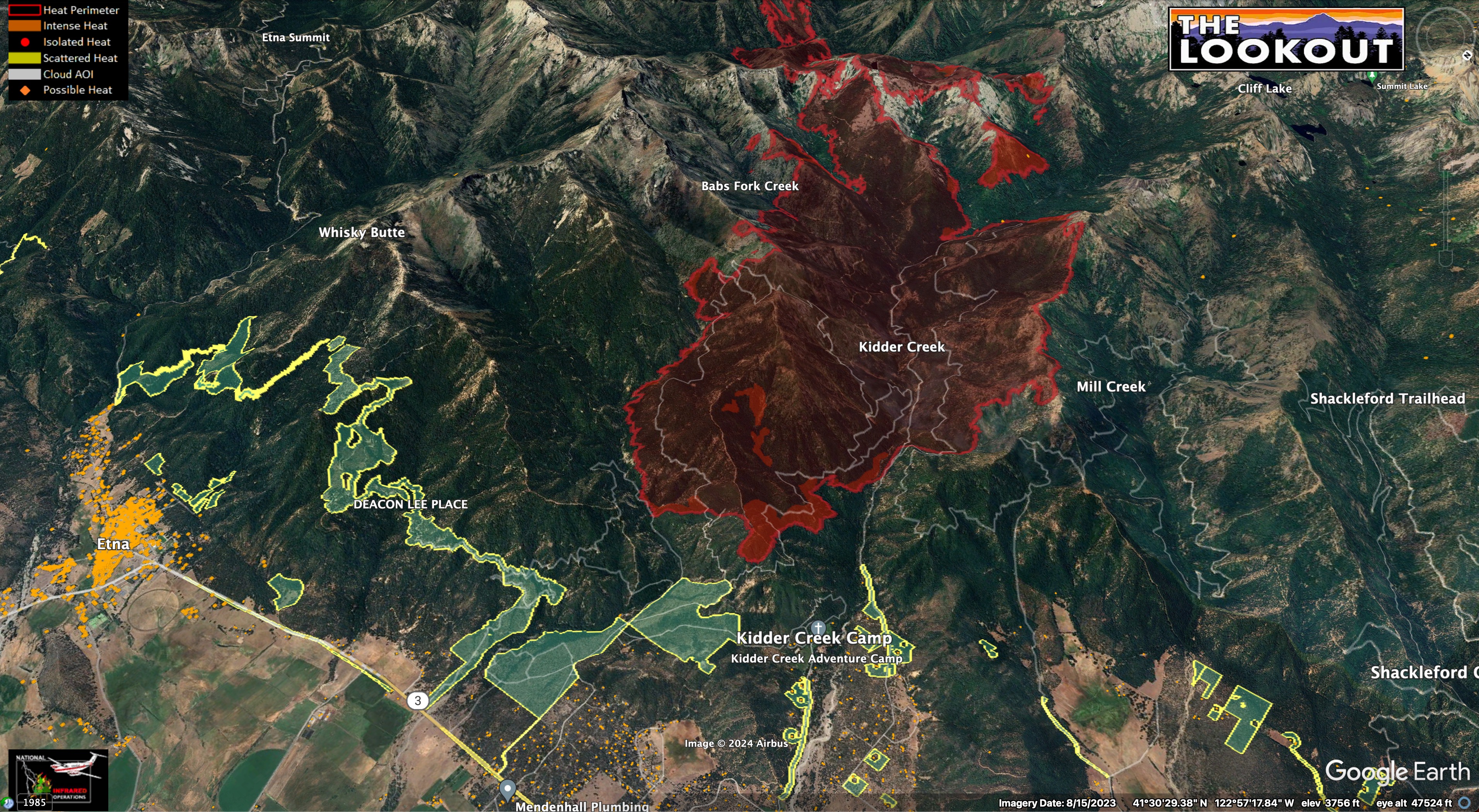
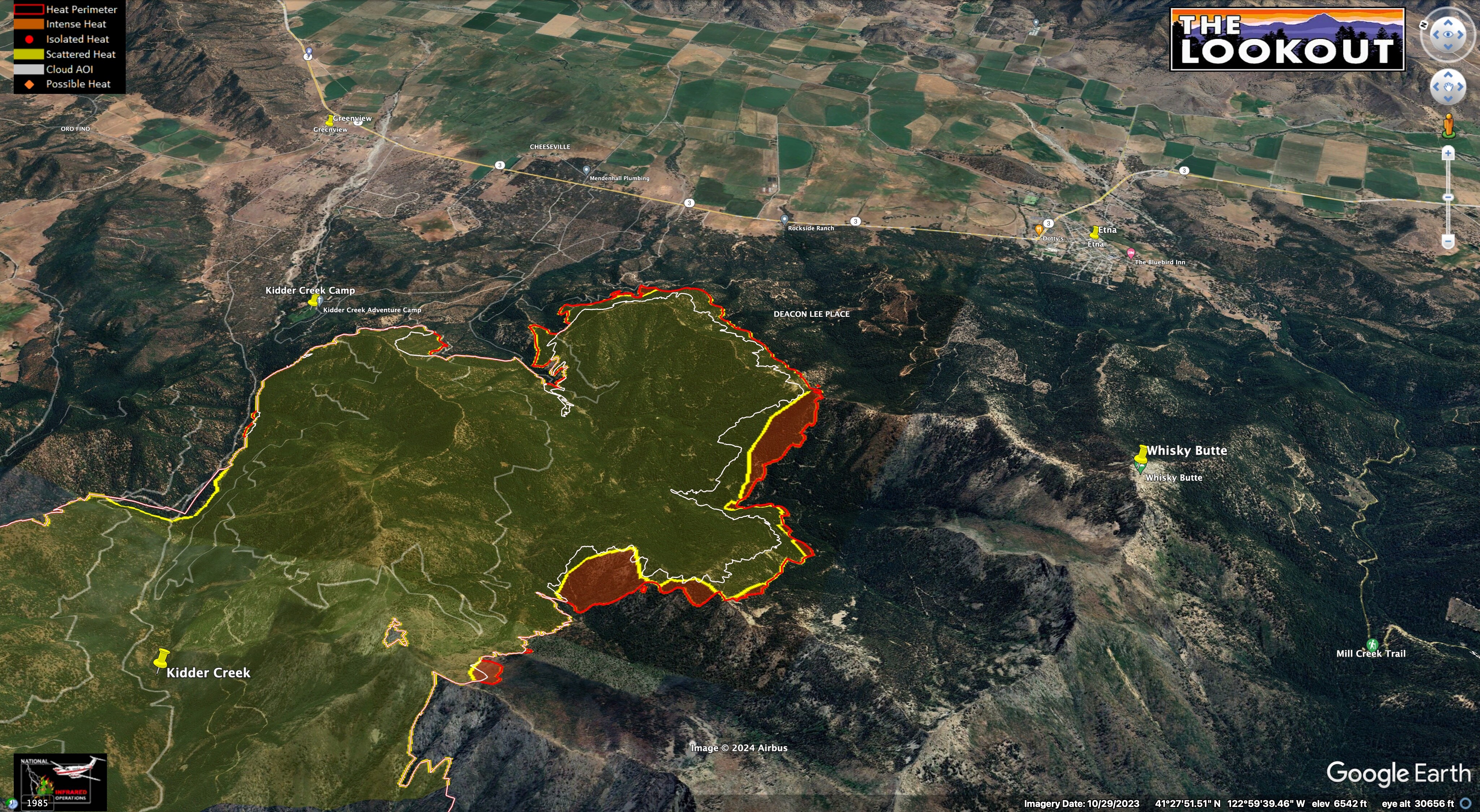
The SE portion of the fire continues to back downhill into Patterson Creek, NW of Etna. The fireline on the ridgeline between Kidder and Mill Creek continued to hold, but the new fire upcanyon may push north into Upper Mill Creek over next couple days.

Crews would like to light backfires on dozer lines between the SE edge of the fire and Etna, but conditions are not favorable to do this right now.

Here is this morning’s Lookout Livestream.

8 Likes

Satellite view looking as though the Shelly might have kicked into another gear…

6 Likes

As in she’s moving?

2 Likes

It did. Even capped out for a short time.

4 Likes

Any updates on size?

VLAT 914 over fire

3 Likes

Last I saw was 10K+ acres . An evacuation warning went out about 15 minutes ago for part of Etna.

4 Likes

Isn’t that where the Fed ICP is?

3 Likes

Yes it is in Etna right outside town.

4 Likes

The last hour is pretty impressive on Fort Jones webcam.
Looks like the fire crossed Patterson Creek today is now cresting the ridge NW of Etna.
https://ops.alertcalifornia.org/cam-console/1651

5 Likes

Per the evening briefing the fire is now 12, 683 acres.

4 Likes

ICP is on the eastern edge of the town. OPs map has some dozer line to the west of the town, but evening operation update talked about how it crossed other lines.

Fire looking very active on the camera.

4 Likes

Thanks Zeke, I was just looking at your pervious live stream and the camera roll to try to figure out if the fire was on that ridge to the left and above Patterson Creek.
Appreciate your good sharing.

4 Likes

Here’s mapping from about midnight last night.
And if you like your maps moving, and with commentary, I just did a live stream.

10 Likes
5 Likes

CAL FIRE IMT 6 activated to the Shelly.

8 Likes

Are they going to zone it like the Lake fire?

South Ops is showing CICIMT 1 activated, I imagine to transition with CICIMT 12.

4 Likes
3 Likes

The fire was a bit less active yesterday due to calmer weather and a little rain. It spread between 500’ and 1,000’ downhill toward Scott Valley on the SE flank. It was also active on the north side of Whiskey Butte, and upstream from the Kidder Creek Trailhead. Mapping from 7/15/24 - 2am. Source: NIROPS.

White line is 24 hour growth.


7 Likes

Anyone got the link for the IAP?

1 Like

https://ftp.wildfire.gov/public/incident_specific_data/calif_n/!2024_Federal_Incidents/CA-KNF-005159_Shelly/IAP/

4 Likes