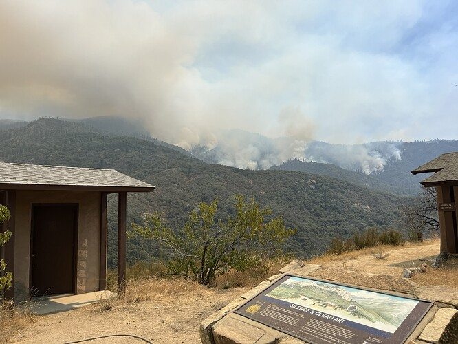
State ID:CA
3 letter designator:KNP
Fire name: Coffee Pot
Location: North West of Homer’s Nose
Reported acres: 869
Rate of spread: Moderate
Report on Conditions: Started as a single tree lightning strike.
Structure threat: Not now
Resources: Complex Incident Management Team
Hazards: Step terrain with roll out potential
Weather:
Radio channels:
Scanner link:
Webcam link:
https://cameras.alertcalifornia.org/?pos=36.2888_-118.8421_13&id=Axis-BlueRidge1
Agency Website:
Updated acreage of 1,107
Updated acreage of 1,305.
AA15 up over the fire and two Scooper’s lifted off Fresno.
Might be 2 copters up there already. Keep falling off the radar.
There’s also a Cobra66 flying out of Edwards AFB. Reconnaissance training?
AA51 (think this is the mapping plane) and AA55 up over the fire and two Scooper’s from Fresno. The scoopers worked pretty much all day yesterday.
1 copter up there already.
Acreage should be updated today since AA51 is up there now.
2,231 acres
Acreage flown this morning is 2683 +452
Fire still active around majority of perimeter. Intense fire close to perimeter.
AA15 was up early but smoked out and then went up again early afternoon. I didn’t intercept any fixed wing activity, just copters.
Just a hair over 3k acres, most recent update from the command team mentioned indirect lines are 50% complete. Lines from S fork drive to Cinnamon Gap and the line from cinnamon gap to the top of case mountain are nearing completion. Op update yesterday mentioned that aerial ignitions on the SE section of the Incident occurred to produce low intensity fire and create buffer at some Sequoia groves.
I’m assuming more ignitions are planned in the coming days to fill in the box.
Looks like some good firing off about to start. From Inciweb 8/27:
The Coffee Pot Fire increased by 244 acres. Sixty-three percent of primary and indirect control lines totaling nearly 18 miles have been constructed. Indirect control lines between South Fork Drive and Cinnamon Gap, Cinnamon Gap to the top of Case Mountain, the Tower Check to Mineral King Road, and along South Fork Drive have been completed. Hoses, pumps, and storage tanks were placed along the indirect control lines to assist with fire operations. Firefighters also removed brush and chipped materials along Mineral King Road and conducted a low-intensity backing fire to remove vegetation in the Eden Creek grove of Giant Sequoias. Three, 10-person Fire Use Modules began implementing indirect control lines on the eastern flank, heading toward Homers Nose.
Now that we have established indirect control lines on the southern and western flanks, we are shifting our focus to a direct attack to contain the fire and protect the adjacent communities. If all conditions are favorable, crews will initiate a strategic firing operation using a backing fire to control the intensity and rate of spread of the fire. Beginning tonight, crews and engines will work around the clock to support the firing operation. The strategic firing operation will start near Case Mountain and continue to South Fork Drive, employing drip torches and targeted aerial ignition. We anticipate that this operation will last multiple days.
Looks like some BTU’s being produced yesterday afternoon. Firing op then it settled down.
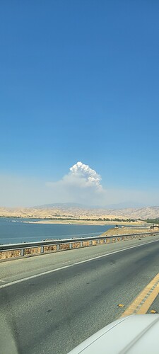
From Success Lake near Porterville:
7,526 acres 11% contained
AA51 mapped it at 9806 acres.
7526 acres (+0 acres), grass, brush and timber, 11% contained (+0% containment)
CICIMT15 (Clemo) tentative transfer of command 9/1 from team 5
It’s now bumping the castle fire scar along the east portion of the fire

