AA15 and AA430 both went up this morning and stated that Branch 2 & 3 are too smokey to use aircraft. A copter tried to work in Div.C but unable to help due to smoke.
EDIT UPDATE 15:00;
AA430 departed as there is no visibility for any aircraft on this incident.
I can see why on the RAMMB satellite page… KNP winds are slack with a sight east push. Windy has a stronger upper level winds out of the west pulling the smoke away from the fire ground. Looking at Ventusky for that intel.
Hear AA say today fire is just skunking around in most places. Not too much activity. Seems to be hung up on ridges. Weather is on a downward cooling trend for awhile. Hopefully crews are able to get in and do some cutting and air clears up for more drops. Dozers on the far, way out out doing contingency. That’s about it
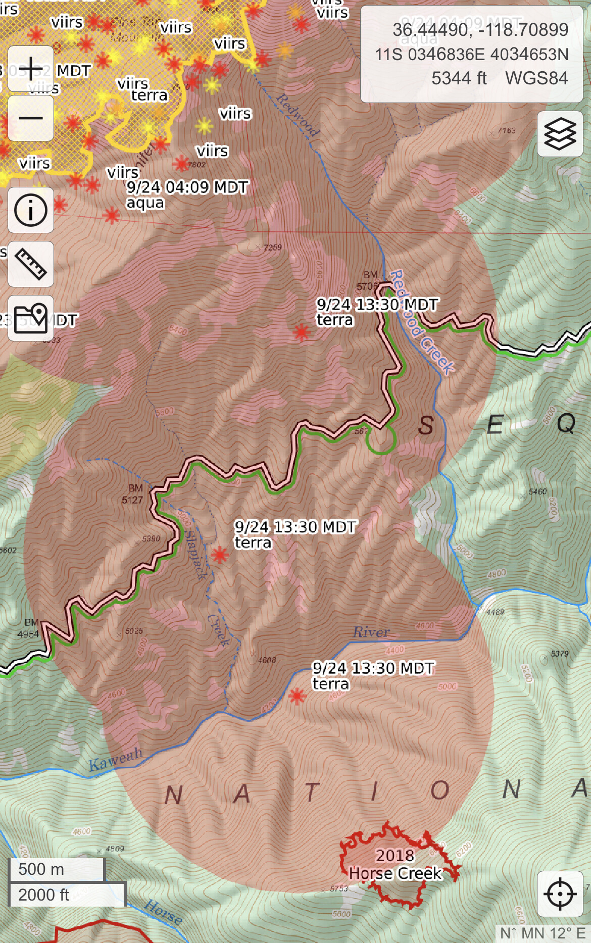
I don’t know what time that report was. But it does not accurately describe what happened today. There were several good runs from the fire today and it moved significantly closer to the North Fork of the Kaweah River. When I drove out tonight after my shift change the fire was very active on the ridge above the River and had progressed today more than it has in 3 days.
Not a problem at all. Just saying what I saw today. We have been building contingency lines from The North Fork of the Kaweah River North for Cal Fire and are now on the east side of Hartland to protect the communities. Have been driving it every day since Sunday and the fire was more active today.
I saw that too along redwood creek down to the south fork. Could just be heat in the column though - hoping to get more details on the first report? is that on the ground/first hand/ radio info @phoenix559 ?
To the south, it will run into the Castle fire burn from last year. All kinds of road improvements done with all sorts of new dozer roads put in.But to the east and west between KNP and Castle, who knows
There’s no roads or dozer lines there , that’s the east fork below mineral king, case mtn to west and north, al park land to the south and south west and east , not good at all , very little fire history in that area in the last 50 years that I know of , a few small fires from lightning that’s it , if it runs south up the canyon headed straight for mineral king area
There is some granite up on top before the valley on south side. If it continues around the north side it’ll stop by timber gap. The mouth of the valley is only defendable spot. I was up there 2 weeks ago and the fuel load is heavy. Hoping the crews have had good luck in cabin cove, atwell mill, and silver city.
Yes that was a lightning strike, and a dirty burn , lots of rock mixed where the eden fire was , surprisingly they hit that with retardant drops , we were staying at our friends cabin in cabin cove that weekend