XTU T/F 5148 headed to Hartland Christian Camp
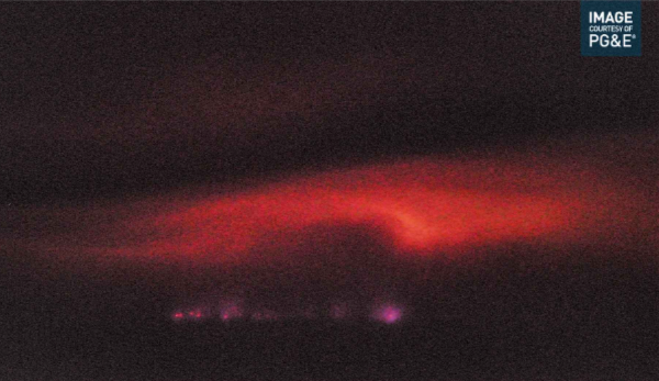
Some trippy images from buck rock.
http://www.alertwildfire.org/sierra/index.html?camera=Axis-BuckRock1&v=fd40742

I know it’s been asked just can’t find it. I am headed to the fire anyone have the IAP password. And what the heck why is it password protected? Is there any Intel on what this thing is doing.
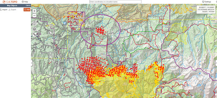
Anyone know whats up with these viirs hits (circled in purple) couple miles north of the fire- Is this like just a fire camp or a glitch or is there something going on there?
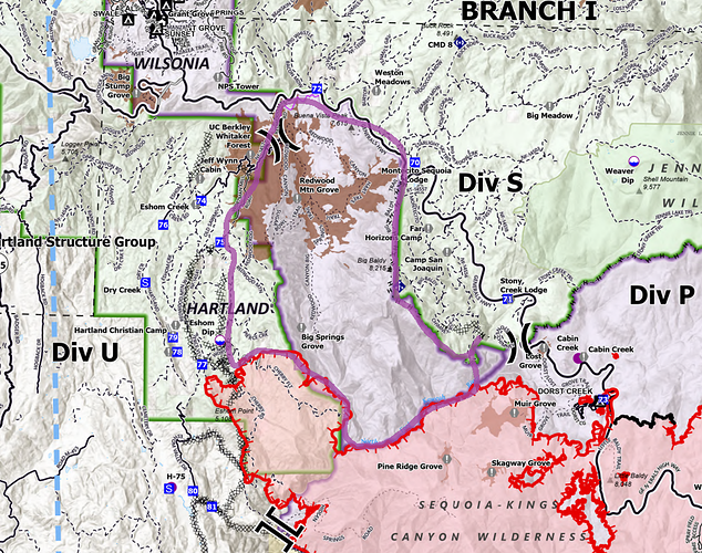
Firing Operation
FR? Burning out all of redwood canyon? that would be firing out 12k acres for a 4k acre spot.
actually the more i look at it the better it looks-- would be nice if it wasn’t so hot tho. Atleast they’ll be in the shade. Drawn in purple is my guess at where that will end up?
They are firing in multiple locations due to movement across the North Fork.
Fire in division x/z is getting pretty active. It’s the orange dot in the middle.
https://rammb-slider.cira.colostate.edu/?sat=goes-17&sec=conus&x=7975.00048828125&y=3966.000244140625&z=4&angle=0&im=18&ts=1&st=0&et=0&speed=130&motion=loop&maps[borders]=white&lat=0&p[0]=cira_natural_fire_color&opacity[0]=1&pause=0&slider=-1&hide_controls=1&mouse_draw=0&follow_feature=0&follow_hide=0&s=rammb-slider&draw_color=FFD700&draw_width=6
Swaths of Redwood Canyon have hosted prescribed fires throughout the years - that’ll hopefully keep any burnout fires from getting too feisty.
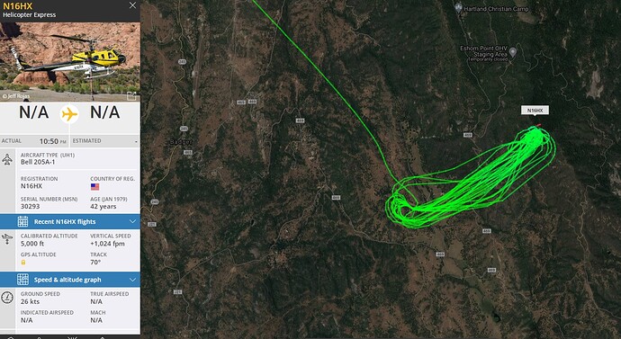
This guy has been working his tail off for this area of the fire. Water pickup on the west, fighting fire on the east.
They just refueled and came back for more.
Crews took a moment to remember Daniel holmes today.
AQI in 3R’s area is 710-870. Heavy smoke day down the canyon
Not much better in Squaw Valley, 450-550 all day.
Hoo Wee down to 200 right now… Purpleair
I would like to know the plan to hang up this burn to the North. The road to redwood canyon would be difficult to hold.
The Generals Highway appears from the IR to already have spots over it.
Redwood Canyon has had fire in it, but it has lots and lots of regrowth. There are sections that I know were burned 10 years ago, that had lots of under story earlier this summer.
Being in the Park I’m uncertain of the tactics, and if they will change on the Forest side of Generals Highway.
Does anyone have a concept of the fire severity in areas? A large majority of the road accessible area of the park has now been affected. Combined with the Rough fire, will be almost all of the Park.
Between the lack of Comm’s, Fed team command post at a different location than CF camp, Side by Sides cruising around with Drip torches, and TUU trying to protect within the DBA and SRA, It’s fair to question what the objective is. State resources being assigned to KNP for “unified” mission and State resources assigned to TUU in support of TUU’s objectives.
Fair to question the parks objectives. We all know Cal Fires objectives are to put the fire out and go home.
This management of this fire has been for resource benefit. There is no clear leaders intent and the control objectives were put on the IAP after 10 days without them. The team needs to have a clear plan concerning firing and not allow groups to go rogue. I listened to a tac channel and it included private insurance engines. What in the heck is going on. I have lost all faith in this team!
They pulled the mineral king structure group out and combined them with Div C. I heard all Div C resources got pulled off the line because of the spot below MK road. Any truth to this?
Won’t look good if it gets well established in the East Fork drainage. Pray for rain.


